A tour of the world's oddest borders, from a town split between Belgium and the Netherlands to a mountain summit shared by two nations
Credit: Jermaine Lewis / Pexels
A border is usually an abstraction: a line on a map, invisible on the ground, enforced by fences, checkpoints, or simply the honor system between neighboring nations. In a small number of places, though, that line becomes something a traveler can touch, straddle, or walk across without leaving sight of home. These are spots where cartography becomes a physical experience, where a single step can move a person from one currency to another, one language to another, and sometimes one continent to another.
Some of these places exist because of medieval land deals that split villages into overlapping puzzle pieces of territory. Others were drawn by surveyors chasing rivers, mountain ridges, or watersheds that never cared much about straight lines. A few were built on purpose: peace monuments, cross-border office buildings, and pedestrian bridges designed specifically to mark two nations meeting at one spot. In a handful of cases, the boundary in question is not between two countries at all, but between two continents, drawn along a strait, a mountain range, or a canal that geographers settled on centuries ago and the world has used ever since.
None of this is trivia for its own sake. Knowing where and why these borders exist says something about how empires divided territory, how modern nations negotiate, and how geography resists the tidy lines humans try to draw across it. For travelers, these spots also tend to make for memorable stops: a café with two cash registers, a hiking trail that crosses a border three times in an hour, a bridge where the paperwork required to walk across takes longer than the walk itself.
What follows are 20 real, verifiable places around the world where it is possible to stand in two countries, or two continents, at the same time. Some require little more than a short walk from a parking lot. Others require a passport, a guide, and a fair amount of planning. All of them say something about how the modern map came to look the way it does.

Credit: Jérôme / Wikimedia Commons (CC BY-SA 3.0)
In the southern Netherlands, a few kilometers from the Belgian city of Turnhout, sits one of the strangest border towns on Earth. Baarle is really two towns sharing one name: Baarle-Nassau, which belongs to the Netherlands, and Baarle-Hertog, which belongs to Belgium. The Belgian portion consists of 22 separate parcels of land scattered inside Dutch territory, and a handful of those Belgian parcels contain even smaller Dutch parcels inside them.
The border does not follow roads or rivers. It cuts through gardens, shops, and in a few cases individual homes. Small white crosses and metal pins embedded in the pavement mark the line as it crisscrosses the town center, and house numbers carry small Dutch or Belgian flags to show which country each building belongs to. One well-known shop near the town center has two separate entrances, two cash registers, and two phone numbers, one for each side of the line running through the middle of the building.
The arrangement dates to the Middle Ages, when the Lords of Breda and the Dukes of Brabant traded, sold, and swapped parcels of land through a long series of local agreements. Those medieval deals were never cleaned up into a single tidy border. When Belgium and the Netherlands became separate countries in the 19th century, the tangle of overlapping land claims in and around Baarle was written into the Treaty of Maastricht in 1843 and has remained largely unchanged since.
For most of the 20th century, the split border created small everyday complications. Dutch bars once had to close earlier than Belgian ones, so patrons would simply move their drinks to a table on the Belgian side of the room. Fireworks, restricted in the Netherlands, are sold freely on the Belgian side. During the pandemic, differing Dutch and Belgian rules created similar oddities, with residents just meters apart living under different restrictions.
Since Belgium and the Netherlands both belong to the European Union and the Schengen area, none of this requires a passport today. Visitors can follow a marked walking route through the town center that passes about 12 signposted enclaves, crossing the border repeatedly along the way. Two mayors, two police forces, and two postal systems still operate side by side, serving a population of roughly 10,000 people who have simply learned to live with a map that looks like a jigsaw puzzle.
Credit: Ziko van Dijk / Wikimedia Commons (CC BY-SA 4.0)
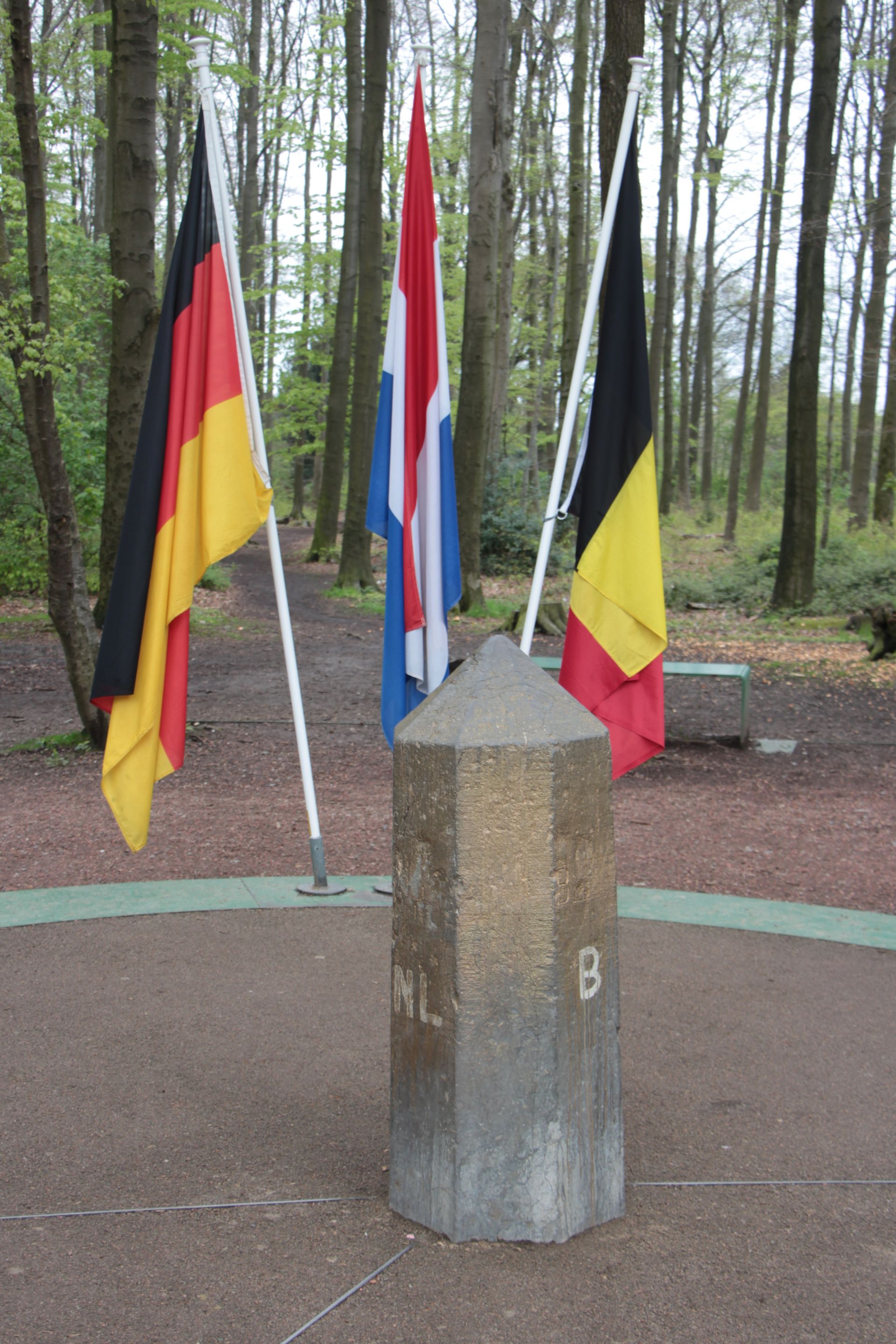
Near the Dutch town of Vaals, a low, forested hill called the Vaalserberg rises to 322 meters above sea level. It is the highest point in the European part of the Netherlands, but it is known for a different reason: its summit is a tripoint, the exact spot where the Netherlands, Belgium, and Germany all meet. The Dutch call it the Drielandenpunt, or Three Country Point, and it draws a steady stream of visitors who want to stand in three nations within the same few seconds.
The tripoint itself is marked by a low, tiered concrete monument set into a paved plaza, with lines cut into the ground to show exactly where each border falls. Flags and coats of arms mark each country's territory, and it is entirely possible to move between the Netherlands, Belgium, and Germany simply by shifting from one foot to the other. Because all three countries belong to the Schengen area, no passport or border check is required to do this.
The site has more history packed into it than its quiet forest setting suggests. Between 1830 and 1919, this was actually a four-way meeting point, bordering a small neutral zone called Moresnet that Prussia and the Netherlands both claimed because of a valuable zinc mine inside it. Moresnet even briefly became the focus of an early 20th-century movement to build a state around the constructed language Esperanto. After the First World War, the Treaty of Versailles folded Moresnet into Belgium, leaving the tripoint as it exists today.
Beyond the border marker itself, the surrounding area has grown into a small tourist complex. A viewing tower on the Dutch side offers panoramic views stretching into all three countries, while a second tower stands on the Belgian side. A hedge labyrinth sits a short walk from the tripoint, along with cafés, hiking trails, and a network of roads with names like Four Borders Road that nod to the area's layered history.
The Vaalserberg is also woven into regional sporting life. The Amstel Gold Race, a well-known professional cycling event held each spring, climbs the hill and briefly crosses into Belgium before returning to Dutch roads. For most visitors, though, the appeal is simpler: a chance to walk a paved circle that touches three countries, take a photograph, and leave having visited all three without needing a car, a boat, or a plane.
Credit: TylerTheTraveler / Wikimedia Commons (CC BY-SA 4.0)
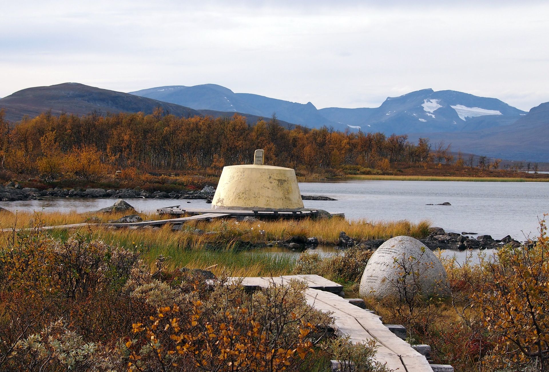
Far above the Arctic Circle, in a remote stretch of Scandinavian wilderness, a squat concrete marker rises out of a lake called Goldajärvi. This is Treriksröset, the point where Norway, Sweden, and Finland meet, and it holds the distinction of being the northernmost tripoint on Earth. Unlike border points hemmed in by cities or highways, this one sits in genuine backcountry, reachable only by boat or on foot.
The most common route starts in the Finnish village of Kilpisjärvi. From there, visitors can either hike about 11 kilometers through Malla Strict Nature Reserve, Finland's oldest national park, or take a seasonal boat across a lake followed by a shorter walk. Either way, the reward is the same: a monument built partly in the water, connected to dry land by a small elevated walkway that lets visitors circle the marker on foot, crossing from one country into the next every few steps.
The current concrete marker dates to 1926, though the tripoint itself has been recognized since 1897, when Russia, which then controlled Finland, helped negotiate the modern boundary. Because the border briefly touches all three nations along a short stretch of shoreline, walking a full loop around the monument means passing through Sweden, a small pocket of Norway, and Finland within less than a minute.
Almost nothing marks the spot as a tourist destination in the usual sense. There are no gift shops, no visitor center, and no paved parking lot. What there is instead is silence, tundra, and a lake that in winter freezes solid enough to walk across, though most visits happen during the brief Arctic summer, when boat transport runs and the trail is clear of snow.
Treriksröset offers a useful contrast to the more built-up tripoints of central Europe. It shows how the same basic idea, three national borders converging on a single point, can look completely different depending on where in the world it happens to fall. In the Alps or the Low Countries, tripoints often come with cafés and gift shops. Here, at 69 degrees north, the reward is simply the landscape and the knowledge of exactly where a person is standing.
Credit: Katsutoshi Seki / Wikimedia Commons (CC BY-SA 3.0)
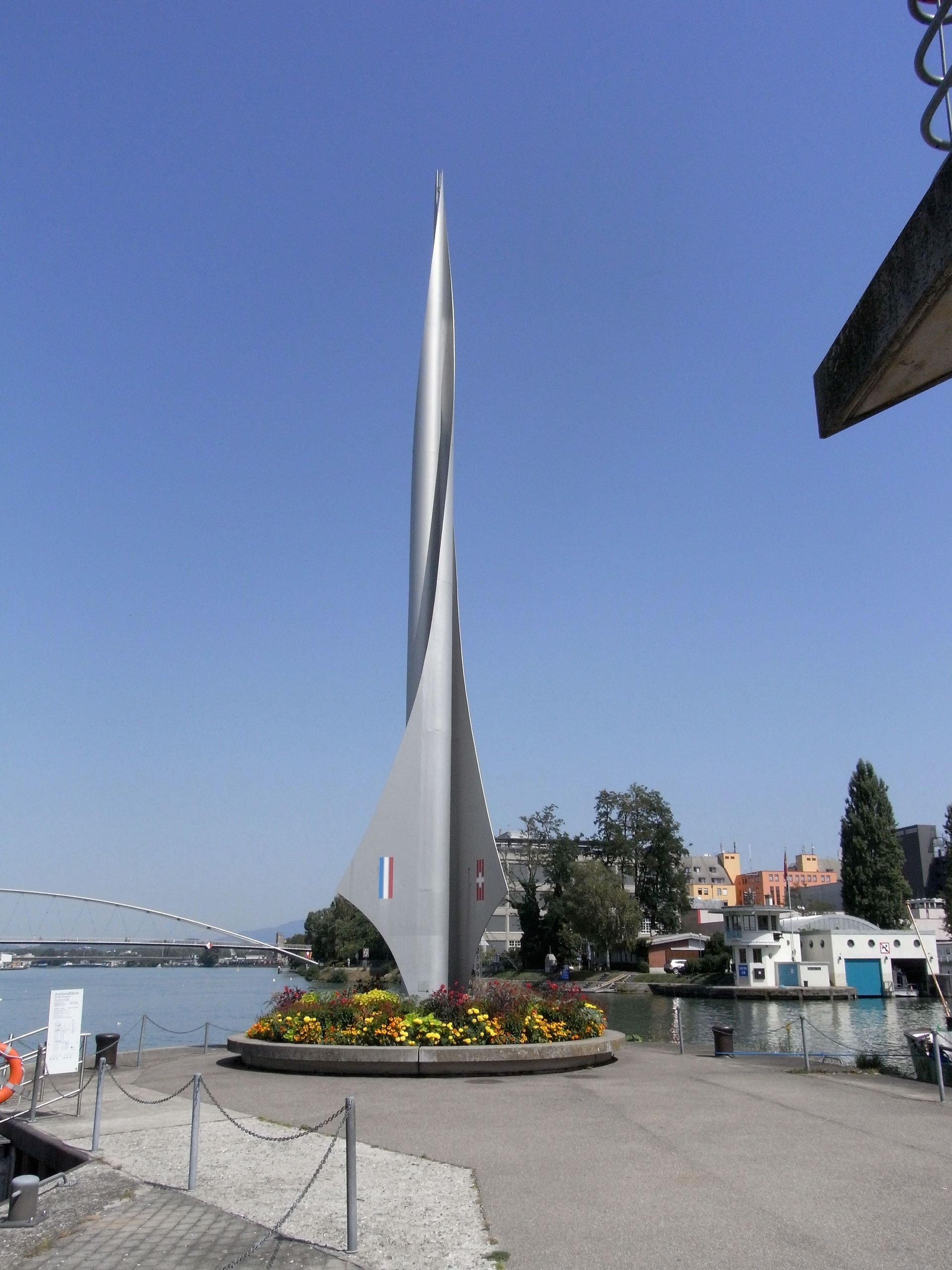
At the northern edge of Basel, Switzerland, the Rhine River curves past a spot where three national borders converge: Switzerland, France, and Germany. This tripoint, known in German as the Dreiländereck, is one of the few in the world located inside a major city rather than out in the countryside, which makes it unusually easy to reach by tram, bicycle, or on foot.
The actual geographic point where the three borders meet sits in the middle of the Rhine itself, a few hundred meters from the riverbank. A tall, spire-shaped iron monument, built in 1957 and reaching more than 18 meters into the air, stands on a strip of Swiss land near the true tripoint and has become the unofficial symbol of the spot. Its wing-shaped fins carry the flags of all three countries.
Visitors who want to touch all three borders on a short walk, rather than admire the monument from a distance, can do so easily. Starting from French territory in the town of Saint-Louis, a walk of well under an hour crosses a bridge into Germany near Weil am Rhein, then continues on to Swiss soil close to the monument itself. Because Switzerland has been part of the Schengen area since 2008, no passport checks interrupt the walk under ordinary circumstances, though travelers should still carry identification.
The area around the monument has developed into an unlikely gathering spot. In summer, a section of the riverbank operates as an informal beach with sand, lounge chairs, and a bar, drawing local residents rather than tour groups. Boat tours and small water taxis run along the Rhine here, giving visitors a way to see the tripoint from the water if they would rather not walk the full loop through three countries on land.
Basel's location at this crossing point has shaped the city's identity for centuries, well before the current monument existed. Long before Switzerland and the European Union settled into their present borders, this stretch of the Rhine was a crossroads of trade and travel between French, German, and Swiss territory, and the modern tripoint is really just the latest marker of a much older pattern of overlapping influence in one of Europe's most international small cities.

Credit: Mirek256 / Wikimedia Commons (CC BY-SA 3.0)
In the far southeastern corner of Germany, where the state of Saxony gives way to Poland and the Czech Republic, the town of Zittau sits at the heart of a region known locally as the Dreiländereck, or Three Country Corner. Unlike some tripoints built specifically as tourist attractions, this one grew out of a landscape shaped by the Lusatian Neisse River, which forms much of the border between Germany and Poland here.
The precise tripoint lies at the confluence of the Neisse and a small tributary stream, exactly where the borders of Germany, Poland, and the Czech Republic converge. Unlike Vaalserberg or Treriksröset, there is no walkway or platform allowing visitors to stand at the exact point without getting wet, since the spot sits in the middle of the water. What travelers can do instead is walk the shoreline paths on the German side, cross a bridge into Poland, and continue on to the Czech border town of Hrádek nad Nisou, visiting all three countries within about an hour on foot.
Since Poland and the Czech Republic joined the Schengen area on December 21, 2007, none of this requires showing a passport at a checkpoint, since Germany's border posts here were removed entirely. Flags and informational panels near the confluence mark the tripoint for visitors, and a Euroregion effort called Neisse-Nisa-Nysa, founded in 1991, coordinates cross-border cooperation in the area, from transit tickets that work across all three countries to joint economic projects.
Zittau itself, a town of about 25,000 people, has a history stretching back to the 13th century, when it grew wealthy enough as a trading center to earn the nickname "Die Reiche," or the Rich. Its old town still holds a large 15th-century Lenten veil, a decorated cloth once used to cover church altars during Lent, considered one of the largest surviving examples anywhere in Europe.
For visitors, the appeal of the Zittau tripoint lies less in a single dramatic monument and more in the texture of daily cross-border life. Roughly 13,000 people commute from Poland into Saxony's job market each day, joining a steady flow of shoppers, students, and workers crossing in every direction, in a region where three currencies, languages, and legal systems overlap in a way that residents have simply come to treat as normal.
Credit: Abhinaba Basu / Wikimedia Commons (CC BY 2.0)
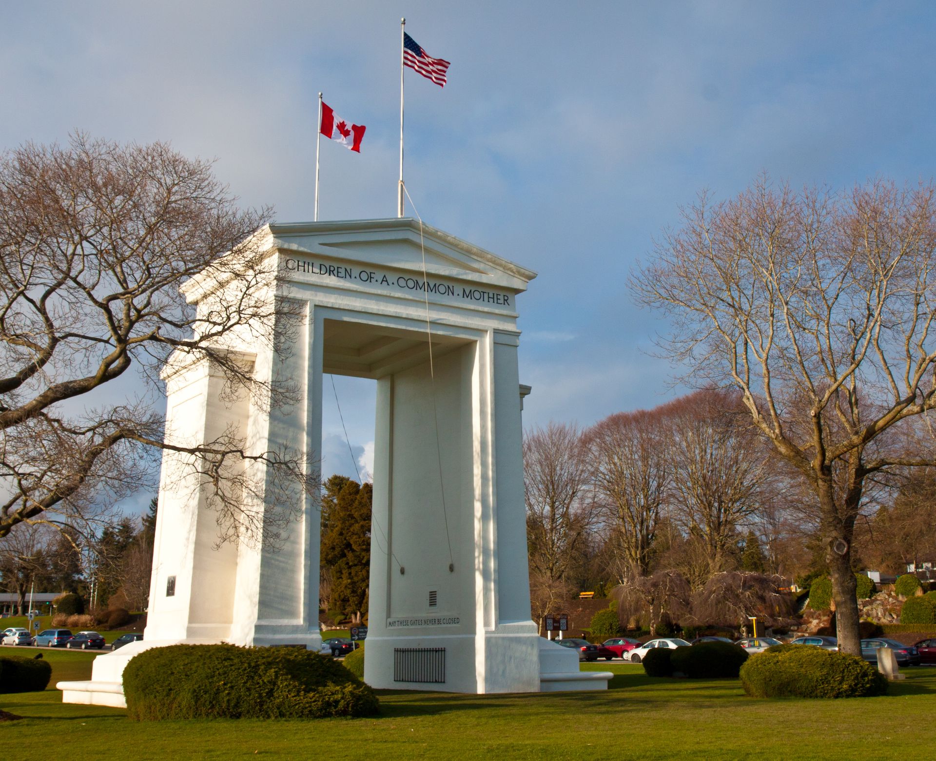
At the far western edge of the U.S.-Canada border, where the line meets the Pacific coast near Blaine, Washington state, a 20-meter-tall white arch rises directly out of the ground on the international boundary itself. This is the Peace Arch, dedicated in 1921 to mark more than a century of peace between the U.S. and Canada following the War of 1812, and it sits inside a unique binational park that straddles the border without a fence in sight.
Peace Arch Park is technically two parks: Peace Arch Historical State Park on the American side, in Blaine, and Peace Arch Provincial Park on the Canadian side, near Surrey, British Columbia. Visitors can walk between the two halves of the park and cross the international line as many times as they like, taking photographs beside the arch itself without a passport check, so long as they stay inside the park grounds.
The arch's design carries the peace theme through its details. Iron gates inside the archway are permanently fixed open, and inscriptions on each side read "Children of a common mother" facing the U.S. and "Brethren dwelling together in unity" facing Canada. The monument was funded and championed by Samuel Hill, an American road builder and peace advocate, and built using steel and concrete contributed from both countries.
The park has hosted its share of history beyond the ribbon-cutting. In 1952, the singer and activist Paul Robeson, barred from international travel during a period of political tension in the U.S., performed from a flatbed truck parked on American soil to an audience gathered on the Canadian side, since the border itself could not stop his voice from carrying. During the pandemic, the park briefly became known as a meeting place for binational couples and families kept apart by travel restrictions, since standing inside it did not count as officially entering the other country.
Leaving the park to enter Canada or the U.S. proper still requires passing through the formal border checkpoints at either end, and current entry requirements should always be checked before a visit. Within the park boundaries themselves, though, the border remains what its builders intended: a line to be crossed freely, marked by gardens, lawns, and a monument built by two countries working together rather than staying on separate sides of a fence.
Credit: Ramkumar Ramachandran / Pexels
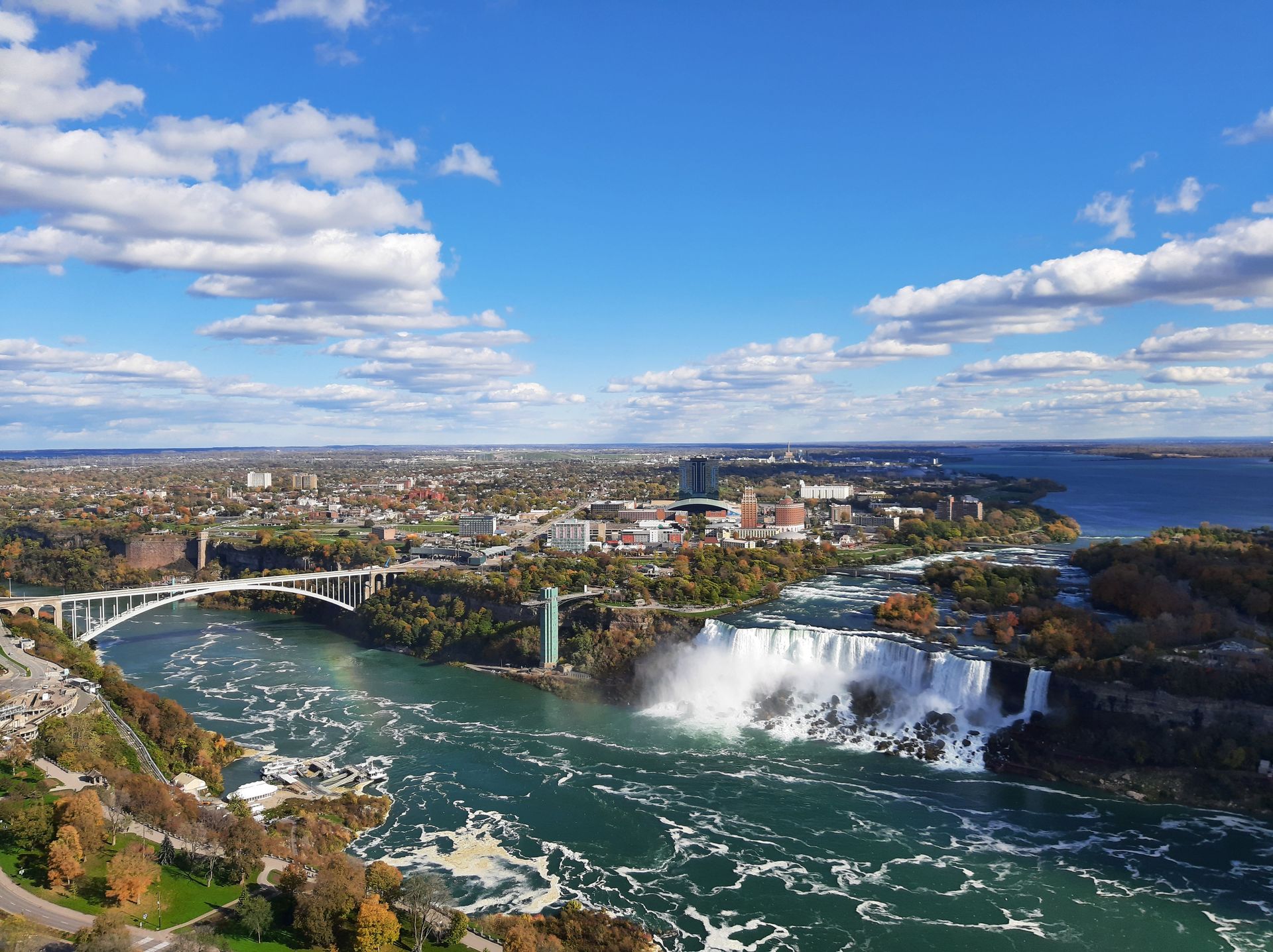
Just downstream from the roaring drop of Niagara Falls, a steel arch bridge connects the cities of Niagara Falls, New York, and Niagara Falls, Ontario. Known as the Rainbow Bridge for the rainbows that often form in the mist blowing off the falls, it opened in 1941 and remains one of the more scenic and heavily used border crossings between the U.S. and Canada.
The bridge carries both vehicle lanes and a dedicated pedestrian walkway, and it is the walkway that gives visitors the clearest sense of standing directly on an international border. Roughly halfway across, a bronze plate fixed to the railing marks the exact spot where the U.S. ends and Canada begins. Travelers $TRV who pause there can look south toward the Niagara Gorge or north toward the Canadian skyline while standing with one foot in each country, mist from the falls drifting across the bridge deck below.
Crossing on foot takes about 10 to 15 minutes at a relaxed pace, longer if the crowds are heavy or the view demands a few extra photographs. A passport or equivalent travel document is required in both directions, and small tolls apply to pedestrians and cyclists, collected only when entering one of the two countries rather than both. Commercial trucks are barred from the bridge entirely, which keeps traffic lighter here than at some of the region's other crossings.
The bridge takes its name from the natural spectacle beside it rather than any literal color scheme, since the structure itself is plain steel rather than painted in rainbow hues. It replaced an earlier span, the Honeymoon Bridge, which collapsed in 1938 after a buildup of ice in the gorge below cracked its supports. The current bridge's designer, Richard Lee, also worked on the nearby Lewiston-Queenston Bridge farther down the river.
For many visitors, walking across the Rainbow Bridge is treated as an attraction in its own right rather than simply a way to get from one country to the other. The views of both American Falls and Horseshoe Falls from the bridge deck are considered among the best in the area, and the experience of formally leaving one nation and entering another on foot, with a waterfall as the backdrop, is not something many other border crossings in the world can offer.
OCT_2012_(8157355503)-1920x1280.jpg)
Credit: calflier001 / Wikimedia Commons (CC BY-SA 2.0)
Roughly 50 kilometers northwest of Seoul, along one of the most heavily fortified borders on Earth, sits a small cluster of buildings known as Panmunjom. This is the Joint Security Area, the one place along the Korean Demilitarized Zone where soldiers from North and South Korea stand facing each other at close range, and the site most associated with the idea of physically stepping from one Korea into the other.
The Korean War ended in 1953 not with a peace treaty but with an armistice, which pulled both sides' forces back two kilometers to create the Demilitarized Zone, a buffer strip that despite its name is one of the most heavily armed borders anywhere. Inside that zone, at Panmunjom, a set of low blue buildings straddles the Military Demarcation Line. A conference table inside the main building sits with its center line exactly on the border, meaning a visitor can walk around one end of the table and technically step from South Korea into North Korea within the same room.
That crossing has happened on camera more than once, most notably during a 2018 inter-Korean summit and a brief, informal crossing by a sitting U.S. president the following year. For ordinary travelers, access to the Joint Security Area has depended heavily on the political climate at any given moment. Tours were suspended for extended periods after a 2023 incident involving an unauthorized crossing, and access since then has been intermittent, with visitor programs sometimes limited to a nearby information center rather than the blue buildings themselves.
Visiting, when tours are running, involves a formal process. Travelers $TRV typically join a guided group from Seoul, provide passport details in advance, follow a strict dress code, and receive a briefing at a nearby military post before being escorted to the site. Photography rules are enforced closely, and visitors are told not to gesture or point toward soldiers on the northern side.
Because conditions change without much notice, anyone hoping to visit Panmunjom should confirm current tour availability before planning a trip. Even when the blue buildings themselves are off-limits, nearby overlooks and museums still offer a view into the Demilitarized Zone and an explanation of why this narrow strip of land remains one of the most closely watched borders anywhere in the world.
Credit: Jeremy Boley / Unsplash
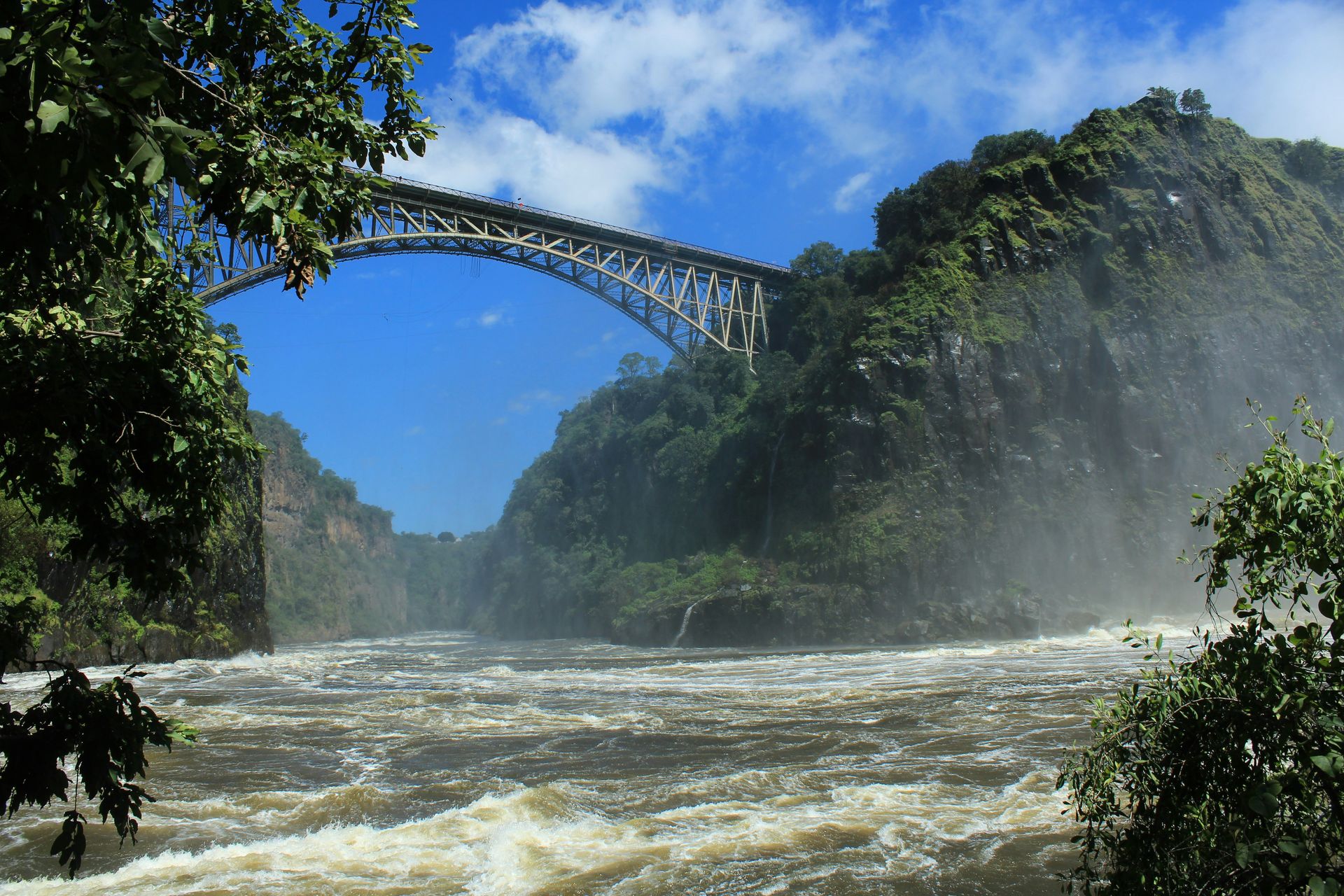
Below the thundering curtain of Victoria Falls, where the Zambezi River drops into a narrow gorge on the border between Zambia and Zimbabwe, a century-old steel bridge spans the divide. Victoria Falls Bridge was commissioned in 1900 by the British colonialist Cecil Rhodes, who wanted a rail crossing built close enough to the falls that passengers on passing trains would feel the spray on their faces. Rhodes died before construction began, but the bridge was completed in 1905 largely to his specifications.
The bridge carries road, rail, and foot traffic across the gorge, linking the town of Victoria Falls in Zimbabwe with the city of Livingstone in Zambia. Border posts sit at either end, and the stretch of bridge between them is treated as neutral ground rather than the territory of either country, a detail that made it useful for a set of unsuccessful political negotiations in 1975, when Rhodesian and regional leaders met inside a railway carriage suspended above the gorge specifically because the location did not belong to either side.
Today the bridge is best known for adventure tourism rather than diplomacy. A commercial bungee operation has run from the bridge since the early 1990s, offering a jump of about 111 meters toward the Zambezi below, along with a swing and a zip line that crosses the gorge from the Zambian side to the Zimbabwean one. Visitors can also join a historical walking tour out onto the bridge deck itself, 128 meters above the river, to learn about its construction and its role linking the two countries for more than a century.
Crossing the bridge to see the falls from both sides requires stopping at border posts and, depending on nationality, purchasing a day visa on either the Zambian or Zimbabwean side. Many visitors choose to base themselves in one country and make a day trip across to see the other, since both Victoria Falls town and Livingstone offer different, complementary views of the same falls.
More than a century after it opened, Victoria Falls Bridge remains one of only three road links between Zambia and Zimbabwe and the only rail connection between the two countries, making it as important to regional transport today as it was to Rhodes's original vision of a railway running the length of the African continent.

Credit: Simonetta Di Zanutto on Flickr / Thiodor2012 / Wikimedia Commons (CC BY-SA 2.0)
For most of the 20th century, a fence ran straight through what should have been a single town on the border between Italy and what was then Yugoslavia. After the Second World War, a 1947 peace treaty gave the historic city of Gorizia to Italy while assigning its railway station, on the eastern edge of town, to Yugoslavia. Rather than lose access to that station, Yugoslavia built an entirely new city beside it, called Nova Gorica, meaning simply New Gorica in Slovenian.
For decades, the two cities faced each other across a heavily guarded frontier, separated by the kind of fencing associated with the Iron Curtain elsewhere in Europe. That changed in 2007, when Slovenia joined the Schengen area and the physical barriers came down. The border still exists on paper, running directly through a large plaza in front of the old railway station, known on the Italian side as Piazza Transalpina and on the Slovenian side as Trg Evrope, or Europe Square $SQ. A round mosaic set into the pavement marks the exact line, and visitors can stand with one foot in each country while looking at a station building that once symbolized division.
In 2025, Nova Gorica and Gorizia jointly held the title of European Capital of Culture, the first time in the program's history that the honor went to two cities in two different countries at once, sharing the title that year with the German city of Chemnitz. The joint program, built around the idea of a border transformed into a meeting place, funded new cultural venues, a pedestrian bridge over the nearby Soča River, and an underpass connecting Nova Gorica directly to the border square.
Beyond the symbolism, the two cities function increasingly as one urban area, sharing a joint administrative board since 2011 and a dedicated cross-border bus line, launched in 2026, connecting the Gorizia train station with the Nova Gorica bus station. Italian and Slovenian mix easily in shops and cafés on both sides of the old line.
Visitors drawn by the 2025 cultural program will find that the border square, and the broader spirit behind it, remain worth a visit well after that year's official events ended, alongside the region's vineyards, the emerald waters of the Soča River, and Gorizia's centuries of layered history under Habsburg, Italian, and Yugoslav rule.
Credit: Andreas Hörstemeier / Wikimedia Commons (CC BY-SA 2.0)
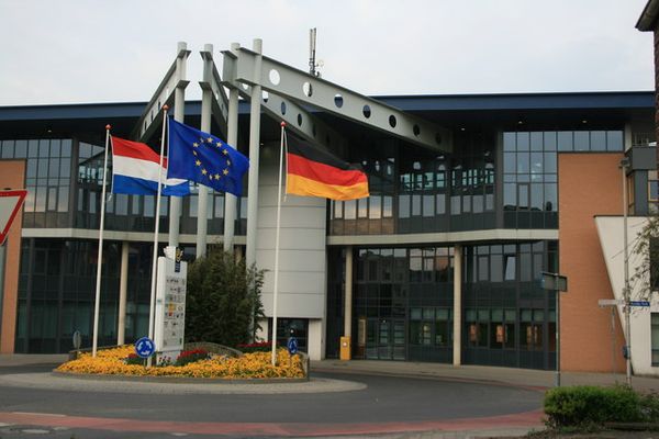
On a quiet street connecting the Dutch town of Kerkrade with the German town of Herzogenrath, a modern office building was constructed in 2001 with an unusual condition attached to its design: it had to sit directly on top of the international border. The result, called the Eurode Business Center, is a rare example of a building deliberately placed astride two countries rather than one that simply happens to sit near a boundary.
Kerkrade and Herzogenrath were effectively one community until the Congress of Vienna redrew borders across Europe in 1815, splitting families and streets between the Netherlands and what would become Germany. The two towns have spent the years since finding ways to function as a single place despite the line between them, sharing a joint name, Eurode, along with institutions such as a combined fire service and a shared police presence. Local residents can even borrow library books from either side of the border.
The Eurode Business Center, opened in June 2001 by the sitting Dutch prime minister and the state premier of North Rhine-Westphalia, took that cooperation further by building the border directly into its architecture. Dutch brick covers the Netherlands side of the building's exterior while German plaster covers the German side. Around 70 businesses currently operate inside, and companies can choose to register as a Dutch or German legal entity depending on which side of the building they occupy, letting some firms take advantage of tax and employment rules on either side of the line.
The building also houses practical cross-border services, including a joint police station and an information point that helps commuters who live in one country and work in the other navigate the tax, pension, and social security systems of both. Regular walk-in sessions are held for residents confused by paperwork that changes depending on which side of a hallway they happen to be standing on.
Unlike more famous border landmarks built for tourists, the Eurode Business Center was designed primarily to solve practical problems for two towns that never stopped thinking of themselves as one community. Visitors who do stop by will find a working office building rather than a monument, but one where a short walk from one end to the other genuinely means leaving the Netherlands and entering Germany.
Credit: (WT-shared) FreakRob / Wikimedia Commons (CC BY-SA 3.0)
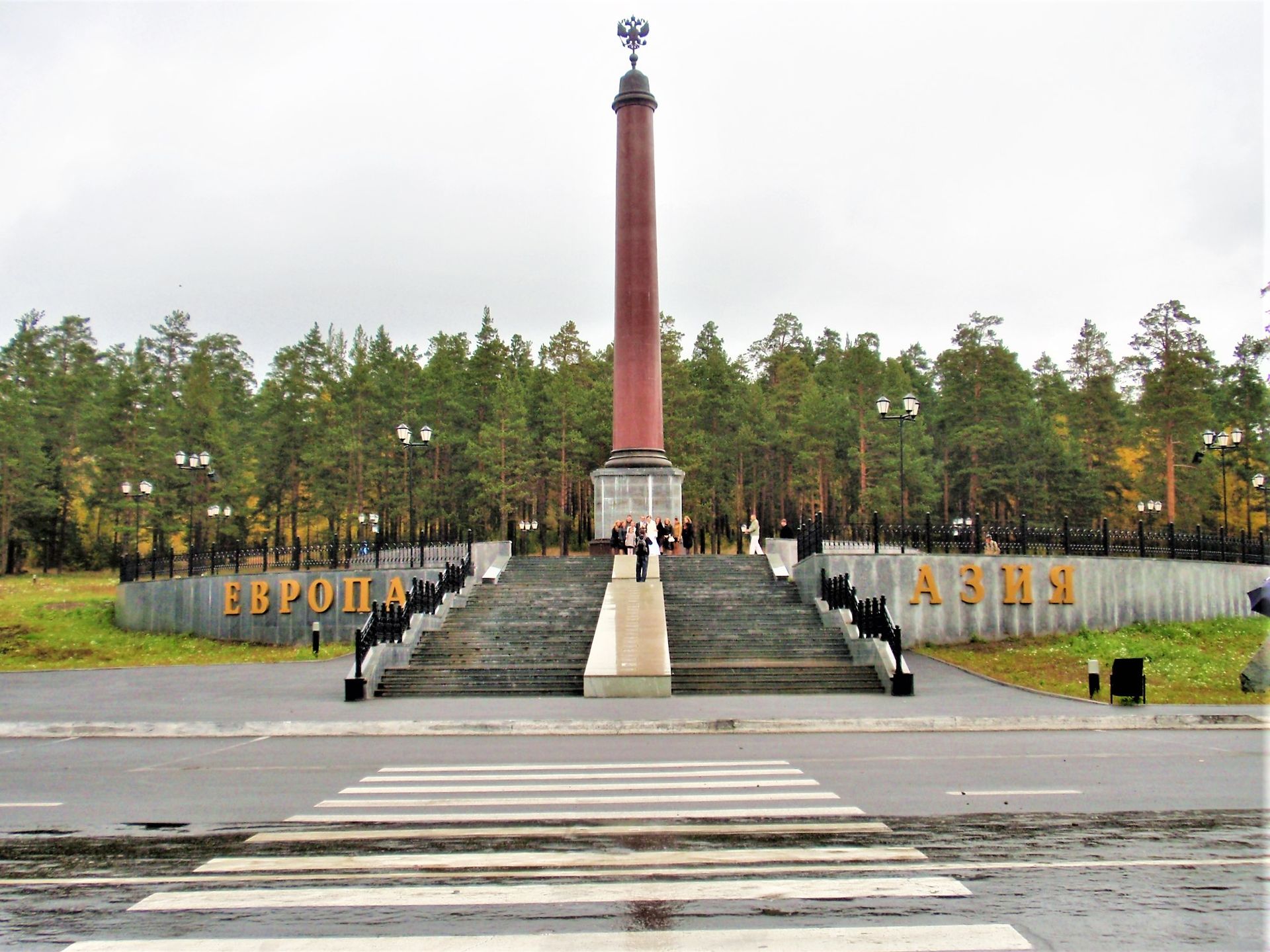
The Ural Mountains, a long, relatively low range running north to south through Russia, have marked the conventional boundary between Europe and Asia since the early 18th century, an idea first proposed by a Swedish army officer held prisoner in the region and later championed by Vasily Tatishchev, the founder of the city of Yekaterinburg. Because that boundary runs directly through Russian territory rather than along a coastline or a river between two countries, it created something unusual: a single nation with a foot on each continent, a status Russia shares with only a handful of other countries.
Near Yekaterinburg, several monuments mark the line at different points, since the exact boundary has always been more a matter of convention than precise survey. The most visited sits about 17 kilometers from the city center along the highway toward Perm, a marble obelisk topped with a metal spire bearing the letters E and A, for Europe and Asia. At its base sit two stones, one carried from Cape Roca in Portugal, the westernmost point of mainland Europe, and the other from Cape Dezhnev in far eastern Russia, marking the easternmost edge of Asia.
An older and more historically significant marker stands near the town of Pervouralsk, close to Mount Berezovaya. First built in wood in 1837 ahead of a visit by the future Tsar Alexander II, it was later rebuilt in marble and topped with a double-headed eagle. According to local tradition, the tsarevich marked the occasion by drinking a glass of wine on the European side of the marker and a second on the Asian side, a gesture visitors sometimes still repeat with a toast of their own.
Reaching the obelisks generally requires a taxi or an organized tour from Yekaterinburg, since no regular public transportation serves the sites directly. Newlyweds are a common sight at the markers, tying ribbons to nearby trees for good luck, and the obelisk closest to the city has become recognizable enough to appear on Russia's redesigned 5,000-ruble banknote alongside other Yekaterinburg landmarks.
Istanbul's marathon is often described as the only marathon course to cross two continents, but Yekaterinburg has quietly staked its own claim, hosting a Europe-Asia International Marathon $MPC that follows the same boundary the obelisks mark, giving runners here the chance to cross from one continent into the other without ever leaving Russian soil.
Credit: Joshua Kettle / Pexels
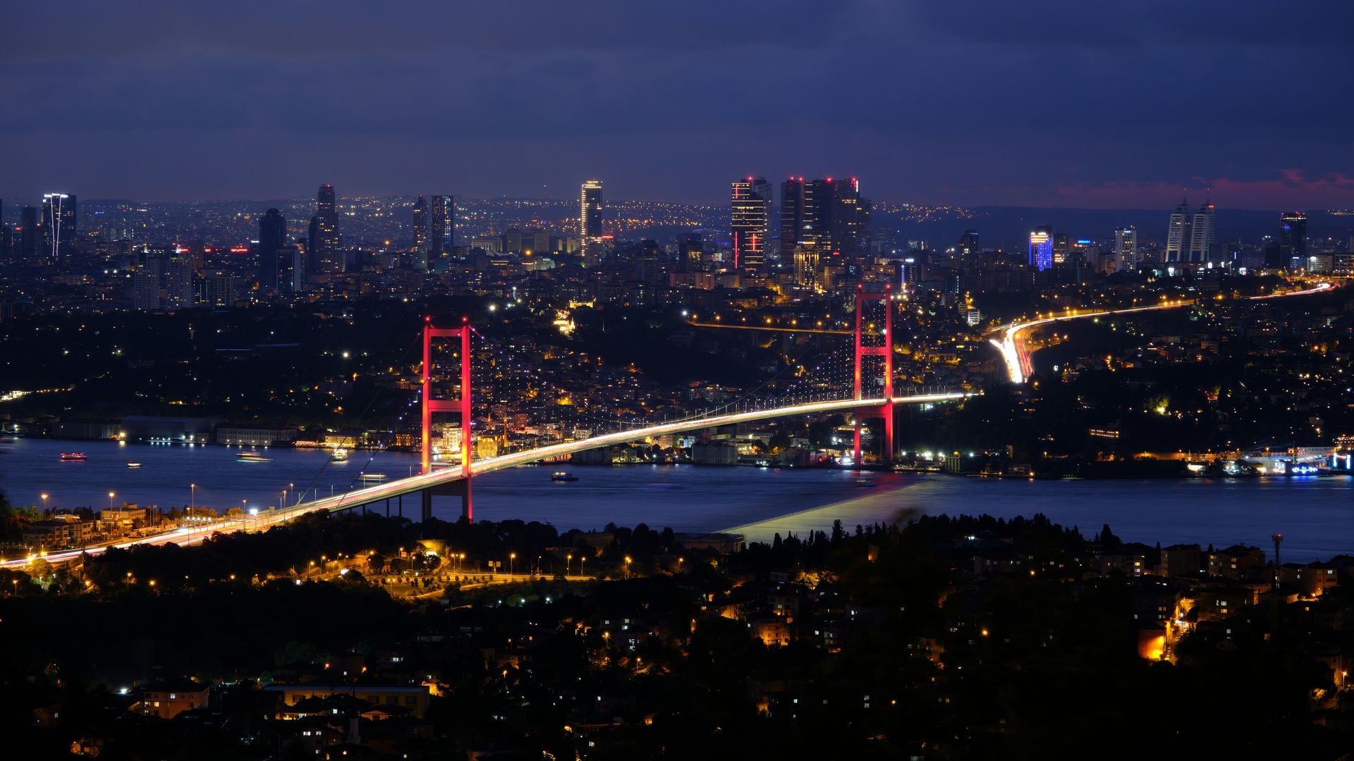
Most cities sit entirely on one continent or another, but Istanbul straddles the line between them. The Bosphorus Strait, a narrow waterway connecting the Black Sea to the Sea of Marmara, splits the city in two: a European side to the west and an Asian side to the east. Roughly 15 million people live in Istanbul today, spread across both continents and connected by a set of bridges, tunnels, and ferries that carry hundreds of thousands of commuters back and forth every day.
Three suspension bridges span the Bosphorus, linking the European and Asian sides for vehicle traffic. Beneath the strait, the Marmaray rail tunnel and the Eurasia road tunnel let trains and cars pass under the water rather than over it, meaning a subway ride through central Istanbul can involve crossing from one continent to another without a passenger ever noticing the transition. Ferries have carried passengers across the strait for far longer than any bridge or tunnel has existed, and the short boat ride remains one of the more scenic ways to move between continents in the city.
Once each year, one of these crossings closes to traffic entirely for the Istanbul Marathon $MPC, widely described as the only marathon course in the world that passes through two continents. Runners start on the Asian side of the city, cross a bridge over the Bosphorus with the strait visible far below, and finish on the European side near the Blue Mosque and the Hippodrome, passing landmarks including Dolmabahçe Palace and the Galata Bridge along the way. The race has run most years since 1979 and now draws tens of thousands of participants from around the world.
Istanbul's position between continents is not just a geographic curiosity. For more than 1,500 years, the city, first as Byzantium, then Constantinople, then Istanbul, has served as a meeting point between European and Asian trade routes, religions, and empires, a role reflected today in landmarks like the Hagia Sophia and the Topkapi Palace, which sit within walking distance of each other on the European side alone.
Visitors curious about the continental divide do not need to run a marathon to experience it. A short ferry ride from the European district of Eminönü to the Asian district of Üsküdar takes only about 15 to 20 minutes and costs little, offering one of the simplest ways anywhere in the world to travel from Europe to Asia and back again in a single afternoon.
Credit: AashayBaindur / Wikimedia Commons (CC BY-SA 3.0)
Egypt is unusual among the world's nations in that its territory spans two continents. The vast majority of the country lies in Africa, but the Sinai Peninsula, across the Suez Canal, is considered part of Asia. The canal itself, a human-made waterway completed in 1869 connecting the Mediterranean and Red Seas, has served as the conventional dividing line between the two continents ever since, meaning a country that looks unified on a map is technically split between them.
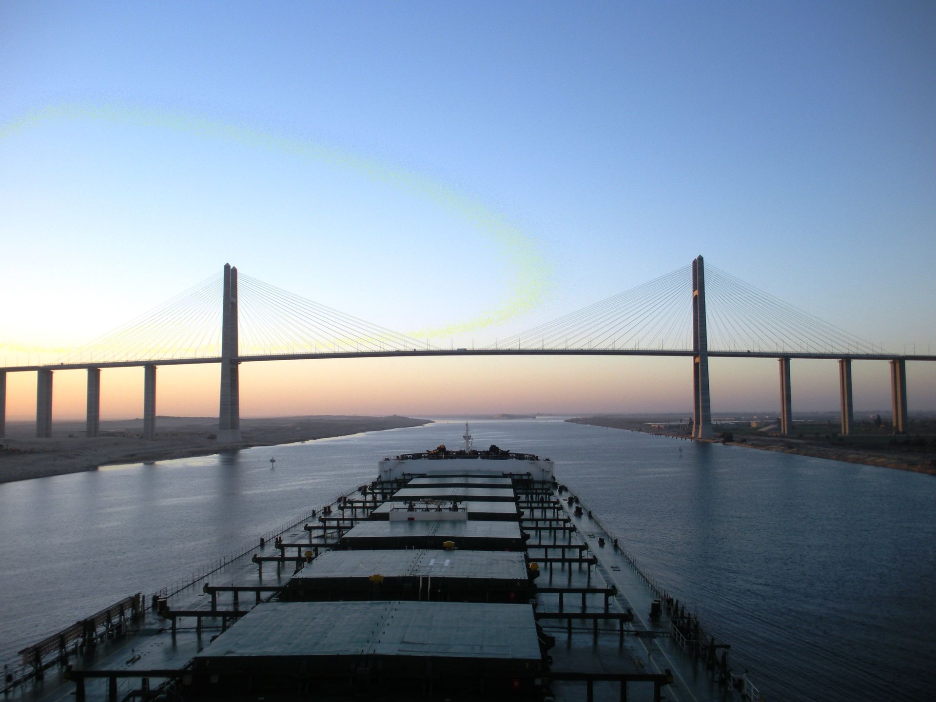
For more than a century after the canal opened, crossing it meant waiting for a ferry or a temporary pontoon bridge, since a permanent structure risked blocking one of the busiest shipping routes in the world. That changed in 2001 with the completion of the Suez Canal Bridge, sometimes called the Al-Salam Peace Bridge or the Egyptian-Japanese Friendship Bridge in honor of the Japanese government funding that covered 60 percent of its construction cost. The bridge crosses the canal near the town of El Qantara, whose name simply means "the bridge" in Egyptian Arabic.
Two pylons shaped like ancient Egyptian obelisks rise 154 meters above the water, supporting a cable-stayed span with 70 meters of clearance underneath, enough for large container ships and tankers to pass beneath without slowing down. The full crossing, including its approach roads, stretches about 3.9 kilometers, connecting mainland Egypt in Africa with the Sinai Peninsula in Asia by road for the first time in the canal's history.
A second option exists for travelers who would rather go under the canal than over it. The Ahmed Hamdi Tunnel, an older crossing built beneath the waterway, carries vehicle traffic between the two continents as well, giving Egypt two separate fixed links across one of the world's most important shipping channels.
For most travelers, crossing the Suez Canal Bridge or driving through the tunnel beneath it is simply part of a longer journey between Cairo and the beach resorts of the Sinai Peninsula, rather than a destination in its own right. Still, few other places in the world let a driver cross from one continent to another on a bridge without ever leaving the same country, using a road that exists specifically because two of the busiest sea lanes on Earth meet at this single point in the desert.
Credit: Slava Auchynnikau / Unsplash
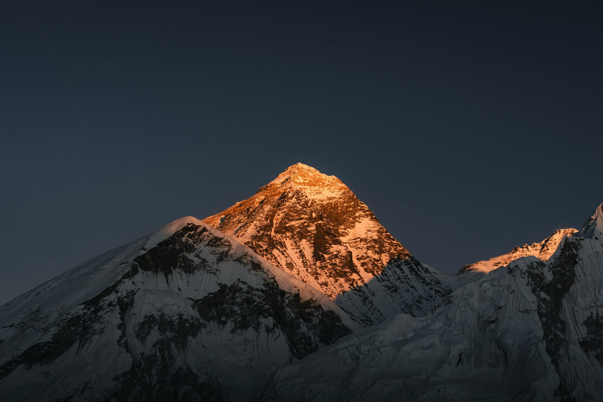
At 8,849 meters, Mount Everest is the highest point on Earth, and it also happens to sit directly on an international border. The line between Nepal and China, specifically the Tibet Autonomous Region, runs across the mountain's summit ridge, meaning the small patch of snow and rock at the very top of the world belongs to neither country alone. Climbers who reach the summit are, technically, standing in both nations at once.
Nepal calls the mountain Sagarmatha, while in Tibet it is known as Chomolungma. Both names are used officially, and for decades the two countries even measured the mountain's height differently, since Chinese surveys traditionally excluded the snow cap while Nepali measurements included it. In 2020, after a joint survey, Nepal and China agreed on a single official height, settling a small but symbolically important disagreement between the two nations that share the peak.
The two sides of the mountain offer very different climbing experiences. The southern route, through Nepal's Khumbu region, is by far the more popular approach, supported by decades of infrastructure, experienced Sherpa guiding teams, and the option of independent trekking to base camp for those with no interest in reaching the summit itself. The northern route, through Tibet, allows vehicles to reach a base camp accessible by road, but requires more restrictive permits and generally attracts fewer climbers.
Reaching the exact summit, where the border technically runs, is obviously not something available to casual visitors. Only a few thousand people have ever stood there since Edmund Hillary and Tenzing Norgay made the first confirmed ascent in 1953, and the climb remains dangerous enough that several hundred people have died attempting it. For nearly everyone else, the closest most travelers get to the Nepal-China border at altitude is one of the base camps on either side, both of which offer views of the summit from a considerable, and considerably safer, distance.
Still, Everest belongs on any list of places where a national border becomes something physical rather than abstract, if only because it is one of the most extreme examples on Earth: a boundary between two countries drawn not through a valley or a city, but across the highest and most inhospitable point on the planet.
Credit: Desaga Thierry / Pexels
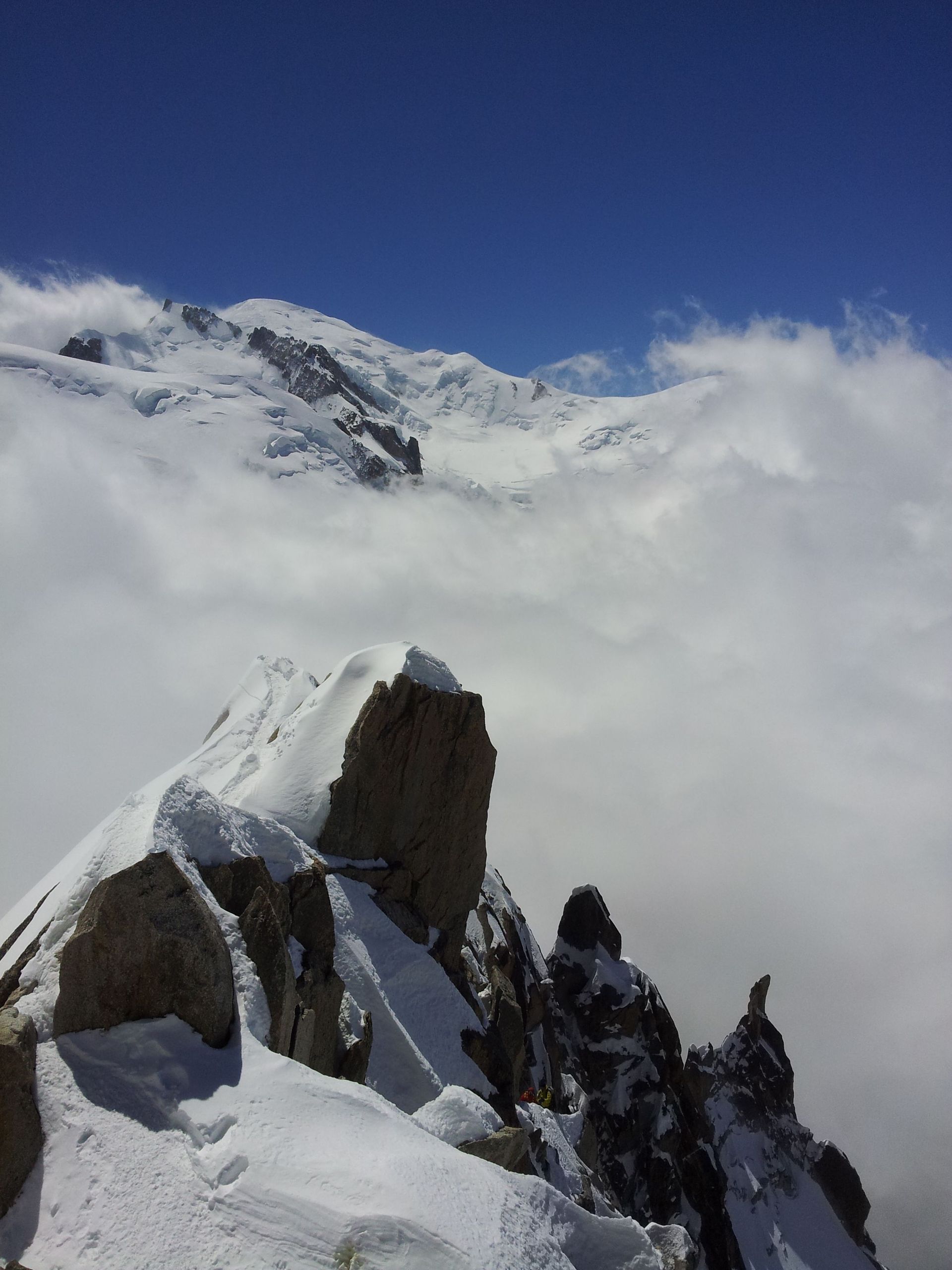
Rising 4,807 meters above the Alps, Mont Blanc is the highest mountain in Western Europe, and it sits on the border between France and Italy. Unlike Mount Everest, however, exactly where that border falls at the summit has been a genuine, ongoing disagreement between the two countries for more than a century, one of the more unusual diplomatic disputes still active between two members of the European Union.
The disagreement traces back to an 1860 treaty that assigned the border along the region's watershed, the natural line separating valleys that drain toward France from those draining toward Italy. French government maps, based on later 19th-century surveys, place the summit entirely within French territory. Italian maps, by contrast, argue that the original watershed line splits the summit, along with a nearby peak called the Dôme du Goûter, between both countries. The disputed area amounts to roughly 65 hectares atop Mont Blanc itself, a small but symbolically significant patch of ice and rock.
Both governments have raised the issue periodically without resolving it. Italian officials have formally protested what they view as French cartographic overreach, while France has generally described the disagreement as a matter of differing interpretations rather than a dispute requiring urgent resolution. Switzerland's official mapping agency takes a notably neutral position, marking the summit area as contested territory on its own maps of the region.
For climbers, the disagreement rarely intrudes on the experience of summiting the mountain itself. Most ascents begin from Chamonix on the French side, using the popular Goûter Route, while the Italian town of Courmayeur offers access from the other side of the massif. A cable car connects the two towns across the mountain range by way of the Col du Géant, letting visitors move between French and Italian territory at altitude without climbing at all.
Mont Blanc is a reminder that not every border dispute involves military tension or global headlines. Sometimes two friendly, neighboring democracies simply disagree, quietly and for well over a century, about exactly where one country ends and the other begins at the top of a mountain both claim as a point of national pride.
Credit: Aliman5040 / Flickr (CC BY-SA 3.0)
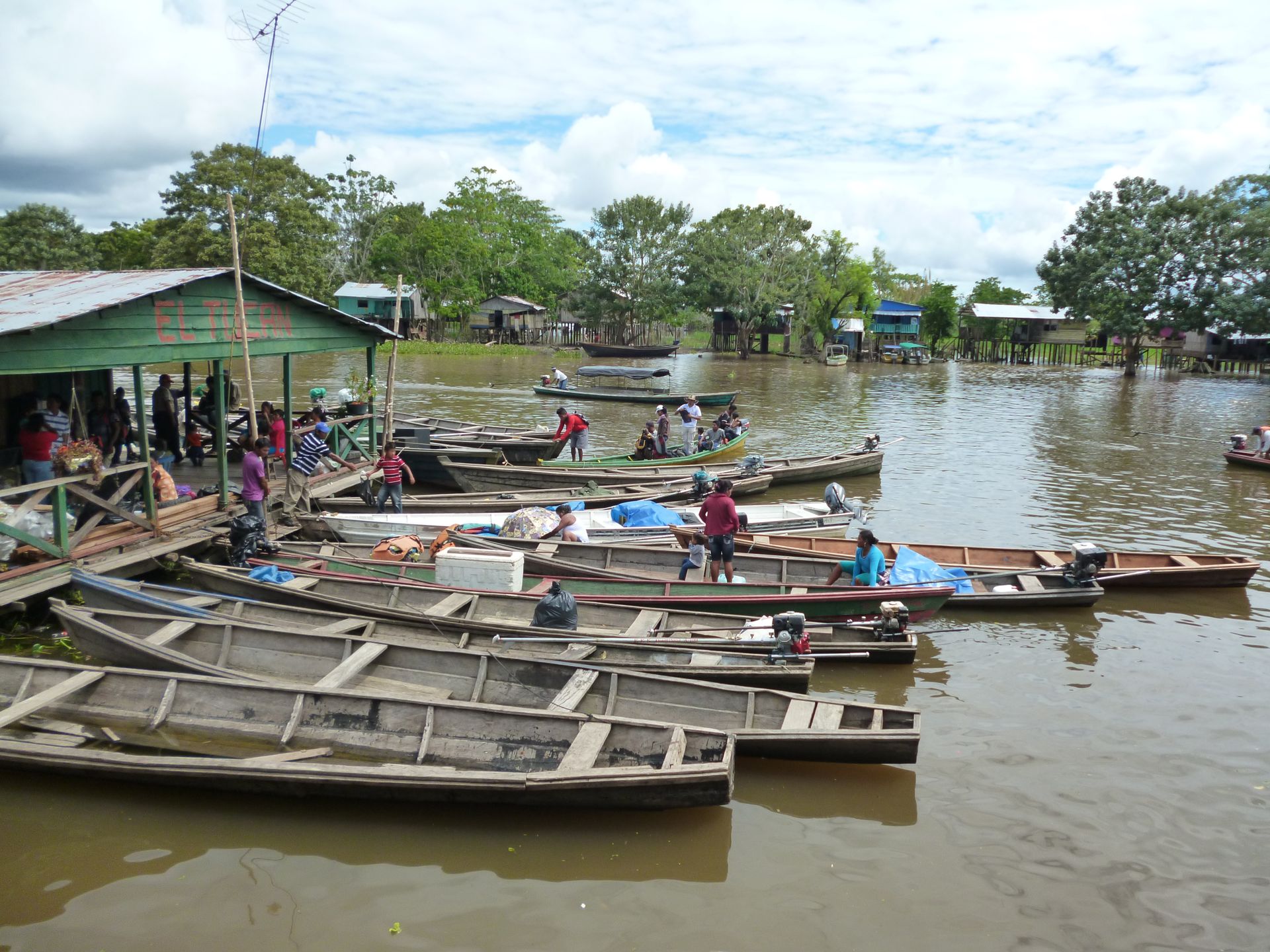
Deep in the Amazon $AMZN rainforest, where Brazil, Colombia, and Peru meet, two cities have grown together so closely that the international border between them amounts to little more than a street. Tabatinga, in Brazil, and Leticia, in Colombia, sit side by side along the Amazon's Solimões River, separated by a road called Avenida da Amizade, or Friendship Avenue, which functions as the border itself.
There is no fence, checkpoint, or gate along most of this line. Residents and visitors walk, drive, or take a motorized rickshaw back and forth between the two cities constantly, for shopping, work, or simply a change of scenery, without showing identification. The mix of Portuguese and Spanish spoken in the area has even produced a local blend sometimes called Portuñol, a sign of just how thoroughly the two communities have merged despite belonging to different countries.
That informality has limits. Travelers $TRV who need an official entry or exit stamp, whether to continue deeper into Brazil or Colombia or to satisfy a border check elsewhere later, must visit a dedicated immigration office in each town: Brazil's Federal Police post in Tabatinga, and Colombia's immigration desk at the Leticia airport. It is entirely possible to walk across the open border without doing this, but skipping it can create complications later for travelers who need proof of a legal entry or exit.
A third country sits within easy reach as well. Santa Rosa de Yavarí, a small Peruvian village, faces both Tabatinga and Leticia across the river and is reachable by a short boat ride, giving visitors the option of touching three countries in a single day, something rarely possible anywhere else in South America without a far longer journey.
Because neither Tabatinga nor Leticia connects to the rest of its country by road, most visitors arrive by air or by a multi-day boat trip along the Amazon from cities like Manaus. That isolation is part of what has allowed the two towns to develop a shared identity of their own, shaped as much by the river and the rainforest around them as by the national governments in Brasília and Bogotá that technically govern each side of Friendship Avenue.
Credit: Diego Rezende / Pexels
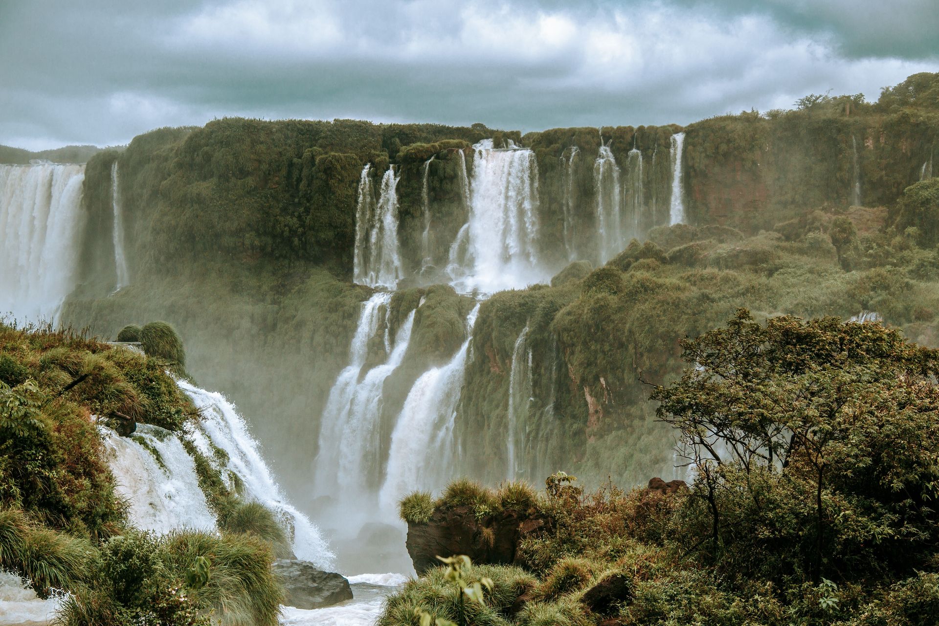
Where the Iguazú and Paraná rivers meet in South America, three countries come together at a spot known simply as the Triple Frontier. Argentina, Brazil, and Paraguay each claim a stretch of riverbank near the confluence, and each has built an obelisk, painted in its own national colors, to mark the spot from its own side of the water.
The three cities anchoring the area, Puerto Iguazú in Argentina, Foz do Iguaçu in Brazil, and Ciudad del Este in Paraguay, together form one of the largest tripoint regions by population anywhere in the world, home to roughly 950,000 people. Most travelers experience the Triple Frontier from one of the riverside viewpoints, where all three obelisks are visible at once across the water, rather than by physically standing at the exact point where the borders converge, since that spot sits in the river itself rather than on dry land.
Visiting all three countries in a single day is nonetheless entirely realistic. The Tancredo Neves International Bridge connects Puerto Iguazú with Foz do Iguaçu across the Iguazú River, while the Friendship Bridge links Foz do Iguaçu with Ciudad del Este across the Paraná. A traveler based in any one of the three cities can cross both bridges, visit all three national obelisks, and return to a hotel bed the same night, passing through immigration at each crossing along the way.
The area's obelisks date to 1903, when a border treaty settled this stretch of the frontier, though the surrounding towns have transformed considerably since. Ciudad del Este in particular grew into a major hub for cross-border commerce, drawing shoppers from both Argentina and Brazil, while Foz do Iguaçu and Puerto Iguazú have built their economies primarily around tourism to the nearby Iguazu Falls, one of the largest waterfall systems on Earth.
Most visitors come to this corner of South America for the falls rather than the tripoint itself, but the Triple Frontier makes for an easy detour, offering a chance to see three national flags, three currencies, and three distinct cultures meet at the edge of one of the continent's most significant natural landmarks.
Credit: Mehmet Turgut Kirkgoz / Pexels
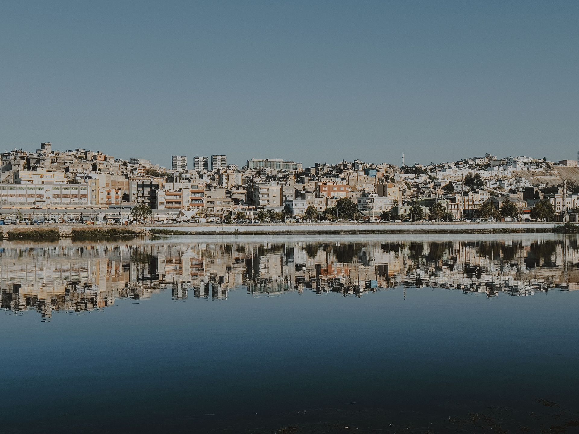
On the northern coast of Morocco, two small cities fly the flag of Spain. Ceuta and Melilla have been Spanish territories since the 16th century, centuries before Morocco existed as an independent state, and today they hold the unusual distinction of being the only places where the European Union has a land border on the African continent.
Both cities function as autonomous communities within Spain, using the euro, following Spanish law, and sending representatives to the Spanish parliament, just as mainland Spanish regions do. Ceuta sits near the Strait of Gibraltar, directly across the water from the British territory of Gibraltar, while Melilla lies farther east along the Moroccan coast. Both are physically surrounded by Moroccan territory on their landward sides, separated from it by fencing that has grown taller and more heavily monitored in recent years.
Morocco has never accepted Spain's claim to the two cities and regularly calls for their return, describing them as colonial holdovers similar to Gibraltar itself, a comparison Spain firmly rejects. Spain's position is that Ceuta and Melilla have been continuously Spanish for far longer than Morocco has existed in its current form, and that their populations, who vote in Spanish elections and identify largely as Spanish, should not be handed to another country against their wishes. The dispute has produced periodic diplomatic tension between Madrid and Rabat without escalating into open conflict.
For visitors, both cities offer a cultural mix shaped by their location. Roman ruins, Spanish colonial architecture, and Moorish influences sit alongside each other, and cross-border trade, both formal and informal, has long shaped daily life on both sides of the fence. Thousands of Moroccan women have historically worked as porters, carrying goods across the border for resale, a trade that depends heavily on the tax advantages of Ceuta and Melilla's special economic status within Spain.
Reaching either city typically means arriving by ferry from mainland Spain, since flights are limited and land border crossings from Morocco can be unpredictable depending on the state of relations between the two governments at any given time. For a traveler willing to make the trip, though, Ceuta and Melilla offer a rare geography lesson: proof that a European Union border can exist entirely surrounded by African soil.
Credit: Jermaine Lewis / Pexels
At just 87 square kilometers, the Caribbean island of Saint Martin is small enough to drive across in under an hour, yet it has been divided between two European countries for centuries. The northern, larger portion belongs to France as the Collectivity of Saint Martin, while the southern portion, Sint Maarten, is a constituent country within the Kingdom of the Netherlands. According to local legend, the two nations settled the exact border in 1648 with a walking race: a Frenchman and a Dutchman set off from opposite ends of the island, and the line was drawn wherever the two men met.
Whether or not the race actually happened as the legend describes, the resulting border has remained remarkably open for more than 370 years. There are no checkpoints, no customs booths, and no passport checks anywhere along the roughly 16-kilometer line separating the two sides. Drivers crossing between French and Dutch territory notice the change mainly through small details: the road surface, the language on signs, which switches between French and English or Dutch, and the currency, euros on one side and U.S. dollars widely accepted on the other.
An obelisk on Concordia Hill, along the main road connecting the French capital of Marigot with the Dutch capital of Philipsburg, marks the border formally. Built in 1948 to celebrate 300 years of peaceful coexistence between the two sides, it carries both the 1648 date of the original treaty and the 1948 anniversary, and remains a popular stop for visitors curious to stand with one foot in French territory and the other in Dutch.
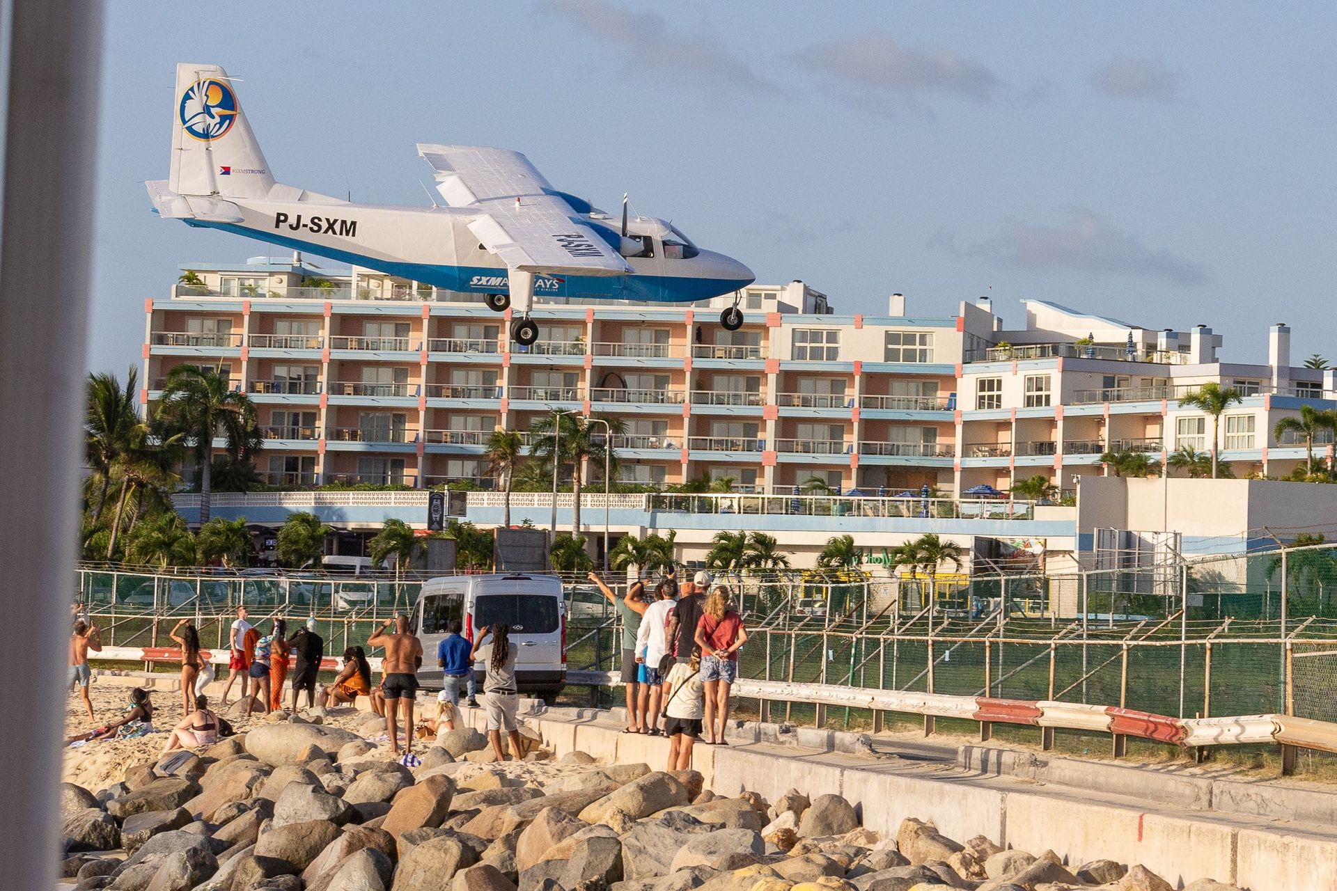
The island's split identity extends well beyond the border itself. Sint Maarten's Princess Juliana International Airport sits close enough to Maho Beach that arriving jets pass just above sunbathers' heads before touching down, a sight that has made the beach one of the most photographed spots in the Caribbean. The French side, meanwhile, tends to draw visitors looking for a quieter pace, with smaller resorts and a more distinctly European atmosphere in towns like Marigot and Grand Case.
A 2023 agreement between France and the Netherlands finally settled a long-running dispute over the border's exact path through Oyster Pond, a bay on the island's eastern coast, formally mapping more than 400 boundary points for the first time. Even with that update, the island's defining feature remains unchanged: two countries, one small piece of land, and a border that has stayed essentially open since the 17th century.
