From the Nile to the Mississippi, these 20 rivers didn't just carry water — they carried empires, trade routes, revolutions, and the rise of cities

Credit: BabijaPhoto JB / Pexels
Water does not wait. It cuts through rock, carries silt, drowns valleys, and deposits the sediment that becomes fertile ground. Long before humans understood hydrology, they understood something more immediate: life clusters around rivers. The earliest permanent settlements were not built on high ground for safety, nor in forests for shelter. They were built on riverbanks, where water was reliable, soil was rich, and movement was possible.
The story of human civilization is, in large part, a story of rivers. The Tigris and Euphrates defined the world's first cities in Mesopotamia. The Nile made Egypt possible — not just as a place to live, but as an empire capable of monumental ambition. The Indus gave rise to one of antiquity's most sophisticated urban cultures, with drainage systems and city planning that would not appear again in Europe for thousands of years. The Yellow River shaped China's earliest dynasties, and its floods shaped Chinese governance — demanding collective labor, centralized authority, and engineering ingenuity on a massive scale.
Rivers did more than sustain agriculture. They were the internet of the ancient world: the fastest, cheapest, and most reliable way to move goods, people, and ideas across vast distances. Roman merchants shipped olive oil up the Rhine. Arab traders navigated the Euphrates to reach Persian markets. West African kingdoms taxed the Niger River trade in gold and salt for centuries before European contact. The Congo Basin held together ecological and cultural networks across central Africa that colonial mapmakers would later carve apart with straight lines.
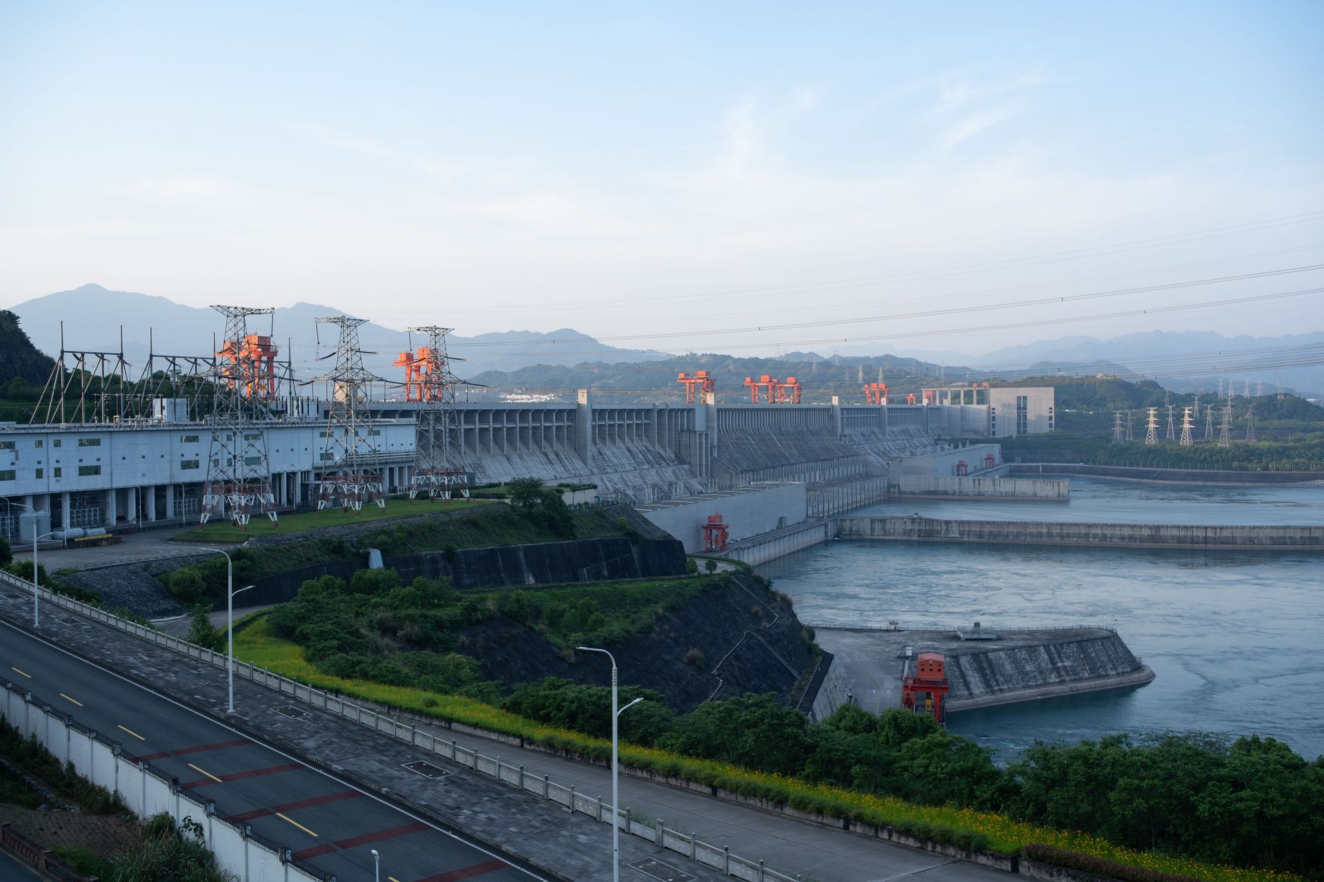
As industrialization arrived, rivers became something else again: power sources. The water wheel, the mill, the early factory — all of them depended on rivers with reliable gradient and flow. The rivers of New England powered the textile mills that launched American manufacturing. The Ruhr powered German steel. The Yangtze now powers a significant share of China's electricity through the Three Gorges Dam.
Rivers also shaped catastrophe. Floods destroyed cities, reshaped borders, and forced migrations that altered the genetic and cultural composition of entire regions. The Yellow River has changed course multiple times in recorded history. The Mississippi's great flood of 1927 accelerated the Great Migration of Black Americans northward. The Indus floods of recent decades have repeatedly displaced millions in Pakistan.
These 20 rivers are not simply geographic features. They are actors in human history — forces that determined who could eat, who could trade, who could build armies, and who could survive.
Credit: RDimitra M.K / Pexels
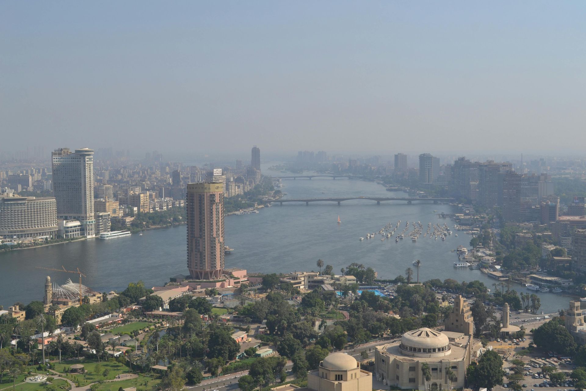
No river has inspired more sustained human ambition than the Nile. Stretching roughly 6,650 kilometers from its sources in the East African highlands to its delta on the Mediterranean coast, it is the longest river in the world by most conventional measurements. But its historical significance has never been about length. It was about the flood.
Every year, predictably, the Nile flooded its banks between June and September. When the waters receded, they left behind a thick layer of black silt — extraordinarily fertile soil in the middle of one of the world's most inhospitable deserts. The Egyptians called this strip of land "Kemet," the black land, and it was where they grew their grain, their flax, their papyrus. Beyond it was "Deshret," the red land — the desert that was hostile, deadly, and unfarming.
This geography concentrated the Egyptian population into a narrow corridor, which made it unusually easy to govern, tax, and mobilize for large projects. The pharaoh who controlled the Nile controlled everything. Massive bureaucracies grew up around the measurement of the flood, the distribution of water, and the administration of surplus grain. The nilometer — a graduated column used to measure flood height — was also a tool of fiscal control: a high flood meant high yields, which meant higher taxes.
The Nile's agricultural surplus was what made the pyramids possible. Contrary to the popular image of slaves under the lash, the pyramid builders were largely paid laborers — craftsmen, engineers, and seasonal workers who were fed from state granaries, treated for injuries by state physicians, and buried with honors when they died on the job. The pyramids were not just tombs. They were the product of a food surplus large enough to feed thousands of non-farming specialists year after year.
The Nile also connected Egypt to the wider ancient world. To the south, it linked Egypt to Nubia and the kingdoms of Sudan — trade partners, rivals, and at times rulers of Egypt itself. To the north, its delta gave access to the Mediterranean, where Egyptian grain became a strategic commodity that shaped the politics of Greece, Rome, and later the Byzantine Empire. Alexandria, built at the Nile's mouth by Alexander the Great in 331 BCE, became the ancient world's greatest center of scholarship, commerce, and cultural exchange.
Egypt's dependence on the Nile created a civilization unusually attentive to cycles, timing, and celestial observation. The Egyptian calendar was built around the flood. Their cosmology was shaped by the river's annual drama of death and renewal. Even their funerary culture — with its emphasis on preservation, passage, and afterlife — echoed the Nile's own rhythm: the land dies, the flood comes, and life returns.
Today the Nile remains central to the politics of northeastern Africa. Ethiopia's Grand Ethiopian Renaissance Dam, completed in stages from 2020, has created serious diplomatic tension with Egypt and Sudan, which depend on the river's flow. The ancient question — who controls the Nile? — has not been answered. It has only been updated.
Credit: SERHAT TUĞ / Pexels
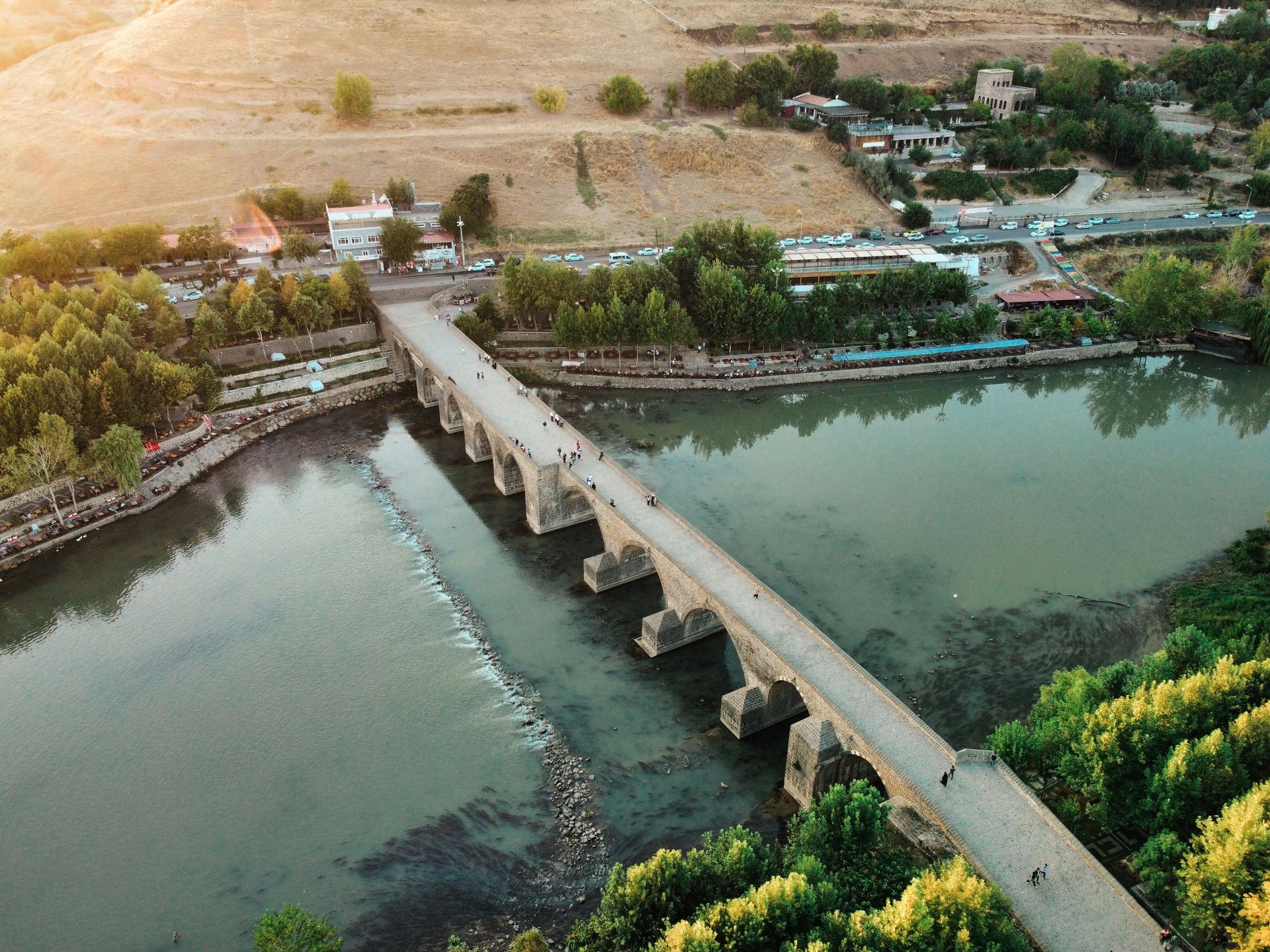
These two rivers gave the world its first cities. Rising in the mountains of eastern Turkey, the Tigris and Euphrates flow southeast through what is now Iraq and empty into the Persian Gulf — a journey of roughly 1,900 kilometers for the Euphrates and 1,850 for the Tigris. Between them lies a flat, alluvial plain that the ancient Greeks called Mesopotamia: "the land between the rivers."
Around 3500 BCE, the Sumerians built the world's first urban civilization here. The cities they founded — Uruk, Ur, Eridu, Nippur — were not villages that grew large. They were planned centers of administration, trade, and religious practice. Uruk, at its peak around 3200 BCE, had a population that may have reached 50,000 people, making it likely the largest settlement on Earth at that time.
The rivers made this possible, but not easily. Unlike the Nile, the Tigris and Euphrates flooded unpredictably — sometimes devastating, sometimes insufficient. The Sumerians responded with engineering. They built canals to redirect water, levees to contain floods, and irrigation channels to extend cultivation into land the rivers did not naturally reach. Managing this infrastructure required coordinated labor on a large scale, which in turn required administrative systems, record-keeping, and hierarchy.
Out of that administrative need came writing. The earliest known written documents — clay tablets inscribed with cuneiform script — are not poems or religious texts. They are inventories: records of grain stored, workers paid, livestock counted. Writing was born as a tool of economic management, and it was the Tigris-Euphrates civilization that first needed it badly enough to invent it.
Mesopotamia also produced the world's first legal codes. The Code of Hammurabi, inscribed around 1754 BCE during the Babylonian period, covered property rights, wages, trade regulations, and family law. It was not the first legal system in the region — earlier Sumerian and Akkadian codes existed — but it is the best preserved and most comprehensive from the ancient world.
The religious traditions of Mesopotamia left a permanent mark on the cultural heritage of billions. The Epic of Gilgamesh, written in Sumerian and later Akkadian, includes a flood narrative that closely parallels the biblical story of Noah. Mesopotamian cosmology, calendar systems, and astronomical observations shaped the development of early Jewish, Christian, and Islamic traditions, transmitted partly through the Hebrew Bible's origins in a region culturally continuous with ancient Mesopotamia.
The rivers themselves became symbols of cosmic order. The Tigris and Euphrates appear in the Book of Genesis as two of the four rivers flowing out of Eden. To the people who lived between them, these rivers were not just water sources. They were the axis around which the world was organized.
Credit: Rahul Pathania / Unsplash
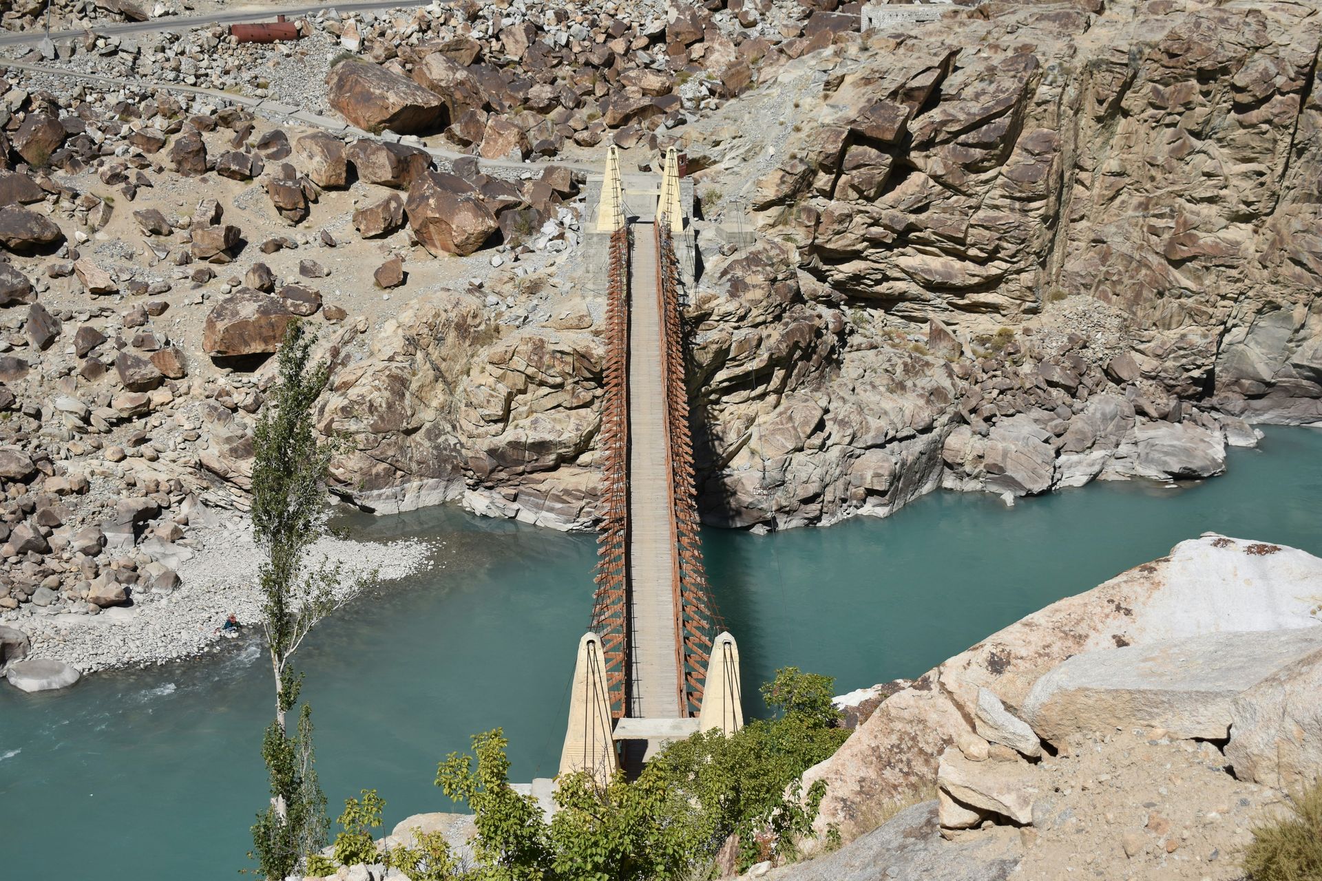
The Indus River flows approximately 3,180 kilometers from the Tibetan Plateau through what is now Pakistan to the Arabian Sea. For much of its length it is a high-volume, fast-moving river fed by glacial melt and monsoon rainfall. And along its banks, beginning around 3300 BCE, one of the ancient world's most sophisticated urban civilizations developed — and then, around 1900 BCE, almost entirely disappeared.
The Indus Valley Civilization, also called the Harappan Civilization after its best-known city, stretched across an area larger than ancient Egypt and Mesopotamia combined. Its two largest cities — Mohenjo-daro and Harappa — each had populations that may have exceeded 40,000 people at their height. They were built on a grid plan, with straight streets, standardized brick sizes, and a level of urban infrastructure that was not matched in Europe until the Roman period.
The most arresting feature of these cities was their sanitation. Nearly every house in Mohenjo-daro had access to a bathing room and a connection to a covered drainage system that ran beneath the streets. Waste was channeled into collection pits or channels outside the city. This was not primitive plumbing — it reflected a civic culture that placed high value on cleanliness, and an administrative system capable of building and maintaining city-wide infrastructure.
The Indus Valley people were prolific traders. Archaeological evidence shows that Indus goods — seals, beads, pottery — reached Mesopotamia and the Persian Gulf region. The standardized system of weights and measures used across Harappan sites suggests a sophisticated commercial culture, though the writing system they used to record transactions remains undeciphered.
Why the Indus Valley Civilization declined remains one of archaeology's central questions. The most widely supported explanation involves climate change: a prolonged weakening of the monsoon around 2000 BCE may have reduced the river's flow, undermining agriculture and forcing the population to disperse eastward toward the Ganges plain. The cities were not burned or sacked in any obvious way. They seem to have simply emptied out over several generations.
The Indus River today flows almost entirely through Pakistan, and the civilization that bore its name is one that present-day Indians, Pakistanis, and the global South Asian diaspora all claim as an ancestor. It represents a deep, pre-literate root of South Asian culture — urban, cosmopolitan, technically accomplished — that was forgotten for millennia before 19th-century archaeology recovered it.
Credit: Canva Images
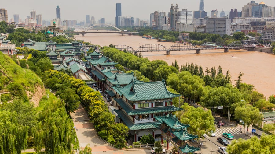
The Yellow River, known in Chinese as Huang He, is roughly 5,464 kilometers long and carries more sediment than any other river on Earth. That sediment — fine yellow loess soil blown in from the deserts of central Asia — gives the river its name and its character. It also makes the river extraordinarily unpredictable. Over the past three millennia, the Yellow River has changed its lower course more than two dozen times, and its catastrophic floods have killed more people than any other natural disaster source in history.
China's earliest dynasties — the Shang and Zhou — developed along the middle reaches of the Yellow River, in the agricultural heartland of the North China Plain. The loess soil carried by the river is among the most fertile in Asia, and the region's relatively flat terrain made it suitable for the kind of large-scale millet and wheat cultivation that could sustain dense populations. The river corridor was also China's first political core: the Zhou dynasty, which lasted from roughly 1046 to 256 BCE, consolidated Chinese culture, philosophy, and bureaucratic traditions across the river's watershed.
Confucius was born in what is now Shandong province, in the Yellow River basin. The foundational texts of Chinese civilization — the I Ching, the Book of Songs, the Classic of History — were compiled during the Zhou period in this region. The river was not merely a backdrop to these developments. It was the logistical foundation that fed the populations that produced them.
The river's floods were so regular and devastating that controlling them became a defining challenge of Chinese statecraft. Legend attributes the founding of Chinese civilization to Yu the Great, a mythological figure who tamed the floods through engineering rather than prayer — by dredging channels, building dikes, and redirecting water rather than fighting it. Whether or not Yu existed, the legend encodes a real historical truth: Chinese governance required hydraulic management at a scale that demanded centralized authority, technical expertise, and coordinated labor.
By the Han dynasty (206 BCE to 220 CE), hydraulic engineering was a core function of the imperial state. Tens of thousands of workers were mobilized to maintain dikes and clear channels every year. When those systems failed — as they periodically did — the consequences were catastrophic. The flood of 1887 killed an estimated 900,000 to two million people. The 1938 flood, caused deliberately when Nationalist Chinese forces breached dikes to slow the Japanese advance, killed hundreds of thousands and displaced millions more.
Today the Yellow River faces a different problem: it barely reaches the sea. Decades of water extraction for agriculture and industry have left the river's lower reaches frequently dry. The civilization the Yellow River built now consumes it faster than it can flow.
Credit: Shiv Prasad / Unsplash
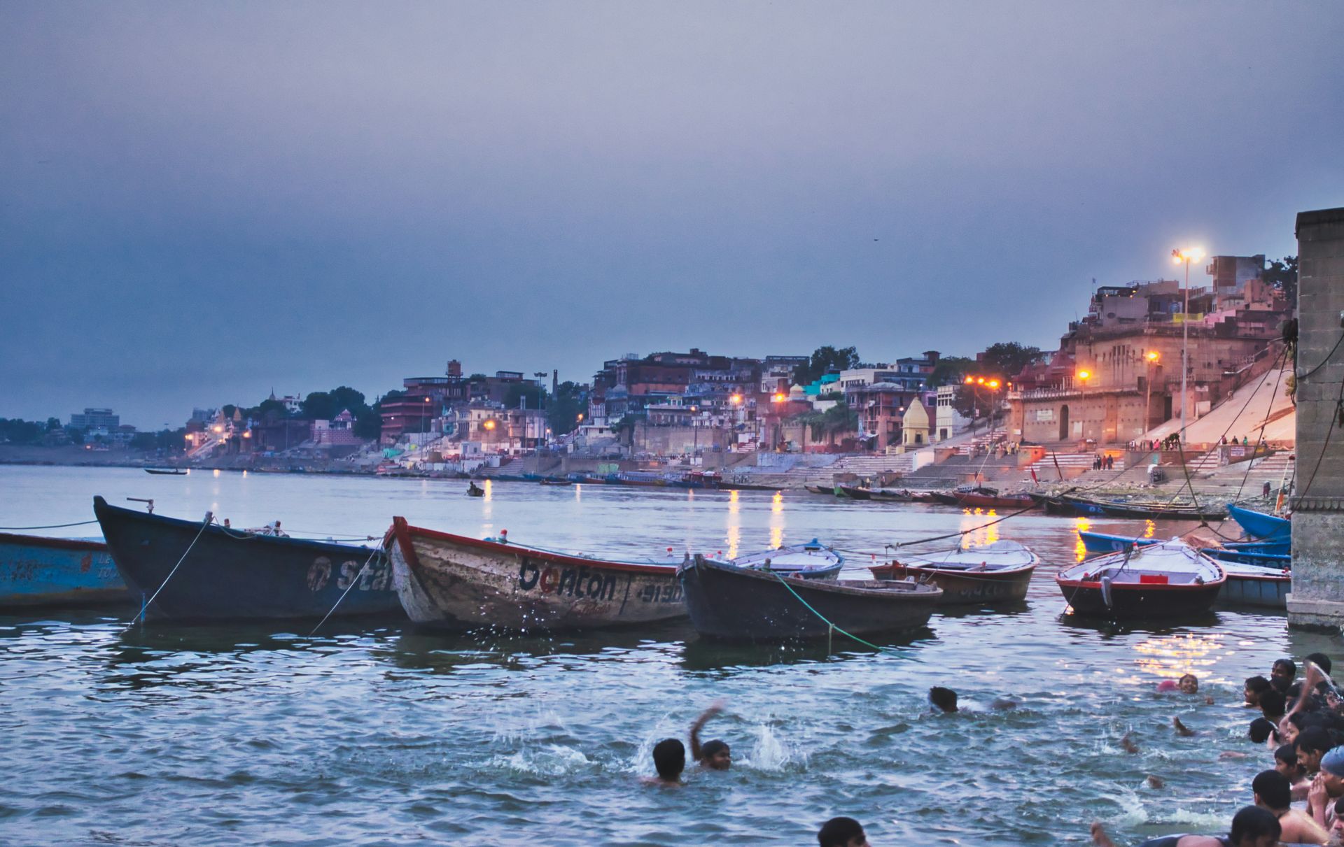
The Ganges flows roughly 2,525 kilometers from the Gangotri Glacier in the Indian Himalayas to the Bay of Bengal, passing through some of the most densely populated land on Earth. Its basin is home to more than 400 million people. More than any other river in the world, the Ganges is a sacred object — a living deity in Hindu tradition — and its religious significance has shaped the history of the Indian subcontinent as deeply as its agricultural and commercial value.
In the Vedic texts composed between roughly 1500 and 500 BCE, the rivers of India figure prominently as sacred forces. The Ganges, called Ganga, is personified as a goddess who descended from heaven to purify the earth. Bathing in the Ganges is believed to wash away sins and liberate the soul from the cycle of rebirth. Ashes of the dead scattered in its waters are thought to ensure a favorable afterlife. Varanasi, the holy city on the Ganges, has been continuously inhabited for at least 3,000 years and may be the oldest continuously lived-in city in the world.
This spiritual geography shaped practical geography. Cities grew along the Ganges because it was holy, and their sanctity was reinforced by pilgrimage economies that brought millions of people — and their spending — into the river corridor every year. The Ganges plain became the demographic and economic heartland of the Indian subcontinent, a position it has held since at least the Magadha kingdom of the fifth century BCE, which grew along the river's middle and lower reaches.
The Maurya Empire — the first polity to unify most of the Indian subcontinent — was centered at Pataliputra, near the confluence of the Ganges and Son rivers. The Gupta Empire, which oversaw what is sometimes called India's classical period in mathematics, astronomy, literature, and philosophy, was also centered on the Ganges plain. The river was not incidental to these achievements. A river this fertile, this navigable, and this central to trade created the surplus wealth and population density that made large empires viable.
The Ganges also shaped the development of Buddhism. Siddhartha Gautama, who became the Buddha, was born in the foothills near the Ganges watershed, delivered his first sermon at Sarnath on the Ganges plain, and attained enlightenment at Bodh Gaya in the Ganges basin. The early Buddhist sangha spread along the river's trade routes.
Today the Ganges is critically polluted. Industrial effluents, sewage from riverside cities, and agricultural runoff have created water quality conditions that public health specialists describe as a serious crisis. Successive Indian governments have launched Ganges cleanup initiatives with limited results. The river that Hindu tradition regards as inherently purifying faces a challenge that devotion alone cannot solve.
-1920x1275.jpg)
Credit: Neil Palmer / CIAT / Flickr / Wikimedia Commons (CC BY-SA 2.0)
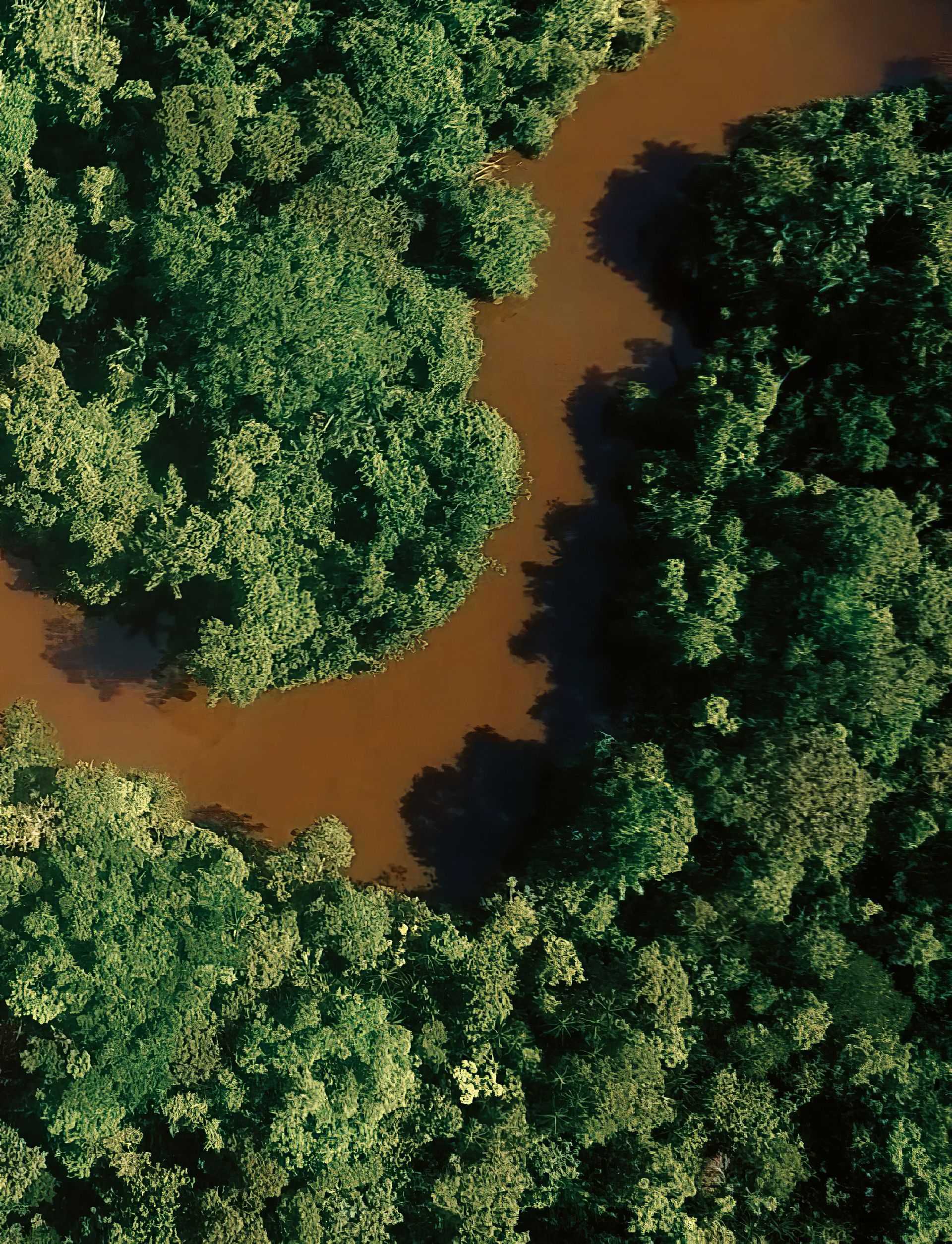
The Amazon $AMZN carries more water than any other river on Earth — roughly 20% of all freshwater discharged into the oceans globally comes from the Amazon alone. At its widest, the river stretches so broadly that you cannot see the opposite bank. Its basin covers approximately 7 million square kilometers across nine countries, predominantly Brazil, and it contains the largest tropical rainforest on Earth.
For most of its known history, the Amazon was considered a largely pristine wilderness — untouched, uninhabited, or at least sparsely populated. That understanding was wrong. Archaeological research since the 1990s has documented extensive pre-Columbian settlement throughout the Amazon basin, with populations that may have numbered in the tens of millions before European contact. The "terra preta" — dark, human-made soil found across thousands of sites — is evidence of intensive, long-term agriculture: generations of people enriching poor tropical soil with charcoal, bone, and organic waste to create permanent farmland.
The Amazon's pre-Columbian civilizations did not build in stone the way Mesoamerican or Andean cultures did, which contributed to the historical assumption that the basin was empty. They built in wood and earth, in ways that the forest reclaimed quickly. But the forest itself, in many areas, bears the marks of human management — fruit trees planted in patterns, monocultures of useful species, cleared areas that maintained their character for centuries after the people who made them were gone.
European contact devastated Amazonian populations through epidemic disease. Smallpox, measles, and other Old World diseases swept through communities with no prior exposure, killing the majority of people within decades. The river itself then became a highway for colonization: Portuguese and Spanish expeditions traveled its tributaries to find labor, gold, and converts. The rubber boom of the 19th and early 20th centuries brought another wave of exploitation, with indigenous people enslaved or killed across vast areas of the basin.
The Amazon today is the center of one of the most consequential environmental confrontations in the world. Deforestation — driven by cattle ranching, soy agriculture, illegal logging, and infrastructure development — has eliminated roughly 17% of the original Amazon forest in 50 years. Scientists who study the basin's ecology have warned that continued deforestation risks pushing the forest past a tipping point, beyond which large sections could convert to savanna — releasing stored carbon, reducing rainfall across South America, and permanently altering the regional climate.
The river remains the Amazon basin's primary transportation system and the lifeblood of communities — indigenous and non-indigenous — that depend on its fish, its floodplains, and its connectivity.
Credit: Diego Concepción / Pexels
The Congo River is the deepest river in the world and the second-largest by discharge, after the Amazon $AMZN. It runs approximately 4,700 kilometers through central Africa, draining a basin roughly the size of Western Europe. Its current is so powerful and its channel so deep that in some sections it exceeds 220 meters in depth — a measurement that no other river anywhere approaches.
The Congo basin has been continuously inhabited by human populations for tens of thousands of years. The pygmy peoples of the rainforest — among them the Aka, Baka, and Mbuti — have lived in symbiosis with the forest and river for at least 60,000 years by some genetic estimates, representing one of the longest continuous human habitations of any ecosystem on Earth. The Bantu expansion — the great migration of agricultural Bantu-speaking peoples across sub-Saharan Africa over the past three to four thousand years — used the Congo basin's rivers and forests as corridors, spreading languages, technologies, and farming practices across the continent.
The river was central to the rise of the Kingdom of Kongo, a sophisticated polity that at its height in the 15th and 16th centuries controlled a territory spanning parts of present-day Angola, the Republic of Congo, and the Democratic Republic of Congo. The kingdom had a complex administrative structure, a system of taxation, and a thriving trade in copper, ivory, and textiles. When Portuguese explorers arrived in the 1480s, they found a state capable of sophisticated diplomacy — and one that quickly became entangled in the Atlantic slave trade in ways that proved catastrophic for the region.
The Congo River was later the stage for one of the most brutal chapters of the colonial period. King Leopold II of Belgium claimed the entire Congo basin as his personal property in 1885 and operated it as a private commercial enterprise until 1908. The systematic extraction of rubber and ivory was enforced through terror: forced labor quotas, mutilation, and mass killings. The death toll from Leopold's Congo Free State has been estimated — with considerable historical controversy — at between one and ten million people.
Today the Democratic Republic of Congo holds approximately 50% of Africa's remaining rainforest and enormous reserves of minerals, including cobalt — a material central to the batteries used in electric vehicles and consumer electronics globally. The Congo River's hydroelectric potential is the largest of any river on Earth. The Inga Dam site, which has been under development in various forms for decades, could theoretically generate enough electricity to power a substantial portion of the African continent.
Credit: Juergen Striewski / Pexels
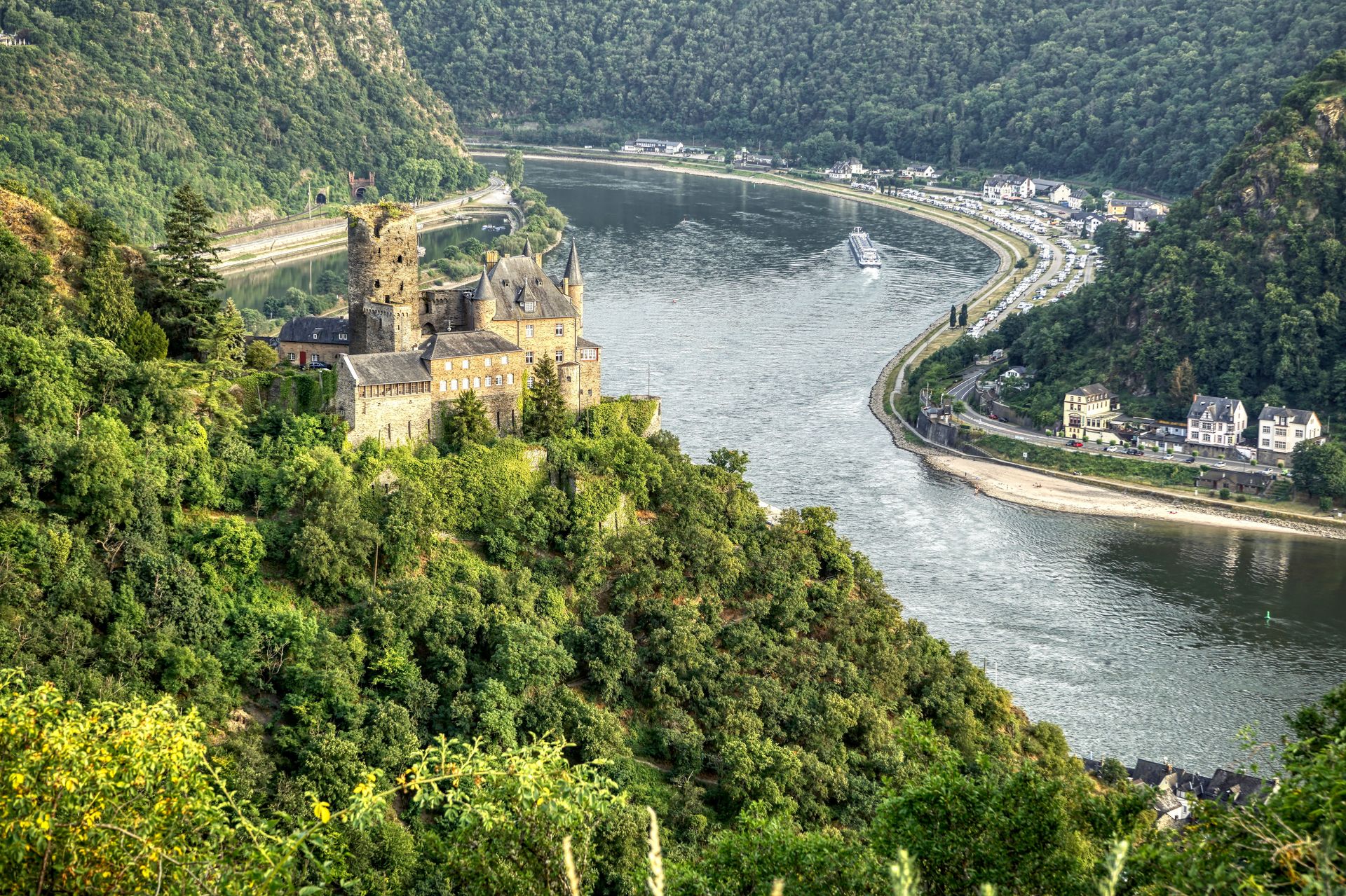
The Rhine flows roughly 1,230 kilometers from the Swiss Alps to the North Sea, passing through Switzerland, Liechtenstein, Austria, Germany, France, and the Netherlands. It is not long by global standards, but few rivers in history have been more heavily trafficked, more politically contested, or more central to the industrial development of a major world region.
The Rhine was the northern border of the Roman Empire for nearly four centuries. Roman legions built fortifications, roads, and supply depots along its western bank, and the river separated the Roman provinces of Gaul from the Germanic tribes to the east who were never successfully incorporated. The cultural divide that the Rhine represented — between Romanized Europe and Germanic Europe — shaped the later development of what became France and Germany, two countries whose modern national identities were partly forged in opposition to each other across this river.
During the medieval period, the Rhine became one of Europe's most important trade routes. The Hanseatic League, the great mercantile network of northern European cities, depended heavily on Rhine traffic to move goods between the North Sea ports and the interior of the continent. Wine from the Rhine valley, textiles from the Low Countries, and metals from the Rhineland moved through a network of tolls, warehouses, and trading fairs that made cities like Cologne, Strasbourg, and Basel into major economic centers.
The Rhine's industrial transformation began in the 18th century and accelerated sharply in the 19th. The Ruhr region, where the Rhine's tributaries drain the coal and iron deposits of western Germany, became the industrial heartland of continental Europe. Krupp steel, manufactured in Essen on the Ruhr, became synonymous with German industrial and military power. The Rhine and its tributaries carried coal, iron ore, and finished steel in volumes that made Germany the dominant industrial economy in Europe by the time of the First World War.
Both World Wars were fought partly over control of the Rhine's industrial watershed. The Rhineland was demilitarized under the Treaty of Versailles in 1919, and Germany's remilitarization of the Rhineland in 1936 was one of the early acts of aggression that signaled the direction of Hitler's foreign policy.
The Rhine was severely polluted by the mid-20th century — so contaminated by chemical, agricultural, and industrial waste that by the 1970s large stretches were effectively dead. An ambitious international cleanup effort, coordinated by the International Commission for the Protection of the Rhine beginning in the 1980s, dramatically improved water quality. The return of salmon to the Rhine by the 1990s became one of modern Europe's most cited environmental recovery stories.
Credit: Barbara Hartmann / Pexels
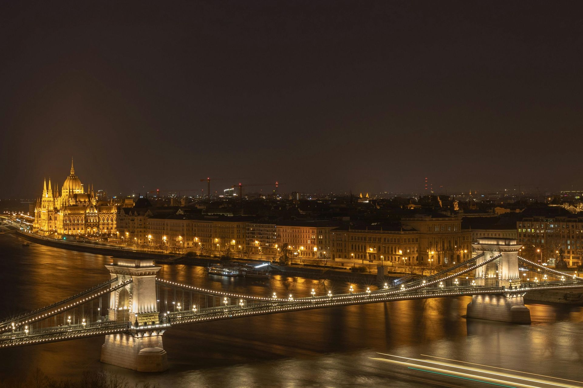
The Danube is Europe's second-longest river, flowing approximately 2,860 kilometers from the Black Forest in Germany to the Black Sea, passing through or alongside 10 countries — more than any other river in the world. That geographic reach made it one of history's great corridors of migration, trade, and empire, and a boundary that successive powers tried to use, control, or cross.
For the Roman Empire, the Danube was the eastern counterpart to the Rhine: the empire's principal defensive frontier in central and southeastern Europe. Legions were stationed along its banks from Bavaria to Romania, and the river marked the edge of the Roman world for most of its imperial history. Dacia, the territory north of the lower Danube in what is now Romania, was one of the few trans-Danubian lands that Rome actually conquered and held — the emperor Trajan crossed the Danube twice, in 101 and 105 CE, building the first stone bridge across the river to do so.
The Danube was also a migration corridor. The great movement of peoples during late antiquity and the early medieval period — Huns, Goths, Avars, Bulgars, Magyars — used the Danube valley as a highway into Europe. The Magyars, who arrived in the Carpathian Basin in the late ninth century, settled around the Danube and its tributaries and founded what became Hungary. The river ran through the heart of their new kingdom and shaped its geography, its borders, and its defenses for the next millennium.
The Ottoman Empire's northward expansion in the 15th and 16th centuries was also a Danube story. The siege of Vienna in 1529 — and the later siege in 1683 — were the high-water marks of Ottoman power in central Europe, and both campaigns were supplied and supported through the Danube corridor. The river served as a contested border between the Ottoman and Habsburg empires for nearly three centuries, and the strategic importance of the Danubian principalities (present-day Romania) was a major source of tension between those two powers.
The Danube featured prominently in 19th-century nationalism. As the Habsburg and Ottoman empires weakened, the peoples of the Danube basin — Serbs, Romanians, Bulgarians, Czechs, Slovaks — organized national movements that defined themselves partly in terms of the river's geography. The Congress of Berlin in 1878 reorganized the Danube valley's political map, creating new states and establishing freedom of navigation on the river as an international principle.
Johann Strauss II immortalized the Danube in his waltz "The Blue Danube" in 1867 — at the very moment the river's political geography was being remade by nationalism. The Danube was never actually blue; its color depends on season and conditions. But the waltz fixed a romantic image of the river in European cultural memory that persists alongside its more turbulent political history.
Credit: Tony Webster / Wikimedia Commons (CC BY-SA 4.0)
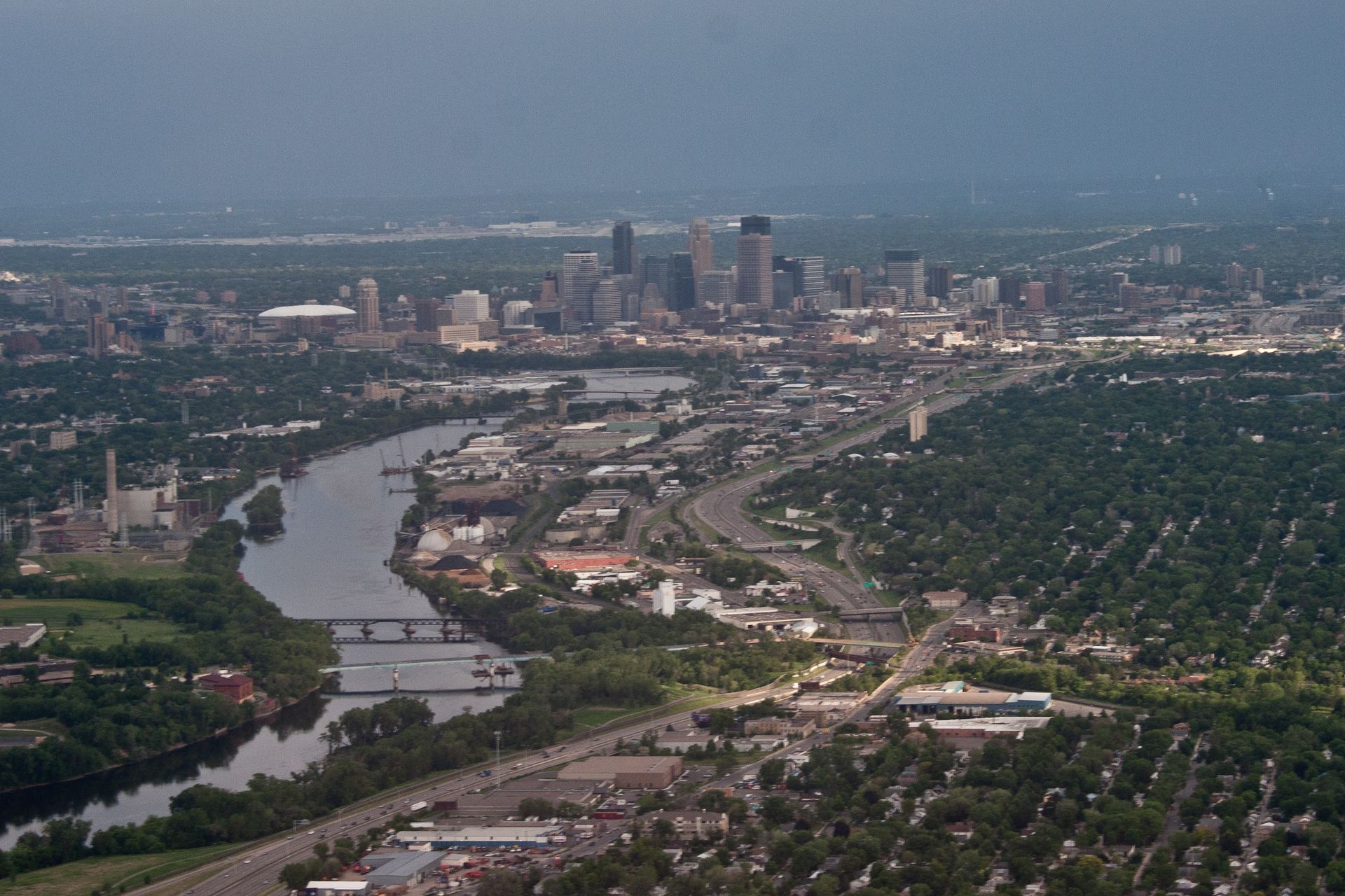
The Mississippi River drains approximately 3.2 million square kilometers of North America — roughly 40% of the continental U.S. — and flows 3,730 kilometers from its source at Lake Itasca in northern Minnesota to the Gulf of Mexico. Together with its tributaries, the Missouri and Ohio rivers, it forms the world's third-largest drainage system and the primary hydrological spine of the American interior.
Long before European contact, the Mississippi was the axis of one of North America's most complex pre-Columbian civilizations. The Mississippian culture, which flourished between roughly 800 and 1600 CE, built large ceremonial centers with flat-topped earthen mounds across the Mississippi and Ohio valleys. The largest of these centers, Cahokia — located near present-day St. Louis, Illinois — had a population of perhaps 10,000 to 20,000 people at its peak around 1100 CE, making it one of the largest settlements in North America at that time.
European exploration and colonization of North America was organized around the Mississippi from the beginning. The French, who established Louisiana at the river's mouth in 1699, understood that control of the Mississippi meant control of the interior. New Orleans, founded in 1718, became one of the most strategically important cities in North America — the gateway through which the produce of the entire interior could reach world markets. The Louisiana Purchase of 1803, in which the U.S. bought French territory stretching from New Orleans to the northern plains, was driven in large part by Thomas Jefferson's determination to secure American control of the Mississippi.
The river transformed American commerce in the 19th century. The steamboat, introduced on the Mississippi in 1811, made it possible to move goods upstream as well as down, linking the agricultural interior to New Orleans and through it to the world. By the 1840s, the Mississippi-Missouri-Ohio system was the busiest internal waterway on Earth. Mark Twain, who worked as a steamboat pilot on the river before becoming a writer, captured the Mississippi's character in works that became central to American literary identity.
The river also carried the history of slavery. The lower Mississippi valley — the cotton and sugar lands of Louisiana, Mississippi, and Arkansas — was one of the densest concentrations of enslaved people in the antebellum South. The internal slave trade moved hundreds of thousands of people down the river to the cotton fields. The Civil War was in part a fight for control of the Mississippi: when Ulysses S. Grant captured Vicksburg in July 1863 and the Union controlled the full length of the river, the Confederacy was effectively split in two.
The great Mississippi flood of 1927 — the most destructive river flood in U.S. history — inundated 70,000 square kilometers of land and displaced nearly one million people, most of them Black sharecroppers in the lower Mississippi valley. The flood accelerated the Great Migration, as hundreds of thousands of Black Southerners left the Delta for northern cities. It also prompted the Flood Control Act of 1928, which made the federal government responsible for flood control along the Mississippi for the first time.
Credit: Mo Eid / Pexels
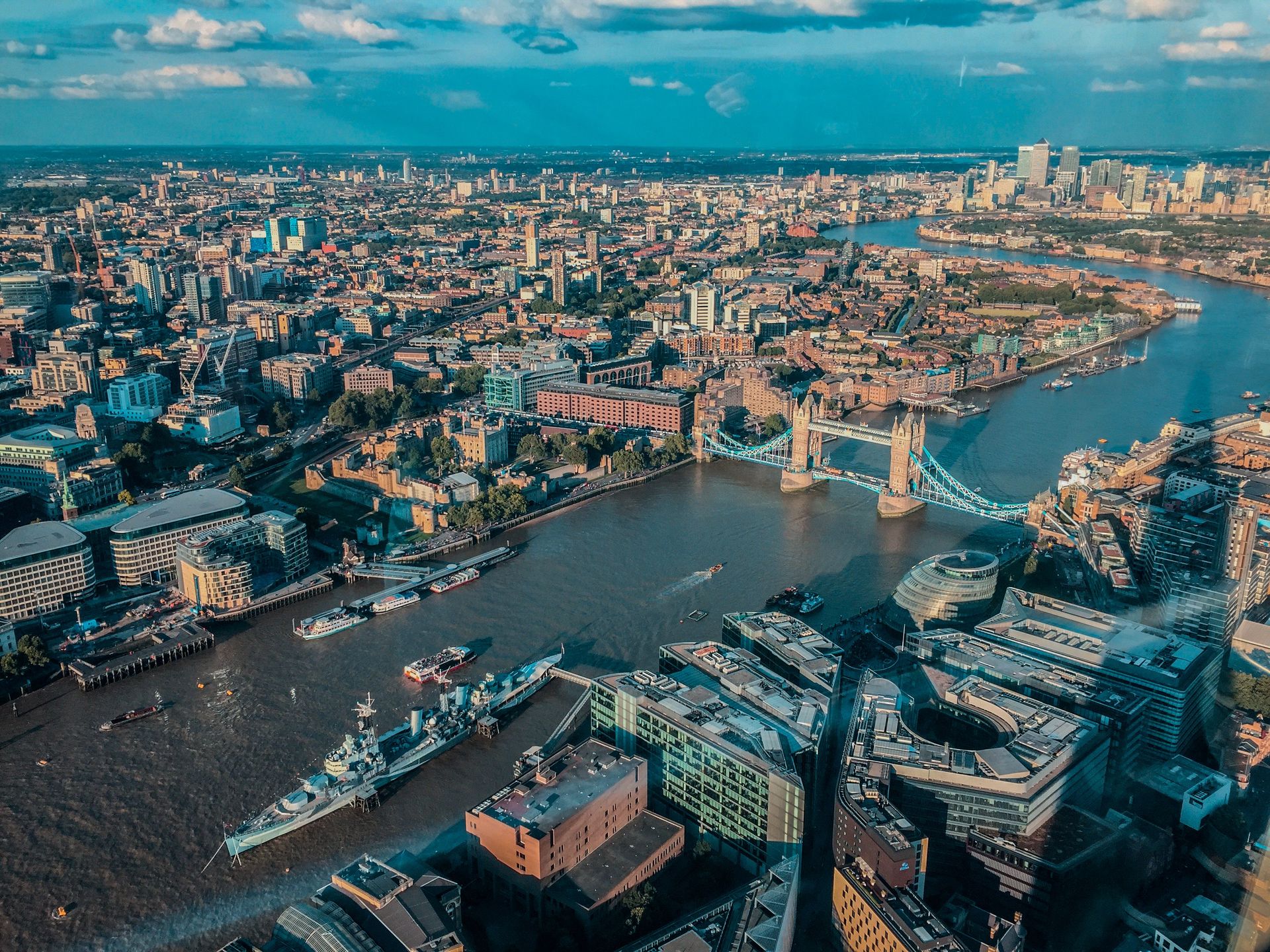
The Thames is only 346 kilometers long — modest by any global standard — but its role in the development of one of history's most consequential cities makes it one of the most historically significant rivers in the world. London exists because of the Thames. The river determined the site of the city, defined its commerce for two millennia, shaped its public health crises, and gave British imperial power its logistical foundation.
The Romans chose the site of Londinium around 43 CE partly because the Thames at that point was both tidal and narrow enough to bridge. The tidal reach meant ships could sail upstream from the sea, making the site a natural entrepôt. The bridging point — near what is now London Bridge — became the lowest crossing of the river and therefore the convergence point of all road traffic from the south of England. This geographic logic has never changed. The site has been continuously occupied and commercially important for nearly two thousand years.
Medieval London grew along the Thames, and the river was the city's primary commercial artery. The Pool of London, the stretch of river between London Bridge and the Tower, was one of the busiest harbors in the medieval world. Wool, cloth, wine, spices, and grain moved through it in volumes that made London the dominant commercial city in northern Europe by the 14th century.
The Thames also carried the machinery of empire. The East India Company, founded in 1600, operated from the Thames. The docks built east of the city in the 19th century — the West India Docks, the East India Docks, the Royal Victoria and Royal Albert Docks — were built to handle the trade of a global empire. At their peak in the late 19th century, the Thames docks were the largest enclosed dock system in the world, handling goods from every continent.
The river's darker history centers on public health. By the mid-19th century, London's Thames was an open sewer. The population of the city had grown faster than its waste disposal infrastructure, and raw sewage flowed directly into the river from which many Londoners also drew drinking water. Cholera epidemics in 1832, 1848, and 1854 killed tens of thousands of people. The "Great Stink" of 1858, when the smell from the river became so overwhelming that Parliament was unable to function, finally forced action. Joseph Bazalgette's great sewer system, built between 1859 and 1875, rerouted London's sewage away from the Thames and is considered one of the great public health engineering achievements of the 19th century.
Credit: Fatih Turan / Pexels
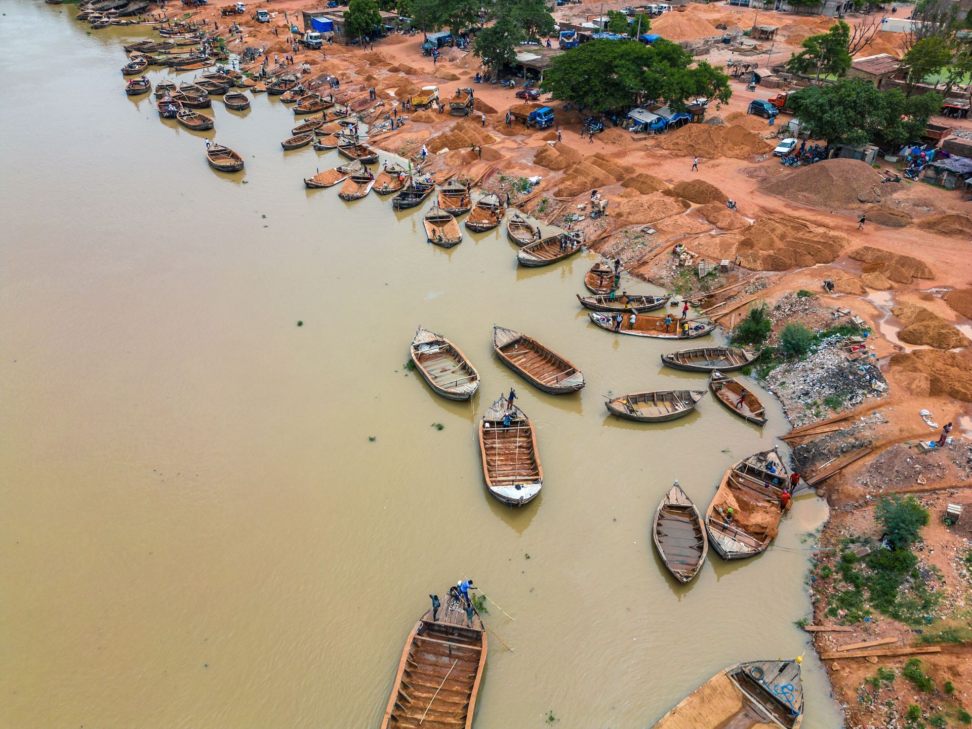
The Niger River traces one of the most unusual paths of any major river in the world. Rising in the highlands of Guinea — close to the Atlantic coast — it flows northeast into the Sahara before bending sharply southeast and eventually emptying into the Gulf of Guinea through an enormous delta in what is now Nigeria. This counterintuitive path, covering roughly 4,180 kilometers, confused European geographers for centuries. As late as the early 19th century, the direction in which the Niger flowed was still disputed among European scholars.
The people living along the Niger had no such confusion. For thousands of years, the river sustained one of sub-Saharan Africa's most productive agricultural and commercial corridors. The Inner Niger Delta — a vast inland flood plain in what is now Mali — is one of the most ecologically productive regions on the continent: a seasonal lake-and-grassland system that supports enormous fish populations, millions of migratory birds, and pastoralists who move their cattle across the flooded plains every year.
The Niger bend — the great northern curve of the river near the edge of the Sahara — was the axis of several of the medieval world's wealthiest empires. The Ghana Empire, the Mali Empire, and the Songhai Empire each in turn controlled the trade routes that crossed the Sahara from north to south, exchanging West African gold and salt for Mediterranean goods. Timbuktu, situated near the Niger bend, was at its height in the 15th and early 16th centuries one of the world's most important centers of Islamic scholarship and book culture. Its libraries held hundreds of thousands of manuscripts.
The slave trade devastated the Niger corridor from the 15th century onward. European demand for enslaved labor in the Americas intersected with existing intra-African slave-trading networks to produce a catastrophic drain of population from the region. The Sokoto Caliphate, established in what is now northern Nigeria in 1804, was itself a major slave-holding society, with enslaved people working in agriculture, crafts, and domestic service on a large scale.
Today the Niger Delta is one of the most oil-rich regions in Africa and one of the most environmentally damaged. Decades of petroleum extraction, punctuated by frequent spills and flaring, have contaminated soil and water across an area that was once extraordinarily biodiverse. The delta's fishing communities have seen their livelihoods destroyed by pollution that the Nigerian state and international oil companies have been slow to address.
Credit: Monika Guzikowska / Unsplash
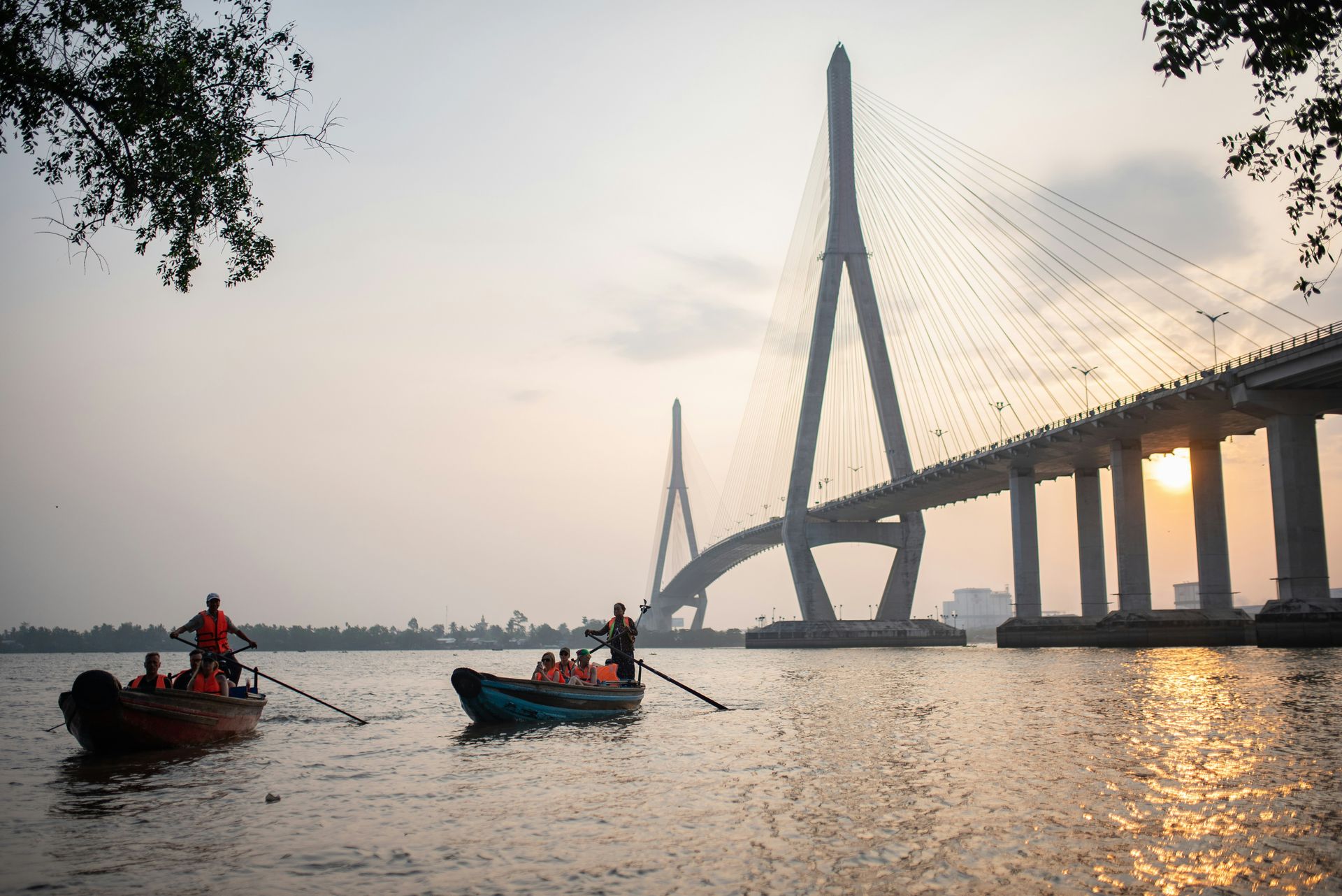
The Mekong flows approximately 4,350 kilometers from the Tibetan Plateau through China, Myanmar, Laos, Thailand, Cambodia, and Vietnam before emptying into the South China Sea through a wide delta. It passes through more countries than almost any other river in Asia, and the civilizations, ecologies, and geopolitical tensions it connects make it one of the most contested waterways in the world today.
The river's lower basin — what geographers call the Lower Mekong, below China's border — is one of the world's most biodiverse aquatic ecosystems. The Tonle Sap lake in Cambodia, which fills from the Mekong during the monsoon season and drains back into it during the dry season, is the largest freshwater lake in Southeast Asia and the most productive freshwater fishery in the world per unit area. The fish of the Mekong and Tonle Sap feed tens of millions of people across Cambodia, Laos, and Vietnam, providing the primary protein source for populations that have no alternative of comparable scale.
The Mekong basin was the cradle of several of Southeast Asia's most significant civilizations. The Khmer Empire, which built Angkor Wat and controlled much of mainland Southeast Asia between the ninth and 15th centuries, was centered on the Tonle Sap and the Mekong floodplain. The empire's agricultural productivity — enabled by an elaborate system of irrigation reservoirs called barays — depended entirely on understanding and managing the river's seasonal fluctuations. When the hydraulic systems broke down, likely due to a combination of over-extension and climate variability, the empire collapsed.
The Mekong was also a Cold War battleground. The Ho Chi Minh Trail, the supply route used by North Vietnamese forces during the Vietnam War, crossed the Mekong's tributaries in Laos, and the U.S. conducted extensive bombing of the Laotian interior to interdict it. The Khmer Rouge's takeover of Cambodia in 1975, which led to the deaths of an estimated 1.5 to two million people, was partly enabled by the chaos that U.S. bombing had caused in the Cambodian countryside.
Today the Mekong faces an acute threat from upstream hydropower development. China has built 11 large dams on the upper Mekong since 1993, fundamentally altering the river's flow patterns. The downstream effects — reduced sediment, altered flood pulses, changes to fish migration — are measurable and serious. Laos has also built dams on the lower Mekong over the objections of Cambodia and Vietnam. The countries that depend most on the river's natural hydrology have the least power to protect it from the countries building upstream.
Credit: 高 长华 / Pexels
The Yangtze is the longest river in Asia, flowing approximately 6,300 kilometers from the Tibetan Plateau to the East China Sea near Shanghai. It drains a basin that contains roughly one-third of China's population and generates an even larger share of China's economic output. No river has been more central to the development of Chinese civilization south of the Yellow River, and none has been more extensively engineered in the modern era.
The Yangtze's agricultural significance is rooted in rice. The river's lower and middle reaches — the broad, flat plains around Wuhan, Nanjing, and Shanghai — produce some of the most intensive rice cultivation on Earth. Rice cultivation in the Yangtze delta dates back at least 7,000 years, to the Hemudu culture, which had already developed sophisticated wet-rice agriculture by 5000 BCE. The Yangtze valley's agricultural productivity was what made southern China wealthy enough to eventually overtake the Yellow River basin as China's economic heartland — a shift that had largely occurred by the Song dynasty (960–1279 CE).
The Grand Canal, one of the greatest engineering projects in pre-modern history, was built to connect the Yangtze with the Yellow River and thus with the political capitals in the north. Construction began in the fifth century BCE and continued in phases, with the most ambitious expansion under the Sui dynasty (581–618 CE). At its peak, the Grand Canal was nearly 1,800 kilometers long and allowed the surplus grain of the Yangtze valley to be shipped north to feed Beijing and the imperial court. The political unity of China depended in part on this logistical connection.
The Three Gorges Dam, completed in 2006 on the middle Yangtze, is the largest hydroelectric power station ever built. It generates approximately 88 terawatt-hours of electricity per year — more than any other power plant in the world — and its reservoir stretches nearly 600 kilometers upstream. The construction required the relocation of more than one million people from towns and cities that were submerged. Significant archaeological sites were lost. The dam has also altered the river's sediment load and affected the ecology of its estuary.
The Yangtze is home to several critically endangered species. The Yangtze finless porpoise and the Chinese sturgeon are both on the verge of extinction, driven by overfishing, pollution, dam construction, and river traffic. The baiji, a freshwater dolphin endemic to the Yangtze, was declared functionally extinct in 2006 — one of the few large mammals to have been driven to extinction by human activity in the modern era.
Credit: deror_avi / Wikimedia Commons (CC BY-SA 3.0)
The Jordan River is only about 251 kilometers long, and for most of its length it is shallow, slow-moving, and heavily depleted by human water extraction. By hydrological measures, it ranks among the minor rivers of the world. By historical and religious measures, it is among the most significant rivers in human experience.
The Jordan rises from the slopes of Mount Hermon, flows south through the Sea of Galilee, and empties into the Dead Sea — the lowest point on Earth's surface, at roughly 430 meters below sea level. The river valley it creates, the Jordan Rift Valley, is part of the Great Rift System that runs from the Bekaa Valley in Lebanon to the East African Rift. This deep geological trench has channeled human movement, settlement, and conflict for hundreds of thousands of years.
The Jordan valley was among the earliest sites of permanent human settlement anywhere in the world. Jericho, located just west of the Jordan's lower reach, is one of the oldest continuously inhabited cities on Earth, with occupation layers dating back at least 11,000 years. The availability of water in an otherwise arid landscape made the Jordan valley a corridor through which migrating populations, trading caravans, and conquering armies moved for millennia.
In the Hebrew Bible, the Jordan is the boundary that the Israelites cross to enter the Promised Land. Joshua leads the people across the river — the waters miraculously parting — as a counterpart to the earlier crossing of the Red Sea under Moses. This narrative made the Jordan a symbol of transition, of the passage from one state of existence to another, that recurred throughout Jewish, Christian, and Islamic religious imagination.
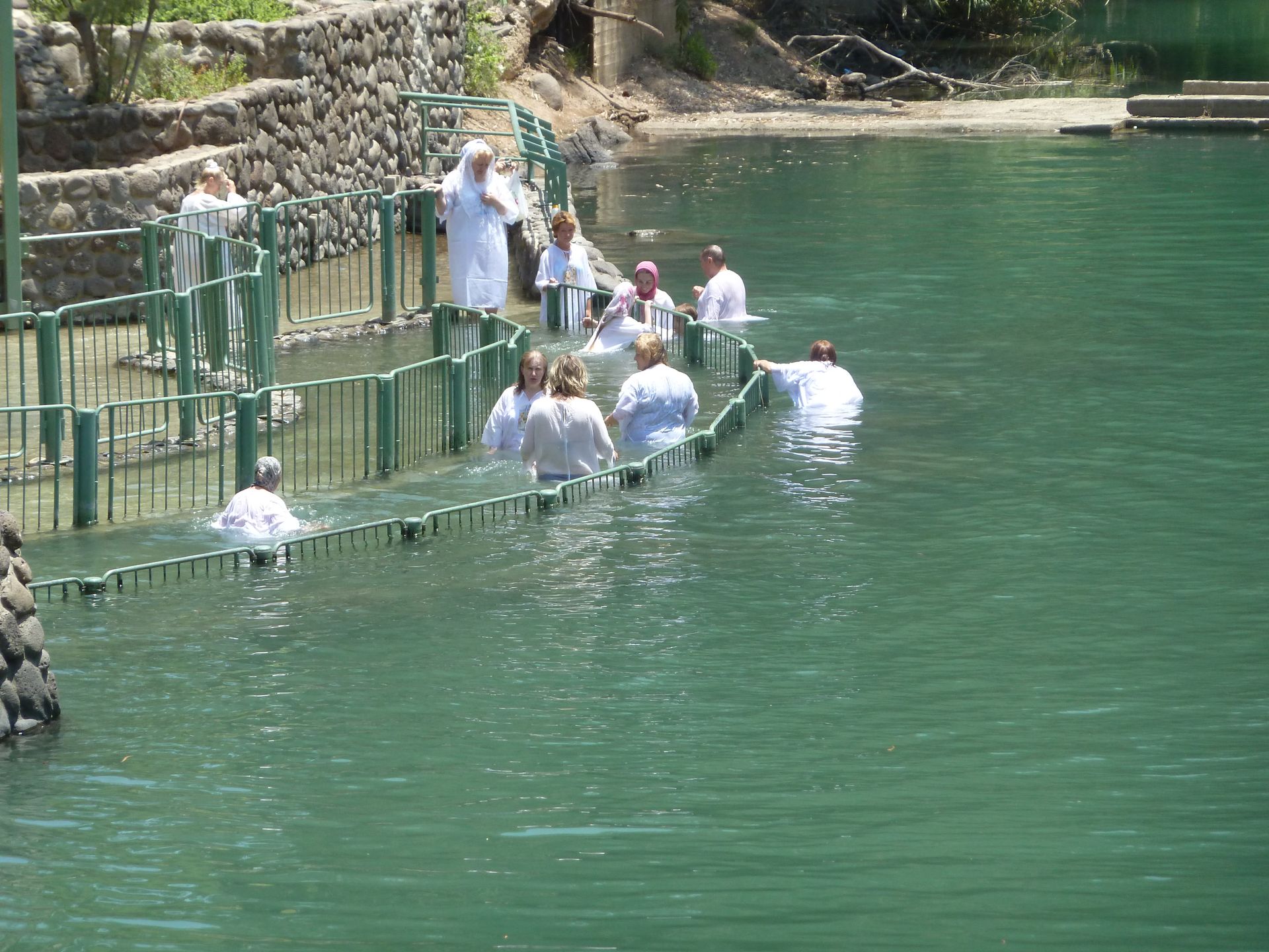
For Christians, the Jordan acquired its central sacred significance through the baptism of Jesus. The Gospel accounts describe John the Baptist performing ritual immersion in the Jordan, and the baptism of Jesus in its waters is considered the inauguration of his public ministry. Christian pilgrims have traveled to the Jordan to be baptized in its waters since at least the fourth century CE. Today the baptismal sites at Qasr al-Yahud in Israel and Bethany Beyond the Jordan in Jordan both receive hundreds of thousands of pilgrims annually.
The river's modern history is a study in how political conflict depletes natural resources. Israel, Jordan, and Syria have all drawn heavily on the Jordan's water since the mid-20th century, and the river now carries a fraction of its natural flow by the time it reaches the Dead Sea. The Dead Sea itself is shrinking at a measurable rate as a result of reduced inflow. The Jordan's transformation from a sacred and significant waterway into a nearly empty channel is one of the starkest examples of human impact on a historically important river.
Credit: Aynur Latfullin / Pexels
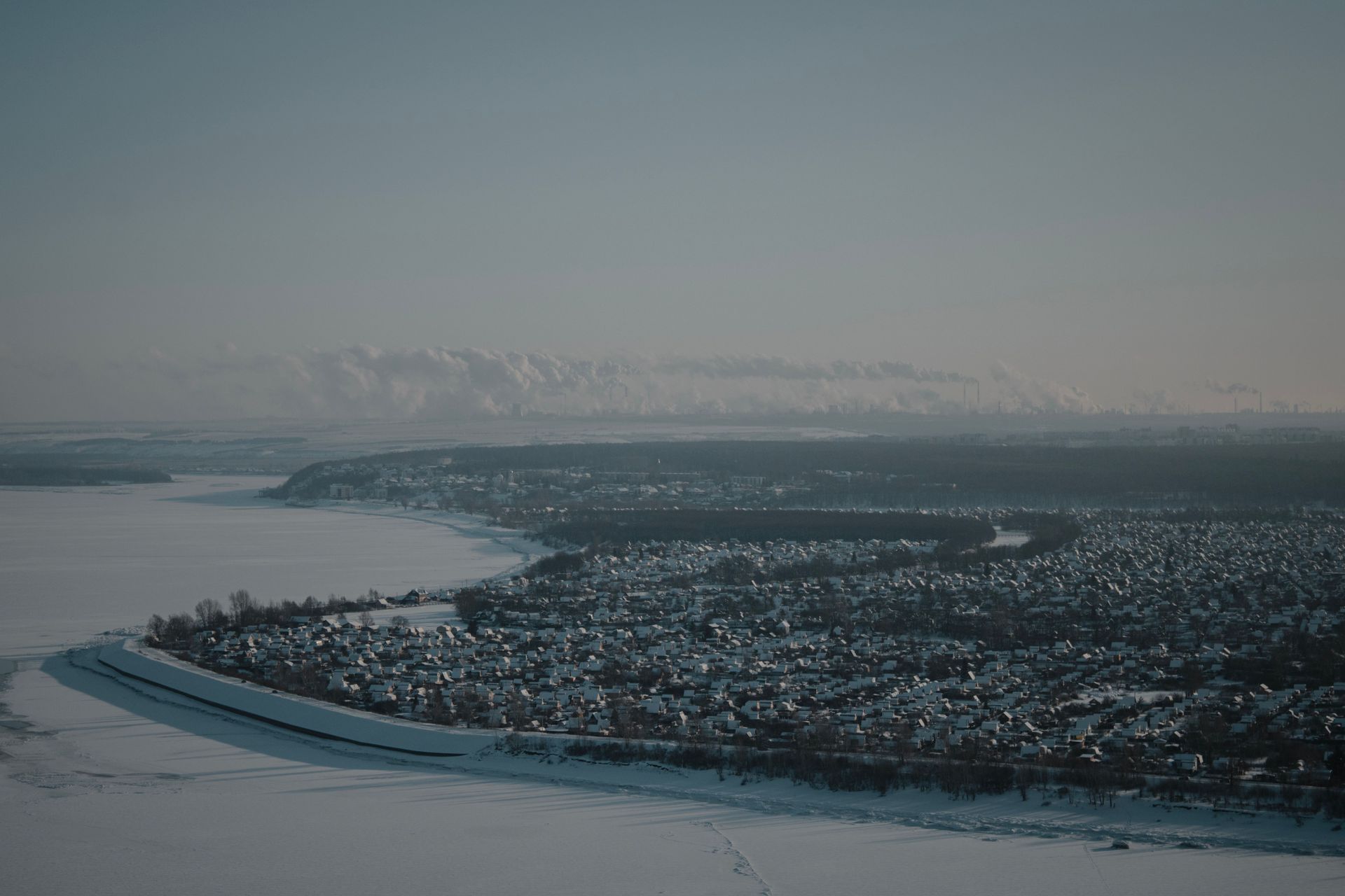
The Volga is the longest river in Europe, flowing 3,530 kilometers from the Valdai Hills northwest of Moscow to the Caspian Sea. Its basin encompasses roughly 1.35 million square kilometers of Russia — a territory larger than France, Germany, and Spain combined. The river has been central to Russian identity, economy, and military history for over a millennium, and Russians have long called it "Mother Volga" in a form of reverence that reflects how completely the river shaped the national imagination.
The Volga was a trade artery before it was a Russian river. In the ninth and 10th centuries, the Volga trade route connected the Baltic Sea to the Caspian, allowing Scandinavian and Slavic merchants to exchange furs, amber, and slaves for Arab silver. The silver dirhams of the Abbasid Caliphate have been found in archaeological hoards across Scandinavia — evidence of the commercial network that ran through the Volga valley. The town of Bulgar, on the middle Volga, was a major hub of this trade and the capital of Volga Bulgaria, a prosperous Turkic state that converted to Islam in 921 CE.
The Mongol conquest of the 13th century shifted the Volga's political significance. The Golden Horde, the western successor state of Genghis Khan's empire, established its capital at Sarai on the lower Volga and ruled the Russian principalities as tributary states for over two centuries. Control of the Volga was central to Mongol power, and Russia's eventual escape from Mongol dominance was bound up with the Muscovite state's gradual military assertion over the river's course — culminating in Ivan the Terrible's conquest of Kazan in 1552 and Astrakhan in 1556, which gave Russia control of the full length of the river.
In the Second World War, the Battle of Stalingrad — fought in and around the city now called Volgograd, on the Volga's western bank — was one of the most destructive battles in history and the turning point of the war on the Eastern Front. The battle lasted from August 1942 to February 1943. The Volga was the Soviet lifeline: supplies, ammunition, and reinforcements crossed the river under German artillery fire throughout the siege. When German forces were encircled and surrendered, the strategic initiative on the Eastern Front shifted permanently to the Soviet Union.
The Volga today is heavily dammed and regulated. Eight major reservoirs on the main stem have converted much of the river into a series of lakes, enabling hydropower generation and navigation but radically altering the ecology of the lower Volga delta. The Caspian Sea, into which the Volga drains, has experienced dramatic changes in water level and salinity over the past century, driven partly by Volga management and partly by climate change. The sturgeon fishery that once made the Caspian famous for its caviar has collapsed to a fraction of its former scale.
Credit: Sean Benesh / Unsplash
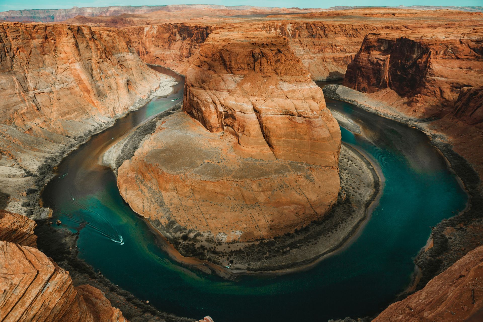
The Colorado River flows approximately 2,330 kilometers from the Rocky Mountains of Colorado through Utah, Arizona, Nevada, and California before crossing into Mexico and, in most years now, failing to reach the Gulf of California. The river carved the Grand Canyon — one of the most dramatic geological features on Earth — and for most of the 20th century it powered the American West, supplying water and electricity to cities and farms that could not otherwise have existed in the desert.
The Colorado's pre-Columbian history is dominated by the peoples who found ways to live in its extraordinarily demanding landscape. The Ancestral Puebloans — builders of the cliff dwellings at Mesa Verde, Chaco Canyon, and hundreds of other sites across the Colorado Plateau — developed agricultural techniques suited to an arid environment and built some of the most architecturally sophisticated structures in pre-Columbian North America. Their dispersal from the Colorado Plateau around 1300 CE, likely driven by a prolonged drought, is one of the best-documented examples of climate-induced social reorganization in the archaeological record.
The Hohokam people of the lower Colorado basin built an extensive canal irrigation system in the Sonoran Desert — roughly 1,500 kilometers of canals in the Phoenix basin alone — that supported a population of tens of thousands for several centuries before declining around 1450 CE. When Anglo settlers arrived in the late 19th century, they found remnants of these canals and used them as the basis for modern Phoenix's irrigation infrastructure. The city of Phoenix, today home to more than 1.6 million people, is in a direct hydraulic line of succession from the Hohokam.
Federal management of the Colorado began in earnest with the Boulder Canyon Project Act of 1928, which authorized the construction of Hoover Dam. Completed in 1935, the dam was at that time the largest concrete structure ever built. It created Lake Mead, still one of the largest reservoirs in the U.S., and generated electricity that powered the development of Los Angeles, Las Vegas, and the broader Southwest. The Colorado River Compact of 1922, which divided the river's water among seven U.S. states and Mexico, allocated more water than the river actually carries in an average year — a miscalculation that has created a structural deficit built into the river's management from the beginning.
Lake Mead and Lake Powell, the two largest reservoirs on the Colorado, have dropped to historic low levels in recent years as drought and rising temperatures have reduced the river's flow while demand has continued to grow. The prospect of the Colorado running dry before it reaches the sea — which it already does in most years — represents a water security challenge with no obvious solution for the tens of millions of people who depend on it.
Credit: Jenny Frost / Unsplash
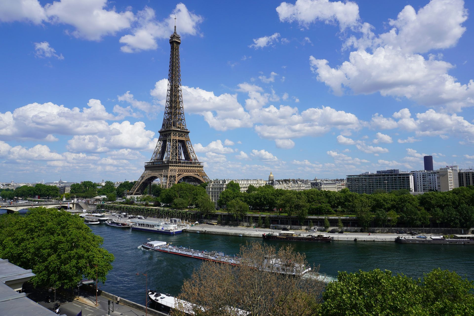
The Seine flows 775 kilometers through northern France, entering the English Channel at Le Havre. By volume and length it is a modest river. By cultural weight, it carries more than almost any other waterway in the world. Paris exists on the Seine, and through Paris the river shaped the art, politics, philosophy, and urban design that the Western world has used as reference points for centuries.
The Parisii, a Celtic tribe, established a settlement on an island in the Seine — the Île de la Cité — sometime in the third century BCE. The site was advantageous for the same reasons as London on the Thames: the island was defensible, the river was navigable, and the location was a natural convergence point for trade. The Romans conquered the settlement in 52 BCE and called it Lutetia. It became Paris, capital of the Frankish kingdom and eventually of France, without ever leaving the island where it began.
The Seine was the artery of medieval Paris's commerce. Goods from Normandy and the English Channel came upriver by boat. The grain, wine, and building stone that fed and built the city arrived by water. The city's oldest neighborhoods cluster on both banks of the river within easy reach of the water. Notre-Dame Cathedral, begun in 1163, was built on the Île de la Cité — the original river island — in a location that reinforced the symbolic centrality of both the river and the church to Parisian identity.
The river was a revolutionary site. During the Reign of Terror, the Seine carried the bodies of the guillotined to mass graves. During the Paris Commune of 1871, its bridges were barricaded. The liberation of Paris in August 1944 was partly organized around control of its crossings. The student and worker uprising of May 1968 — which briefly threatened to topple the French government — played out most intensely in the streets along the Seine's Left Bank.
The Seine also became the organizing spine of Paris's urban design. Baron Haussmann's rebuilding of Paris under Napoleon III in the 1850s and 1860s, which gave the city its distinctive wide boulevards and uniform building heights, was oriented around the river. The grands boulevards fed traffic toward the Seine's bridges. The quais — the river's embankments — were designed as public promenades. The visual experience of Paris from the river, with its layered facades, church spires, and stone bridges, is a design achievement that has shaped the ambitions of urban planners worldwide.
Credit: BabijaPhoto JB / Pexels
The Zambezi is Africa's fourth-longest river, flowing approximately 2,574 kilometers from its source in northwestern Zambia through Angola, Botswana, Zimbabwe, and Mozambique before emptying into the Indian Ocean. At Victoria Falls — on the border of Zambia and Zimbabwe — the river plunges over a basalt cliff in one of the world's largest waterfalls, dropping into a gorge that generates a mist visible from 50 kilometers away. The falls are known locally as "Mosi-oa-Tunya" — the smoke that thunders — a name that predates David Livingstone's visit in 1855 by centuries.
The Zambezi valley was inhabited by anatomically modern humans from at least 100,000 years ago, and the river corridor was a migration route for early human populations moving between eastern and southern Africa. The valley's ecology — a mix of savanna, woodland, and floodplain — supported hunter-gatherer populations through deep prehistory before agricultural communities began to settle along its banks during the Bantu expansion.
The Mutapa Empire, known to early Portuguese traders as the Monomotapa, controlled the middle and upper Zambezi valley from roughly the 15th to the 17th centuries. The empire was built on gold — mined in the plateau north of the Zambezi — and its trade connections extended to the Indian Ocean coast, where Swahili city-states served as intermediaries between the African interior and merchants from India, Arabia, and Southeast Asia. Portuguese attempts to control this trade contributed to the Mutapa Empire's eventual decline.
David Livingstone's explorations along the Zambezi in the 1850s and 1860s were framed explicitly as part of a "civilizing mission" — a combination of anti-slavery activism, Christian evangelism, and commercial promotion that was typical of the era's humanitarian imperialism. His 1858–1864 Zambezi Expedition attempted to find a navigable route into the interior but was defeated by the Cahora Bassa rapids. Livingstone's writings about the Zambezi and his advocacy against the East African slave trade became highly influential in Britain and helped build the political pressure that led to increasing British involvement in southern and central Africa.
The Kariba Dam, completed in 1959 on the Zambezi between Zambia and Zimbabwe, created one of the world's largest artificial lakes and displaced roughly 57,000 Tonga people from their homeland along the river valley. The dam's construction was presented as a development achievement for the Federation of Rhodesia and Nyasaland, but the Tonga received little of its benefit and the resettlement was conducted with limited compensation or consultation. Their displacement became a landmark case in the history of dam-induced displacement and the rights of affected communities.
Credit: Wikimedia Commons (CC BY-SA 3.0)
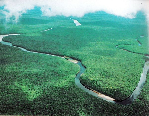
The Orinoco flows approximately 2,140 kilometers through Venezuela and along the Colombian border before emptying into the Atlantic Ocean through a broad delta in northeastern Venezuela. It is South America's third-largest river by discharge and the hydrological core of one of the continent's most biodiverse and least densely populated regions. Through the Casiquiare canal — a natural waterway connecting the Orinoco system to the Amazon $AMZN — the two great river systems of South America are linked, creating a continuous network of navigable water across a vast portion of the continent.
The Orinoco basin was home to complex indigenous societies long before European contact. The Arawak-speaking peoples who inhabited the river's banks and delta were skilled canoe builders and long-distance traders, with connections stretching to the Caribbean islands and the Amazon basin. The Yanomami people of the upper Orinoco and adjacent areas of Brazil represent one of the largest relatively isolated indigenous groups in South America, with a culture and ecological knowledge adapted to the rainforest environment over thousands of years.
European interest in the Orinoco was initially driven by the legend of El Dorado — the mythical city of gold that Spanish explorers believed lay somewhere in the interior of South America. Gonzalo Jiménez de Quesada, Francisco de Orellana, and Walter Raleigh all led expeditions in search of it, following the Orinoco and its tributaries into terrain that proved inhospitable, unpredictable, and ultimately disappointing for gold-seekers. El Dorado was never found, but the searches mapped much of the Venezuelan and Colombian interior and brought the Orinoco basin into European geographic consciousness.
Alexander von Humboldt's scientific expedition to the Orinoco in 1800 was one of the most consequential scientific journeys of the 19th century. Humboldt and his companion Aimé Bonpland spent months on the river, documenting plant species, measuring physical parameters, and — most significantly — confirming the existence of the Casiquiare canal, the natural bifurcation connecting the Orinoco to the Amazon. Humboldt's published accounts of the journey became foundational texts of modern ecology and biogeography, influencing Charles Darwin among others.
The Orinoco delta today faces pressure from oil development and from mercury contamination associated with illegal gold mining upstream in Venezuela's Bolívar state. The Yanomami people in the upper basin have been severely affected by illegal mining activity, which has brought disease, violence, and mercury poisoning into communities that had limited prior exposure to the outside world. Venezuela's economic collapse in the 2010s reduced state capacity to regulate or control the mining, with consequences that indigenous health organizations have described as a humanitarian crisis.
