
25 overlooked travel destinations in South America
From Bolivian ruins to Surinamese colonial cities, these 25 South American destinations reward travelers willing to look beyond the continent's most-visited landmarks
Credit: Leo Castro, Pexels
South America is one of the most geographically and culturally diverse regions on Earth, yet most international visitors follow a familiar circuit: Buenos Aires, the Inca Trail, the Amazon $AMZN, the Atacama, Rio de Janeiro. These are worthwhile destinations, but they represent a fraction of what the continent offers. Outside the well-worn routes lie cloud forest fortresses, colonial cities that haven't changed in centuries, glacial valleys framed by volcanoes, Amazonian islands the size of small countries, and wetlands teeming with wildlife that rivals anything in Africa.
The continent spans nearly 18 million square kilometers and 12 sovereign countries, plus French Guiana. It contains the world's largest rainforest, the longest mountain range, the driest desert, and some of the most complex pre-Columbian civilizations ever recorded. Yet travel coverage — and tourist infrastructure — clusters around a handful of flagship sites. The result is that extraordinary places go almost entirely unvisited by international travelers.
Part of this is practical. Getting to Guyana's interior savannahs or a small colonial town in the Colombian coffee region takes more planning than booking a flight to Cusco. Some destinations lack the marketing budgets of more established tourism economies. Others are obscured by proximity to a more famous neighbor — travelers pass through on their way somewhere else without stopping.
But the logistics are often simpler than they appear. South America has reliable domestic aviation networks, improving road infrastructure, and a well-established overland bus culture that connects cities and small towns across the continent. Budget and midrange accommodation is available almost everywhere. And the payoff — genuine encounters with local life, landscapes without crowds, and a sense of discovery — is proportionally greater than anything available at a better-known site.
This list draws from all corners of the continent: cities with centuries of history, protected wilderness areas with no permanent population, small towns that serve as bases for harder-to-reach landscapes. All of them are worth the detour.
Mompox, Colombia
Credit: Dpasten, Wikimedia Commons / CC BY 3.0
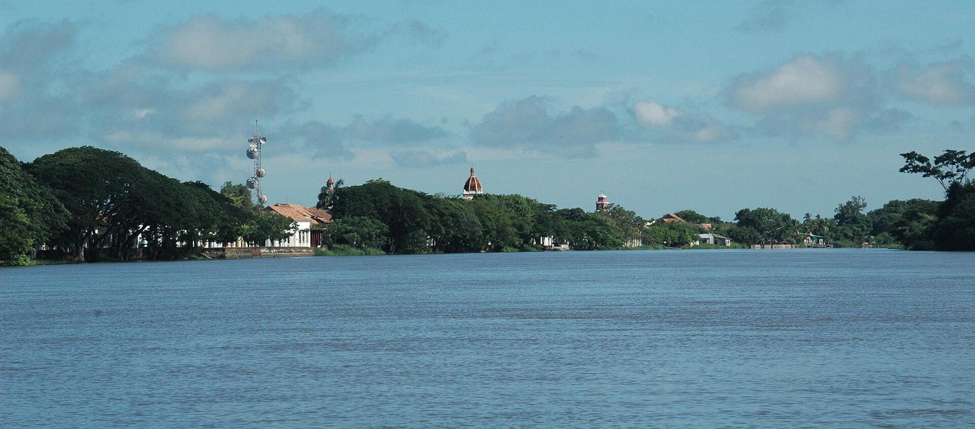
Santa Cruz de Mompox sits on an island formed by a branch of the Magdalena River in northern Colombia's Bolívar department. The town was founded by the Spanish in 1537 and served as a key transit point for colonizers moving goods and people between the Caribbean coast and the interior. During the colonial period, it was wealthier and more strategically important than Cartagena. Then the main channel of the Magdalena shifted away over subsequent centuries, leaving the town effectively bypassed by commerce and modernity. The result is one of the best-preserved colonial streetscapes in Latin America.
UNESCO added Mompox to its World Heritage list in 1995, recognizing the integrity of its historic center. The streets are lined with whitewashed buildings, iron-grilled windows, and churches dating to the 16th and 17th centuries. Seven churches remain standing in the historic core, each with a distinct architectural style reflecting different periods of colonial influence. The Iglesia de Santa Bárbara is notable for its octagonal baroque tower — one of the only examples of this style in Colombia.
Gabriel García Márquez was born in the nearby town of Aracataca, but he drew heavily on Mompox in his fiction. The isolation of the place — its heat, its stillness, its sense of time suspended — appears throughout his work. That quality is still present. The town moves slowly, particularly during the dry season. Life happens on the sidewalks in the evenings, when residents drag chairs outside and the streets fill with conversation.
Mompox is also known for its filigree goldsmithing tradition. Local artisans produce delicate jewelry using techniques passed down over generations — thin threads of gold or silver twisted and soldered into intricate patterns. The work is sold in small workshops throughout the historic center. It is one of the few places in Colombia where this craft survives at scale.
Getting there requires effort. The nearest commercial airport is in El Banco, from which boats and minibuses continue to Mompox. Some travelers arrive by boat along the Magdalena, a journey of several hours from Magangué. The difficulty of access is part of what has preserved the town. Mompox receives far fewer visitors than Cartagena — perhaps a few hours' drive away in terms of the wider Colombian route — and the contrast in atmosphere is striking. Cartagena is polished and tourist-facing; Mompox is lived-in, quiet, and largely indifferent to outside attention.
The Holy Week celebrations in Mompox are considered among the most significant in Colombia. Elaborate processions fill the riverside streets at night, with candles and religious statues carried through the town in a tradition that dates to the colonial era. Accommodation books out months in advance for this period, but outside Holy Week the town is easy to visit independently and remains genuinely uncrowded.
Jardin, Colombia
Credit: Pedro Szekely, Flickr
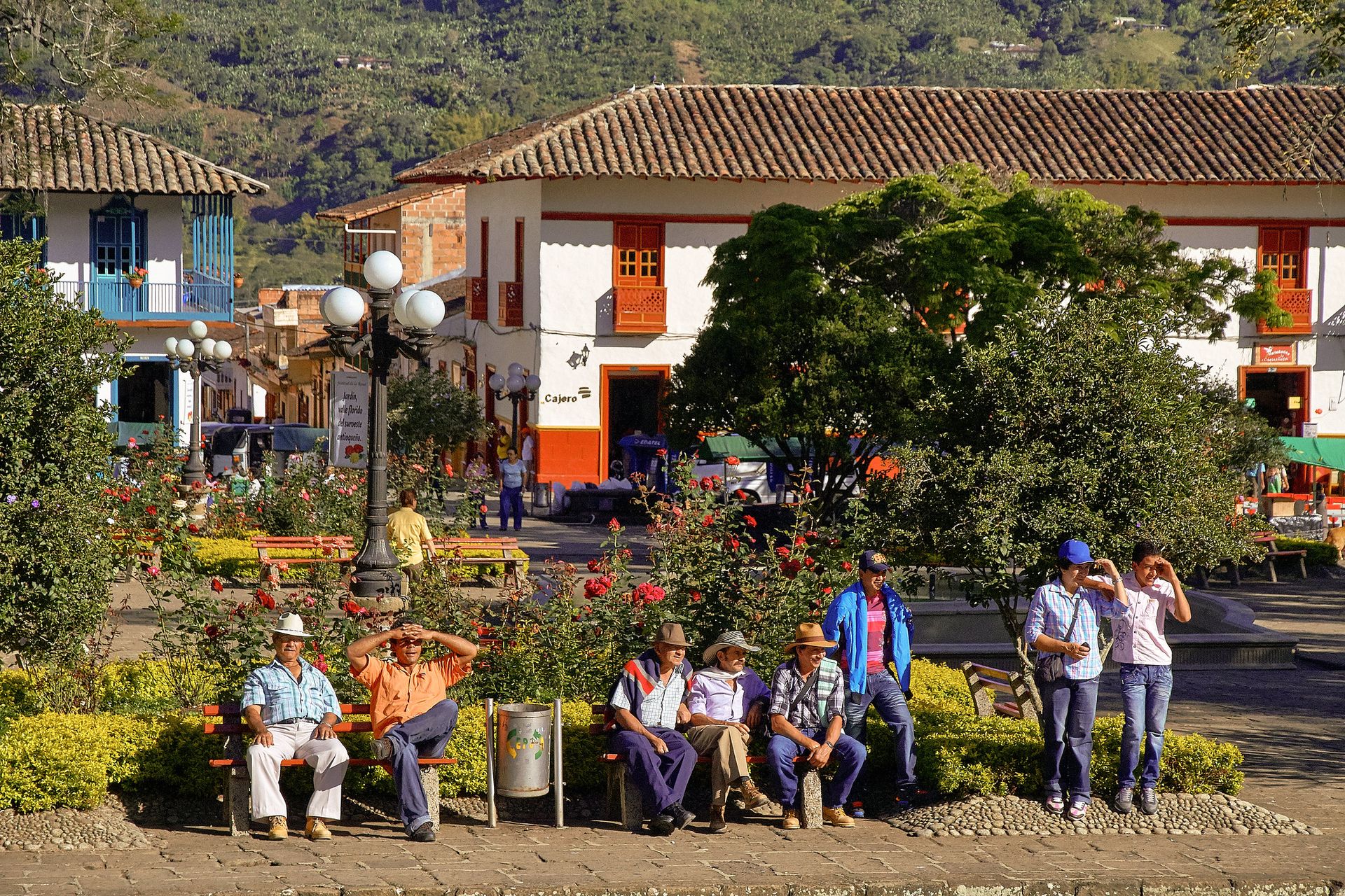
Jardin is a small municipality in the southwest of Antioquia department, situated in a steep valley about 140 kilometers from Medellín. It has the kind of main plaza — wide, tiled, edged with flowering trees and painted cafés — that appears on lists of Colombia's most beautiful towns, yet visitor numbers don't reflect that reputation. The town sits below the influence of more prominent coffee region destinations like Salento, which draws significantly more international traffic.
The coffee produced in and around Jardin is grown on steep mountainsides at elevations above 1,700 meters. Fincas in the surrounding hills offer tours covering the full process from picking to cup. The terrain here is more vertical and dramatic than in parts of the Eje Cafetero that tourists typically visit — some hillside farms are accessible only by jeep or on foot. The altitude and volcanic soil produce beans with pronounced acidity and complexity.
The town is architecturally coherent in a way that many Colombian towns are not. Antioqueño colonial architecture — characterized by two-story buildings with ornate wooden balconies painted in bright colors — lines the streets around the central plaza and extends outward. The Basílica Menor de la Inmaculada Concepción anchors the plaza and is visible from most of the town.
Beyond the center, the surrounding countryside is crossed by hiking trails leading to waterfalls, viewpoints, and indigenous Emberá communities. The Cueva del Esplendor — a waterfall that drops through a hole in a cave ceiling — is one of the more dramatic natural features in the area. It requires a guided half-day hike to reach.
A cable car connects the town center to a hillside viewpoint above Jardin, offering views across the valley and into the surrounding mountains. It is one of the more accessible ways to appreciate the landscape without a full hike.
Jardin has a small but functional tourist infrastructure: guesthouses around the plaza, coffee shops that serve locally grown beans, and guides who know the trails. The town sees Colombian domestic tourists on weekends, particularly from Medellín, but remains largely off the international circuit. Getting there from Medellín takes roughly three hours by bus, with several departures daily.
The contrast with Salento — which draws large crowds and has developed accordingly — is significant. In Jardin, the finca tours are smaller, the streets are quieter, and the texture of everyday Colombian life in a coffee-growing town is harder to miss.
Villa de Leyva, Colombia
Credit: Juan Felipe, Pexels
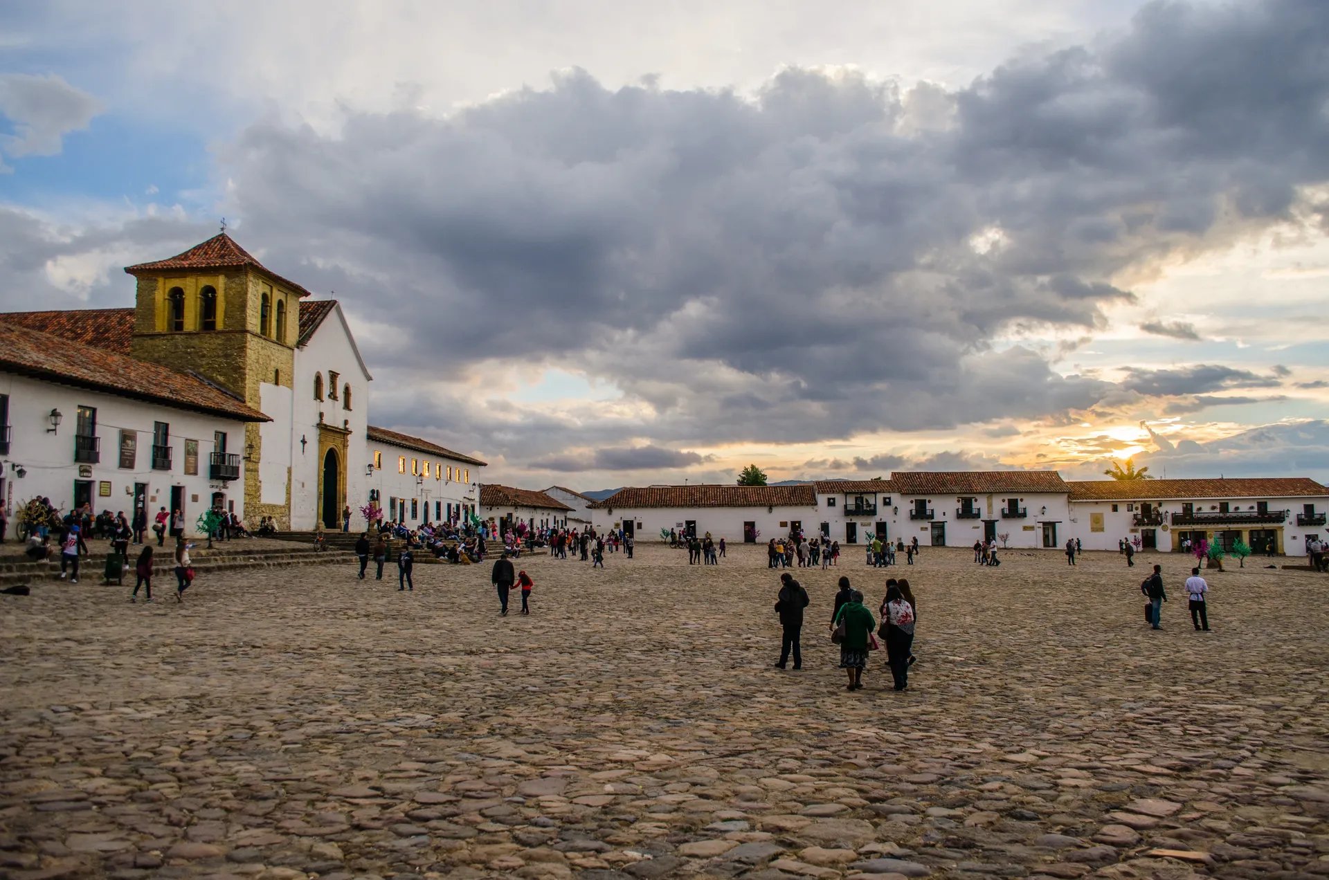
Villa de Leyva sits on a dry plateau in Boyacá department, about 40 kilometers from Tunja and three to four hours from Bogotá by road. It was founded in 1572 and declared a national monument in 1954, a designation that has frozen its colonial architecture in place and restricted new construction in the historic core. The result is one of the most visually coherent colonial towns in Colombia: cobblestone streets, whitewashed walls, and a central plaza that is among the largest in the Americas.
That plaza — the Plaza Mayor — is genuinely vast. Paved with cobblestones and measuring roughly 14,000 square meters, it gives the town a sense of scale unusual for a small mountain settlement. On weekdays it is nearly empty. On weekends it fills with vendors and visitors from Bogotá, but outside high season the crowds are manageable.
The area around Villa de Leyva has a secondary identity as a paleontological site. The surrounding rock formations date from the Cretaceous period and have produced significant fossil finds. El Fósil, a small museum several kilometers outside the town, displays the skeleton of a kronosaurus — a large marine reptile — excavated locally. The fossil is presented in a simple structure that belies its scientific significance.
Other attractions in the surrounding area include the Convento del Santo Ecce Homo, a 17th-century monastery with a courtyard that retains its original flagstones and walls. The El Infiernito archaeoastronomical site, where standing stone monoliths are believed to have been used by the Muisca people to track the solar calendar and determine agricultural cycles, is also within easy reach.
Villa de Leyva has a functioning tourist economy — boutique hotels, restaurants, and weekend visitor traffic from Bogotá — but remains considerably less visited than Cartagena and is entirely off the itinerary of most international travelers who focus on the classic Colombia circuit. The altitude, around 2,100 meters, keeps the climate cool and dry compared to coastal or lowland destinations.
The Boyacá region more broadly rewards exploration. The surrounding landscape is marked by dramatic ravines, high-altitude wetlands called páramos, and small towns that see almost no foreign visitors at all. Villa de Leyva works well as a base for several days in the Andean interior.
Samaipata, Bolivia
Credit: Dpasten, Wikimedia Commons / CC BY-SA 4.0
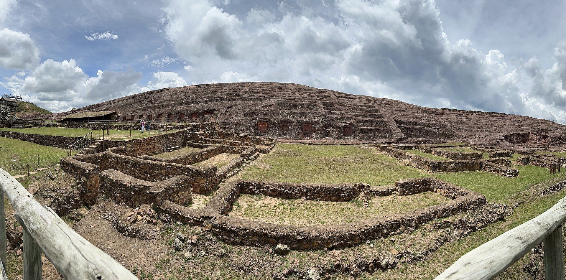
Samaipata is a small town in Santa Cruz department, in Bolivia's lowland east, about 120 kilometers west of the city of Santa Cruz de la Sierra. It sits at approximately 1,650 meters elevation, which gives it a comfortable climate compared to the hot lowlands below. The town itself is pleasant — a mix of Bolivian families and a small community of foreign long-term residents, with a handful of restaurants and guesthouses — but the main reason to visit is the pre-Columbian archaeological site on the hill above the valley.
El Fuerte de Samaipata is one of the most unusual and least-visited UNESCO World Heritage sites in South America, designated by UNESCO in 1998. It consists primarily of a massive sandstone rock formation covering roughly two hectares, carved by a pre-Inca culture into a series of channels, niches, pools, tanks, and zoomorphic figures. A large central area is lined with carved channels and what appear to be ceremonial platforms. The Inca later incorporated the site into their own ceremonial and administrative network, and evidence of Inca construction is visible alongside older carvings.
What makes El Fuerte distinctive is the scale of the carving. The entire surface of the rock has been shaped, not just isolated sections. The full purpose of the channels and niches is not definitively established — theories range from ritual use to water management to astronomical observation — and the site carries an openness to interpretation that more thoroughly excavated sites lack. There is no reconstruction, no replica, and minimal on-site interpretation beyond a small museum near the entrance.
Samaipata also serves as a gateway to sites related to Che Guevara's guerrilla campaign in Bolivia in 1966 and 1967, which passed through this region. La Higuera, the village where he was captured and killed in October 1967, is accessible from here, as is Vallegrande, where his body was publicly displayed. This history is central to Bolivian national narrative and draws visitors interested in 20th-century Latin American politics.
The town has good walking trails in the surrounding hills, and the valley offers some of the most accessible Andean cloud forest in Bolivia. Getting there from Santa Cruz de la Sierra takes two to three hours by bus or shared taxi along a paved road. Santa Cruz has direct international flights, making Samaipata more accessible than its obscurity might suggest.
Sucre, Bolivia
Credit: Tom D'Arby, Pexels
Sucre is Bolivia's constitutional capital — the seat of the judicial branch and the city designated as the national capital in Bolivia's constitution — though La Paz has long served as the seat of the executive and legislative branches. This jurisdictional reality is part of what keeps Sucre off the main tourist radar: visitors associate the capital of Bolivia with La Paz, and Sucre ends up treated as a secondary stop if it appears on the itinerary at all.
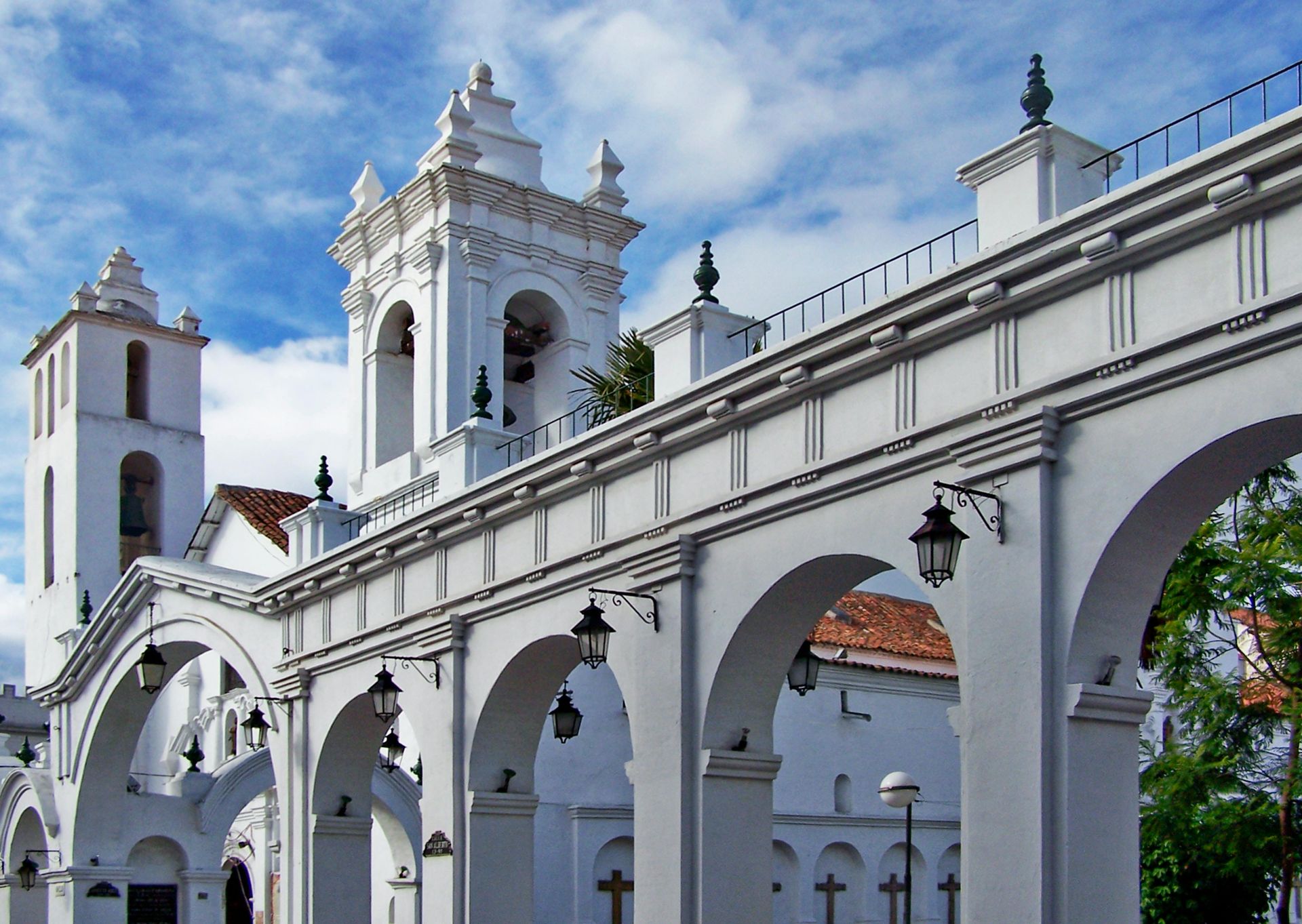
The city was founded in 1538 and declared a UNESCO World Heritage Site in 1991. Its colonial center is exceptionally well preserved. A local regulation has long required buildings in the historic core to maintain white exteriors, giving the city the nickname La Ciudad Blanca. The result is a visually unified streetscape that feels less like a curated museum than a functioning city that simply never had reason to modernize its architecture.
Sucre sits in a broad valley in the Bolivian highlands at approximately 2,750 meters elevation — lower than La Paz's 3,640 meters, which makes it significantly more comfortable for travelers concerned about altitude. The climate is mild year-round owing to the altitude and the sheltered valley setting.
The most remarkable attraction in the area is not in the city center. About five kilometers from Sucre, at a site called Cal Orck'o, a cement factory exposed a cliff face containing one of the largest and most diverse collections of Cretaceous dinosaur footprints ever found. The tracks were laid down approximately 68 million years ago and include prints from multiple species. A park called Parque Cretácico has been established at the site. Visitors see the cliff from elevated viewing platforms — the footprint surface itself is steep and fragile — and a museum provides geological and paleontological context.
The city has good infrastructure for independent travelers: hostels, midrange hotels, restaurants, Spanish-language schools, and reliable connections to other Bolivian destinations by bus or air. It is a more comfortable base for exploring the Bolivian interior than either La Paz or Potosí, and it connects well to the road south toward the Salar de Uyuni.
Quebrada de Humahuaca, Argentina
Credit: Tanenhaus, Flickr
The Quebrada de Humahuaca is a narrow mountain valley in the province of Jujuy, in the far northwest of Argentina. It runs roughly north to south along the Río Grande for about 150 kilometers, passing through a succession of small towns before climbing toward the Bolivian border. UNESCO added the quebrada to its World Heritage list in 2003, recognizing it as a cultural landscape that has served as a major transit route between the Andean highlands and the lowlands for at least 10,000 years.
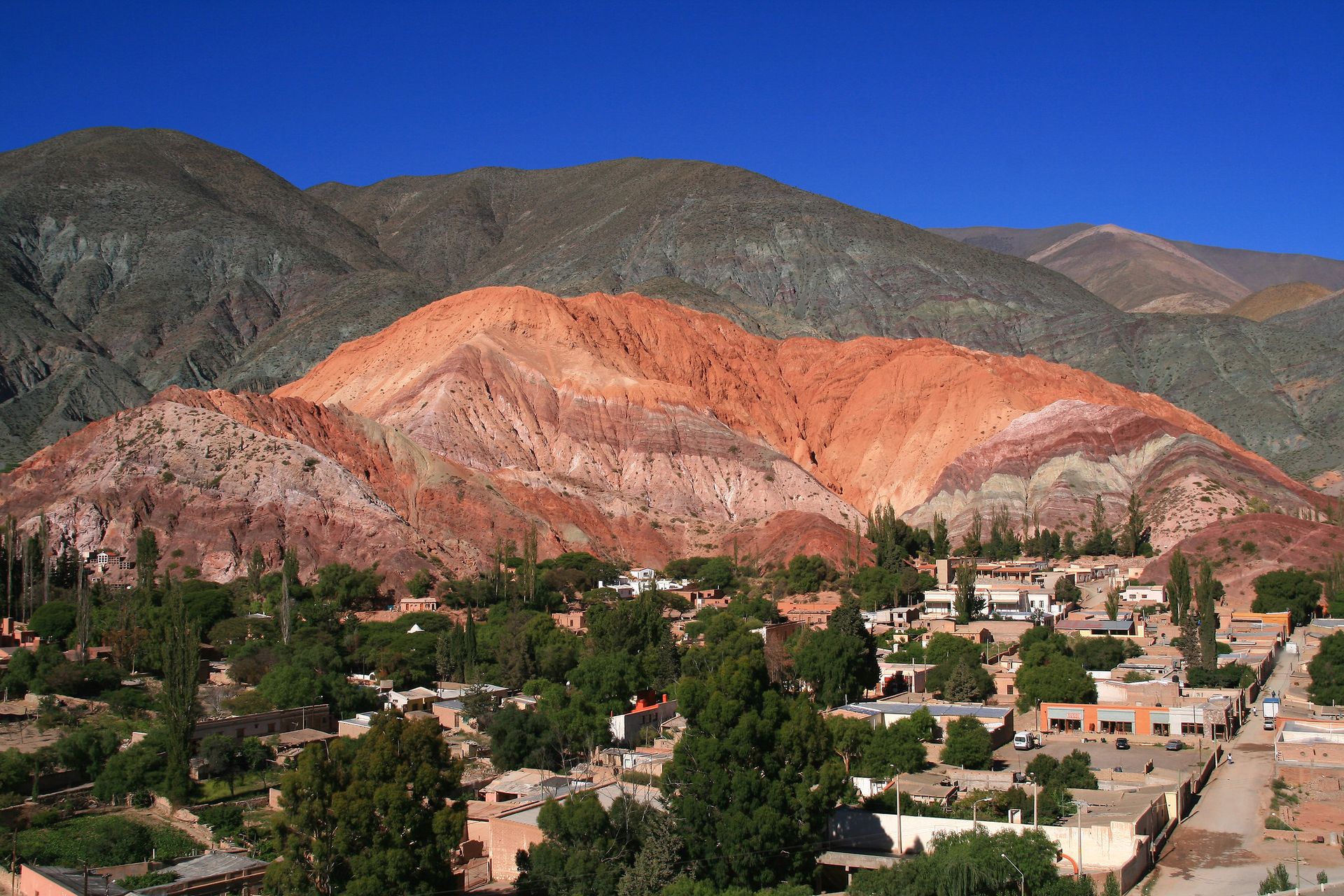
The valley's geological formations are the first thing most visitors notice. The hillsides are stratified in layers of red, purple, orange, and yellow — the result of different mineral compositions in sedimentary rock deposited over millions of years. The most photographed section is the Cerro de los Siete Colores near the town of Purmamarca. The colors shift perceptibly as the light changes through the day.
The main towns along the valley have distinct characters. Purmamarca is small and tourist-oriented, built around a church and a crafts market. Tilcara, roughly in the middle of the valley, has the most developed tourism infrastructure and is home to the Pucará de Tilcara — a partially reconstructed pre-Inca fortified settlement on a hill above the town. Humahuaca, the largest town and the one that gives the valley its name, is less polished and feels more like a working Andean town. Its central monument — a figure of a local indigenous leader raising a hand at noon each day via a mechanical clock mechanism — is one of the stranger roadside attractions in northern Argentina.
The quebrada is also the setting for one of Argentina's most distinctive Carnival celebrations. In the weeks before Lent, towns along the valley fill with music, masks, and the ritual of Pachamama — offerings to the earth — that blends indigenous Andean tradition with Catholic ceremony. The processions are led by carnival figures called diablos and accompanied by brass bands playing a regional style called chicha.
Getting to the quebrada from Buenos Aires involves a flight to Jujuy or Salta, both of which have multiple daily connections, followed by a short drive or bus ride into the valley. The region sees growing Argentine domestic tourism but remains below the radar of most international itineraries focused on Patagonia or Buenos Aires.
Iberá Wetlands, Argentina
Credit: Flickr
The Iberá Wetlands cover approximately 1.3 million hectares in the province of Corrientes, in northeastern Argentina. They form one of the largest wetland systems in South America and support a concentration of wildlife that is rarely discussed outside Argentine conservation circles. The wetlands sit in a shallow depression fed by rainwater rather than river inflow, creating a system of lakes, marshes, floating islands called embalsados, and corridors of dense aquatic vegetation.
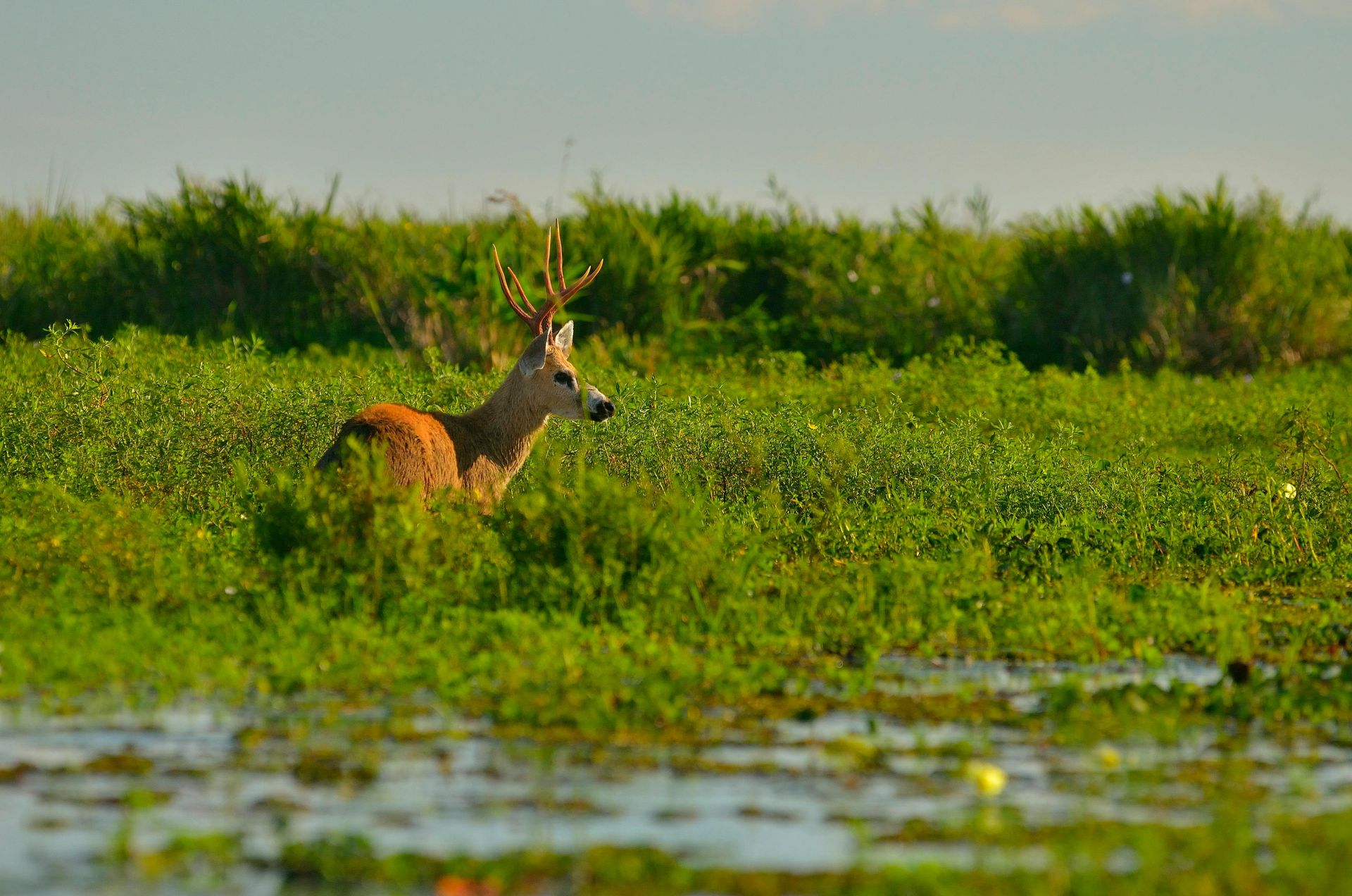
The wildlife is the primary reason to visit. Caimans are abundant and visible from the banks throughout the day. Capybaras — the world's largest rodent — roam the grassland edges in groups. Marsh deer wade through the shallows at dawn and dusk. Giant river otters have been reintroduced successfully after being hunted to local extinction in the 20th century. Maned wolves, giant anteaters, and pampas foxes move through the drier grassland sections. The birdlife includes jabiru storks, roseate spoonbills, comb ducks, and hundreds of other species.
The Iberá is also the site of one of the most ambitious rewilding programs in the Americas. Rewilding Argentina has worked to restore species that were extirpated from the region over the past century. Jaguars — absent from this part of Argentina for roughly 70 years — have been reintroduced and now have an established breeding population in the wetlands. This makes Iberá one of the few places in the temperate Southern Hemisphere where wild jaguars can be seen.
The main visitor base is the town of Colonia Carlos Pellegrini, a small settlement accessible by unpaved road from the provincial capital Corrientes. Several lodges and guesthouses in Pellegrini offer guided boat trips, horseback riding through the grasslands, and walking excursions. The infrastructure is functional rather than luxurious, with notable exceptions among the higher-end lodges built specifically for conservation tourism.
Access requires a flight to Corrientes or Posadas and then several hours of road travel. The unpaved sections are passable in a normal vehicle during the dry season but can become difficult in heavy rain. The effort involved in getting there has kept visitor numbers low. Outside Argentine nature tourism circles, the Iberá is almost entirely unknown internationally — despite offering wildlife encounters that are more accessible, and in some cases more varied, than those in more heavily marketed destinations elsewhere on the continent.
El Bolsón, Argentina
Credit: Patagonia Savage, Pexels
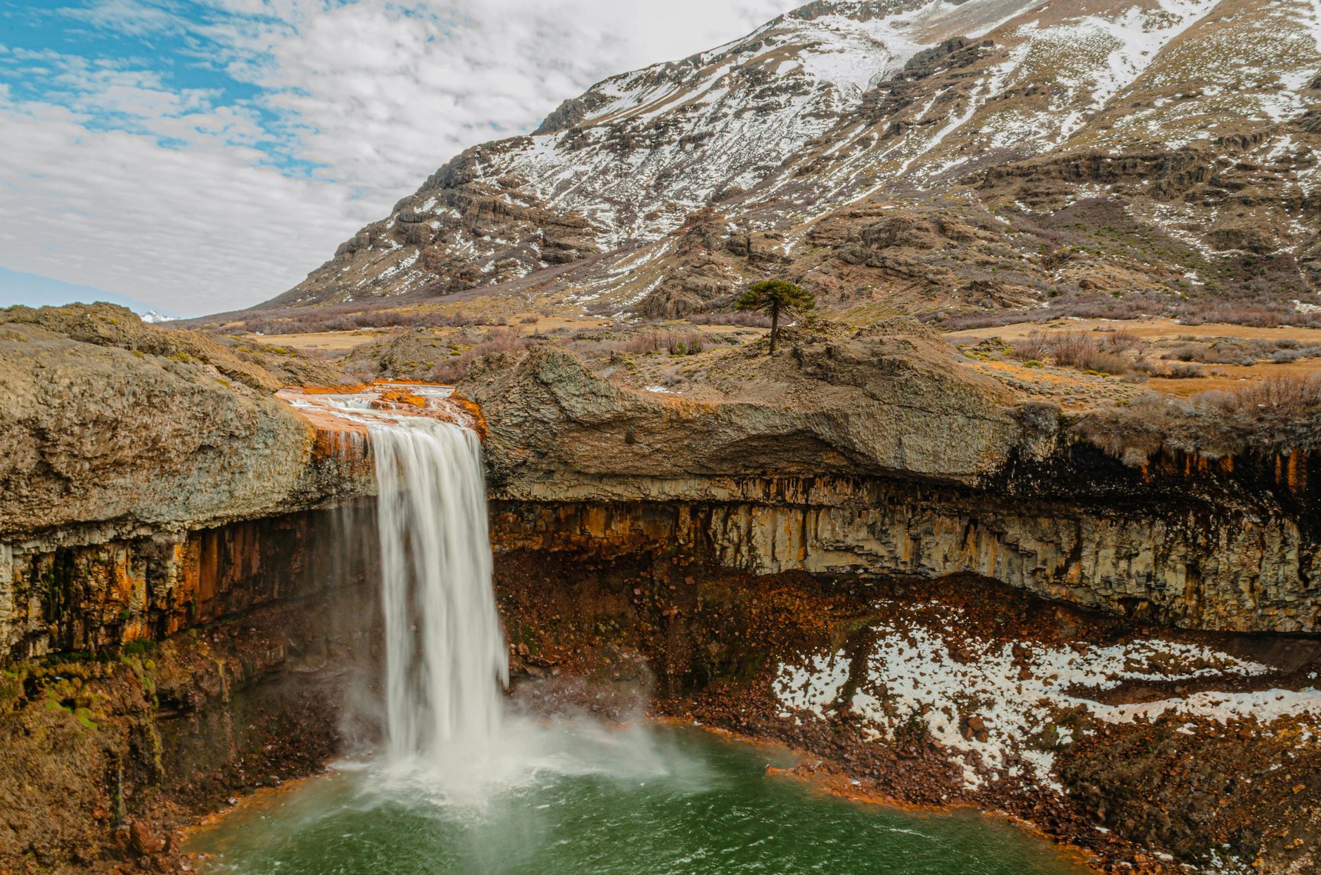
El Bolsón is a small city in the province of Río Negro, in the northern part of Patagonia, roughly 130 kilometers south of Bariloche. It sits in a valley ringed by mountains at a lower elevation than Bariloche, which gives it a warmer and wetter microclimate that supports hops cultivation, berry farming, and organic agriculture at scales unusual for Patagonia. This anomaly is known locally as the valley's microclimate, and it shapes the town's character.
The city has a countercultural history. Beginning in the 1970s, El Bolsón attracted artists, craftspeople, and people seeking an alternative to urban Argentina. This community established the Feria Artesanal, a craft market held in the main plaza on Tuesdays, Thursdays, Saturdays, and Sundays. The market is one of the most established artisan markets in Patagonia, selling ceramics, leather goods, handmade clothing, honey, jams, and smoked meats from local producers. It has been running in its current form for decades and is not a tourist imitation of a traditional market but a genuine commercial institution.
The area is better known domestically for craft beer than for tourism infrastructure. El Bolsón has a dense cluster of microbreweries relative to its population, using locally grown hops. Several breweries operate taprooms along the main street or on the outskirts of town. The local brewing tradition predates the craft beer boom in Buenos Aires and is taken seriously here.
Hiking in the surrounding mountains is the other main activity. The trails on the flanks of the ranges to the west and the Cajón del Azul to the east offer routes ranging from accessible half-day walks to multi-day backcountry treks. The Cajón del Azul — a narrow canyon with a river running through it — requires a river crossing to reach the main campsite and is one of the more celebrated short treks in northern Patagonia.
El Bolsón receives some overflow from Bariloche — visitors may add a day trip or overnight stay — but it rarely appears as a primary destination on international itineraries. It lacks the infrastructure of Bariloche but also lacks the crowds. The Feria Artesanal, the brewing scene, and the hiking make it a worthwhile stop for travelers already in the northern Patagonian lakes district.
Lençóis Maranhenses, Brazil
Credit: Leo Castro, Pexels
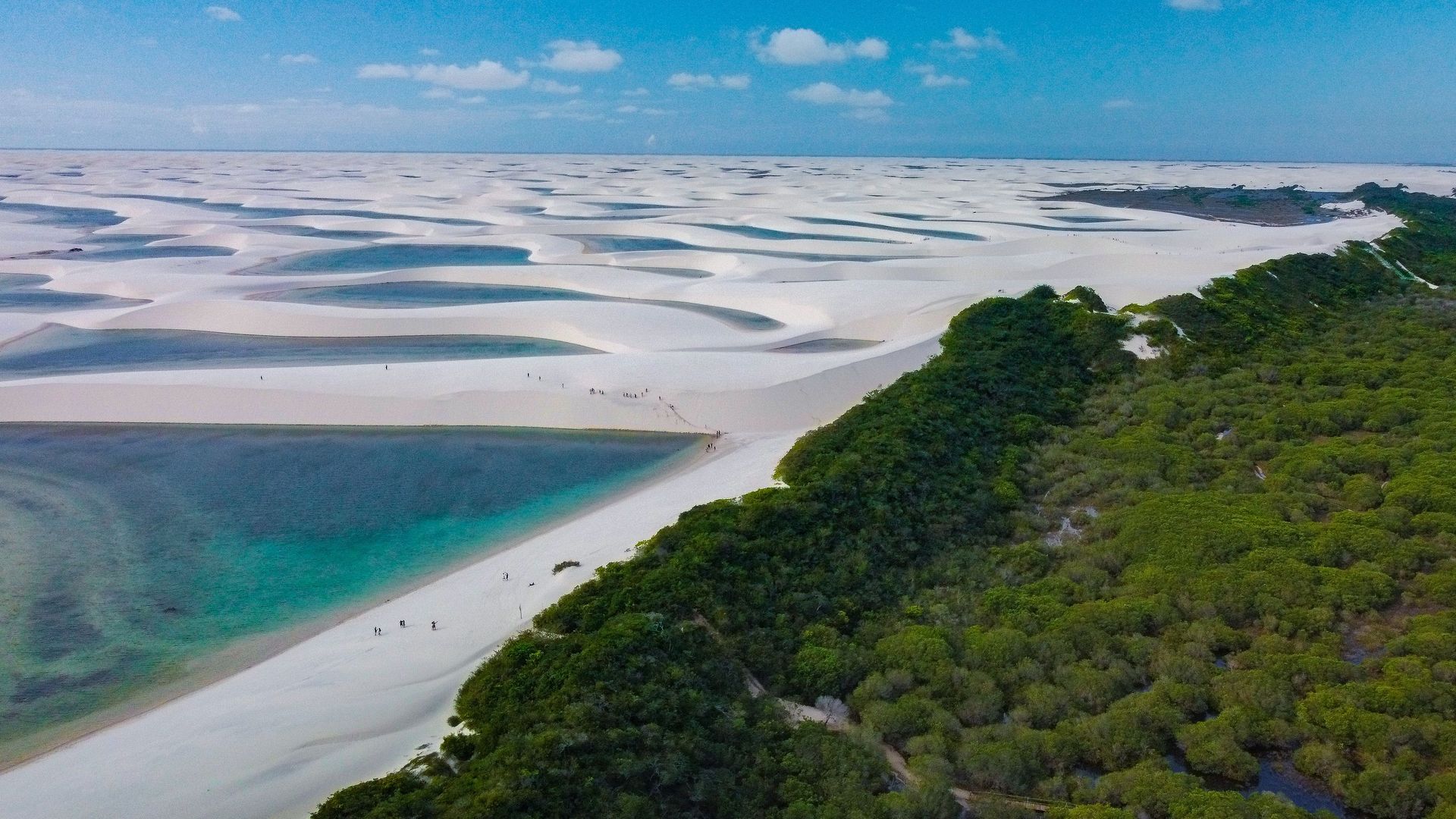
Lençóis Maranhenses is a national park in the state of Maranhão, in northeastern Brazil. It covers roughly 155,000 hectares of coastal dunes and is best known for a landscape that appears, at first glance, impossible: white sand dunes interrupted by hundreds of clear-water lagoons that form between the dune ridges after the rainy season. The lagoons — ranging in color from clear to deep blue or green depending on depth and light — fill between April and September each year.
The landscape is sometimes described as a desert, but this is inaccurate. The region receives significant rainfall, particularly between January and June. It is the combination of heavy rain and fast-draining sandy substrate that creates the lagoons: water cannot percolate through the sand quickly enough and pools in the interdune valleys before evaporating during the dry season. By October and November, most of the lagoons have emptied.
The main access points are the town of Barreirinhas and, for the western section of the park, the smaller settlements of Atins and Santo Amaro. Barreirinhas is the largest town and has the most accommodation and tour operators. Jeep tours are the standard way to reach the park interior; on foot, the dunes are accessible from several points, though the walking is demanding in the heat. Some operators offer multi-day treks between lagoons, with nights spent in hammocks in small villages.
Maranhão is the least-visited of Brazil's northeastern coastal states despite being home to Lençóis Maranhenses and the historic city of São Luís — a UNESCO World Heritage Site with a significant collection of Portuguese azulejo-tiled colonial buildings. Most international Brazil itineraries focus on Rio de Janeiro, the Amazon $AMZN, or Salvador, leaving both of Maranhão's major attractions relatively uncrowded by comparison.
Getting there requires a flight to São Luís and then a bus or transfer to Barreirinhas, a journey of around four hours. The connections are reliable and the road is paved. The best time to visit is between June and September, when the rainy season has filled the lagoons but the skies have cleared for the dry season.
Chapada dos Veadeiros, Brazil
Credit: Daniel 2 Matsuoka, Flickr
Chapada dos Veadeiros is a national park and surrounding plateau in the state of Goiás, in central Brazil, about 260 kilometers north of Brasília. It is one of the most accessible protected wilderness areas in the country from the federal capital — yet it remains largely unknown to international visitors. The park covers a significant portion of the cerrado biome, the vast tropical savannah that covers much of central Brazil and contains extraordinary biodiversity in a form that receives far less attention than the Amazon $AMZN.
UNESCO added the park to its World Heritage list in 2001. The cerrado is one of the world's biodiversity hotspots, home to a large proportion of Brazil's total species — hundreds of bird species, large mammals including giant anteaters, maned wolves, giant armadillos, and pumas, and an extraordinary range of endemic plant life. The plateau itself sits above 1,000 meters, and the combination of altitude, crystalline streams, and exposed quartzite rock formations creates landscapes visually unlike the Amazon basin or the coastal Atlantic forest.
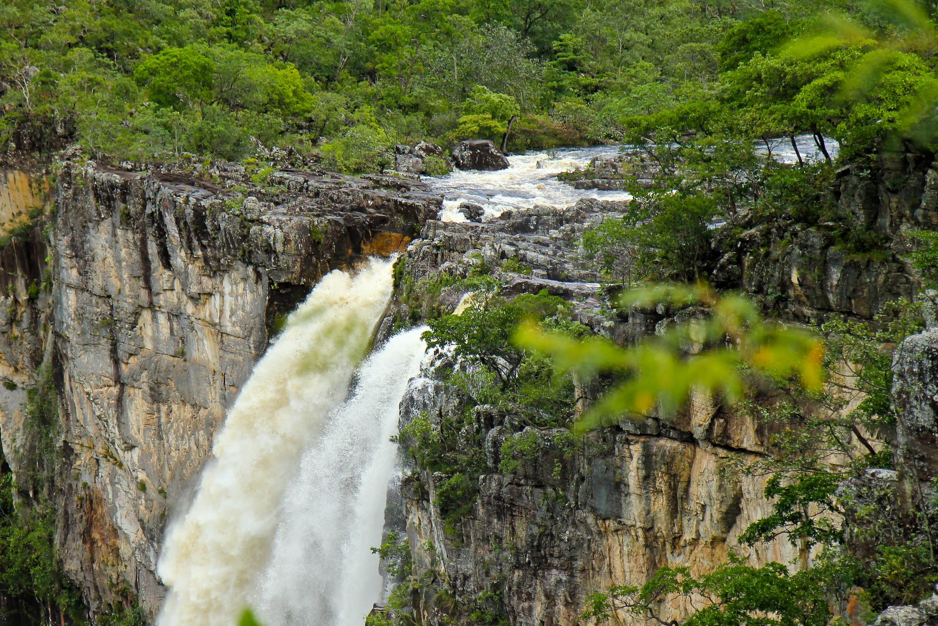
Waterfalls are the most visited feature. The park contains dozens of them, ranging from accessible roadside cascades to more remote falls reached by longer trails. Swimming is permitted at many of them, and the water running off the quartzite formations is exceptionally clear. The Cachoeira dos Couros and Cachoeira do Segredo are among the most photographed.
The gateway town of Alto Paraíso de Goiás has built a small economy around the park and attracts a community drawn to the region's landscape and, for some, its association with new-age spirituality — the Chapada has a long connection to alternative culture in Brazil, centered partly on the village of São Jorge inside the park boundary.
The road from Brasília to Alto Paraíso is paved and takes roughly three hours by car or bus. Guided tours to the major waterfalls can be arranged on arrival, though some trails require a local guide. For travelers already in Brasília, the Chapada makes an excellent multi-day extension that adds a completely different landscape to the itinerary.
Ilha do Marajó, Brazil
Credit: Luciana Christante, Flickr
Ilha do Marajó sits at the mouth of the Amazon $AMZN River in the state of Pará and is one of the largest river islands in the world. Its geography is shaped by the forces of both the Amazon and the Atlantic: the eastern half of the island is lower and wetter, subject to tidal flooding and covered in mangrove and floodplain forest; the western half is drier and dominated by open grassland that supports large herds of water buffalo.
Those buffalo are the defining feature of everyday life on Marajó. They were introduced to the island during the colonial period and have since become central to the local economy and culture. Buffalo pull carts, serve as riding animals, produce milk, and appear on menus throughout the island. In the town of Soure — the main visitor base — buffalo herds can be seen wading through floodplains on the edge of town or being worked by cowboys on the surrounding farms. Buffalo-milk cheese is a local product sold in markets and small shops.
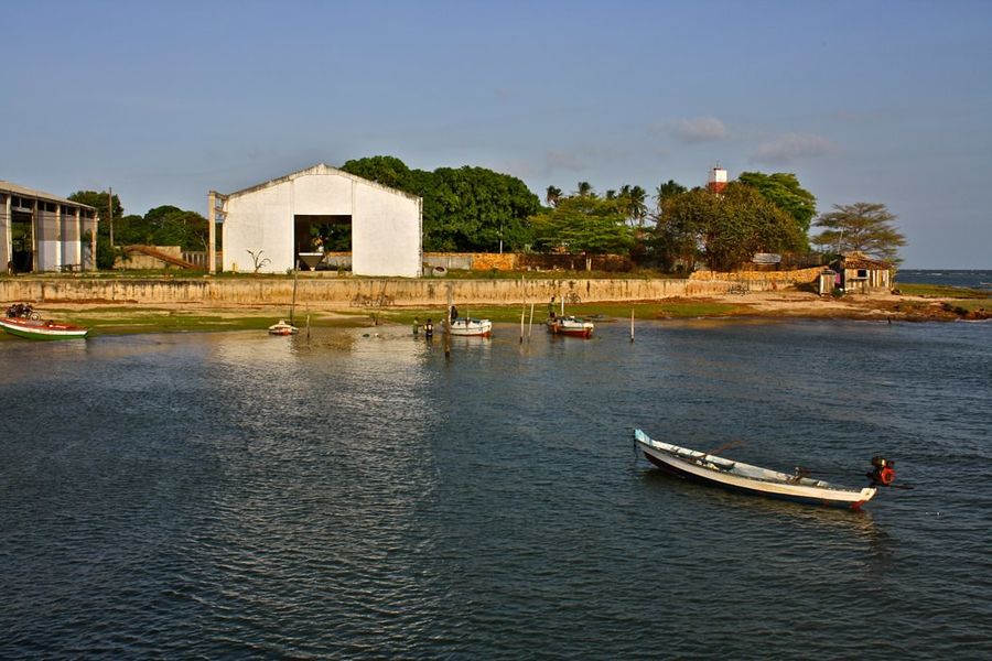
Soure itself is a small, unhurried town with a handful of guesthouses and restaurants. The beaches along the island's northern and eastern coast — Praia do Pesqueiro is the most visited — are broad, flat, and bordered by forest. They receive no ocean surf (the estuary water is too sediment-rich to be clear) but offer something distinctive: the experience of a beach at the edge of the Amazon delta, where the horizon is defined by river and jungle rather than open ocean.
The island is also home to a significant pre-Columbian culture. The Marajoara people, who inhabited the island from roughly 400 CE to 1300 CE, produced sophisticated ceramics with complex geometric and anthropomorphic designs. Pieces are displayed in museums in Belém, and smaller collections exist in Soure. The origins and decline of Marajoara culture remain subjects of ongoing archaeological study.
Getting to Marajó requires a boat from Belém, the regional capital of Pará. The crossing takes roughly two to three hours on a passenger ferry. Belém itself is a significant city with an often-overlooked culinary and cultural identity — its Ver-o-Peso market is one of the most atmospheric in Brazil — and the combination of Belém and Marajó makes for a compelling multi-day itinerary in a part of Brazil that international visitors rarely reach.
Santarém, Brazil
Credit: Lucia Barreiros Silva, Pexels
Santarém is a city of several hundred thousand people in the western state of Pará, situated at the confluence of the Amazon $AMZN and Tapajós rivers in the Brazilian interior. Most travelers who engage with the Amazon go to Manaus; Santarém, though accessible by air and by the major riverboats connecting Belém and Manaus, is rarely a deliberate destination on international itineraries.
The most striking geographical feature near Santarém is not the Amazon itself but the confluence of the Amazon and Tapajós — a meeting of waters where the dark, tannic flow of the Tapajós runs alongside the more sediment-laden Amazon for several kilometers before the two eventually mix. This meeting-of-the-waters effect is comparable to the more famous confluence near Manaus, where the Negro and Solimões meet, but receives a fraction of the visitors.
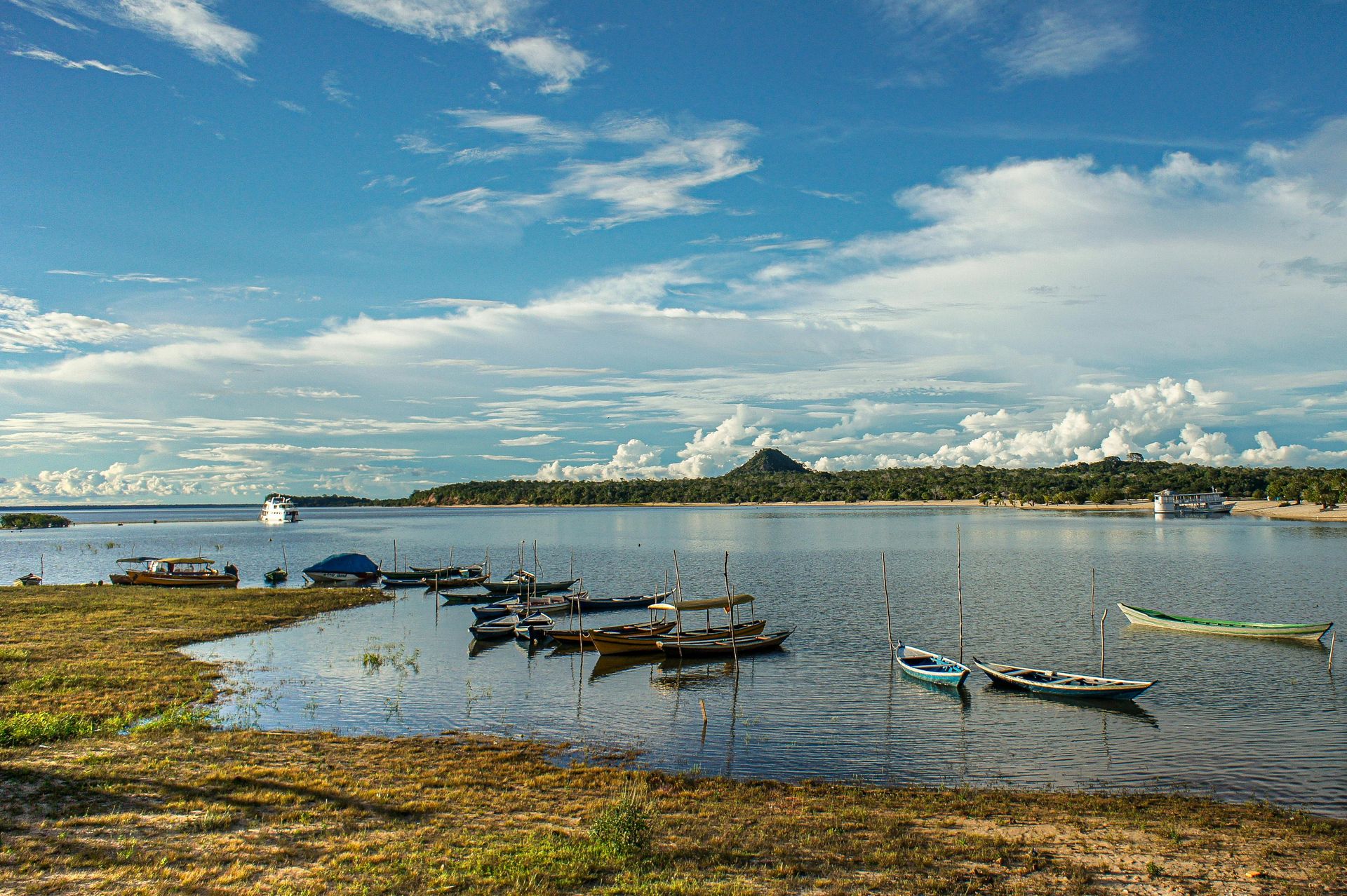
About 35 kilometers west of Santarém, the small village of Alter do Chão sits on a peninsula in the Tapajós River. During the dry season — roughly August through November — a large sandbar emerges from the river at the edge of the village, creating a long beach surrounded by clear water. The clarity and color of the Tapajós water are unusual for an Amazonian location and account for Alter do Chão's growing popularity among Brazilian domestic travelers.
Alter do Chão is also the base for visiting the Tapajós-Arapiuns Extractive Reserve, a large protected area where indigenous and riverine communities live and manage the forest under an extractivist land tenure model. Community-run tourism projects in the reserve offer boat trips, village visits, and guided forest walks — a form of structured community tourism that is relatively rare in the Brazilian Amazon.
The annual Çairé festival in Alter do Chão, held in September, is one of the most distinctive folk-religious festivals in the Amazon region, blending Catholic devotion with indigenous tradition. It draws visitors from across Pará and a small but growing number of international travelers. Getting to Santarém requires a flight from Belém, Manaus, or other Brazilian cities, and the flight time is manageable — the distance is the main barrier, not the logistics.
Kaieteur Falls, Guyana
-1920x1280.jpg)
Credit: Dan Sloan, Wikimedia Commons / CC BY-SA 2.0
Kaieteur Falls is located in Kaieteur National Park, on the Potaro River in the western interior of Guyana. The falls drop approximately 226 meters in a single unbroken plunge, making them one of the most powerful waterfalls in the world by the combination of height and water volume per unit width. They are far less visited than Niagara or Iguazú but represent a remarkable hydrological and ecological phenomenon in a landscape almost entirely undisturbed by human activity.
The falls sit within a tepui ecosystem — the tabletop mountain landscape characteristic of the Guiana Highlands — that supports endemic plant and animal species found nowhere else. The golden rocket frog (Anomaloglossus beebei), a tiny species that lives exclusively in the water-filled bromeliads growing near the falls, is one of the most famous examples. The surrounding forest is pristine — there is no significant human settlement in the immediate vicinity, no hotels at the falls, and no road access.
The standard way to visit is by small aircraft from Georgetown, Guyana's capital. Flights take roughly 45 minutes each way. Day-trip packages from Georgetown include a guided walk to multiple viewing points at the top and edge of the falls. Longer visits involving camping at the park are possible but require advance planning.
Guyana as a whole receives very few international tourists. The country lacks the marketing infrastructure of neighboring Brazil or Venezuela, and its English-speaking Caribbean identity gives it a different cultural character from most of South America. Georgetown, the capital, is worth a day of exploration on its own. The city's wooden colonial architecture — including St. George's Cathedral, one of the tallest wooden churches in the world, and the Stabroek Market — reflects its British Guiana heritage. The colonial residential streets of Camp Street retain their Victorian-era scale.
Kaieteur is the anchor attraction for most visitors, but the broader Guyanese experience — which includes the Rupununi savannah, the Caribbean coast, and a population with roots in Africa, India, indigenous Amerindian communities, and colonial Europe — makes the country one of the most distinct and underexplored in South America.
Rupununi Savannahs, Guyana
Credit: David Stanley, Flickr
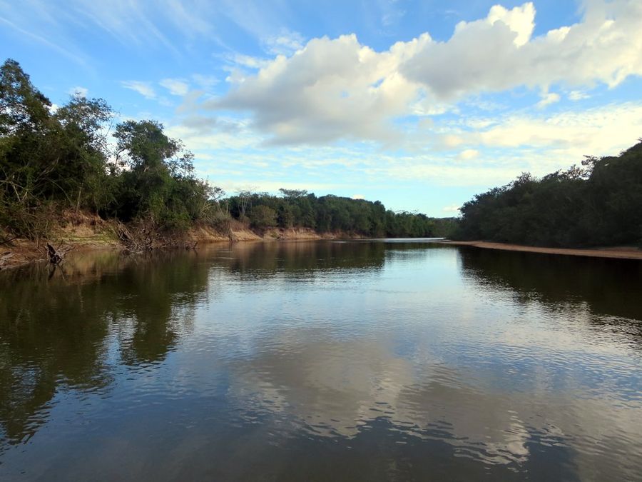
The Rupununi is a vast savannah district in the south of Guyana, near the borders with Venezuela and Brazil. It is separated from the rest of the country by dense jungle and is accessible only by small aircraft or by a rough road completed in recent decades. The landscape shifts between open grassland, gallery forests along river courses, and wetlands that flood dramatically during the rainy season.
Wildlife in the Rupununi is diverse and in many areas relatively undisturbed. Giant river otters, giant anteaters, giant armadillos, anacondas, black caimans, and tapirs are all present. The river systems support arapaima — one of the largest freshwater fish in the world, capable of reaching over two meters in length — as well as a rich assemblage of other freshwater species. Jaguar tracks are regularly found along river edges and forest clearings.
The region is home to the Makushi and Wapishana peoples, indigenous communities who have lived here for millennia. Several of these communities have developed community-based ecotourism programs in the North and South Rupununi districts. Visitors stay in community lodges, travel by dugout canoe or on horseback, and are guided by local residents who know the land and its species in detail. These programs are small-scale and require advance booking; they are not set up for drop-in visitors.
The private Karanambu Lodge, established by naturalist Diane McTurk and now operated by her family, is one of the most established wildlife tourism operations in the Rupununi. It is known particularly for its giant river otter rehabilitation work. Elsewhere in the region, the Iwokrama International Centre for Rain Forest Conservation and Development operates a canopy walkway and lodge in the transition zone between the Rupununi and the northern forest belt.
Access from Georgetown typically involves a flight to the town of Lethem on the Brazilian border, followed by road travel into the savannah. Most visitors book package arrangements through Georgetown-based tour operators. The result is one of the more genuinely remote wildlife experiences available on the continent — and one of the least crowded.
Paramaribo, Suriname
Credit: Rafaeljantz, Wikimedia Commons / CC BY-SA 4.0
Paramaribo is the capital of Suriname, a small country on the northeastern coast of South America that was a Dutch colony until 1975. It is one of the least-visited capital cities in the Western Hemisphere, partly because Suriname receives little attention in international travel media and partly because it requires a somewhat deliberate routing — direct flights operate from Amsterdam and Miami, as well as regional connections through Trinidad, but it sits outside the standard South American travel circuit.
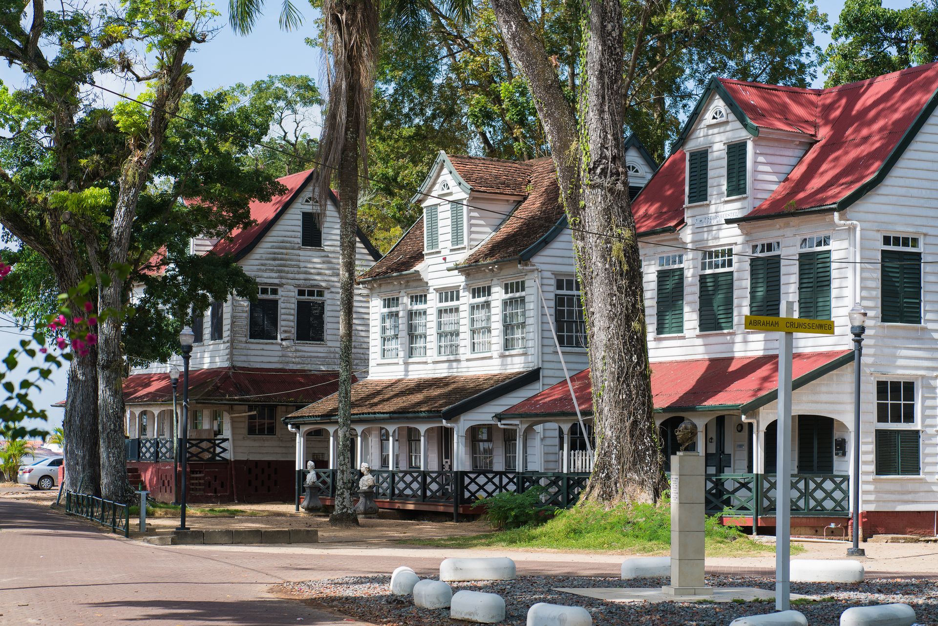
The historic inner city of Paramaribo was designated a UNESCO World Heritage Site in 2002. The architecture is defined by 17th, 18th, and 19th-century Dutch colonial wooden buildings — a style largely absent elsewhere in South America, which was colonized primarily by Spain and Portugal. The main square, Independence Square $SQ, is flanked by Fort Zeelandia, a 17th-century Dutch fortification now serving as a museum, and the Presidential Palace. The Cathedral of Saints Peter and Paul, built in wood and completed in 1885, is one of the largest wooden buildings in the Americas.
Suriname's population is among the most ethnically diverse in the world. The country's colonial history brought Javanese and Hindustani laborers as indentured workers after emancipation, alongside the existing African, indigenous Amerindian, and European populations. The result is a society where Javanese warungs, Hindustani roti shops, and Creole dishes coexist in the same market street. Surinaams roti — flatbread filled with curried vegetables and meat — is one of the country's most characteristic foods.
The Centrale Markt in Paramaribo is the best place to encounter the breadth of the country's culinary culture. Vendors sell tropical fruits, dried fish, Javanese food, and herbs used in traditional medicine. The market is active in the mornings and offers a more functional, local experience than the tourist-oriented markets common in other South American capitals.
Suriname's interior is covered by pristine Amazonian rainforest and is home to Maroon communities — descendants of escaped enslaved people who established independent societies in the jungle in the 17th and 18th centuries and maintain distinct cultural traditions to this day. River trips into the interior from Paramaribo are possible and give access to villages that retain traditional architecture, craft, and custom.
Chachapoyas, Peru

Credit: Martin St-Amant (S23678), Wikimedia Commons / CC BY 3.0
Chachapoyas is the capital of the Amazonas region in northern Peru, set on a ridge at around 2,335 meters elevation in a zone that transitions between the Andes and the Amazon $AMZN basin. The name refers both to the modern city and to a pre-Inca civilization — the Chachapoya people — who inhabited the cloud forest of this region for several centuries before being conquered by the Inca in the 15th century.
The main archaeological attraction is Kuelap, a massive walled fortress complex built by the Chachapoya on a ridge at about 3,000 meters. The walls reach up to 20 meters in height in places and enclose several hundred circular stone structures. The site is considerably older than Machu Picchu and receives a fraction of the visitors. Access was improved with the opening of a gondola lift in 2017, replacing what had been an arduous climb from the valley floor.
The Chachapoya also built cliff-side burial sites called chullpas in dramatic locations — on sheer rock faces, in cave openings high above rivers. The most visited is Revash, a group of small painted tomb structures set into a cliff face in the Santiago de los Valles area. Getting to Revash requires a hike of a few hours from the nearest village.
Gocta waterfall, brought to the attention of the wider scientific community in 2005, is located near the village of Cocachimba, roughly two hours from Chachapoyas city. It falls in two stages and ranks among the tallest waterfalls in Peru. The hike to the base of the lower falls passes through cloud forest and can be done independently or with a local guide.
The Museo de Leymebamba, about two hours south by road, houses hundreds of mummies and accompanying artifacts recovered from a clifftop burial site at Lake Huayabamba. These are among the best-preserved examples of Chachapoya funerary culture and are displayed in a purpose-built museum in a small mountain town that feels entirely disconnected from Peru's main tourist circuit. For travelers who make the effort to reach this part of northern Peru, the density of extraordinary, uncrowded sites is unlike anything on the Cusco–Lima axis.
Paracas, Peru
-1920x1080.jpg)
Credit: Alex Proimos, Wikimedia Commons / CC BY 2.0
Paracas is a small coastal town in the Ica region, about 240 kilometers south of Lima on Peru's Pacific coast. The surrounding landscape is defined by coastal desert, and the town serves as the entry point to the Paracas National Reserve and the jumping-off point for boat trips to the Ballestas Islands.
The Ballestas Islands are a cluster of rock formations rising from the Pacific, home to large colonies of Humboldt penguins, South American sea lions, Peruvian boobies, and other seabirds and marine mammals. They draw comparisons to the Galápagos as a more accessible alternative — the comparison is imprecise in terms of biodiversity, but the concentration of wildlife is genuinely impressive. Boat trips from the Paracas dock take roughly two hours round trip. The islands cannot be landed on; the boats circle the rocks at close range, giving passengers clear views of the wildlife from the water.
The Paracas National Reserve, south of the town, protects a stretch of desert coastline where the Andes meet the Pacific. The landscape ranges from white sand beaches to red rock formations, and the reserve includes both the coastal area and a portion of the ocean. Flamingos are often visible in the shallow bays within the reserve, wading in water that reflects the surrounding desert light.
The town is small and visitor-oriented, with accommodation ranging from budget hostels to hotels facing the bay. The infrastructure is set up primarily for day-trippers from Lima or travelers passing through on the way to Ica and the Nazca Lines. But Paracas is worth treating as a destination rather than a transit stop — the reserve deserves at least a full day, and the light in the late afternoon, when the desert colors intensify, is distinctive.
The Paracas culture, a pre-Columbian civilization that inhabited this region roughly 2,000 years ago, is known for its extraordinary textiles and its practice of intentional head shaping. The Paracas Candelabra — a large geoglyph carved into a hillside visible from the sea, in character similar to the Nazca Lines but located to the north — is visible during the boat trips to the Ballestas Islands.
Iquitos, Peru
Credit: Bruno Girin, Flickr
Iquitos is the largest city in the Peruvian Amazon $AMZN and one of the largest cities in the world with no road connection to the outside. The only ways in or out are by air — regular flights connect to Lima and other Peruvian cities — or by riverboat along the Amazon and its tributaries, a journey of several days from the nearest road-connected city. This isolation has shaped the city's character profoundly.
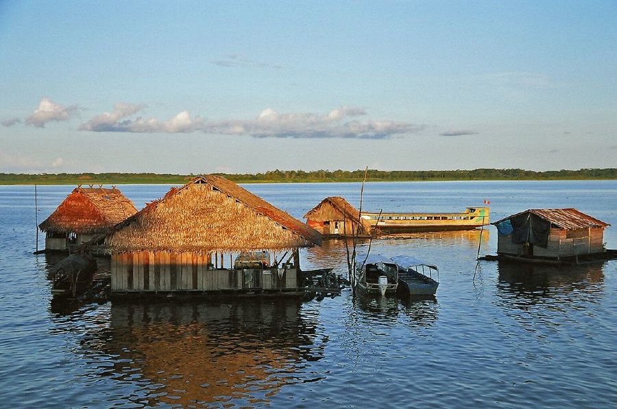
The city has a population of roughly half a million and a functioning commercial economy based on oil, fishing, timber, and river trade. It is not a jungle outpost but a real city, with traffic, markets, universities, and a commercial center. Its waterfront district, Belén, is built on floating platforms that rise and fall with the Amazon's seasonal flood cycle — during the high-water months, much of Belén is accessible only by canoe.
Iquitos's architectural curiosity is a collection of early 20th-century buildings on the central boulevards tiled with Portuguese azulejos — painted ceramic tiles that are more commonly associated with Brazil or Portugal than with the deep Amazon interior. These were installed during the rubber boom of the late 19th and early 20th centuries, when Iquitos briefly became wealthy through the export of wild rubber. The boom attracted European capital and a European aesthetic to the most remote corner of the continent; it also financed the exploitation and displacement of indigenous Amazonian people.
The jungle around Iquitos provides access to wildlife tourism in the Peruvian Amazon. The Pacaya-Samiria National Reserve, accessible by riverboat, is one of the largest protected areas in Peru and one of the most biodiverse regions in the Amazon basin. Operators offer lodges and river tours of varying duration and depth. River dolphins, sloths, monkeys, caiman, and macaws are among the wildlife commonly encountered.
The Belén Market is one of the most distinctive markets in South America. It sells the full range of Amazonian produce: exotic fruits, medicinal plants, river fish, and an array of products from the forest. It is dense and active in the mornings, entirely oriented toward local commerce rather than visitors. For anyone interested in Amazonian material culture and everyday life, it is more instructive than any jungle lodge.
Chiloé Island, Chile
Credit: claudia ceruti, Pexels
Chiloé is an archipelago off the coast of Los Lagos region in southern Chile, about 1,000 kilometers south of Santiago. The main island — Isla Grande de Chiloé — is the second largest island in South America after Tierra del Fuego. It is connected to the mainland by a short ferry crossing at Pargua, and the island's capital, Castro, is a small city built on a hillside above a fjord.
Chiloé is known internationally — if at all — for its wooden churches. The archipelago contains 16 wooden churches collectively inscribed as a UNESCO World Heritage Site in 2000. Built between the 17th and 19th centuries by Jesuit and later Franciscan missionaries, the churches were constructed entirely from native timber using traditional joinery. The designs blend European church architecture with local materials and craftsmanship. They stand in small coastal and inland villages across the main island, each slightly different in color and proportion. The church at Dalcahue and the large cathedral in Castro are among the most visited.
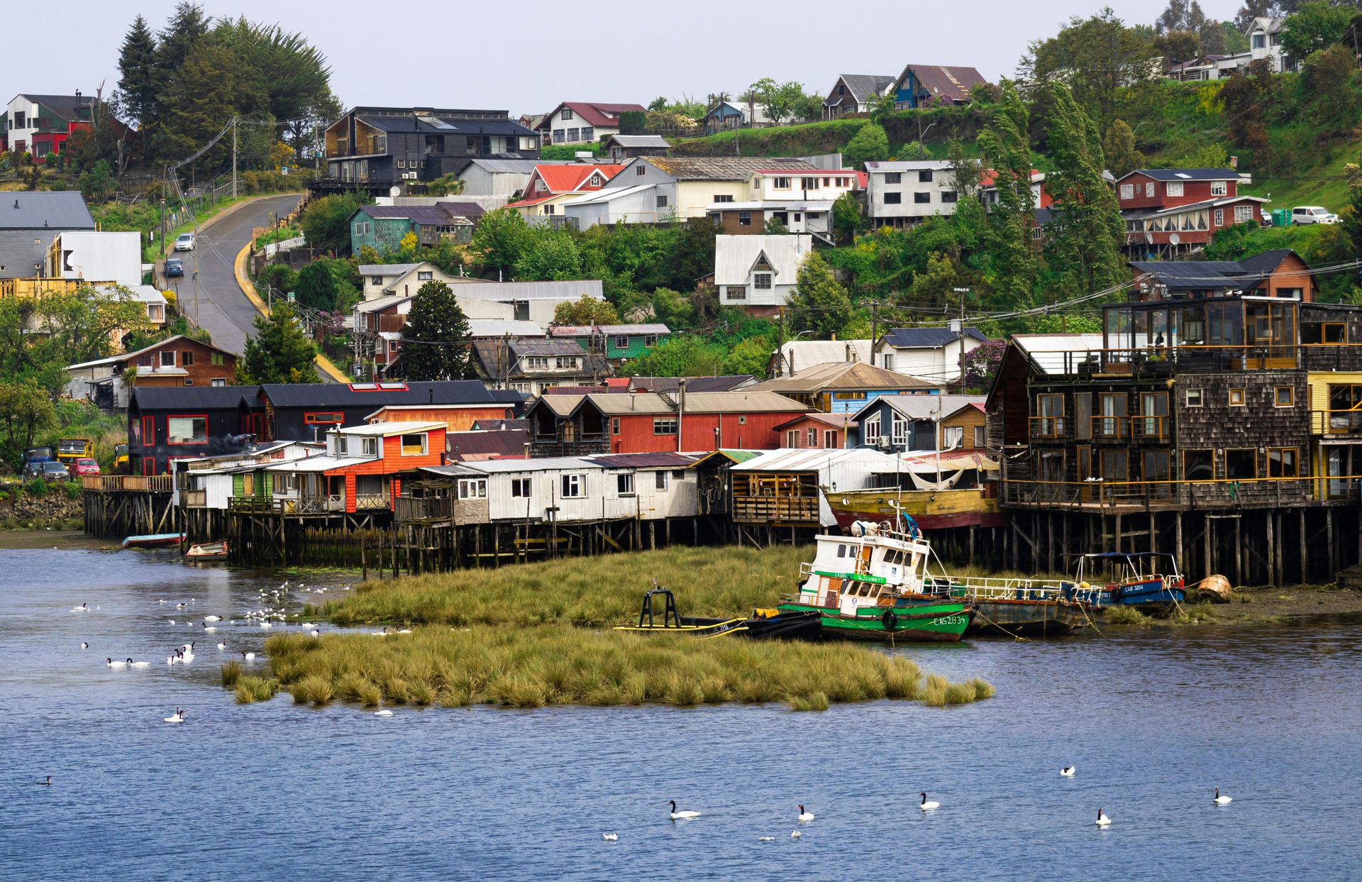
The palafitos — wooden houses built on stilts over the water of Castro's inner harbor — are the island's most photographed image. They are still inhabited and reflect a building tradition that emerged from the tidal character of Chiloé's coastline. The colors are vivid: red, yellow, blue, and orange paint on wood, with fishing boats tied below.
Chiloé has its own mythology, separate from mainland Chilean culture. Stories of the Trauco (a forest dwarf), the Caleuche (a phantom ship), and the Brujos de Chiloé (a secret society of sorcerers believed to control the island's fate) are part of everyday cultural conversation in a way that suggests genuine, not performative, cultural continuity. These stories are collected in regional literature and taught in local schools.
The food is equally distinctive. Curanto — shellfish, meats, and potatoes cooked over hot stones in a pit — is the most emblematic preparation. Served in restaurants across the island in its pot version called pulmay, it takes hours to prepare and is associated with communal gatherings. Smoked salmon and dried seafood are also produced locally. Chiloé is frequently bypassed by travelers focused on Patagonia further south, but it rewards a stay of several days.
Valdivia, Chile
Credit: Camilo Pinaud, Unsplash
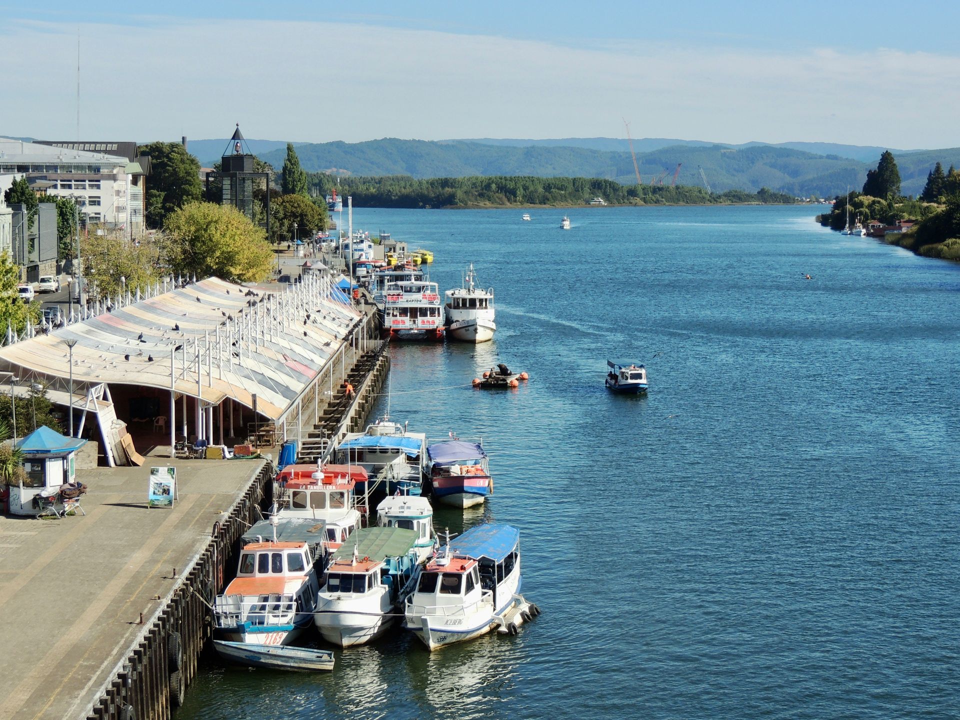
Valdivia is a city of roughly 170,000 people in the Los Ríos region of southern Chile, about 840 kilometers south of Santiago. It sits at the confluence of several rivers — the Valdivia, Calle-Calle, and Cruces — and its identity is inseparable from water. Houseboats, a riverfront market, maritime history, and a climate shaped by heavy rainfall define the experience of the city.
The city was founded by the Spanish in 1552, destroyed by a major earthquake in 1575, rebuilt, and then subjected to one of the most destructive earthquakes in recorded history in 1960. The 1960 Valdivia earthquake — measuring 9.5 on the moment magnitude scale — is the largest earthquake ever instrumentally recorded. The earthquake and the associated tsunami caused massive destruction across the region. The Corral and Niebla forts at the river mouth, which guarded the approach to the city during the colonial period, were damaged but remain partially standing and are accessible by boat.
Valdivia has a visible German heritage. Significant numbers of German immigrants arrived in the mid-19th century, encouraged by the Chilean government to settle the southern frontier. They brought brewing traditions, architectural styles, and surnames that are still common in the region. The craft beer culture in Valdivia — often described as one of the birthplaces of Chilean microbrewing — builds on this legacy. The Kunstmann brewery, established in 1997 on a German tradition, has a large riverside facility open to visitors, and several smaller breweries operate in and around the city.
The fluvial island of Teja, connected to the main city by bridges, is home to the Universidad Austral de Chile and the Austral Museum complex, which houses archaeological and natural history collections focused on southern Chile. It is considered one of the better regional museums in the country.
A river cruise to the Corral and Niebla forts is a popular half-day activity and provides a useful perspective on the city's maritime and military history. The Valdivian coastal reserve to the west protects a stretch of temperate rainforest — one of the few in South America — and the road through it offers access to the coast and the fortifications by land.
Punta del Diablo, Uruguay
Credit: Matias Peretti, Pexels
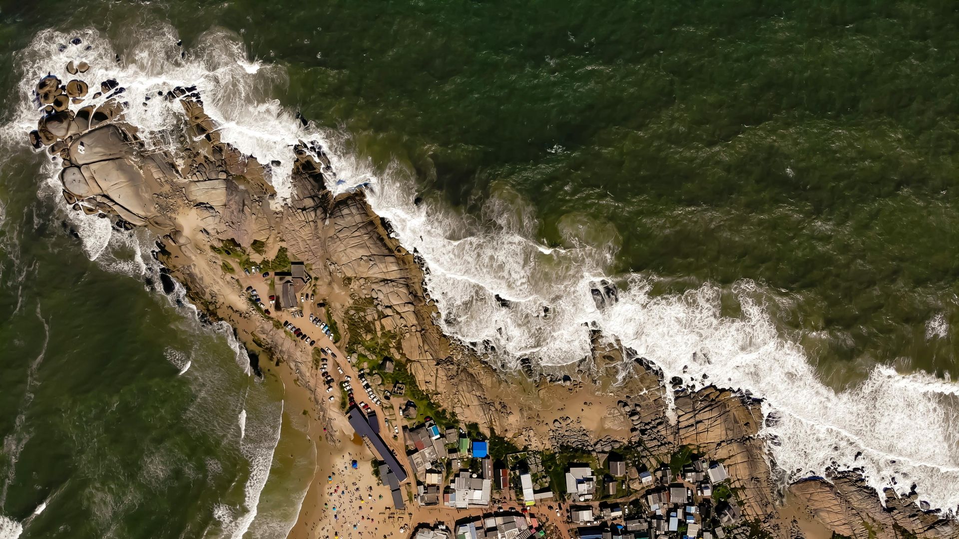
Punta del Diablo is a small Atlantic fishing village on the far northeastern coast of Uruguay, close to the border with Brazil. It sits on a rocky headland between two beaches — Playa del Pescador to the north and Playa Grande to the south — and retains the character of a working coastal village rather than a developed resort. The permanent population is small, and the original economic basis was fishing, which is still practiced from the beach.
During the summer months — December through February — Punta del Diablo fills with Argentine, Brazilian, and Uruguayan tourists drawn by the beaches and the relatively undeveloped landscape. But outside this window, the village is quiet to the point of near-emptiness. It lacks the infrastructure that drives year-round tourism: no major hotel chains, no beachfront malls, no resort strips.
The architecture is consistent with this informality. Accommodation is almost entirely in cabañas (small rental cabins), guesthouses, and camping sites scattered through the pines and eucalyptus above the beach. Building has been constrained by proximity to the Santa Teresa National Park, which begins just to the north and protects a long stretch of coast.
Santa Teresa National Park is the main natural feature in the area. It contains a large colonial fortification, the Fortaleza de Santa Teresa, begun by the Portuguese in the 18th century and completed by the Spanish after the territory changed hands. The park also protects several kilometers of Atlantic beach, dunes, and a freshwater lagoon. It has basic camping facilities and a visitor center.
For travelers arriving by bus from Montevideo, the journey takes roughly four to five hours and direct connections run daily. Buses also connect from the Brazilian border crossing at Chuy, about 35 kilometers to the north. Punta del Diablo works well as a final stop on a loop through Uruguay or as a deliberate detour for travelers crossing between Uruguay and southern Brazil. The village's appeal is largely in what it does not have: its informality is the point.
Roraima tepui
Credit: Ederik Palencia Ferreira, Pexels
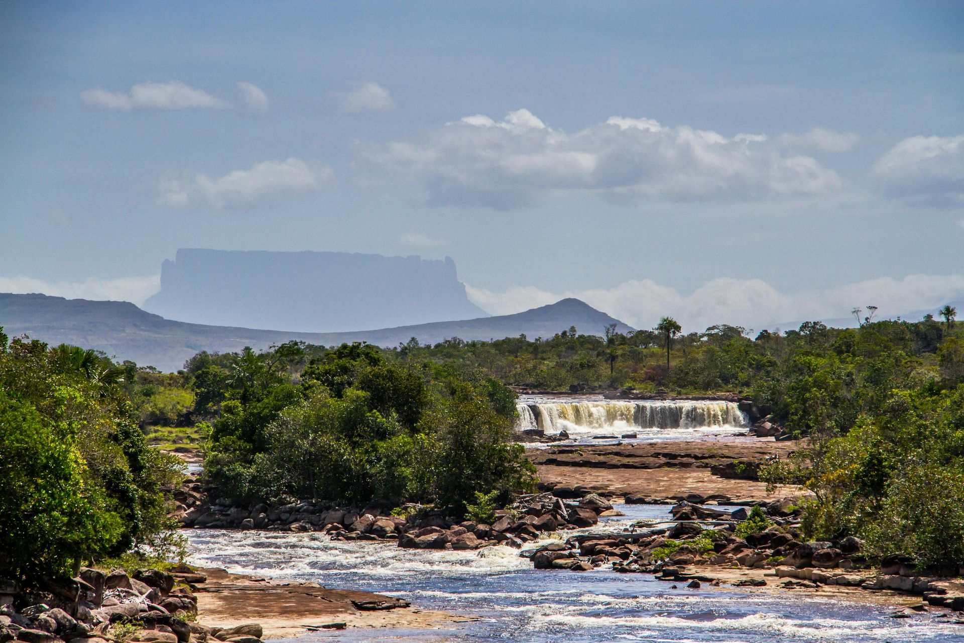
Mount Roraima is a table-top mountain — a tepui — sitting on the intersection of three national borders: Venezuela, Brazil, and Guyana. The summit plateau, at roughly 2,810 meters, is a world unto itself: flat-topped, surrounded by cliffs that drop for nearly a thousand meters, permanently wreathed in cloud, and covered in a landscape of black rock, carnivorous plants, and pools of clear water with no connection to the valleys far below. The plateau receives rain on most days of the year, and the water runs off the cliff edges in long waterfalls that disappear into the jungle beneath.
The tepui was used as the primary inspiration for Arthur Conan Doyle's 1912 novel The Lost World, in which an isolated plateau in South America is found to still support prehistoric life. No prehistoric animals are present in reality, but the isolation of the summit has produced genuine evolutionary novelty: many of the plant and animal species on the plateau are endemic, having evolved in separation from the species in the surrounding lowlands. The carnivorous Heliamphora pitcher plants, which grow in pools on the summit, are found only on tepuis.
The standard trekking route to the summit begins in the Venezuelan village of Paraitepui, accessible from Santa Elena de Uairén near the Brazilian border. The trek takes approximately five to six days round trip, climbing through rainforest and then through the open landscape of the upper slopes before reaching the summit via a natural break in the cliff face on the Venezuelan side. No technical climbing is required. Guides and porters from the indigenous Pemón people — the traditional custodians of this landscape — are required for the trek and are hired in Paraitepui.
The summit is large enough — roughly 31 square kilometers — that hikers can spend days exploring without covering the same ground twice. The constant cloud and mist create visibility that shifts dramatically, sometimes revealing the vast forest below and sometimes obscuring everything beyond 20 meters. Access from Venezuela requires attention to the country's current travel situation; the Brazilian route via Boa Vista and Pacaraima is the more commonly used path for international travelers.
Ciudad Bolívar, Venezuela
Credit: your local connection, Flickr
Ciudad Bolívar is the capital of Bolívar state in southeastern Venezuela, on the south bank of the Orinoco River. It was a key crossing point on the Orinoco during the wars of Venezuelan independence — Simón Bolívar launched campaigns from here — and the city is named in his honor. The old city, clustered on a rocky rise above the river, has a colonial center with 18th-century buildings and a historically significant central plaza.
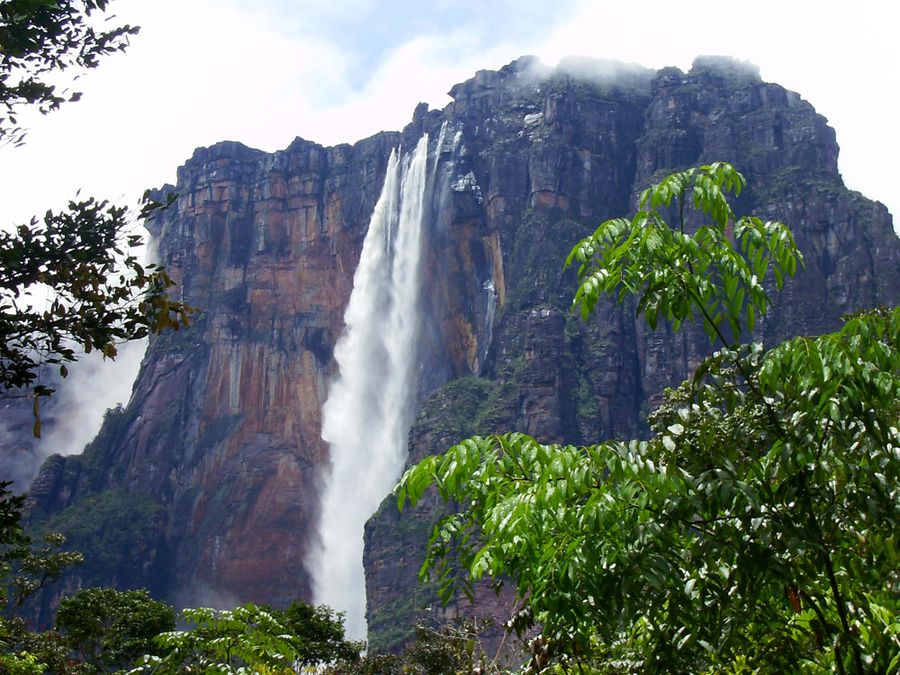
The city is the primary gateway to Venezuela's Gran Sabana region — the highland plateau in the southeastern part of the state that contains Salto Ángel (Angel Falls), the world's highest uninterrupted waterfall, as well as the broader tepui landscape. From Ciudad Bolívar, it is possible to fly to Canaima National Park, from where guided boat and hiking trips to Angel Falls are organized. Canaima lagoon, with its pink sand beaches and the waterfalls that flow directly into it, is a destination in its own right.
The old city's riverfront is marked by the Angostura district — the narrow section of the Orinoco that gives the city its historical name, as angostura means "narrows." The river at this point, while enormous, is compressed enough to have been crossable at a practical scale, and a suspension bridge now spans it several kilometers upstream. The historic iron bridge that served as the previous crossing is now used as a pedestrian walkway.
The Angostura bitters that appear in cocktail recipes around the world were originally produced here in the 19th century, formulated by a German physician working for Bolívar's army as a medicinal tonic. The formula was later moved to Trinidad, where Angostura bitters are still produced today. A small museum in the city documents this history.
Accessing Ciudad Bolívar requires attention to Venezuela's current infrastructure and political situation, which has affected travel logistics throughout the country. The city has a domestic airport with connections to Caracas. For travelers who reach it, the combination of colonial history, river setting, and position as the gateway to one of South America's most spectacular wilderness regions makes it a worthwhile base.
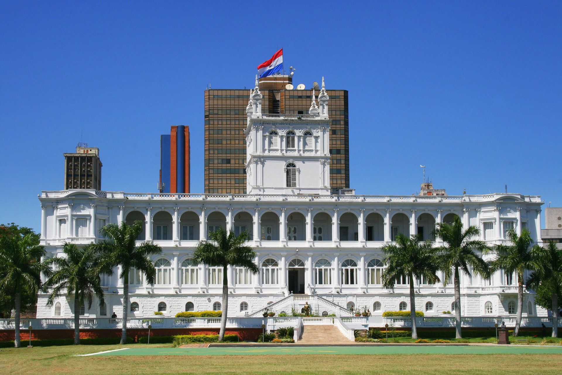
Asunción, Paraguay
Credit: FF MM, Wikimedia Commons / CC BY-SA 4.0
Asunción is the capital of Paraguay and one of the oldest continually inhabited cities in South America. Founded in 1537, it served as the base from which the Spanish colonized much of the continent's southern interior, including the settlement that would eventually become Buenos Aires. Despite this historical significance, it is one of the least visited capital cities in Latin America and rarely appears on international travel itineraries.
The city center shows evidence of multiple historical layers. The Casa de la Independencia, where Paraguayan independence was declared in 1811, is preserved as a museum on a corner in the historic center. The Palacio de los López — an ornate 19th-century government palace on the riverfront, completed in 1892 — reflects the ambitions of Paraguay's pre-Triple Alliance War period. The Triple Alliance War of 1864 to 1870 was a catastrophic conflict in which Paraguay fought simultaneously against Brazil, Argentina, and Uruguay. The demographic damage was severe and shapes Paraguayan national identity in ways that are visible in the museums and public monuments of Asunción.
The Loma San Jerónimo neighborhood, on a hill in the western part of the city, is one of the oldest continuously occupied residential areas and preserves low-rise adobe houses that contrast with the grander colonial architecture of the center. The city's street markets — particularly the Mercado 4 — operate as true commercial centers selling everything from electronics and imported goods to Paraguayan textiles and food, rather than tourist markets.
Asunción lacks the polished tourist infrastructure of Buenos Aires or Montevideo but is inexpensive, navigable on foot in the central area, and offers an encounter with a South American capital that does not orient itself around visitors. Getting there by land from Buenos Aires involves a roughly 16-hour bus journey through the Argentine Chaco; flying takes under two hours. The border with Brazil is also accessible by road. The city's low profile means that travelers who do come encounter it without the scaffolding of an established tourism industry, which has its own kind of value.
Encarnación, Paraguay
-1920x2617.jpg)
Credit: Tom D'Arby, Pexels
Encarnación is a city of around 120,000 people on the Paraná River in southern Paraguay, directly opposite Posadas, Argentina, across the water. It is the third-largest city in Paraguay and draws significant crowds from Argentina and Brazil for its Carnival celebrations each year — but remains virtually unknown to international visitors from outside the region.
The main historical draw is not in the city itself but nearby. The Jesuit missions of La Santísima Trinidad de Paraná and Jesús de Tavarangue, both within easy day-trip distance of Encarnación, are jointly designated as a UNESCO World Heritage Site. These missions were established by the Society of Jesus in the early 18th century as part of the broader network of Jesuit Reductions — mission settlements in the Río de la Plata basin that incorporated indigenous Guaraní people into a structured communal society with its own economy, musical tradition, and built environment.
Trinidad is the better-preserved of the two sites. The ruins of the main church, residential blocks, and workshops are extensive, and the carved stone decorations — angels, geometric patterns, and Christian iconography — remain visible on the original fabric of the structures. The scale of the complex makes clear how significant these missions were at their peak. Jesús de Tavarangue, a few kilometers north, was never fully completed before the Jesuits were expelled from South America in 1767, but preserves the skeleton of a church that would have been exceptional.
The Guaraní language, spoken by the indigenous people who were at the center of the Jesuit mission system, is still widely spoken across Paraguay. It is one of the two official languages of the country alongside Spanish, and most Paraguayans speak both. This makes Paraguay linguistically distinct from every other country in South America and is a living legacy of the colonial history that the mission ruins represent in stone.
Getting to the missions from Encarnación requires a short drive or bus ride. The city itself has accommodation and restaurants, and the Carnival — held in the weeks before Lent, with elaborate floats and costumed performances in a purpose-built sambódromo — is a significant event in its own right if the timing aligns with a visit.