Pixabay / Pexels
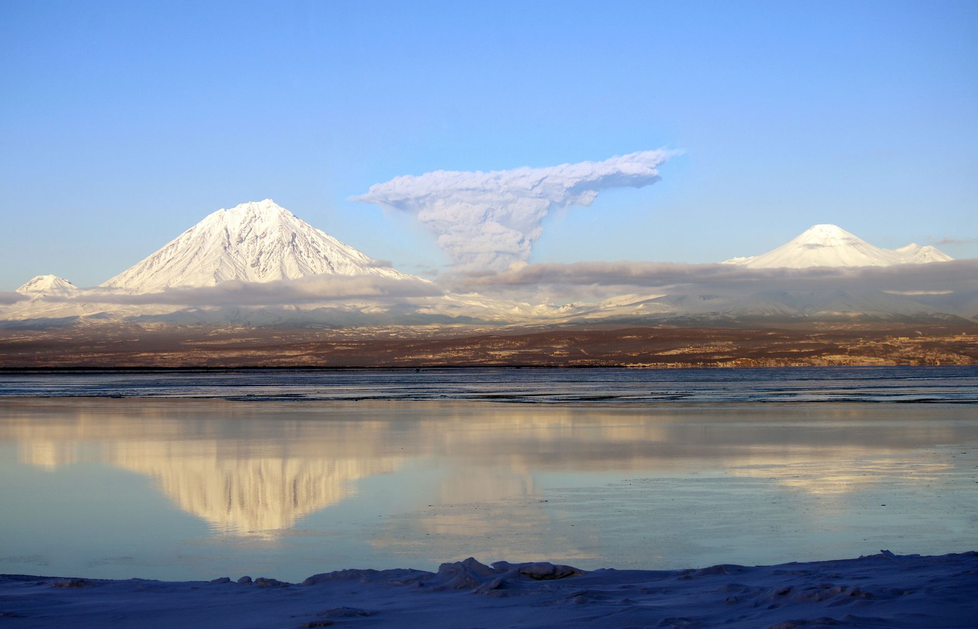
Volcanoes are the most patient destroyers on Earth. They can sleep for centuries, even millennia, beneath landscapes that human civilizations build on, farm around, and eventually forget are dangerous. And then, with little warning or with warnings that are consistently misread, they produce events of such sudden and overwhelming violence that everything built in their shadow disappears — buried under meters of ash, swept away by pyroclastic flows moving at highway speeds, drowned in lahars of volcanic mud. The civilizations that disappear this way are not always small or marginal. Some of them were among the most sophisticated of their time.
The relationship between volcanoes and human history is not simply one of destruction. Volcanic soils are among the most fertile on Earth, which is precisely why people have always lived in the shadow of volcanoes — the agricultural productivity they enable creates the dense populations that eruptions then devastate. Volcanic eruptions have also, paradoxically, preserved civilizations by burying them so rapidly and completely that the ash layer becomes a time capsule: Pompeii is the most famous example, but it is not the only city whose destruction by a volcano also constitutes its preservation.
Eruptions have altered climate, famines, political collapses, migrations, and religious upheavals. The 1815 eruption of Tambora in Indonesia is estimated to have killed 71,000 people directly and produced the Year Without a Summer in 1816, causing crop failures across Europe and North America that killed hundreds of thousands more. The Minoan eruption of Thera around 1600 BCE may have contributed to the collapse of the Bronze Age Mediterranean world. The eruption of Huaynaputina in Peru in 1600 CE was followed by a period of famine and instability in Russia so severe that it contributed to the Time of Troubles and the end of the Rurik dynasty.
This list covers 20 volcanic events and the civilizations, cities, and historical trajectories they altered. Each entry covers the volcano itself, the eruption, what was destroyed, and what — if anything — was preserved or discovered afterward. The archaeology of volcanic destruction is among the richest in the world precisely because burial by ash preserves organic material, wooden structures, and everyday objects that open-air sites lose to time. What volcanoes bury, they sometimes keep.
1 / 20
Andrei Poenalte / Unsplash
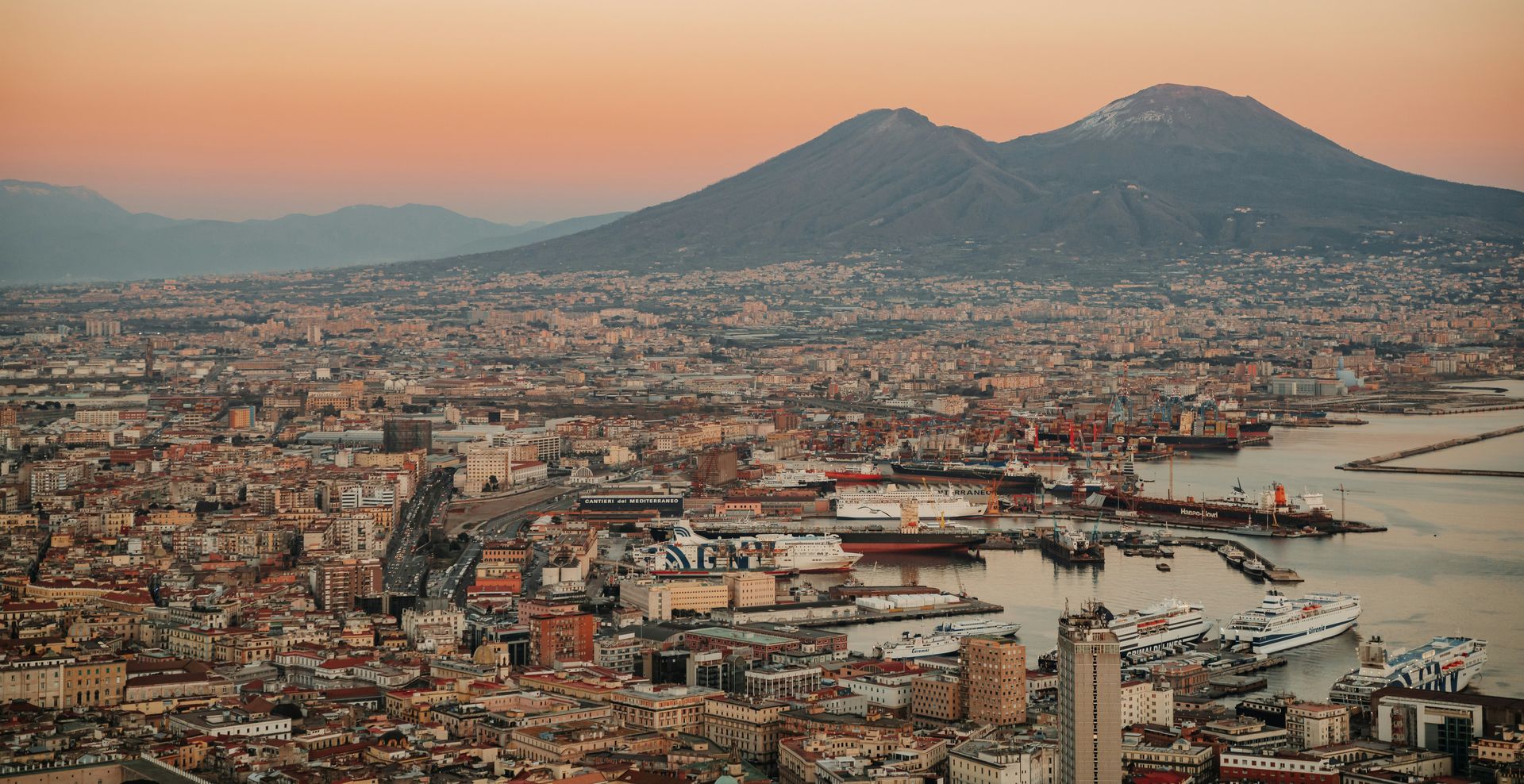
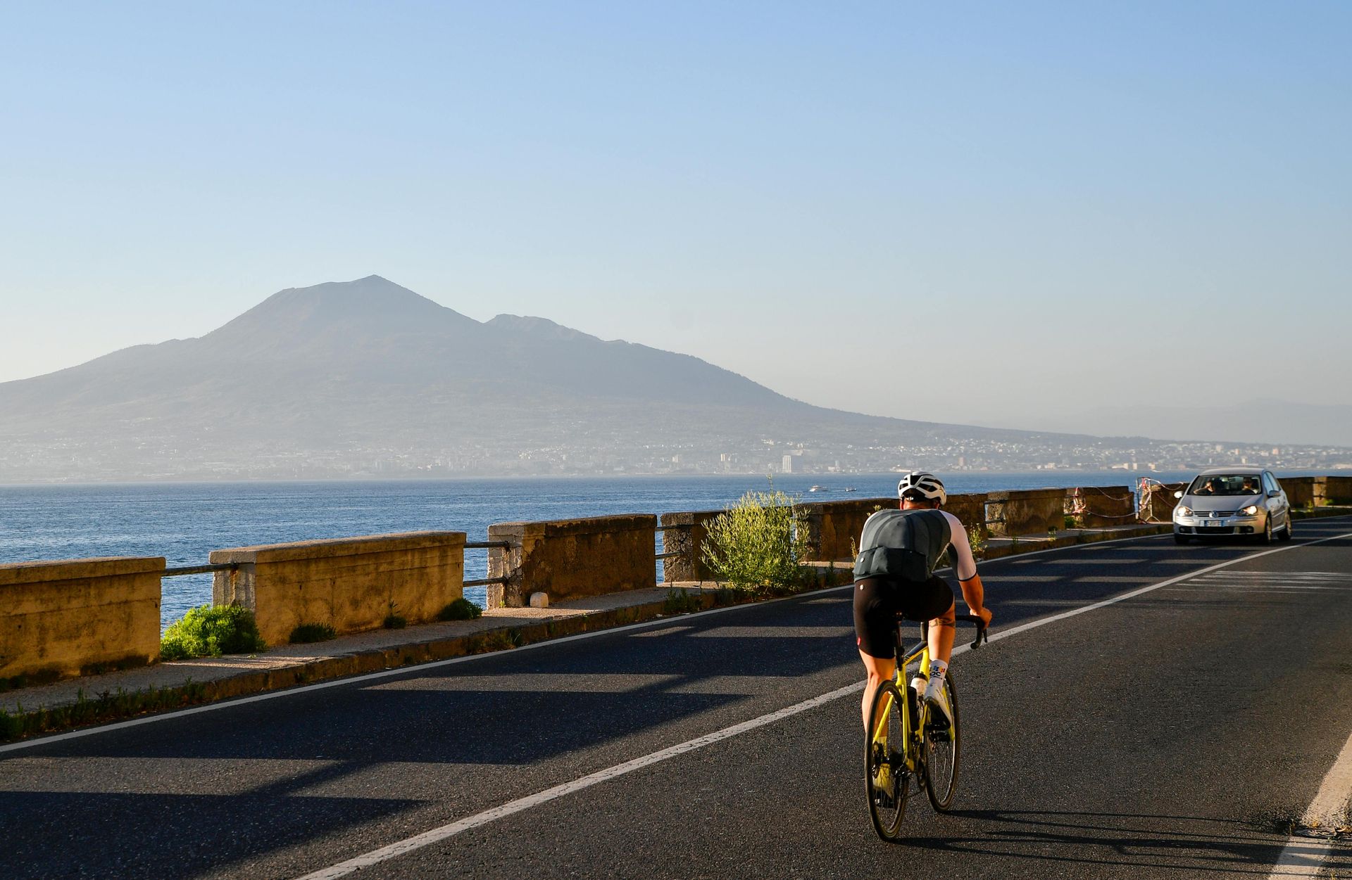
No volcanic eruption in history has had a greater impact on human understanding of the ancient world than Vesuvius on August 24, 79 CE — the eruption that buried Pompeii, Herculaneum, and several smaller settlements under meters of volcanic ash, pumice, and pyroclastic material in less than 24 hours. The burial was so rapid and so complete that the cities were effectively sealed at the moment of the eruption, preserving a snapshot of Roman provincial life in the first century CE with a specificity and completeness that no other archaeological site has matched.
Pompeii was a prosperous Roman city of approximately 11,000 people, a commercial and resort town on the Bay of Naples with a sophisticated urban infrastructure — paved streets, a forum, temples, a large amphitheater, thermopolia (the Roman equivalent of fast food restaurants), brothels, baths, and private houses decorated with elaborate frescoes and mosaics. Herculaneum was smaller and wealthier, a town of approximately 4,000 people whose wooden buildings and organic materials were preserved even more completely than Pompeii's because it was buried under a deeper and faster pyroclastic surge.
The eruption killed an estimated 2,000 people in Pompeii, whose bodies were preserved as plaster casts in the voids left by their decomposed remains in the hardened ash — the technique developed by archaeologist Giuseppe Fiorelli in the 1860s that produced the haunting figures of people and animals in their final positions. The casts include a dog still chained to its post, a family huddled together in a house, and individuals covering their faces against the ash. The physical evidence of dying is preserved at Pompeii in ways that no other site provides.
Excavation of Pompeii has been ongoing since 1748, and the site continues to produce new discoveries. The Great Pompeii Project, launched in 2012, has uncovered a thermopolium with intact food residue, a ceremonial chariot, elaborate frescoes, and skeletons that have yielded DNA evidence about the population's origins. Approximately one-third of the city remains unexcavated.
2 / 20
Emily Geibel / Pexels
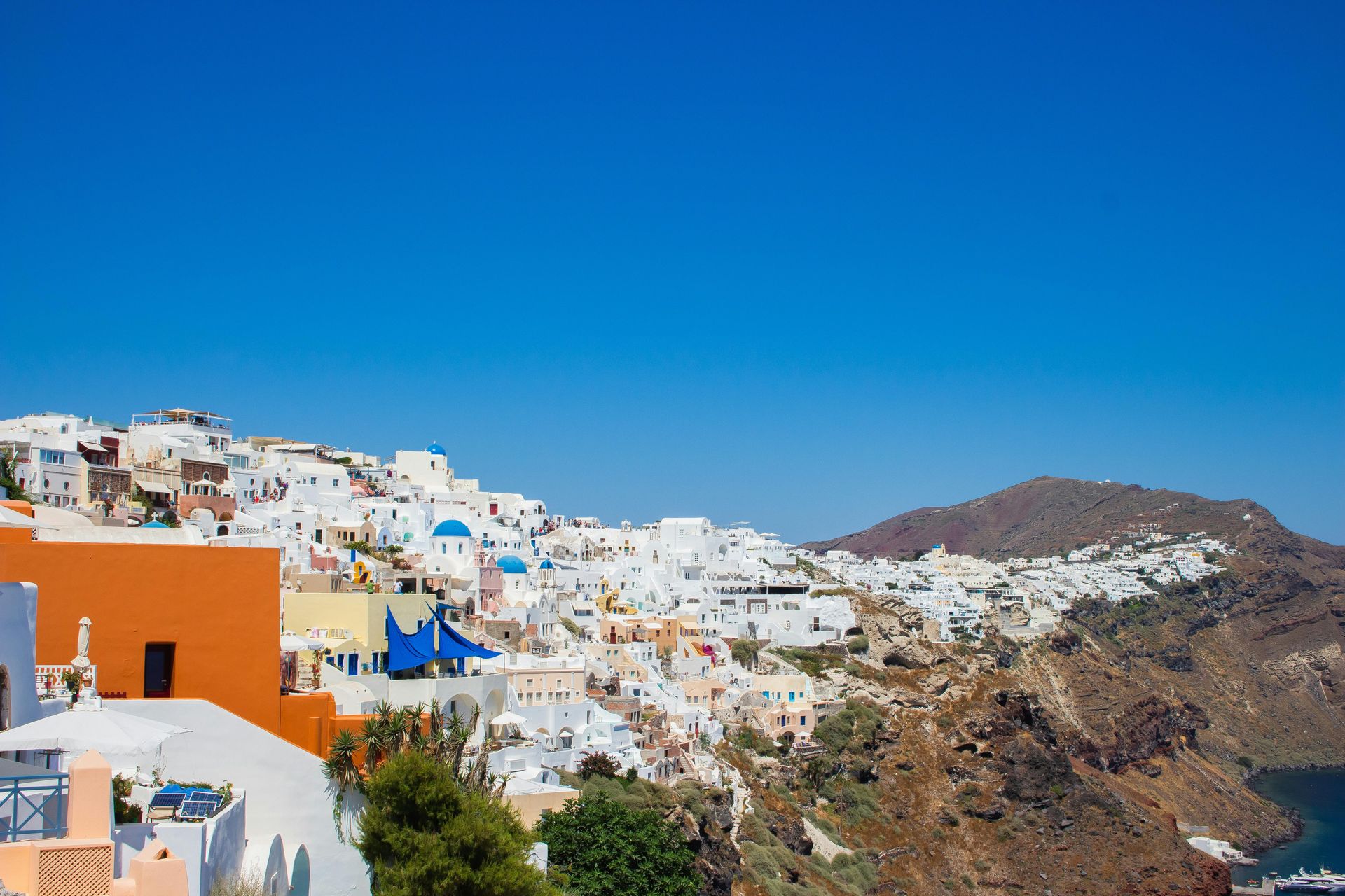
The Minoan eruption of Thera — the volcanic island now called Santorini — is one of the largest volcanic events in the Holocene and one of the most debated in terms of its historical consequences. The eruption, estimated to have occurred sometime between 1650 and 1500 BCE (the date remains contested), produced a caldera collapse that destroyed most of the island of Thera and generated tsunamis that struck the coastlines of Crete, the Aegean islands, and possibly the eastern Mediterranean coast with waves estimated at 9 to 15 meters.
The Minoan civilization, centered on Crete and characterized by sophisticated palace complexes at Knossos, Phaistos, and Akrotiri, was one of the most advanced in the prehistoric Mediterranean — a maritime trading culture with indoor plumbing, complex administrative systems, and art of extraordinary refinement. The eruption buried the Minoan settlement on Thera itself under deep pumice and ash, preserving it in a way that makes Akrotiri — excavated since 1967 — the prehistoric equivalent of Pompeii: a Bronze Age town frozen at the moment of its evacuation, complete with multi-story buildings, frescoed walls depicting ships, landscapes, and daily life, and evidence of a sophisticated urban culture that predates classical Greece by a millennium.
Whether the Thera eruption caused the collapse of Minoan civilization on Crete remains controversial. The Cretan palaces show destruction evidence from roughly 1450 BCE — a century or more after most eruption date estimates — which complicates the direct causation argument. The current consensus is that the eruption severely disrupted Minoan trade networks and agricultural productivity and may have contributed to a period of instability that left Crete vulnerable to Mycenaean Greek takeover. The volcanic event did not immediately destroy Minoan Crete, but it may have set in motion the processes that did.
3 / 20
Diego Lopez / Pexels
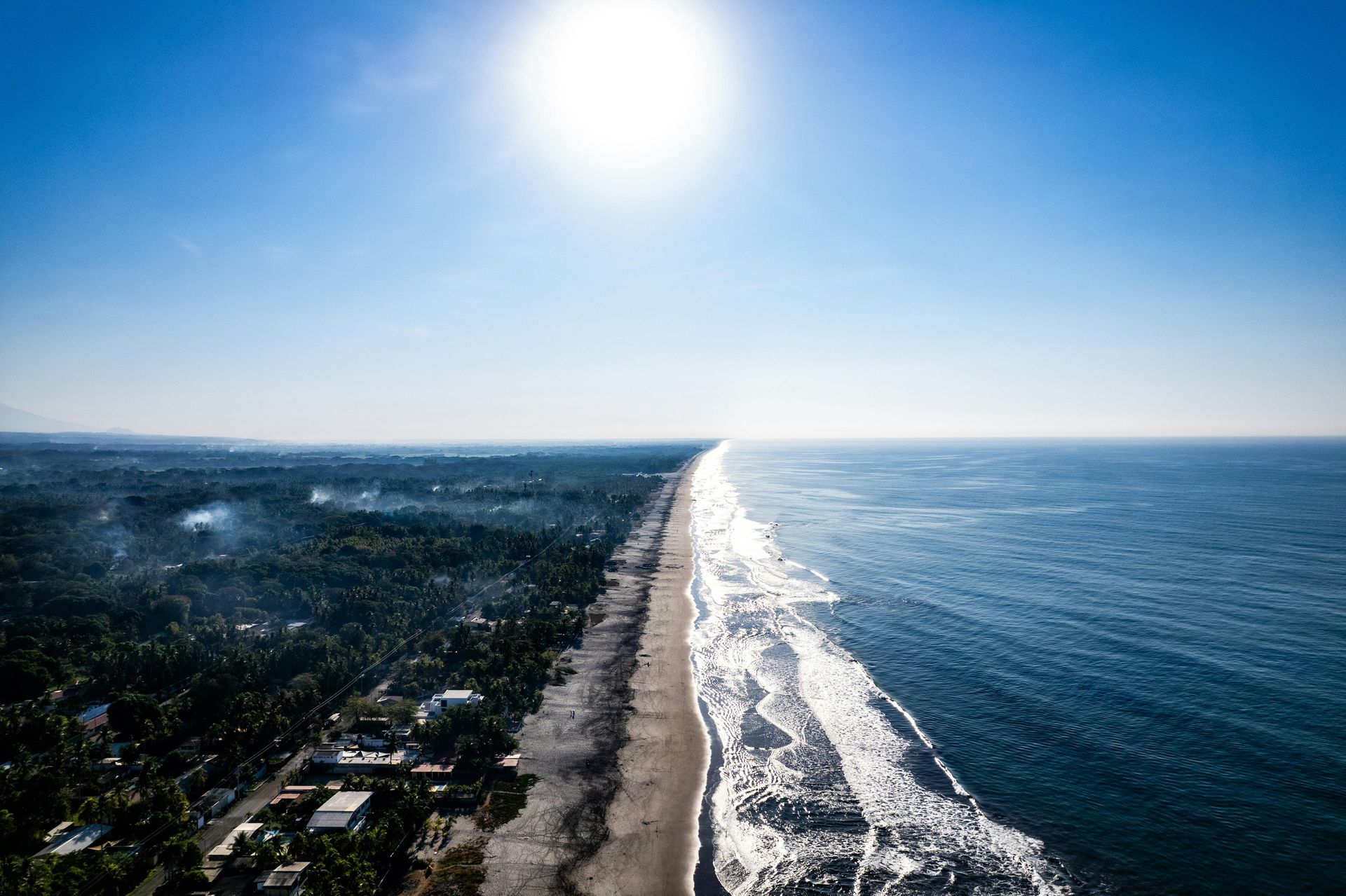
The eruption of Ilopango in what is now El Salvador around 431 CE is one of the most consequential volcanic events in the pre-Columbian Americas and one of the least well-known outside specialist archaeology. The eruption — a Volcanic Explosivity Index 6 event, comparable in magnitude to the 1991 Pinatubo eruption — blanketed an area of approximately 10,000 square kilometers in central El Salvador under thick tephra deposits, buried every settlement within the blast zone, and may have produced a volcanic winter whose effects on agriculture extended across the Northern Hemisphere.
The human consequences for the Maya and other populations of central Mesoamerica were severe and long-lasting. Archaeological surveys of sites within the ash fall zone show complete abandonment following the eruption, with no evidence of reoccupation for up to 200 years in the most heavily affected areas. Populations appear to have migrated northward and southward out of the ash zone, with demographic analysis suggesting a significant displacement of people from the southern Maya lowlands that may have contributed to the subsequent population expansion and cultural florescence in the northern Maya lowlands.
The eruption also buried intact settlements whose excavation has contributed significantly to the understanding of pre-Classic Maya culture. The site of Joya de Cerén in El Salvador — a Maya farming village buried by a later eruption of the Loma Caldera volcano around 660 CE rather than Ilopango — was preserved in a similar fashion and is sometimes called the "Pompeii of the Americas," yielding preserved food stores, agricultural fields, household goods, and structural evidence of village life that organic sites do not preserve.
The Ilopango eruption demonstrates a pattern common in the volcanic archaeology of the Americas: events sufficiently large to displace populations over large areas, leaving behind buried landscapes that contain evidence of the people they displaced.
4 / 20
Margo Evardson / Pexels
Herculaneum deserves its own entry distinct from Pompeii because its preservation is different in kind, not merely in degree. Where Pompeii was buried primarily by pumice fall and ash, Herculaneum was engulfed by a series of pyroclastic surges — dense, superheated flows of gas and volcanic material — that moved at speeds of up to 160 kilometers per hour and reached temperatures of approximately 500 degrees Celsius. The combination of heat and rapid burial carbonized organic materials rather than simply burying them, preserving wooden furniture, food, rope, papyrus scrolls, and the structural timbers of buildings in a form that Pompeii's relatively cooler burial did not achieve.
The boats on the beach at Herculaneum are the most dramatic example of this preservation. Excavations in the 1980s discovered approximately 300 skeletons in arched boat storage chambers on the ancient shoreline — people who had taken refuge at the water's edge, apparently waiting for rescue by boat, when the pyroclastic surge arrived. The skeletal analysis has provided detailed information about the diet, health, and activities of the population in ways that were not possible from the plaster casts at Pompeii.
The Villa of the Papyri at Herculaneum contains the only intact library from the ancient world. Approximately 1,800 carbonized papyrus scrolls have been recovered from the villa since the 18th century, when excavators probing the site through tunnels encountered what they initially thought were charred wooden objects. The scrolls contain texts of Epicurean philosophy, primarily works of the philosopher Philodemus, and represent a fraction of what the villa library likely contained. Modern multispectral imaging and X $TWTR-ray phase-contrast tomography have allowed scholars to read text from scrolls too fragile to unroll — the Herculaneum papyri are the subject of ongoing scholarly effort that produces new readings of ancient texts that were unknown to exist.
5 / 20
Credit: Wikipedia
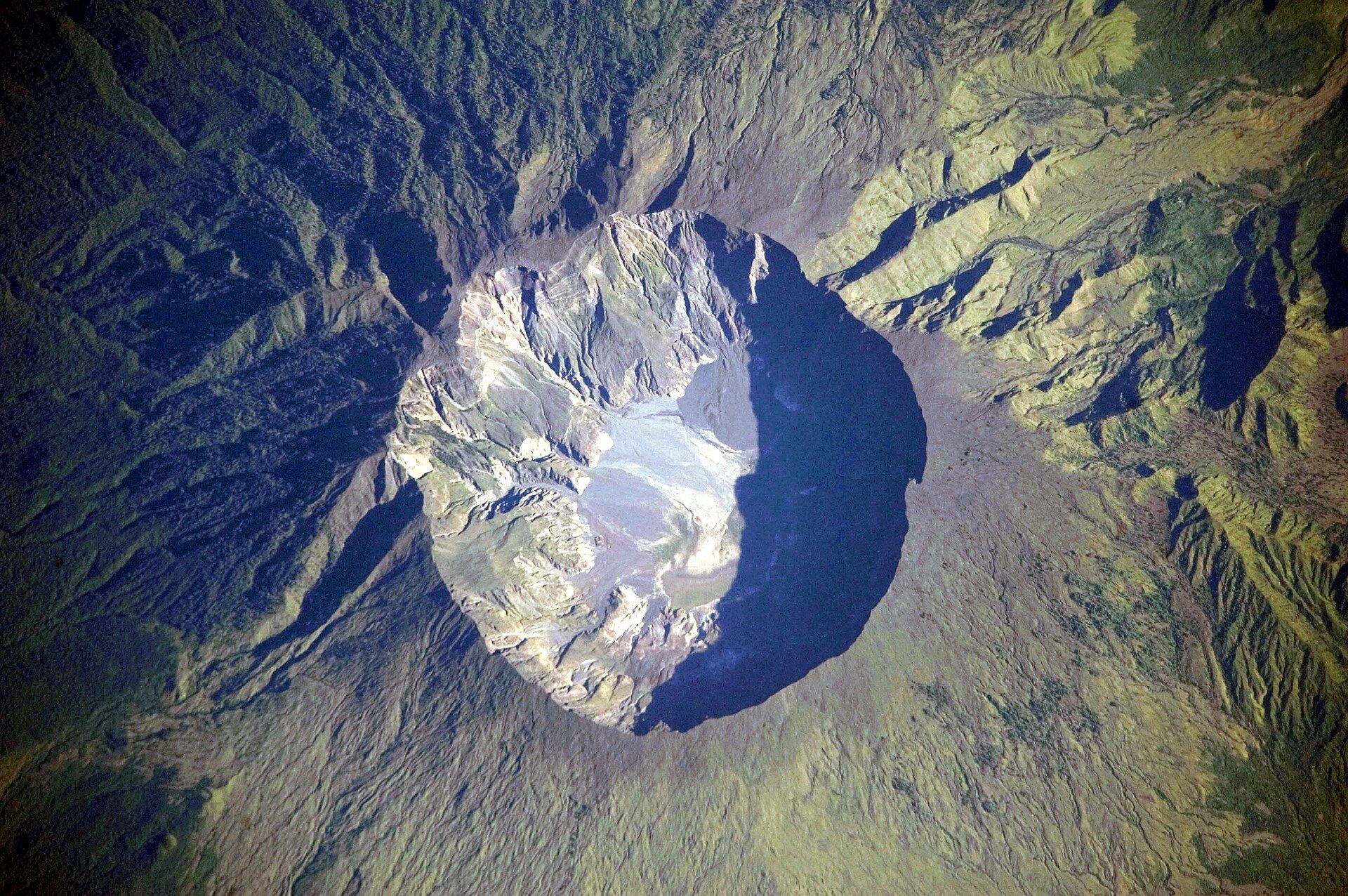
The April 1815 eruption of Mount Tambora on the island of Sumbawa is the largest volcanic eruption in recorded human history, with an estimated Volcanic Explosivity Index of 7 — roughly ten times the energy of the 1883 Krakatoa eruption and significantly larger than any eruption witnessed in the modern era. The eruption killed approximately 71,000 people directly on Sumbawa and the surrounding islands, through pyroclastic flows, tsunamis, and the starvation that followed when the eruption destroyed agriculture across a wide area.
The global consequences extended far beyond Indonesia. Tambora ejected an estimated 160 cubic kilometers of material and approximately 60 megatons of sulfur dioxide into the stratosphere, where it formed a sulfate aerosol layer that reduced global temperatures by approximately 0.4 to 0.7 degrees Celsius over the following year — the climate anomaly that produced 1816, known as the Year Without a Summer.
In Europe and North America, 1816 was characterized by late frosts, failed harvests, and famine. Snow fell in New England in June. The price of oats tripled in parts of Europe, precipitating famine in Ireland, Wales, and Switzerland. The food shortages in Europe contributed to social unrest that destabilized several governments. The famine in Ireland was particularly severe and contributed to early waves of emigration that prefigured the larger migration of the 1840s.
The cultural consequences of the Year Without a Summer are specific and documented. Mary Shelley's Frankenstein was conceived at the Villa Diodati near Lake Geneva in the cold, dark summer of 1816, during the famous gathering with Lord Byron and John Polidori that also produced Polidori's The Vampyre — the template for the modern vampire novel. The German mathematician Karl Drais invented the bicycle in 1817 as an alternative to horses, which were dying in large numbers from the oat shortage. The eruption of a volcano in Indonesia in 1815 produced, among other things, Frankenstein and the bicycle.
6 / 20
Credit: Wikipedia
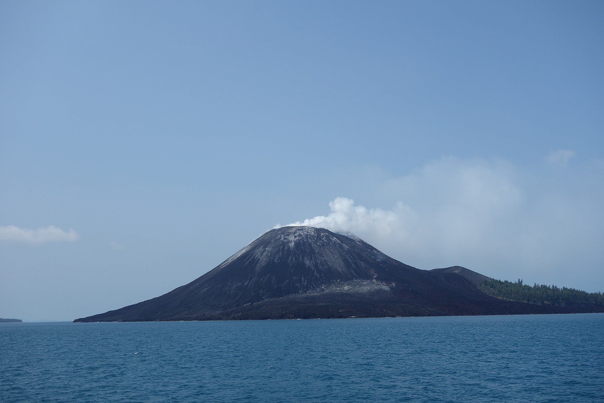
The August 1883 eruption of Krakatoa — the volcanic island in the Sunda Strait between Java and Sumatra — is the first major volcanic disaster of the telecommunications era, the first catastrophic eruption whose effects could be tracked globally in real time by telegraph, and the eruption that produced the loudest sound in recorded history. The explosion on the morning of August 27, 1883, was heard in Rodrigues Island near Mauritius, approximately 4,800 kilometers away, and produced atmospheric pressure waves that circled the Earth multiple times and were recorded on barographs worldwide.
The human death toll — approximately 36,000 people — was caused primarily not by the eruption itself but by the tsunamis it generated, with waves reaching 30 meters in some locations along the coasts of Java and Sumatra. The coastal towns of Merak and Teluk Betung were essentially destroyed by tsunami. A Dutch warship, the Berouw, was carried nearly three kilometers inland by the waves and deposited in a river valley, where it remained for decades.
The eruption destroyed most of the original Krakatoa island, leaving a submarine caldera. In 1927, a new volcanic island emerged from the caldera — Anak Krakatau, "Child of Krakatoa" — which has been erupting intermittently ever since. A partial collapse of Anak Krakatau's flank in December 2018 generated a tsunami that killed 437 people on the coasts of Java and Sumatra, demonstrating that the volcanic system that destroyed Krakatoa in 1883 remains active.
The climatic effects of Krakatoa, while significant, were smaller than Tambora's — a global temperature reduction of approximately 0.25 degrees Celsius. The vivid red and orange sunsets observed across Europe and North America in 1883 and 1884, caused by sulfate aerosols in the stratosphere, were documented in numerous paintings and are generally believed to be reflected in the sky of Edvard Munch's "The Scream," painted in 1893.
7 / 20
Belle Co / Pexels
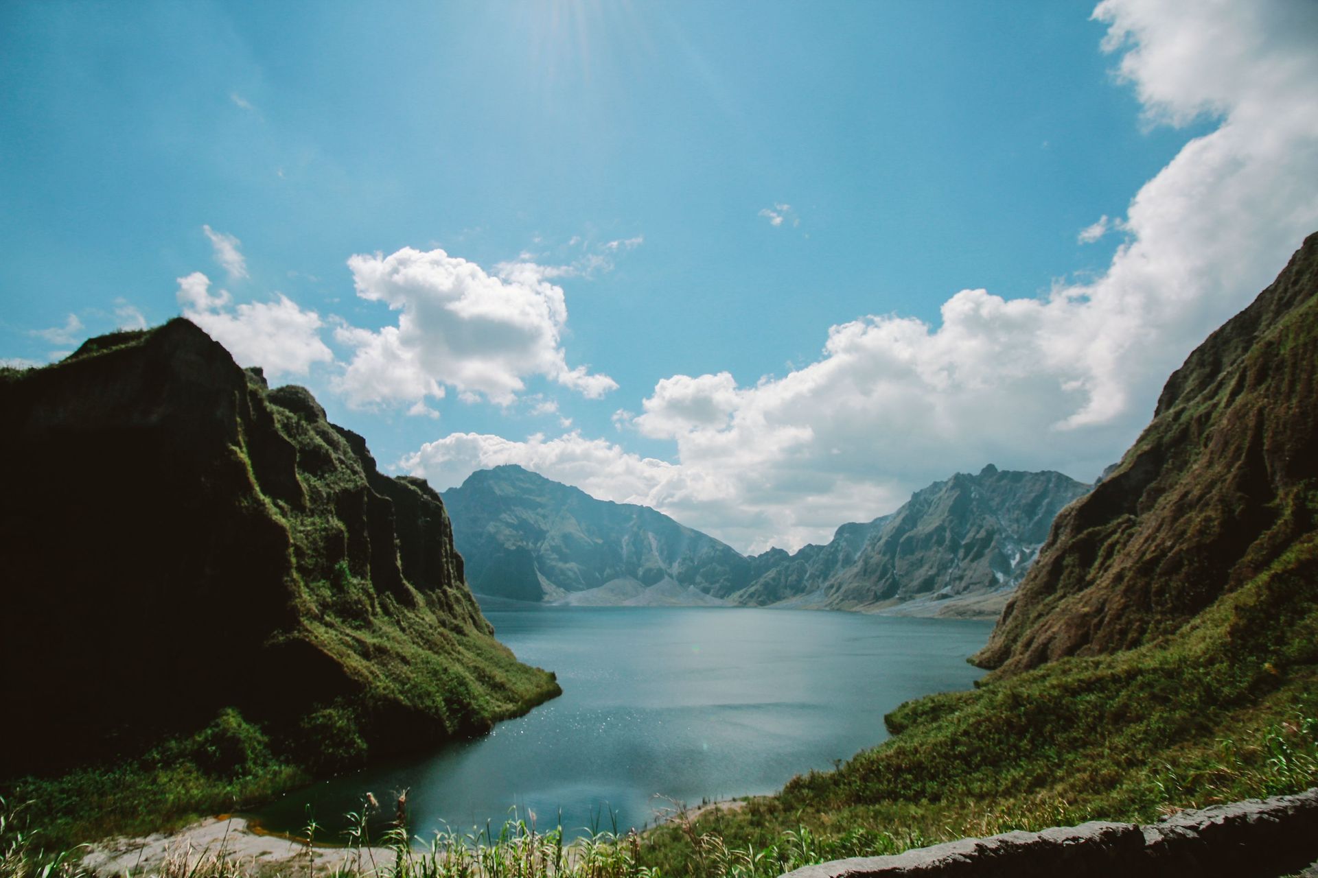
The June 1991 eruption of Mount Pinatubo in the Philippines — the second largest volcanic eruption of the 20th century — is one of the best-documented eruptions in history, occurring in the era of modern volcanology, satellite monitoring, and rapid communications. It is also one of the most successful cases of eruption prediction and evacuation in volcanic history: despite the eruption's enormous scale, the death toll was approximately 800, compared to the tens of thousands that a comparable eruption in an earlier era would have produced.
The eruption was preceded by weeks of increasing seismic activity and small eruptions that allowed volcanologists from the Philippine Institute of Volcanology and Seismology and the United States Geological Survey to issue warnings and coordinate the evacuation of approximately 60,000 people from the danger zone. The Clark Air Base, a major U.S. military installation adjacent to the volcano, was evacuated in the days before the climactic eruption on June 15.
The eruption injected approximately 20 megatons of sulfur dioxide into the stratosphere, producing a global temperature reduction of approximately 0.5 degrees Celsius over the following two years — the largest climate perturbation observed in the 20th century and one that significantly complicated the interpretation of global temperature records during that period, temporarily counteracting the warming trend.
The lahars — volcanic mudflows — generated by Pinatubo were in some ways more damaging than the eruption itself. Rainfall on the deposited ash produced lahars that buried towns and agricultural land in the surrounding lowlands for years after the eruption, with annual lahar flows continuing through the late 1990s and periodically thereafter. The eruption effectively ended American military presence at Clark Air Base, which was abandoned and subsequently converted to civilian use.
8 / 20
Credit: The Hindu
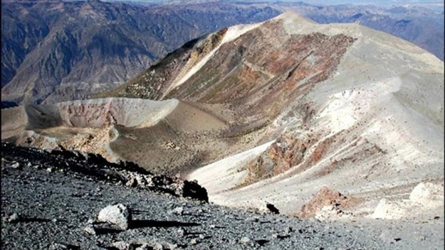
The February 1600 eruption of Huaynaputina in southern Peru is the largest volcanic eruption in South American recorded history — an event largely unknown outside volcanology and climate history, whose global consequences were severe and whose connection to the political upheaval that followed in Europe is one of the more striking examples of volcanic climate forcing in the historical record.
Huaynaputina erupted on February 19, 1600, in what is now the Moquegua region of Peru. The eruption killed approximately 1,500 people directly and buried the surrounding agricultural landscape under volcanic ash. The local consequences were severe but regional. The global consequences — from the stratospheric sulfate aerosol ejected by the eruption — were felt across the Northern Hemisphere in the years immediately following.
Tree ring records from Europe, Russia, and North America show the cold anomaly of 1601 to 1603 as one of the most severe in the past 600 years. In Russia, the agricultural disruption was catastrophic: crop failures in 1601, 1602, and 1603 produced a famine that killed an estimated two million people — roughly one-third of Russia's population — in what became known as the Great Famine. The social and political instability produced by the famine contributed directly to the Time of Troubles, a period of dynastic crisis, civil war, and foreign intervention that ended with the death of Tsar Boris Godunov and the installation of the Romanov dynasty in 1613.
The chain of causation — from a volcanic eruption in the Andes to the founding of the Romanov dynasty that would rule Russia until 1917 — is indirect but documented through the convergence of climate proxy records and historical sources. Huaynaputina is the eruption that most clearly demonstrates how volcanic climate forcing can cascade through human political systems in ways that are far removed from the eruption's immediate geography.
9 / 20
K / Pexels
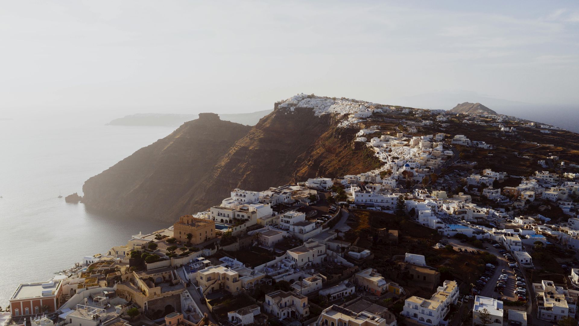
Akrotiri, the Bronze Age settlement on the island of Thera preserved under the pumice deposits of the Minoan eruption, is covered in the Thera entry above in terms of its broader civilizational significance. It deserves a separate entry for what the site itself reveals about the quality of life in the prehistoric Aegean — information that only volcanic preservation makes available.
Akrotiri was a prosperous trading town of several thousand people, organized around multi-story buildings connected by paved streets with underground drainage systems. The buildings preserve frescoes of extraordinary quality and variety: a naval procession depicting ships, helmeted warriors, and a coastal town that may represent Akrotiri itself or a place it traded with; the Spring Fresco, showing swallows and red lilies in a rocky landscape; the Fisherman fresco, depicting a young man with two strings of fish; the Boxing Children, showing two boys sparring.
The frescoes are among the oldest well-preserved examples of narrative painting in the Aegean world, predating the Greek classical tradition by a millennium, and they reveal a society with sophisticated artistic conventions, long-distance trade connections (the naval fresco shows ships of several different regional types), and a quality of daily life that the absence of volcanic preservation would have left entirely invisible. No written records from Akrotiri have been found — it was a pre-literate culture at this point in the development of Aegean writing — which makes the material evidence from the buried city the primary source for understanding how its people lived.
The settlement appears to have been partially or fully evacuated before the eruption — no bodies have been found, and there are indications that some valuables were removed. Whether the residents survived elsewhere or perished in the broader eruption sequence is not known.
10 / 20
Credit: Wikipedia
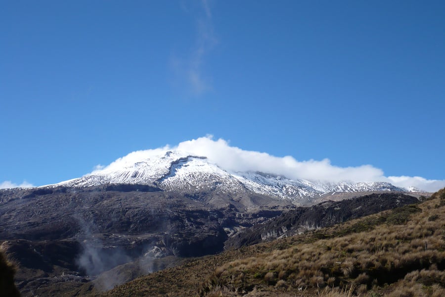
The November 1985 eruption of Nevado del Ruiz in Colombia is not the largest volcanic eruption of the 20th century, nor the most geologically dramatic, but it is the most preventable disaster on this list. The eruption produced a relatively small eruption column, but the heat melted the glacier on the volcano's summit, generating lahars — volcanic mudflows — that traveled down the Lagunillas River at speeds of up to 50 kilometers per hour and struck the town of Armero, 50 kilometers away, at around midnight, killing approximately 23,000 of the town's 29,000 inhabitants.
Geologists had warned Colombian authorities of the lahar risk for months before the eruption. A hazard map produced in October 1985 explicitly showed Armero in the high-risk zone. The map was published in a newspaper but government officials declined to order evacuation, partly from concern about the economic disruption and partly from skepticism about the warnings. When the eruption occurred, some civil defense personnel attempted to reassure residents that the situation was safe even as the lahars were approaching.
The disaster produced 23,000 deaths in a town that need not have lost a single person had the warnings been heeded. Armero was buried under three to eight meters of volcanic mud. The image of 13-year-old Omayra Sánchez, who was trapped in the mud up to her neck for three days while rescue workers were unable to free her, was broadcast globally and became one of the defining images of the disaster.
Nevado del Ruiz prompted a significant rethinking of volcanic risk communication and emergency management globally, contributing to the development of the protocols for volcanic hazard assessment and evacuation planning that allowed the 1991 Pinatubo evacuation to succeed. The contrast between the two events — one a preventable catastrophe, the other a successful evacuation of comparable scale — defines the arc of volcanic risk management in the late 20th century.
11 / 20
The eruption of Long Island volcano in Papua New Guinea around 650 CE is one of the largest volcanic events in the past 10,000 years — a caldera-forming eruption that essentially destroyed the island and may have been large enough to produce significant regional climate effects. It is among the least-known major Holocene eruptions because it occurred in a region with limited contemporary written documentation, and its consequences for the indigenous populations of the surrounding islands and mainland coast are reconstructed primarily from oral traditions and geological evidence.
Oral traditions preserved by communities in Papua New Guinea describe a catastrophic event — the total destruction of a land they call "Motmot" — and these traditions were connected to the Long Island eruption by anthropologists and volcanologists working in the region in the late 20th century. The traditions describe fire, darkness, and the disappearance of an inhabited island, consistent with a large caldera-forming eruption. Oral tradition preserving memory of a volcanic event across approximately 1,400 years — approximately 50 to 60 generations — represents one of the longer documented cases of oral transmission of geological events.
The present-day Long Island is a caldera lake formed by the eruption, surrounded by vegetation that has recolonized the island over the past 1,400 years. Subsequent smaller eruptions have built a new volcanic cone within the caldera. The island has been recolonized by human populations and is currently inhabited, representing the typical pattern of volcanic islands where the fertility of volcanic soils and the availability of fishing draws populations back to the slopes of active volcanoes within generations of destructive eruptions.
12 / 20
The Villa of the Mysteries at Pompeii deserves its own entry because it contains what is arguably the most important single room of ancient Roman painting in existence — the megalographic cycle of the initiation frieze, a series of life-sized figures painted on a vivid red background that circles three walls of a large room in a continuous narrative whose meaning has been debated by classical scholars for more than a century.
The frieze depicts approximately 29 figures in a ritual sequence that most scholars interpret as a Dionysiac mystery initiation — the rites of initiation into the cult of Dionysus, whose proceedings were secret and whose details were never recorded in accessible written sources. The painting is therefore one of the primary sources for understanding these rituals, and its survival is entirely a function of the volcanic burial that preserved it for 1,700 years before its excavation in the 1920s.
The quality of the painting — the draughtsmanship of the figures, the spatial sophistication of the composition, the subtlety of the psychological states depicted — indicates that it was the work of a highly trained painter, possibly working from a famous original or a well-established iconographic tradition. Its survival makes it a primary document in the history of ancient painting — a category in which almost all other examples have been lost.
The Villa of the Mysteries exemplifies the archaeological paradox of Vesuvius: the eruption that ended the lives of the villa's inhabitants also preserved their paintings so completely that we can discuss the psychological nuances of figures painted two millennia ago. The destruction and the preservation are inseparable.
13 / 20
The Oruanui eruption of the Taupo Volcanic Zone in New Zealand approximately 25,500 years ago is the largest volcanic eruption on Earth in the past 70,000 years — an event of such magnitude that it deposited volcanic ash across the entire landmass of New Zealand and ejected enough material to be detected in ice cores from Antarctica. It is included in a list of civilizations buried by volcanoes not because it destroyed a civilization — it occurred tens of thousands of years before New Zealand was settled by humans — but because it shaped the landscape that the Māori people settled approximately 25,000 years later and that continues to define New Zealand's geological character.
The Taupo Volcanic Zone is one of the most volcanically active regions on Earth, a consequence of the Pacific Plate subducting beneath the Australian Plate along a boundary that runs through the center of New Zealand's North Island. The Taupo caldera, formed by the Oruanui eruption and subsequent activity, is the largest volcanic feature in New Zealand and a current geological hazard for the surrounding region.
The most recent major eruption of the Taupo system, the Hatepe eruption of approximately 232 CE, was one of the most violent eruptions of the past 5,000 years and occurred after human settlement — though before Māori arrival in New Zealand, the island having been settled by the Māori only around 1280 CE. The effects of the Hatepe eruption — visible in the reddening of sunsets recorded in Roman and Chinese historical sources — demonstrate that even eruptions in geographically remote New Zealand produced global atmospheric effects.
14 / 20
The direct human consequences of the Tambora eruption for the peoples of Sumbawa and the surrounding islands are often overshadowed by the global climate effects, but the immediate civilizational impact on the island communities was total and permanent. Three kingdoms on Sumbawa — Tambora, Pekat, and Sanggar — were completely destroyed by the eruption. The Kingdom of Tambora, which had developed a distinct culture and language, was entirely eliminated. The Tamboran language, which linguists believe was unrelated to any other known language in the Indonesian archipelago, vanished with its speakers — one of the few documented cases of a complete language extinction caused by a volcanic eruption.
The eruption deposited meters of ash across Sumbawa, destroying all agriculture and killing livestock across the island. The survivors of the immediate eruption faced famine and disease in the following weeks and months, and the population of Sumbawa declined dramatically. The island required years to recover even basic agricultural productivity, and the political structures that had organized Sumbawan society before the eruption did not fully reconstitute.
The loss of the Tamboran language is the most specific and irreversible cultural consequence of the eruption — a linguistic tradition that had developed over centuries, encoding a specific way of understanding the world, disappearing overnight with the people who spoke it. The three kingdoms of Sumbawa whose physical destruction was documented by Dutch colonial administrators provide a rare historical record of the immediate human cost of the largest eruption in the modern era.
15 / 20
Credit: Wikipedia
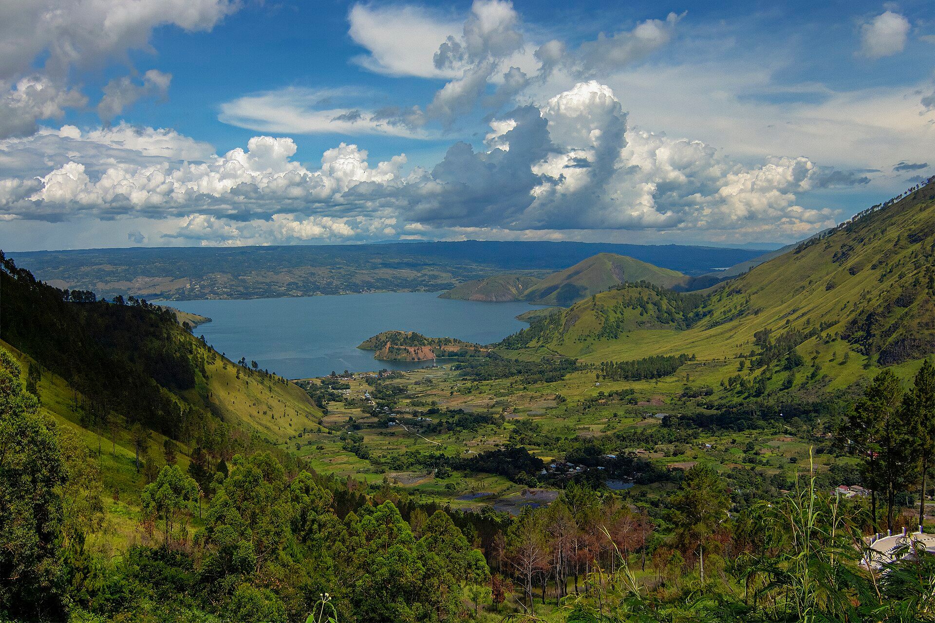
The Toba supervolcanic eruption approximately 74,000 years ago in what is now Sumatra is the largest volcanic event in the past two million years and the subject of one of the more controversial hypotheses in human evolutionary biology: the Toba catastrophe theory, proposed by geneticist Stanley Ambrose in 1998, which argues that the eruption caused a volcanic winter severe enough to reduce the global human population to between 3,000 and 10,000 individuals, creating a genetic bottleneck that explains the relatively low genetic diversity of modern humans compared to other great apes.
The eruption was enormous by any measure — it ejected an estimated 2,800 cubic kilometers of material, produced ash falls detected across South Asia, Southeast Asia, and East Africa, and almost certainly produced a volcanic winter lasting several years. The climate effects would have been catastrophic for vegetation-dependent species in the affected regions.
The genetic bottleneck hypothesis remains contested. Some genetic analyses support a population reduction event around 70,000 to 80,000 years ago, consistent with the Toba eruption, while others find evidence of human populations in South and Southeast Asia before, during, and after the eruption with apparent continuity rather than a major demographic crash. Archaeological evidence from sites in India has been interpreted as showing continuous human occupation across the Toba ash layer, which would argue against total regional population collapse.
Whether or not Toba produced the dramatic bottleneck that Ambrose proposed, the eruption's scale — and the fact that our species apparently survived it — is a remarkable fact about human resilience in the face of the most extreme natural event our lineage has encountered in the past million years.
16 / 20
Gabriela Zezula / Pexels
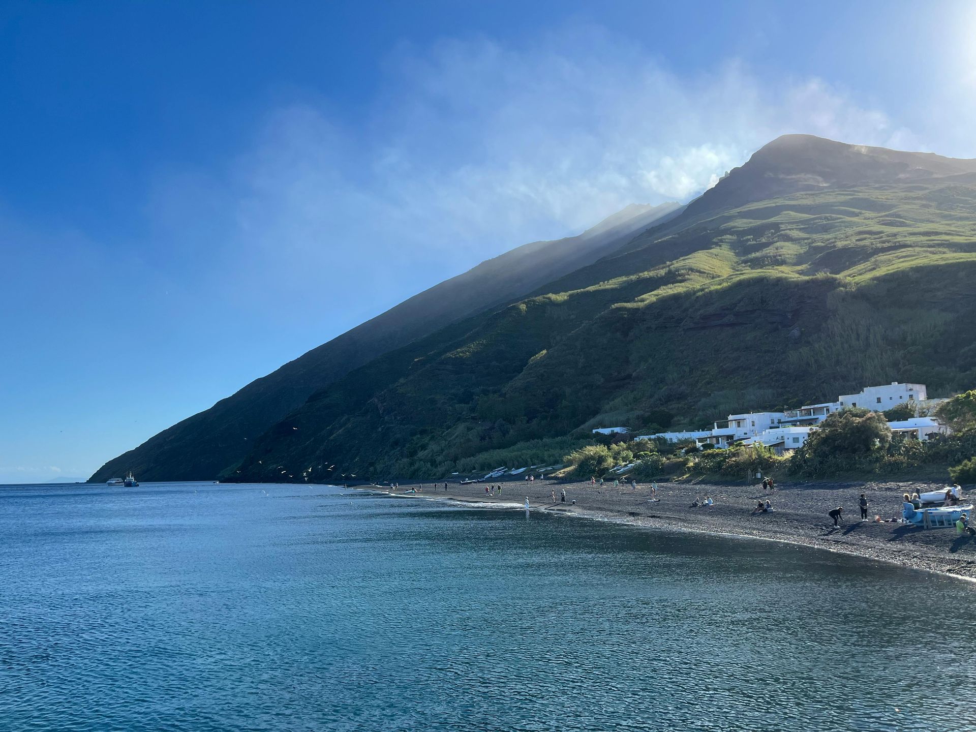
Stromboli, the northernmost of the Aeolian Islands off the coast of Sicily, has been in almost continuous eruption for at least 2,000 years and has served as a natural lighthouse for Mediterranean sailors throughout recorded history — the ancient Greeks called it Strongyle, and its persistent glow was used for navigation across the Tyrrhenian Sea. It is the most consistently active volcano in Europe and one of the most active in the world, producing small explosive eruptions from its summit craters every 15 to 20 minutes on average.
Unlike the catastrophic eruptions that dominate this list, Stromboli's characteristic activity — Strombolian eruptions, a named eruptive style defined by this specific volcano — involves small bursts of incandescent lava fragments thrown a few hundred meters above the crater, driven by the bursting of large gas bubbles rising through the magma column. The activity is regular enough to be predictable in its general character and dramatic enough to attract tourists who climb the volcano specifically to watch the nighttime eruptions from the summit.
Stromboli has produced larger eruptions in historical time — paroxysmal events that send material much higher and generate tsunamis — and one such event in December 2002 generated a tsunami that damaged the village of Stromboli on the island's coast. But the island has been continuously inhabited despite this hazard, a community of a few hundred people living with an active volcano because the Mediterranean island lifestyle, the fishing, and increasingly the tourism the volcano attracts make coexistence the chosen option.
Stromboli illustrates a dimension of the volcanic-civilization relationship that the catastrophic events on this list obscure: for most of human history, the relationship between people and volcanoes has not been occasional catastrophe but continuous negotiation, with communities adapting to volcanic hazards and extracting benefits from volcanic landscapes while accepting risks that are understood and largely manageable.
17 / 20
JENNI AGUSTINA / Pexels
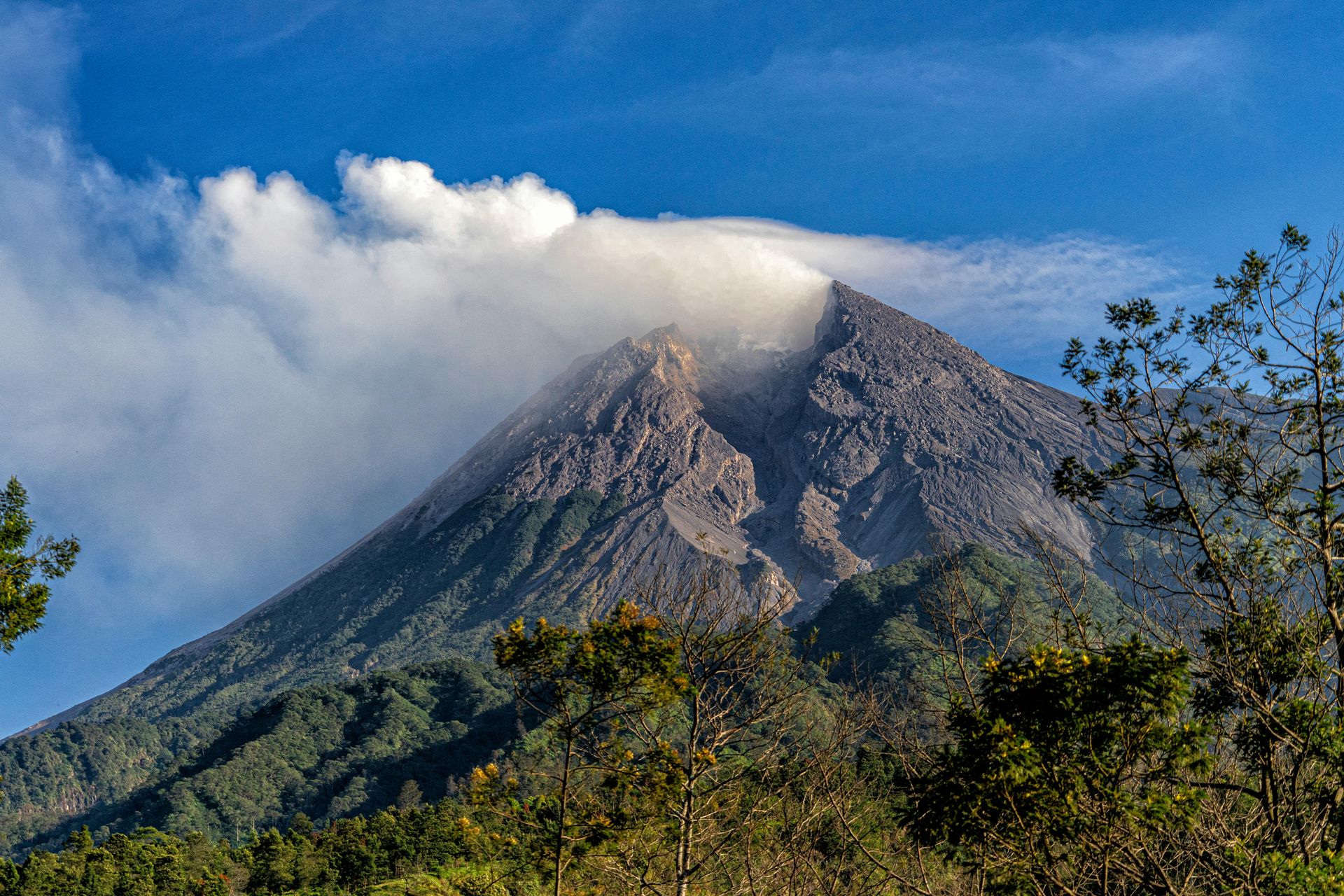
Merapi — "Mountain of Fire" in Javanese — is the most active volcano in Indonesia and one of the most densely populated volcanic regions on Earth. The volcano overlooks the royal city of Yogyakarta and the Borobudur and Prambanan temple complexes — the most significant Buddhist and Hindu monuments in Southeast Asia — from a distance of approximately 30 kilometers. It erupts regularly, with major eruptions in 1930 (killing 1,300), 1994 (killing 60), 2006 (killing 2), and 2010 (killing 353), and its slopes are farmed up to the edge of the officially designated danger zone by communities who have lived in its shadow for centuries.
A major eruption around 1006 CE — the precise date and scale are debated — is believed to have caused the abandonment of the first Mataram Kingdom, the Hindu-Buddhist kingdom that built the Prambanan temple complex in the 9th century CE. The eruption deposited ash across the surrounding agricultural land, disrupted the irrigation systems that supported the kingdom's rice agriculture, and may have contributed to the decision to move the kingdom's center eastward across Java. The Prambanan temples were subsequently buried under volcanic debris from multiple eruptions over the following centuries and were not excavated until the 20th century.
The Prambanan complex — 240 temples, of which the largest, the Shiva Prambanan, stands 47 meters tall — was constructed between approximately 850 and 930 CE and represents the apex of Hindu architecture in Southeast Asia. Its partial burial by volcanic material and its rediscovery in the colonial period constitutes another instance of volcanic destruction serving as inadvertent preservation — the buried portions of the complex were protected from the weathering and looting that affected the exposed sections.
18 / 20

Credit: Wikipedia
The March–April 1982 eruption of El Chichón in the southern Mexican state of Chiapas killed approximately 2,000 people — the majority of the population of nine villages in the eruption zone — in a sequence of pyroclastic surges that swept down the volcano's flanks with little warning. The eruption was particularly deadly because El Chichón had not erupted in living memory, was not monitored, and was not considered an active threat by local authorities or the populations living on its slopes.
El Chichón erupted in three major phases between March 28 and April 4, 1982. The eruptions generated pyroclastic flows and surges that swept 8 kilometers from the summit, destroying everything in their path. The village of Francisco León, the largest settlement in the danger zone with approximately 900 inhabitants, was completely buried. The total area affected by pyroclastic flows covered approximately 153 square kilometers.
The eruption's global significance was disproportionate to its relatively modest direct death toll. El Chichón injected an unusually sulfur-rich plume into the stratosphere — approximately 7 megatons of sulfur dioxide, despite the relatively modest volume of ejecta — producing a sulfate aerosol layer that caused a global temperature reduction of approximately 0.5 degrees Celsius and contributed to disrupted weather patterns across Mexico and Central America in the following years. The eruption also injected material into the El Niño–Southern Oscillation system in ways that may have amplified the severe El Niño of 1982–83.
The indigenous Zoque people had lived on the slopes of El Chichón for centuries, their oral traditions preserving memory of previous volcanic activity. The 1982 eruption destroyed communities whose long historical relationship with the volcano had become dangerously familiar.
19 / 20
Credit: Wikipedia
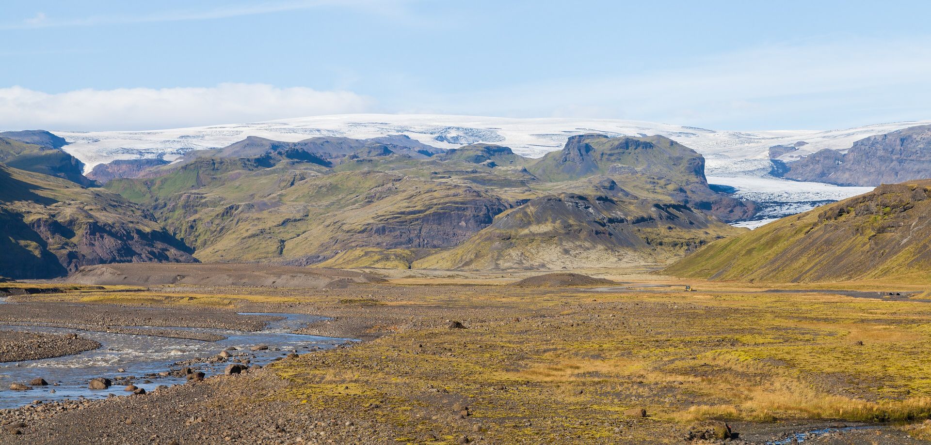
Katla, a subglacial volcano beneath the Mýrdalsjökull ice cap in southern Iceland, has erupted approximately 20 times in recorded history — roughly once every 50 years — with the last confirmed major eruption in 1918. It has now been quiet for longer than its historical average, which has made it the subject of increasing scientific attention and public concern, since an eruption beneath an ice cap produces jökulhlaups — catastrophic outburst floods of meltwater — that can reach flow rates of several hundred thousand cubic meters per second and would destroy roads, bridges, and infrastructure across southern Iceland within hours.
Iceland's entire recorded history is a chronicle of coexistence with volcanic activity, from the founding settlement of the 9th century CE through the catastrophic Laki eruption of 1783 — which killed an estimated 25% of Iceland's population through fluorine poisoning of livestock and the resulting famine — to the 2010 Eyjafjallajökull eruption whose ash cloud disrupted European air travel for weeks. Katla is directly connected to Eyjafjallajökull and has historically erupted within months of that volcano, which raises the possibility that the 2010 eruption may have stressed the system in ways that could contribute to a Katla eruption.
Icelandic civilization has survived repeated volcanic catastrophes by maintaining the social and institutional flexibility to absorb sudden disruptions — moving populations, redistributing food, rebuilding infrastructure — and by the specific resilience of the Norse-derived culture that settled the island. The Laki eruption of 1783, which was almost certainly the most damaging volcanic event in Icelandic history, killed approximately 9,000 people in a population of around 50,000 and required decades of demographic recovery. Katla's anticipated eruption is one of the most carefully monitored volcanic events in the world, with evacuation plans, seismic networks, and flood modeling that represent the current state of volcanic hazard preparedness.
20 / 20
Stephen Taylor / Pexels
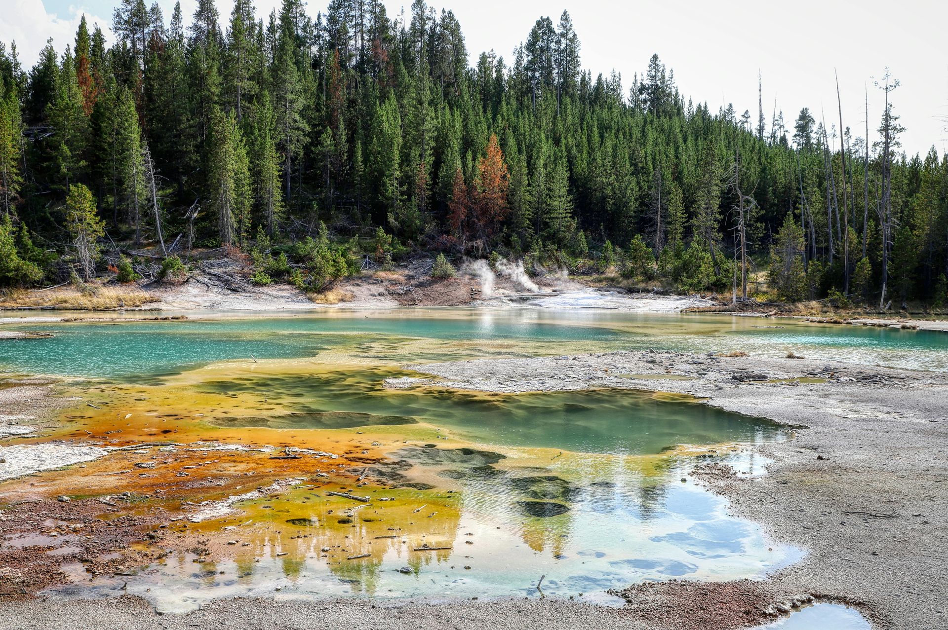
Yellowstone is the most famous supervolcano in the world — a volcanic system whose magma chamber underlies most of Yellowstone National Park in Wyoming and whose previous supereruptions, the most recent approximately 640,000 years ago, were large enough to deposit ash across half of North America. It is also one of the most carefully monitored geological systems in the world and the subject of a specific kind of public anxiety — fed by a significant amount of sensationalized media coverage — that is not proportional to the actual near-term eruption risk.
The three supereruptions of the Yellowstone system — approximately 2.1 million years ago, 1.3 million years ago, and 640,000 years ago — were among the largest volcanic events in the Cenozoic era, ejecting thousands of cubic kilometers of material and producing climate effects that would have been catastrophic for North American ecosystems. The eruptive deposits from these events are visible in the geological record across the continent.
The current state of the system is one of continuing activity — geysers, hot springs, fumaroles, and periodic earthquake swarms — but not of imminent eruption. USGS monitoring of ground deformation, seismicity, and gas emissions shows that while the system is geologically active, there are no current indicators of an impending eruption. The probability of a supereruption in any given century is estimated at approximately 0.00014% — extremely low by any reasonable assessment, though not zero.
Yellowstone's relevance to this list is its role as the extreme end of the volcanic-civilization risk spectrum: a system capable, if it erupted at supereruption scale, of burying much of North America under ash and producing a volcanic winter of sufficient severity to threaten agriculture globally. The civilizational consequences of a Yellowstone supereruption would make every other event on this list look local in scale.
