
15 cities with the world's best public transit
From Tokyo's clockwork rail network to Zurich's integrated tram grid, these cities prove that moving millions of people efficiently is very much a solved problem
Bloomberg / Getty Images
The private car dominated 20th-century urban planning so thoroughly that entire cities were rebuilt around it — freeways carved through neighborhoods, downtowns hollowed out into parking lots, and billions of hours lost to daily commutes that moved one person at a time. The consequences have been well-documented: chronic traffic congestion, poor air quality, high carbon emissions, and a persistent inequality baked into cities where getting around without a car is slow, expensive, or simply impossible.
But a different model has always existed. Dozens of cities — spread across Europe, Asia, and beyond — have spent decades building public transit networks that are fast, reliable, affordable, and genuinely pleasant to use. These are places where a visitor arriving with no local knowledge can figure out how to get across town in under five minutes, where trains arrive on a schedule you can set a watch by, and where the vast majority of residents choose transit not because they have no other option, but because it is demonstrably the best way to get around.
What separates a great transit city from a merely adequate one is rarely a single flashy infrastructure project. It is almost always the result of sustained political commitment, smart integration across different modes — rail, bus, tram, ferry — and pricing structures that make the system accessible to everyone. The best systems are also designed around the rider's experience: clean stations, clear wayfinding, real-time information, and transfers that feel seamless rather than punishing.
The cities on this list come from different regions and have taken different paths. Some built their networks during postwar reconstruction. Others inherited colonial-era rail lines and upgraded them relentlessly. A few started from scratch in the latter half of the 20th century and leapfrogged older systems entirely. What they share is the result: transit that works, at scale, every day.
This is not a ranked list. The cities appear in no particular order of superiority — each excels in different ways, and comparison across vastly different urban contexts is more illuminating than a single leaderboard. What follows is a close look at what makes each of these systems stand out, and what other cities might learn from them.
Tokyo, Japan
Manabu Takahashi / Getty Images
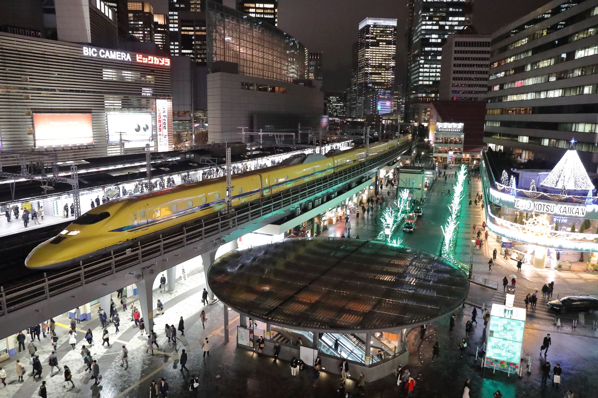
Tokyo operates one of the densest and most heavily used rail networks on the planet. The metropolitan area is served by an interlocking web of subway lines, commuter rail, and long-distance rail that together carry more than 40 million passenger trips on a typical weekday. That figure is not a typo. No other city moves this many people by rail with this degree of regularity.
The system is run by multiple operators — Tokyo Metro and Toei operate the subways, while Japan Railways East and a dozen private rail companies handle commuter and intercity lines — yet it functions as a coherent whole. A single IC card, most commonly the Suica or Pasmo card, works across all operators, all modes, and even at many convenience stores. Riders do not need to think about which company operates which train.
What visitors notice first is the punctuality. Train delays in Tokyo are measured in seconds, not minutes, and when a delay does occur — even a brief one — the railway operator issues a formal written apology that commuters can present to employers as documentation. Delays of more than five minutes are newsworthy enough to be reported. The expectation of on-time performance is not aspirational; it is structural, built into the operating culture and staffing of every line.
The station design reflects a similar obsession with function. Major hubs like Shinjuku, the world's busiest station by passenger volume, handle millions of daily riders through a labyrinth of concourses and exits that would be impenetrable if not for meticulous signage in Japanese, English, Korean, and Chinese. Color-coded lines, numbered exits, and platform screen doors — which prevent both accidents and delays — are standard throughout the network.
Frequency is another defining feature. On most central Tokyo lines during peak hours, trains arrive every two to three minutes. Off-peak service remains frequent enough that most riders do not bother consulting a timetable. This headway-based operation, rather than a fixed clock-face schedule, is a deliberate design choice that prioritizes flow over predictability.
The network is not perfect. Fares can be expensive for long trips across multiple operators, and the system's sheer complexity can overwhelm first-time users. Some outer-suburban areas are served only by bus or infrequent commuter rail. But as a demonstration of what rail transit can achieve in a megacity, Tokyo sets a standard that few systems anywhere approach.
Singapore
Calvin Chan Wai Meng / Getty Images
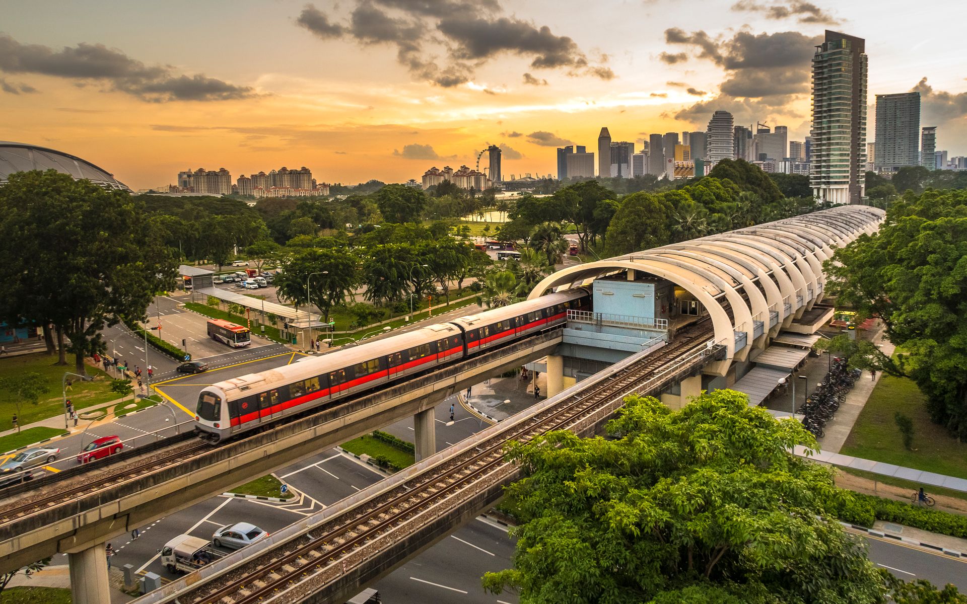
Singapore has built a public transit system almost as an act of national policy. The city-state has no domestic oil supply, limited land, and a population that could easily choke its roads if private car ownership were allowed to grow unchecked. The government has managed this through a combination of high vehicle taxes, a congestion pricing scheme for central districts, and massive sustained investment in rail and bus infrastructure.
The Mass Rapid Transit system, known as the MRT, opened in 1987 and has expanded in nearly every decade since. The network now covers more than 130 stations across six lines, with further extensions under construction. Coverage is dense enough that the government has set a policy target of placing 80% of households within a ten-minute walk of a train station — a threshold that has largely been met.
The buses are equally well-integrated. Real-time arrival information is displayed at stops and available through a widely used app, and bus routes are designed to feed the rail network rather than duplicate it. The two systems share a fare structure, and a single stored-value card — the EZ-Link card — works on both. Transfers within 45 minutes of the first tap carry a discounted fare, reducing the penalty for using multiple modes to complete a trip.
Cleanliness standards in Singapore's transit network are enforced with unusual seriousness. Eating and drinking on trains and in stations is prohibited, and the rule is widely observed. The result is a system that maintains a level of physical cleanliness unusual for networks of this age and scale.
Reliability is consistently high. The MRT suffered a series of high-profile breakdowns in the early 2010s that damaged public confidence and prompted a significant overhaul of maintenance procedures. The Land Transport Authority responded with increased inspection frequency, faster replacement of aging components, and published reliability metrics that remain publicly accessible. Mean distance between failures on most lines has since improved substantially.
Singapore's approach offers a useful lesson for other cities: transit quality is not simply a function of wealth. It requires consistent political will, a willingness to constrain private car use, and an institutional culture that treats reliability as non-negotiable.
Zurich, Switzerland
H. Emre Follow / Pexels
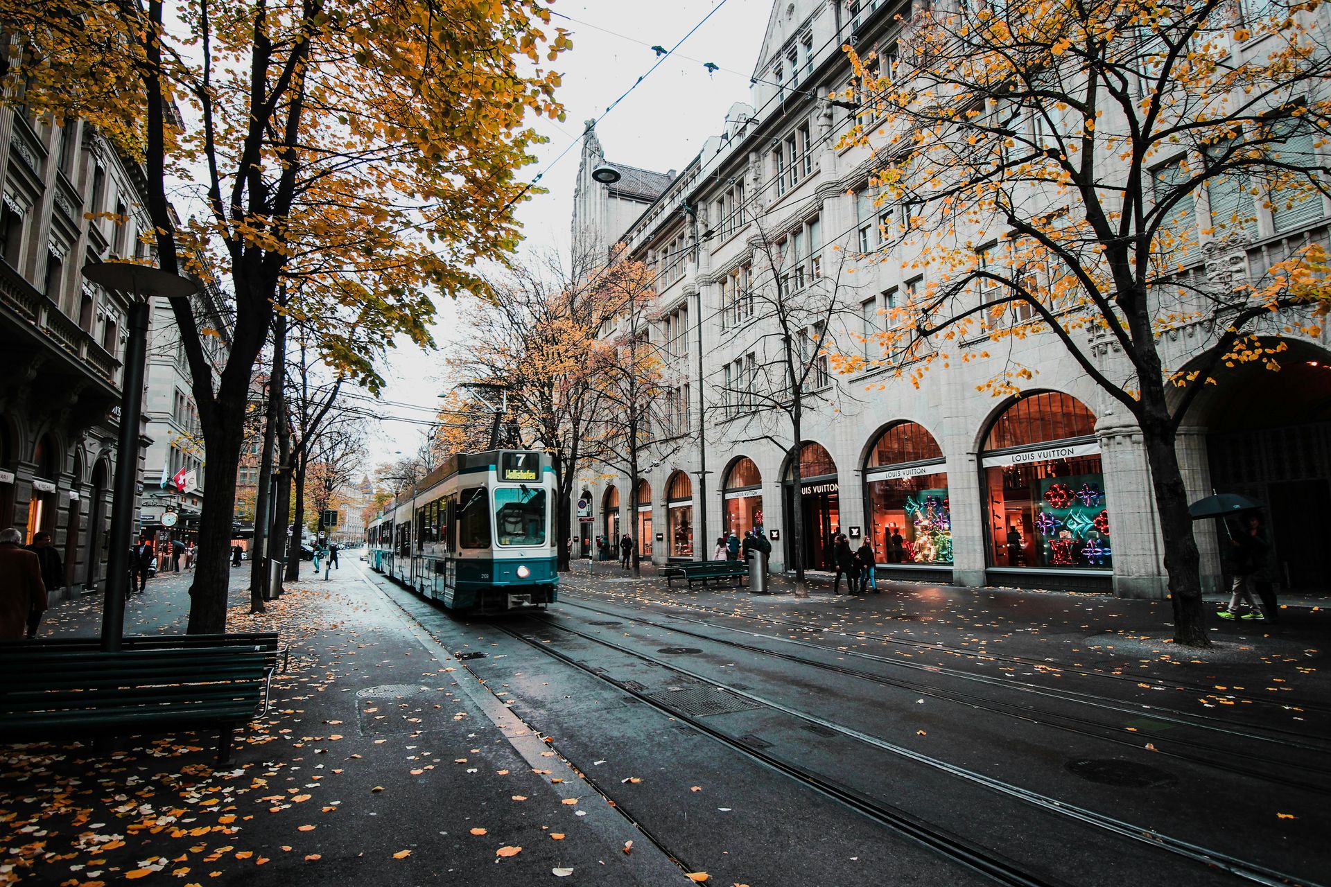
Zurich runs what many transit planners consider the most operationally refined urban transit network in Europe. The system is not the largest, and Zurich is not the most populous city on this list. What sets it apart is integration — the degree to which trams, buses, suburban rail, lake boats, and regional trains function as a single unified system, coordinated to the minute.
The core of the network is the tram, which has operated in Zurich since the 1880s and has never been replaced by a metro. The city has repeatedly chosen to upgrade and expand its tram infrastructure rather than follow the postwar trend of other European cities that tore up their tracks in favor of buses. The result is a surface rail network that is fast, frequent, and deeply embedded in the city's physical fabric.
Timed connections — known in Swiss German as Taktfahrplan, or clockface scheduling — are the organizing principle of the entire cantonal network. Trains, trams, and buses are scheduled so that transfers at major interchanges happen within minutes of each other, and the entire timetable is structured around symmetric intervals: every 30 minutes, every 15 minutes, every 7.5 minutes on core routes. A passenger can travel from the city center to a remote mountain village using three different operators and complete every transfer in under five minutes, if they follow the schedule.
ZVV, the regional transit authority for the canton of Zurich, oversees this coordination. A single monthly or annual pass covers all modes across the entire service zone. Fare integration at this level — spanning urban, suburban, and rural areas with a single ticket — remains rare globally, and Zurich has practiced it for decades.
The system is expensive to operate and to use. A monthly pass for the central zone costs significantly more than its equivalents in most other European cities. But fare revenue is high, the subsidy structure is transparent, and on-time performance consistently exceeds 90%. For a city of roughly 400,000 people, Zurich's transit ridership share is exceptionally high, in part because driving and parking in the central city have been deliberately made difficult and costly.
Hong Kong
CHUNYIP WONG / Getty Images
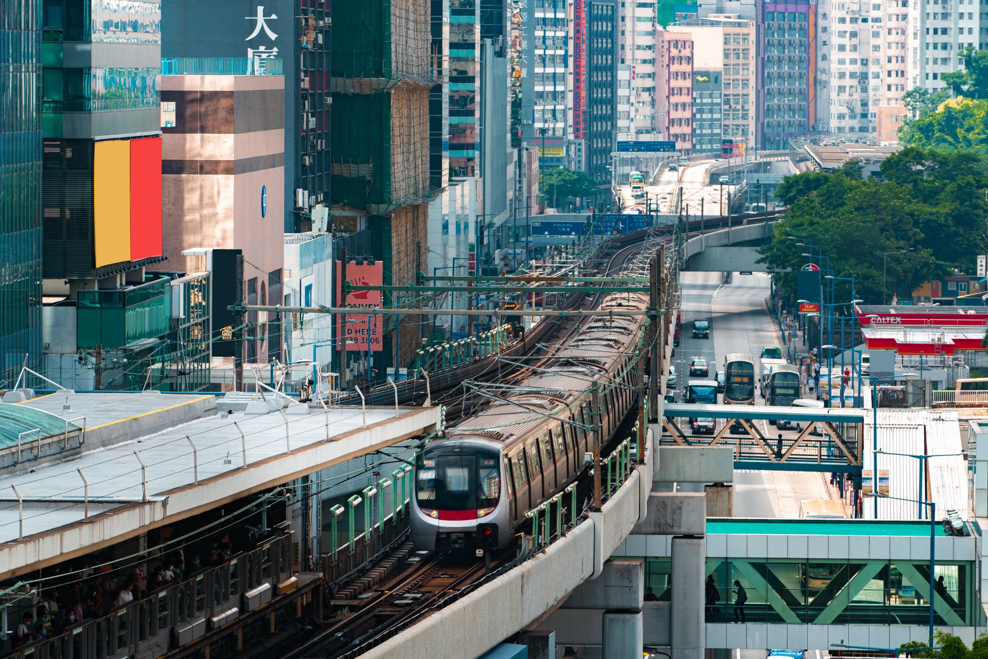
Hong Kong's MTR Corporation runs one of the few metro systems in the world that turns a consistent operating profit. That financial model — which relies on the corporation's rights to develop real estate around rail stations — has allowed the MTR to invest in infrastructure and maintenance without depending entirely on public subsidy. It has also made the system a subject of study for urban planners and transit economists worldwide.
The MTR network itself is compact but extremely efficient. Ten lines connect the dense urban core of Hong Kong Island and Kowloon with the New Territories and extend to the airport and across the border into Shenzhen. Station spacing is tight in the city center, and trains run at frequencies of two to three minutes during peak hours. The system carries around five million passengers per day.
Reliability is the MTR's most cited attribute. On-time performance — measured as the percentage of trains arriving within two minutes of schedule — consistently exceeds 99.9% on most lines. That figure reflects not just good scheduling but intensive maintenance practices, including a rolling program of overnight track and signal work that keeps the infrastructure in good condition without disrupting daytime service.
The fare structure is distance-based, and prices are kept at a level that makes the MTR accessible to most of the population, including lower-income residents. The Octopus card, introduced in 1997, is one of the world's earliest and most successful contactless payment systems for transit, and it now functions as a general-purpose payment card used at convenience stores, restaurants, and parking facilities across the city.
Hong Kong has also built the MTR into its urban planning in ways that are difficult to disentangle. New residential and commercial development in the city is typically planned around station catchment areas, which keeps density high and walking distances short. This land-use and transit integration — sometimes called transit-oriented development — is central to why the system is so heavily used.
Seoul, South Korea
Maremagnum / Getty Images
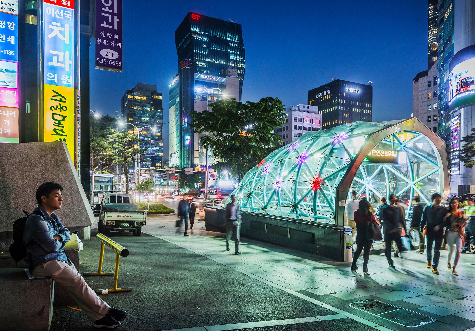
Seoul's subway is among the largest metro networks in the world by route length, and it serves a metropolitan area of more than 25 million people. Nine numbered lines cover the city proper, while a network of national rail and suburban lines extends service into the surrounding provinces of Gyeonggi and Incheon. Together, they form a system that reaches into nearly every part of the metropolitan region.
The fares are notably low. A standard subway trip within the city costs less than the equivalent of one U.S. dollar at current exchange rates, and the T-money card — Seoul's contactless transit payment system — applies discounts for transfers between subway and bus within a set time window. This transfer discount policy, introduced in the early 2000s, substantially reduced the effective cost of multi-modal trips and contributed to a significant shift in ridership patterns.
What makes Seoul's transit particularly notable is how consistently well it has been updated. The oldest lines date from the 1970s, but the network has undergone continuous rolling upgrades: new rolling stock, platform screen doors on all central lines, free Wi-Fi throughout the subway, and real-time arrival information on screens at every platform. The physical condition of most stations is better than in many systems half Seoul's age.
The bus system complements the subway efficiently. In the early 2000s, Seoul undertook a full restructuring of its bus network, eliminating duplicative routes, introducing dedicated bus lanes on major arterials, and converting the central Cheonggyecheon corridor — which had been an elevated freeway — into a pedestrian and transit-priority zone. The bus reform was managed through a semi-public franchise model that standardized fares while contracting operations to private companies.
Accessibility features are a consistent focus. Elevators and escalators connect street level to all platforms, and tactile guidance strips for visually impaired riders are installed throughout the network. Seoul has invested more systematically in universal accessibility than many peer cities, a reflection of legislation passed in the early 2000s that mandated improvements across all public transportation.
Vienna, Austria
serts / Getty Images
Vienna's public transit authority, Wiener Linien, operates a network that covers the city with a density unusual for a European capital of its size. Five U-Bahn metro lines, a tram network with more than 25 routes, and a dense bus network together provide coverage that reaches even the lower-density outer districts. The system carries around one million trips per day in a city of under two million residents.
The politics of transit in Vienna have been consistent for decades. The city government has maintained a policy of keeping fares low, investing in expansion, and actively discouraging car use through parking restrictions and road pricing in the city center. An annual pass — which covers the entire Wiener Linien network including U-Bahn, tram, and bus — was reduced in 2012 to 365 euros per year, a symbolic one-euro-per-day pricing that attracted significant attention. It has since been reduced further.
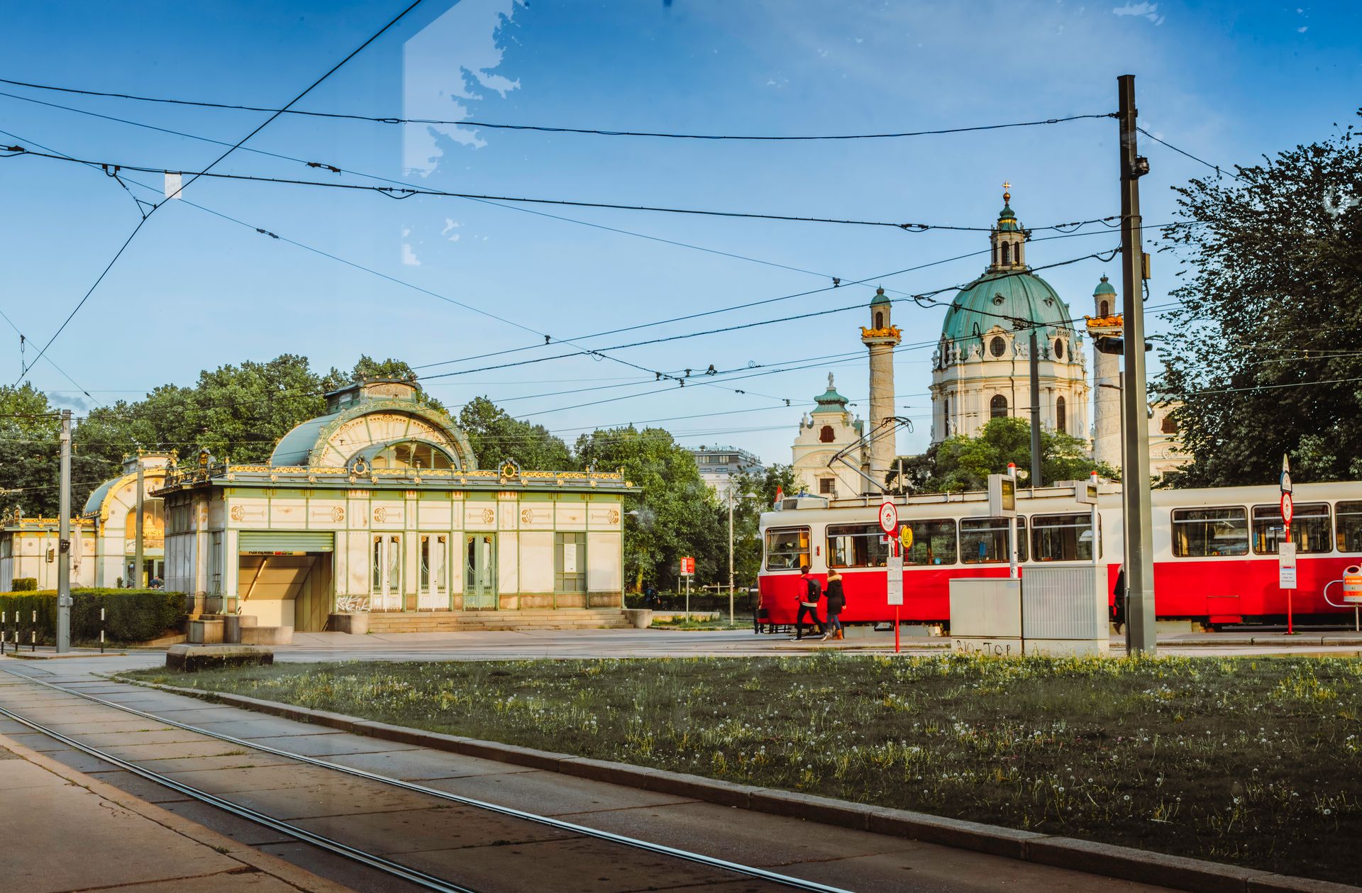
The tram network is one of Vienna's defining features. Unlike many European cities that reduced or eliminated their trams in the postwar decades, Vienna maintained and expanded its network. The trams operate on dedicated tracks separated from general traffic on most major routes, which allows them to maintain schedules independently of road congestion. Combined with high frequency — most central tram routes operate every five to ten minutes during the day — the trams form a surface transit layer that complements the underground U-Bahn rather than duplicating it.
Station design across the U-Bahn varies considerably, reflecting the different eras in which lines were built. The U6, which runs on elevated infrastructure along the Gürtel ring road, has a distinctive industrial aesthetic, while more recently built stations on the U1 and U2 extensions feature contemporary design with generous natural light. Wayfinding is clear and consistent, and most major interchanges are well-signed in multiple languages given the city's large tourist and expat population.
Vienna's modal share for public transit within the city limits is among the highest in Europe, consistently around 38 to 40% of all trips. That figure has held steady or grown over the past decade even as the city's population has increased, suggesting that the network's capacity has kept pace with demand.
Berlin, Germany
Alexander Spatari / Getty Images
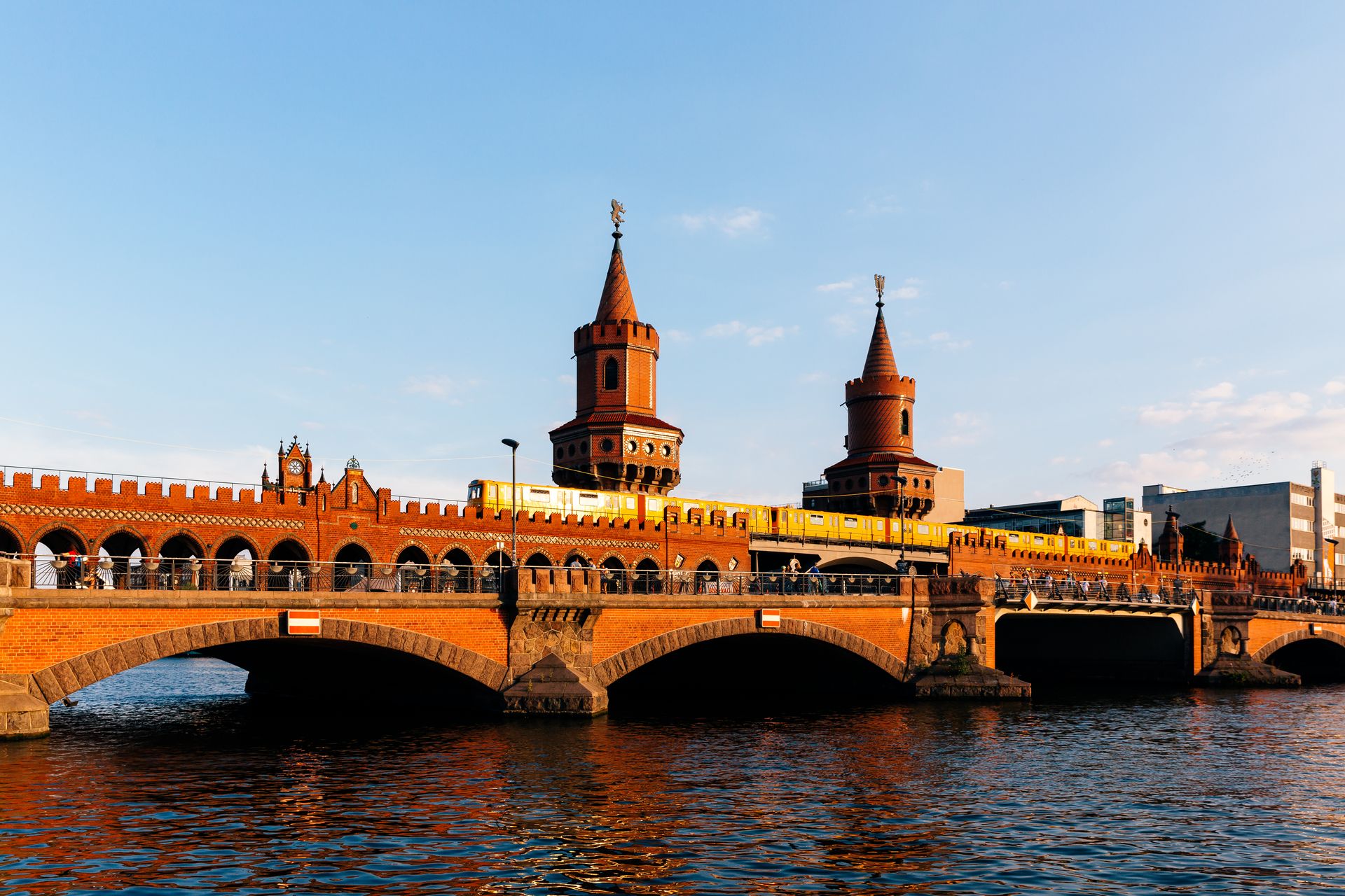
Berlin's public transit system carries the complexity of a city that was physically divided for nearly 30 years and reunified almost overnight. The U-Bahn and S-Bahn lines that serve the city today were built under separate systems, with largely separate networks east and west, and knitting them back together after 1990 required decades of infrastructure investment and political negotiation.
The result is a network that reflects its history: some lines have awkward routing because they were originally designed to terminate at a border that no longer exists, and a few stations still bear the design language of their GDR-era construction. But the overall system is extensive and, by most measures, effective. The BVG operates the U-Bahn, trams, and buses, while Deutsche Bahn operates the S-Bahn commuter rail. A single ticket covers both on the VBB regional transit authority's unified fare system.
The tram network in the former East Berlin is one of the most intact in Germany. Western European cities frequently dismantled their tram systems in the 1950s and 1960s. East Berlin did not, and the tram lines that operate today in Prenzlauer Berg, Friedrichshain, and Mitte are a direct legacy of that divergence. Extensions have been built into former West Berlin neighborhoods in recent years, a deliberate expansion of a mode that the western half of the city once abandoned.
The 9-euro ticket experiment of 2022 — which made all regional and local transit in Germany available for a flat monthly fee of nine euros — was in many ways a Berlin story. Ridership on Berlin's system surged during the three months the policy was in effect, and the data gathered informed subsequent national transit policy discussions. A successor scheme, the Deutschlandticket, introduced a 49-euro monthly cap for all local and regional transit nationwide.
Frequency and coverage in Berlin are good, though not exceptional by the standards of Tokyo or Singapore. Late-night service is robust — the U-Bahn runs around the clock on weekends — and the integration between rail and bus is reasonably seamless. The system's main limitations are the S-Bahn's recurring reliability problems and some gaps in U-Bahn coverage in the outer boroughs.
Copenhagen, Denmark
Westersoe / Getty Images
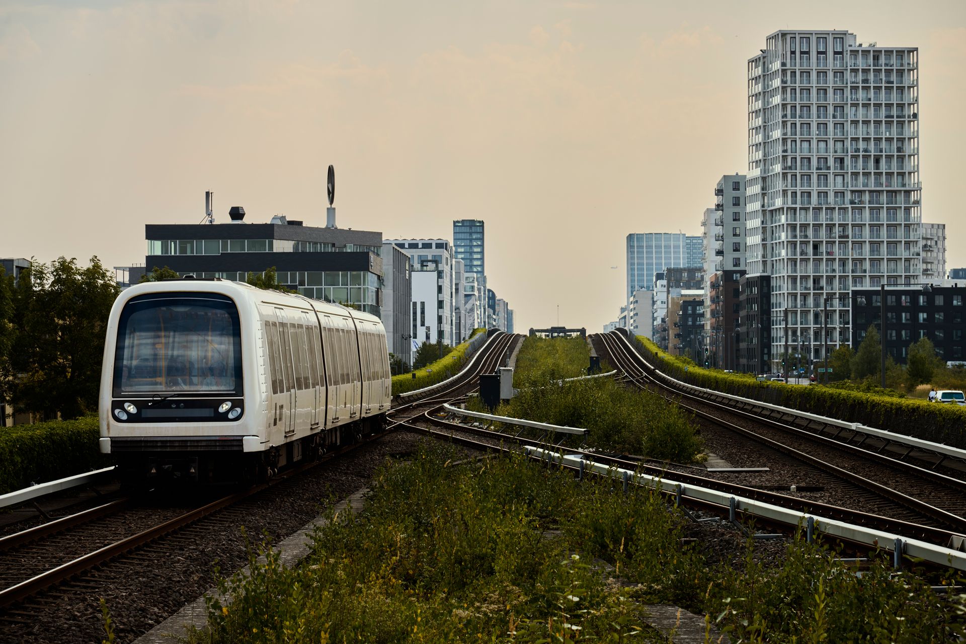
Copenhagen operates a transit network built around one central operational principle: frequency above all else. The Metro, which opened its first line in 2002 and has expanded to four lines, runs driverless trains at intervals as short as two minutes during peak hours and four to six minutes around the clock, 24 hours a day, every day of the year. There is no last train in Copenhagen's Metro. The service simply continues.
The driverless operation is not merely a technological novelty. It has direct operational consequences. Without a driver, trains can be dispatched at very short intervals without the scheduling overhead that manned systems require. It also allows for smaller trains running more frequently — a model that spreads capacity more evenly throughout the day and reduces the penalty for missing a train.
The Metro is complemented by the S-Tog suburban rail network, operated by DSB, which covers a broader catchment area around the region. A regional light rail line — the Letbane — has also come into service in recent years, connecting communities along a ring corridor that was previously poorly served by rail. The three systems operate under a unified fare structure managed by Movia, which also oversees the bus network.
Copenhagen's cycling infrastructure is worth addressing in this context because it functions as part of the same mobility system. The city's investment in protected bike lanes has reduced transit demand on some corridors, but it has also demonstrated how different modes can coexist and reinforce each other. Many Copenhagen residents combine cycling with transit — biking to a station, boarding a train, and cycling from the destination — in a pattern that the city's infrastructure actively supports.
The opening of the Cityringen circular metro line in 2019 transformed the city's transit geography by serving neighborhoods that the original two Metro lines bypassed. The circular alignment means that riders traveling between any two points on the ring can do so without passing through the central hub, reducing crowding at interchanges. It is a design model that several other cities are now studying for future network expansion.
Stockholm, Sweden
Sheviakova kateryna / Getty Images
Stockholm's Tunnelbana — the underground metro — has been operating since 1950 and has grown into a network of three main lines with 100 stations covering the city and inner suburbs. It is not the most extensive system on this list, but it is consistently rated among the most rider-friendly for its combination of reliability, coverage, and visual environment.
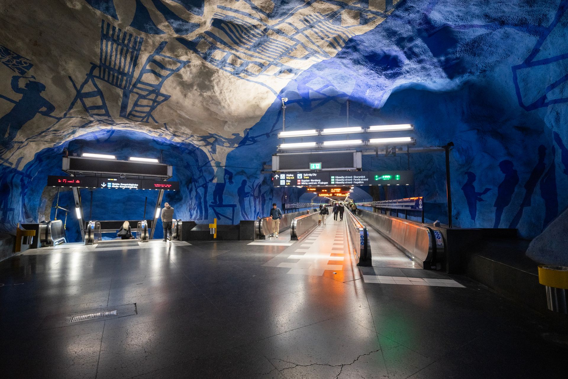
The Tunnelbana's station art program is one of the longest-running municipal public art projects in the world. Over 90 stations feature permanent artworks commissioned from Swedish and international artists. The installations range from elaborate painted rock ceilings in the older stations to contemporary sculpture and mosaic work in newer ones. Some stations — Solna Centrum with its red-orange sky painting, Kungsträdgården with its Roman ruin motif — have become tourist destinations in their own right.
Beyond aesthetics, Stockholm's transit system is notable for its integration with the regional network. The Pendeltåg commuter rail, the Saltsjöbanan and Lidingöbanan light rail lines, and the extensive bus network all operate under the Storstockholms Lokaltrafik authority, which sets a unified fare structure for the entire Stockholm County region. A single monthly pass covers every mode, making multi-modal commuting from suburban areas practical and affordable.
Reliability on the Tunnelbana is good, with on-time performance consistently above 90% on most lines. The most significant operational challenges in recent years have been on the commuter rail network, which has suffered from infrastructure bottlenecks at the central stations. A new underground commuter rail tunnel — the Citybanan — opened in 2017 and substantially relieved that pressure by providing additional capacity through the city center.
Sustainability goals have been a driver of transit policy in Stockholm County. The regional authority has committed to a zero-emission fleet across its bus network, with electric and biogas buses replacing diesel across contracted routes. The transit network is also integrated into the city's congestion pricing scheme, which charges vehicles entering the central city and uses the revenue partly to fund transit improvements.
Taipei, Taiwan
Jaromir / Getty Images
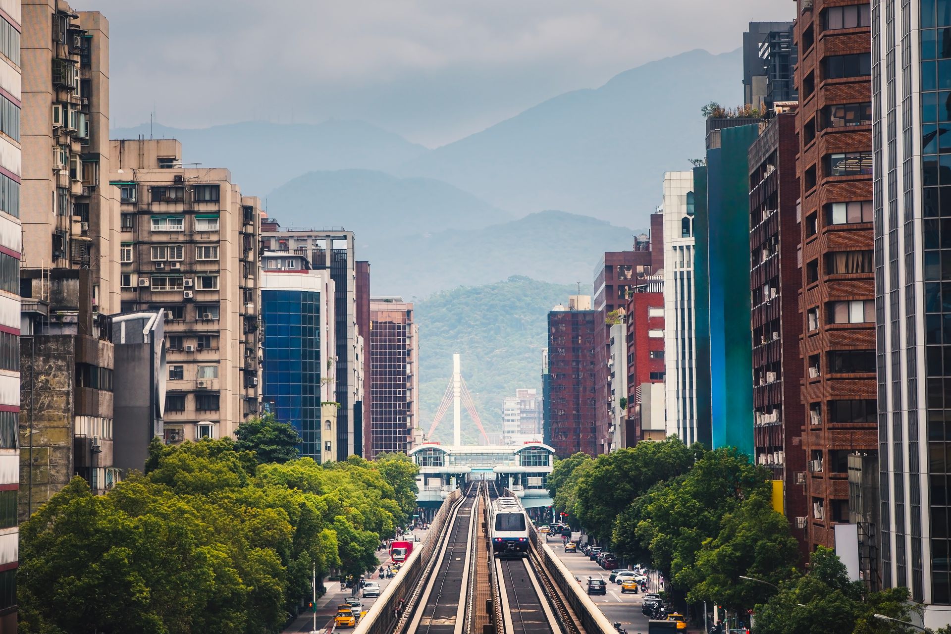
Taipei's MRT opened its first line in 1996, making it relatively young compared to the transit networks of Tokyo or Hong Kong. In the three decades since, it has expanded to six main lines with more than 120 stations and become the backbone of transportation in a metropolitan area of around seven million people. The extension into New Taipei City — formally a separate municipality — has given the network a regional character that its original urban focus did not anticipate.
The MRT is clean to a degree that is sometimes described as clinical. Eating and drinking are prohibited on all trains and in all stations, a rule that is displayed prominently and taken seriously by riders. Station floors are polished, trains are air-conditioned to a consistent temperature, and maintenance cycles are kept tight enough that worn or damaged fixtures are replaced quickly. The physical condition of the system, despite its scale and ridership volume, is better than many systems a fraction of its age.
Fares are distance-based and low by international standards. The EasyCard, Taipei's contactless transit card, functions across the MRT, the city bus network, and — like Singapore's and Hong Kong's equivalents — as a general-purpose payment card. The card system was introduced early in the MRT's history and is now deeply embedded in daily life, used for payments at convenience stores, parking meters, and taxis.
The MRT integrates closely with Taipei's YouBike public cycling scheme, which provides docked bicycles at most major stations for short-distance trips from the station to the final destination. This first-last mile integration has been widely noted as a model for combining rail transit with shared micromobility. The cycling infrastructure in Taipei, particularly along river corridors, provides safe and comfortable connections that complement the rail network rather than competing with it.
Punctuality and reliability data published by the Taipei Rapid Transit Corporation show on-time performance consistently exceeding 99%. That figure reflects a maintenance culture influenced in part by the involvement of Japanese firms in the system's original construction and ongoing operations, where a similar emphasis on precision is standard.
Amsterdam, Netherlands
NurPhoto / Getty Images
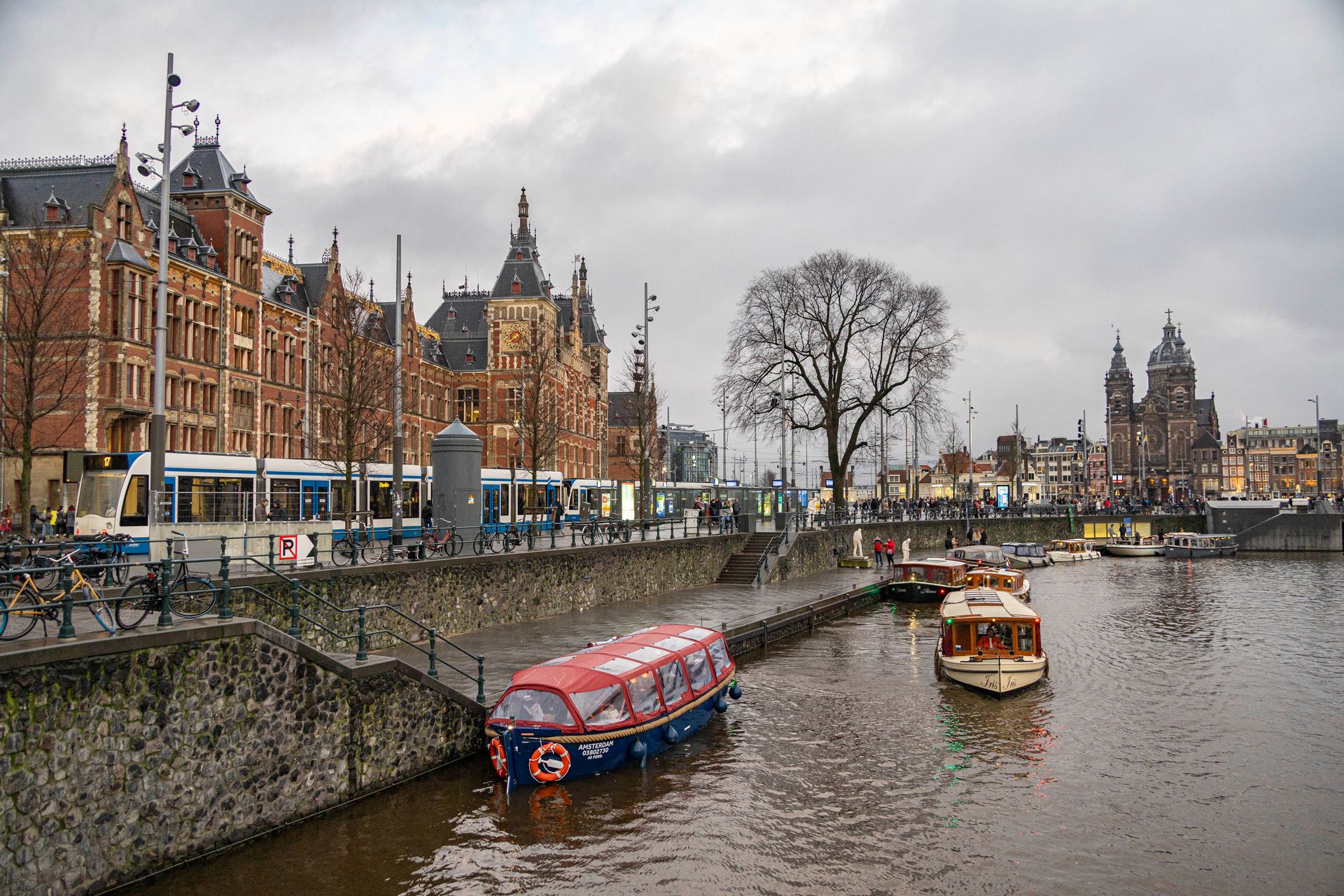
Amsterdam's public transit blends modes in a way that reflects the city's compact, water-threaded geography. The GVB municipal transport authority operates a metro, trams, ferries, and buses across a network designed for a city center where streets are too narrow and canals too numerous for conventional mass transit to work straightforwardly. The result is a layered system that requires some local knowledge to use efficiently, but which functions well once understood.
The tram is the dominant mode in the city center. Thirteen routes crisscross the inner city, running on dedicated tracks along the major thoroughfares and sharing street space with cyclists and pedestrians in some areas. The trams are frequent — most central routes run every five to eight minutes during the day — and they cover parts of the city that the metro does not reach. For short trips across the center, the tram is faster than any alternative short of cycling.
The metro, which has four lines, provides express service between major nodes. Line 52 — the North-South Metro, which opened in 2018 after a troubled 15-year construction period — connects Amsterdam Central to the southern business district via a tunnel under the historic center. The construction was plagued by engineering problems and cost overruns, but the completed line has substantially improved transit access along one of the city's busiest corridors.
The OV-chipkaart, a contactless transit card used across the entire Netherlands, works on all GVB services as well as the regional NS rail network and buses operated by other companies. This national-level fare integration means that a traveler arriving from another Dutch city can continue their journey on Amsterdam's trams and metro without switching payment systems.
Amsterdam's transit exists within a broader mobility ecosystem where cycling has a higher modal share than in almost any other large city in the world. The interaction between cycling and transit is complex: cycling reduces demand on some transit corridors, but the GVB also serves populations — older residents, tourists, those making longer trips — for whom cycling is not the primary option. The two modes generally complement rather than cannibalize each other.
Barcelona, Spain
Jakub Zerdzicki / Pexels
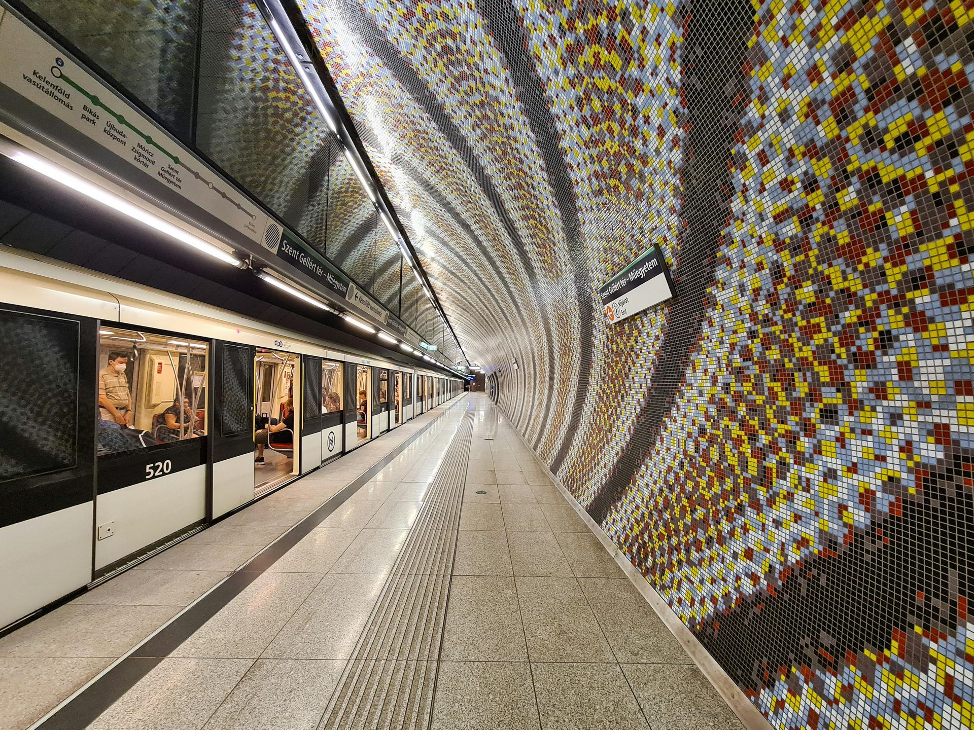
Barcelona's transit network is structured around the TMB — Transports Metropolitans de Barcelona — which operates both the metro and the city bus network. The metro has nine lines covering the dense urban core, and the integration with suburban rail lines run by Renfe and the Ferrocarrils de la Generalitat adds regional reach that extends the effective network well beyond the city limits.
The metro runs on a clockface timetable that offers trains every three to four minutes on central lines during peak hours, dropping to around eight minutes in the late evening. On Fridays and Saturdays, the network runs until five in the morning, and on certain lines, service is continuous through the weekend. This commitment to late-night service — rarer than it should be among European metro systems — reflects Barcelona's culture of late-evening social activity and reduces the pressure on taxis and ride-hailing during peak nightlife hours.
Barcelona's bus network was substantially restructured in 2012 with the introduction of the Xarxa Ortogonal, or Orthogonal Bus Network. The reform replaced a tangled web of inherited bus routes with a grid of horizontal and vertical corridors, each served by a high-frequency route. Transfer points were placed at intersections between horizontal and vertical lines, allowing riders to cross the city with at most one change. Headways on the main routes were reduced to five to seven minutes, making the bus competitive with the metro for many trips.
The T-Mobilitat smart card system, which is being rolled out across the metropolitan area, aims to consolidate fares across all operators — TMB metro and bus, Renfe commuter rail, regional buses, and others — into a single account-based payment system. The integration is not yet complete, but the direction of travel is toward a single-tap experience across the entire metropolitan region.
Station accessibility has improved substantially over the past decade, with elevators installed at most metro stations in the central lines. The physical condition of the system varies more than in some peer cities, with older stations on the L1 and L3 lines showing wear that newer extensions do not, but the operational metrics — frequency, coverage, reliability — are consistently strong.
Paris, France
Mika Volkmann / Getty Images
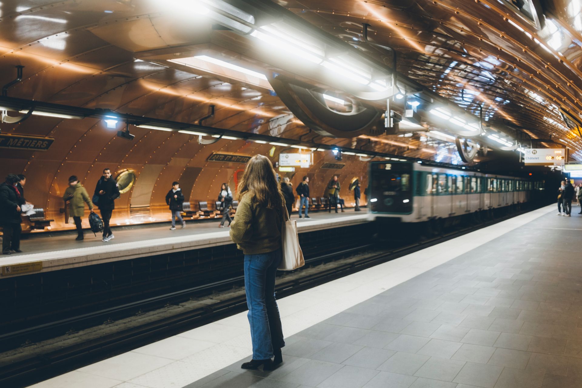
Paris operates one of the densest urban rail networks in the world. The Métro has 16 lines and around 300 stations across an urban area of roughly 100 square kilometers — a coverage density that means almost no address in central Paris is more than 500 meters from a metro station. Combined with the RER regional express network, the Transilien suburban rail system, and a bus network that reaches areas the rail lines do not, the RATP and SNCF together provide transit access to nearly every corner of the Île-de-France region.
Station density is the defining feature of the Paris Métro. Unlike systems designed around long spacing between stations with rapid acceleration between them, Paris placed stations close together to maximize walkability. This design choice, made largely in the early 20th century when the network was built, means that trains stop frequently — typically every 400 to 600 meters in the city center. The result is a system that is slower for long trips but genuinely walkable in origin and destination, reducing the need for connecting modes at either end of a journey.
The RER lines are a different animal. Five lines — A through E — cross the city center on underground tunnels and continue into the suburbs on surface tracks, providing express service over much longer distances. The RER A, which passes through the heart of Paris between Saint-Germain-en-Laye in the west and Marne-la-Vallée in the east, carries over one million passengers on a typical weekday, making it one of the busiest urban rail lines in the world by passenger volume.
Paris is also in the middle of a major transit expansion. The Grand Paris Express project involves the construction of four new metro lines and extensions to two existing ones, adding approximately 200 kilometers of rail and 68 new stations to the network by the mid-2030s. The project is the largest transit infrastructure investment currently underway in Europe, reflecting the recognition that the existing network, however dense in the city center, leaves large parts of the inner suburbs poorly served.
The Navigo pass, which provides unlimited travel on all RATP and SNCF services within the Île-de-France region for a monthly fee, is one of the most comprehensive integrated fare products of any major transit authority in the world.
Shanghai, China
Yaorusheng / Getty Images
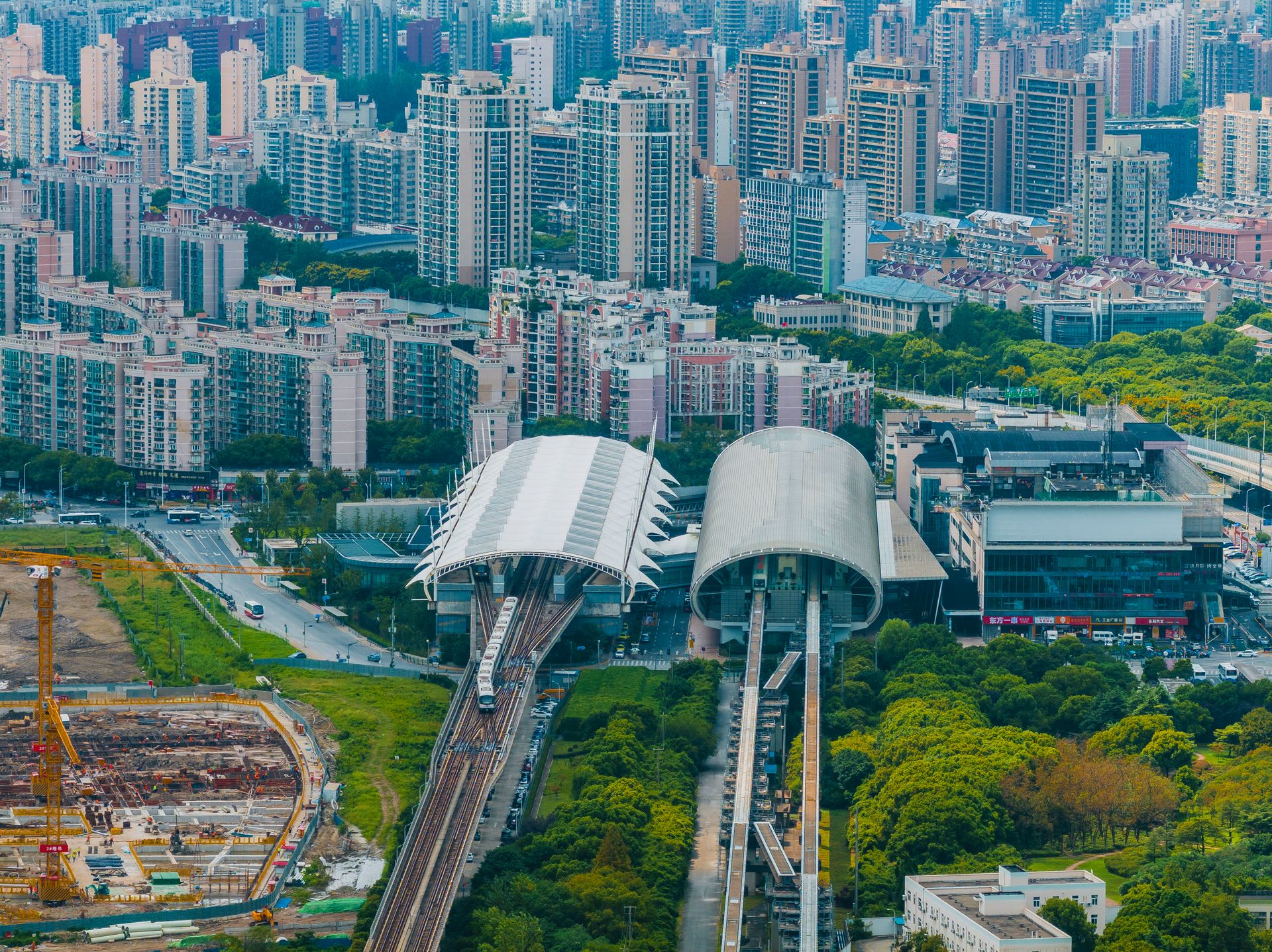
Shanghai's metro is the longest urban rail network in the world by total route length, and it has reached that scale in an extraordinarily short time. The first line opened in 1995. Today, the network has more than 20 lines and over 500 stations, with construction of new lines continuing on a schedule that would be unimaginable in most other cities. The scale of expansion reflects both the city's rapid population growth and a national policy commitment to urban rail as a solution to metropolitan mobility.
The construction pace has sometimes outrun demand in outer areas, where new lines serve districts that are still sparsely populated. But in the city's dense inner core — the former concession areas, the Bund waterfront, the central business district — the metro provides a level of service that matches or exceeds older systems in European capitals. Trains on the central lines run every two to three minutes during peak hours, and the rolling stock is modern and consistently maintained.
Fares are low. A typical trip within the urban core costs the equivalent of around 50 U.S. cents, and the distance-based fare structure scales modestly for longer journeys. The transportation card used across Shanghai — the Jiaotong Card — is accepted on all metro lines, buses, and ferries, and can also be used for payment at some retail locations. Newer payment options include mobile payment via Alipay and WeChat Pay, which are accepted at all metro gates.
The airport connections are worth noting. The Maglev train connecting Pudong International Airport to the Longyang Road metro station operates at speeds up to 430 kilometers per hour and covers the 30-kilometer distance in eight minutes. Though it connects to the metro rather than directly to the city center, and its fare is set above the standard metro price, it represents one of the few commercially operating high-speed maglev transit services in the world.
The integration between metro and other modes is still developing relative to the system's size. Bus networks in outer districts can be difficult to navigate without local knowledge, and the wayfinding in some stations prioritizes Chinese-language signage over multilingual options. But for the scope of what has been built and the speed at which it has been built, Shanghai's metro is a transit achievement with few modern parallels.
Osaka, Japan
Thananat / Getty Images
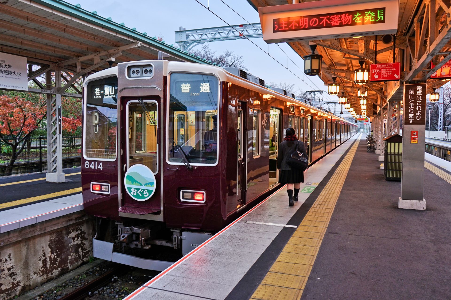
Osaka's transit ecosystem is a microcosm of Japan's broader rail culture: multiple private and public operators, a dense network of overlapping lines, and a level of service reliability that treats a two-minute delay as a significant incident. The city is served by the Osaka Metro — the municipal subway system — along with lines operated by Kintetsu, Hankyu, Hanshin, Nankai, and several other private rail companies, plus JR West commuter services. The density of this combined network within the greater Osaka-Kobe-Kyoto region is second only to Tokyo in Japan.
The private rail operators in the Osaka region deserve particular attention because they represent a model of transit financing that is genuinely unusual by global standards. Companies like Hankyu and Kintetsu built not just rail lines but entire communities along those lines — residential developments, department stores, amusement parks, and hotels — using the rail corridor as the organizing spine of a broader real estate and commercial business. The rail operations are profitable in part because the ancillary businesses they enable generate revenue that subsidizes the core service.
The Osaka Metro itself — formerly the Osaka Municipal Subway, rebranded as a private entity in 2018 — operates eight lines with high frequency across the city's dense urban core. The network integrates at multiple interchange stations with the private operators, and a single IC card (ICOCA, the JR West regional card, or its national equivalents including Suica) is accepted across all operators. A visitor arriving from Tokyo can use the same card they loaded at Shinjuku Station to ride every train in Osaka without reloading or changing cards.
Dotonbori, Shinsaibashi, Namba, Umeda — the major commercial and entertainment districts of central Osaka — are all directly served by multiple metro lines and private rail stations. The proximity of transit to destinations means that the effective walkability of the city, measured as the distance between a station and the place a rider actually wants to reach, is extremely high. In most parts of central Osaka, walking out of a station and arriving at a destination within five minutes is the norm, not the exception.
The regional scope of the network is also worth noting. A traveler in Osaka can reach Kyoto in 15 minutes on the Hankyu Kyoto Line, Kobe in 25 minutes on the Hankyu Kobe Line, and Nara in 40 minutes on the Kintetsu Nara Line — all on private railways, with frequent service throughout the day. This regional connectivity, provided by private operators at fares comparable to municipal transit in other cities, makes the entire Kansai region function as a single interconnected transit zone.