From Angkor Wat's world-record temple to Easter Island's 1,000 moai standing 2,200 miles off the coast of Chile
Anthony DELANOIX / Unsplash
Landmarks do something that photographs and descriptions cannot fully replicate: they place a person inside history at a scale that makes history feel real. Standing at the base of the Great Wall of China, at the edge of the Machu Picchu citadel, or inside the courtyard of the Taj Mahal produces a physical encounter with the ambition, engineering, and belief systems of civilizations that no museum exhibit can substitute for. The world’s most famous landmarks draw millions of visitors each year, not out of habit but because the experience of being present at them remains genuinely affecting in ways that are difficult to anticipate until you arrive.
The geography of famous landmarks spans every inhabited continent and encompasses natural wonders alongside human construction, ancient ruins alongside buildings still in active use. What unites them is historical significance paired with visual power: the ability to communicate something immediately to the eye while rewarding deeper investigation with layers of cultural, political, and artistic meaning. Planning visits to these sites takes thought: the most famous landmarks are also the most crowded, and the difference between a visit during peak season and one in the shoulder season can determine whether the experience is transformative or exhausting.
These 10 landmarks come from U.S. News & World Report’s selection of the most famous landmarks in the world, covering archaeological sites, natural formations, religious structures, and civic monuments across Asia, Europe, Africa, Oceania, and the Americas. The first 10 from the full 32-landmark list appear here, representing nine countries across five continents and spanning ancient ruins, religious monuments, natural landmarks, and civic structures built across 4,500 years of human history, from the Pyramids of Giza to the Sydney Opera House, and from Victoria Falls to Machu Picchu and beyond.
allPhoto Bangkok / Unsplash
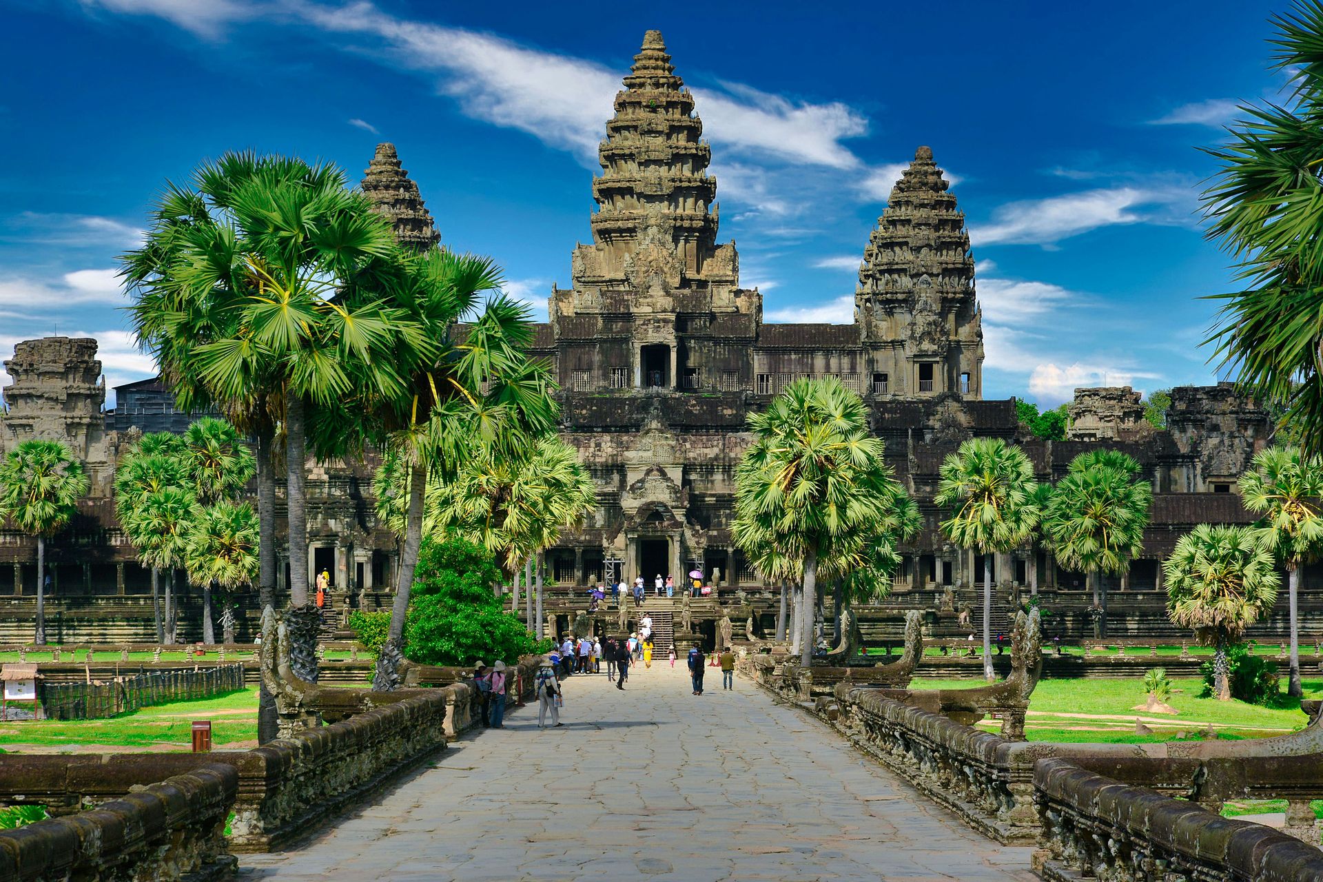
Angkor Wat is the world’s largest religious monument and the centerpiece of Angkor Archaeological Park, one of Southeast Asia’s most significant archaeological sites. The park preserves the remains of the capital of the Khmer Empire, which dominated the region from the ninth to the 15th centuries, and the entire complex is designated a UNESCO World Heritage Site. The Angkor Wat temple itself is the most expansive structure within the park, but the full site extends well beyond it.
The Bayon temple at Angkor Thom, located north of the main Angkor Wat complex, is a separate highlight worth scheduling into the visit. Its towers of carved stone faces give it a visual character entirely distinct from the main temple’s towers and reflecting pools. A guided tour is the recommended approach for understanding Angkor Wat’s history and the specific qualities of Khmer architecture. The relationship between the temple’s proportions, its cardinal orientation, and its religious symbolism is not immediately legible without explanation.
Angkor Wat is accessible from the city of Siem Reap by taxi, tuk-tuk, or bicycle, as the park sits on the city’s edge. Climbing to the top of Angkor Wat offers views that reward the effort, and the best light for photography typically falls in the early morning when the sun rises over the towers and reflects in the surrounding moat. The scale of what the Khmer builders achieved across hundreds of square kilometers of jungle, with no machinery beyond human labor, is among the most arresting facts a visitor takes away from the park. The best light for photography and the thinnest crowds both favor early morning arrivals, when mist still lingers around the temple towers. Angkor Wat opens at 5 a.m. for precisely this reason, and the first light across the reflecting pools has drawn photographers to the site for decades. Tuk-tuks waiting outside the gate at that hour are plentiful and inexpensive.
Photoholgic / Unsplash
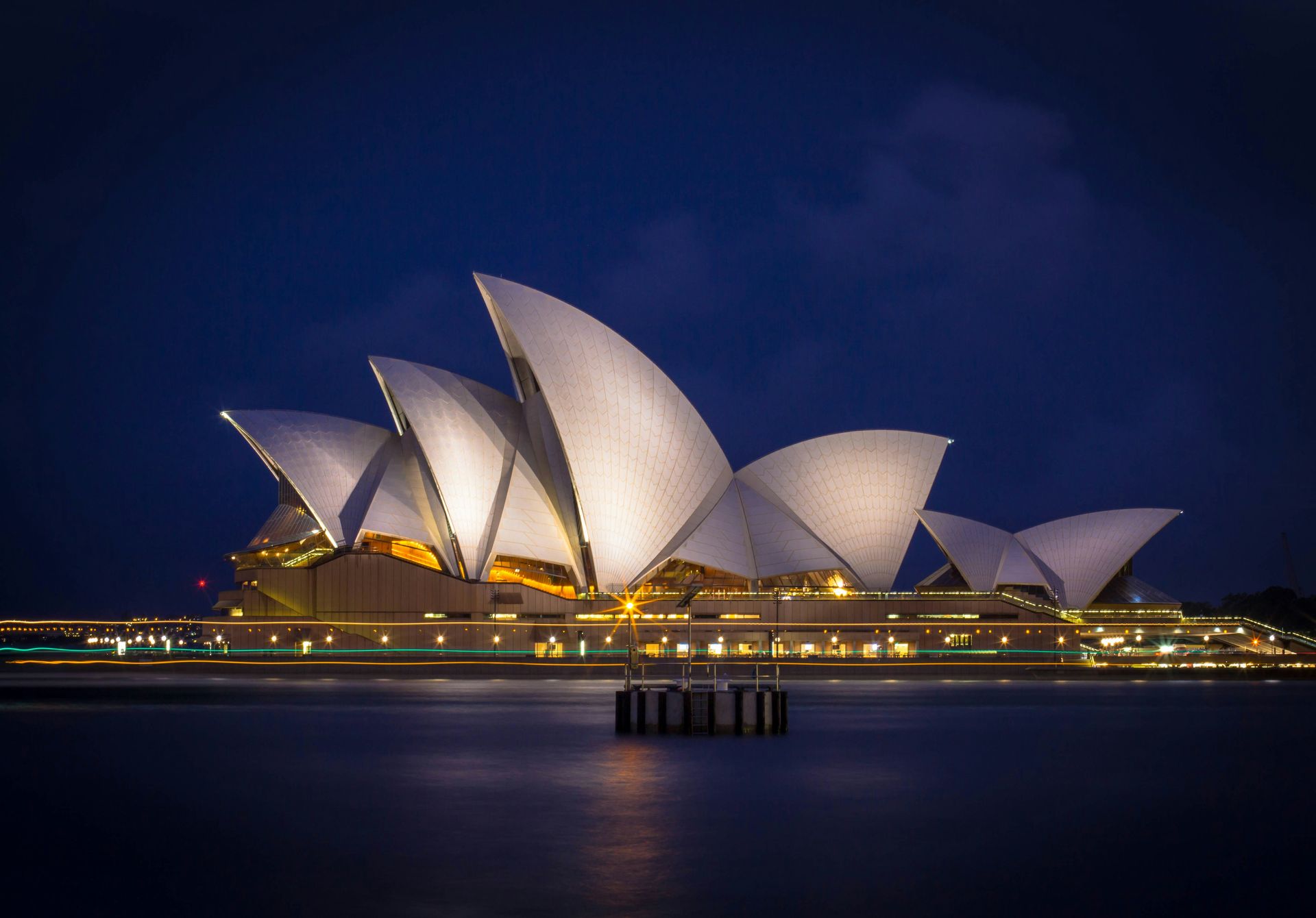
The Sydney Opera House stands alongside Sydney Harbour in one of the world’s most recognizable harbor settings and ranks among the busiest performing arts venues on the planet, hosting operas, orchestras, ballet, theater, and more throughout the year. The building’s sail-like shell roofs, designed by Danish architect Jørn Utzon, gave the structure an exterior form so distinctive that it became Australia’s most recognizable building within years of opening in 1973.
Visitors who want more than the exterior can take the hour-long guided Sydney Opera House Tour, which covers the performance halls, the backstage areas, and the architectural story of the building’s notoriously complex construction. A comprehensive backstage tour delves deeper into the working spaces behind the stages. For those who want to linger, the venue’s indoor and outdoor restaurants offer harborside dining with direct views of both the Opera House and the Sydney Harbour Bridge.
The setting, architecture, and programming together give the Sydney Opera House a layered appeal that few landmarks do. Most famous buildings can only be admired from the outside or walked through as historical exhibits. The Sydney Opera House is a living cultural institution where visitors can attend a world-class performance in one of the world’s most architecturally celebrated buildings on the same evening. The harbor setting amplifies the visual impact from every approach: by ferry, by foot along the promenade, or from the bridge above. The Opera House’s visual power in the harbor context is the reason Sydney has one of the most photographed skylines in the Southern Hemisphere. The building and the bridge form a composition that no single element would produce alone. Few landmarks in the world manage to define their host city’s global image as completely as the Opera House has defined Sydney since its 1973 opening, a function that pure architecture, without the programming and ongoing cultural life, rarely achieves.
Timelab / Unsplash
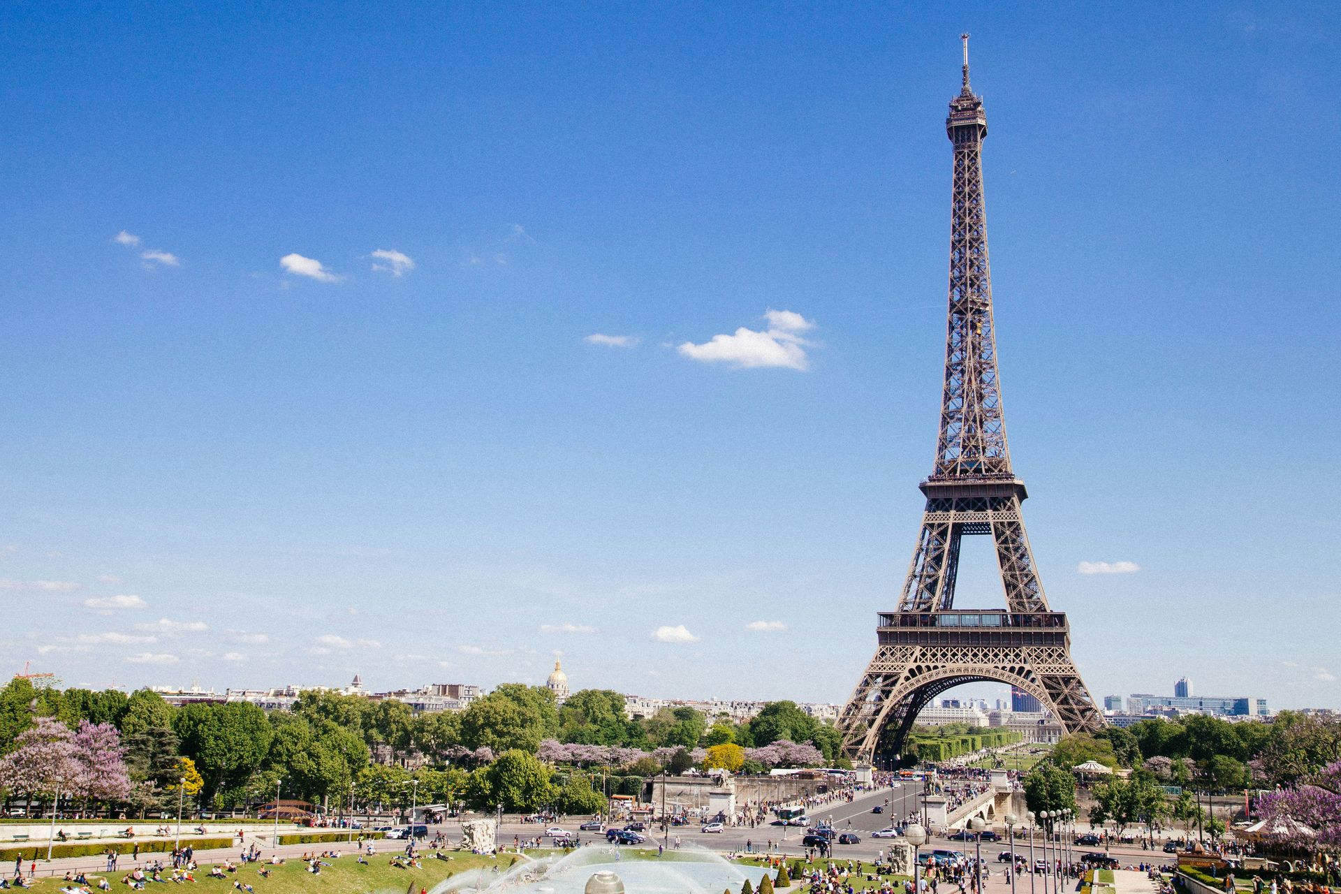
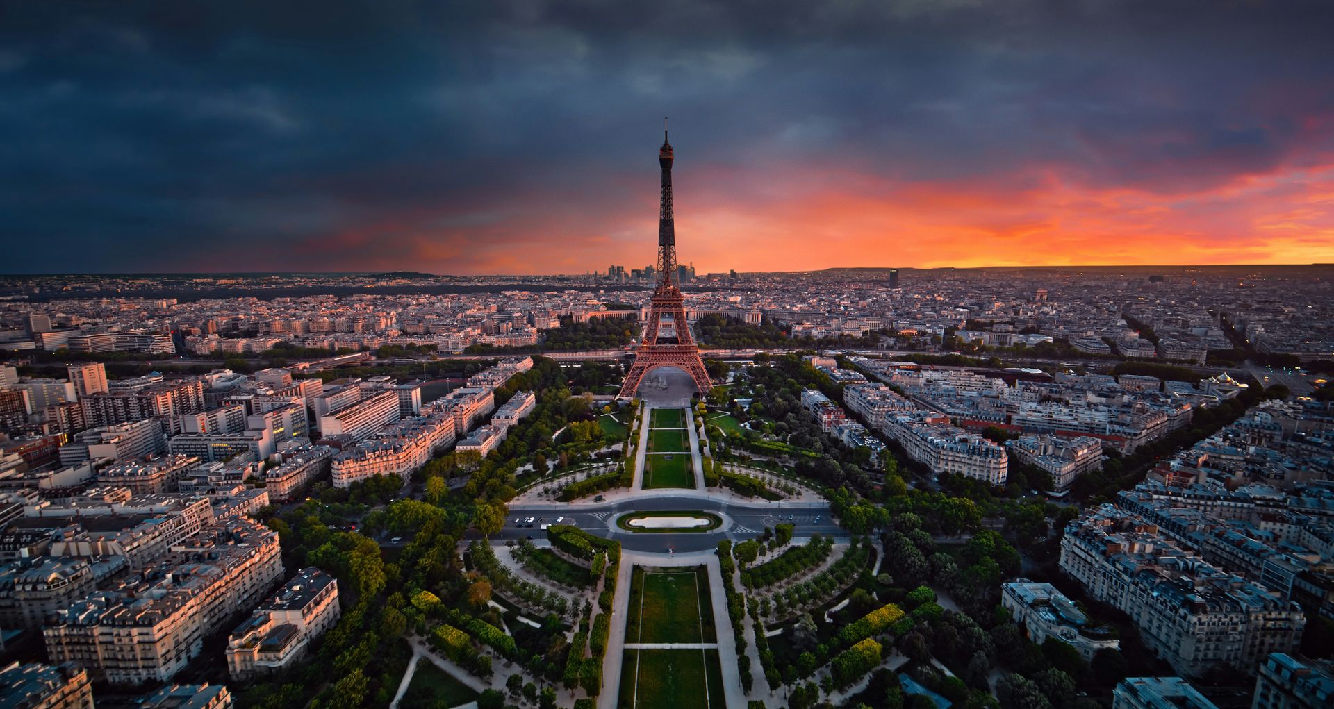
The Eiffel Tower is one of the most visited monuments in the world, so planning a visit matters significantly. The peak crowds fall between late June and early September, making spring and fall the preferred seasons for visitors who want to spend time at the tower without contending with the longest queues. The cheapest ticket option covers only the second level, and visitors willing to climb nearly 700 stairs can save money by taking the elevator.
For unobstructed views of Paris from above, the top level is worth the price premium. The city’s layout, including the Seine, the rooftops, and the distant hills, reads differently from 900 feet than from the second level, and the experience of standing at the summit of the structure that dominated Paris’s skyline for decades before the city built anything taller gives the view a historical dimension. Two restaurants operate inside the Eiffel Tower: Madame Brasserie on the first level and the Michelin-starred Jules Verne, which enforces an elegant dress code.
After dark, the Eiffel Tower puts on its own light show at the top of each hour, producing the golden sparkle effect that inspired the “City of Light” designation Paris has held for over a century. The show lasts several minutes and transforms the structure from a daytime landmark into something more theatrical. Watching from the Trocadéro esplanade across the Seine gives the best unobstructed vantage point and puts the tower’s full height in context against the surrounding cityscape. The Trocadéro also places visitors in the center of one of Paris’s most ceremonial axes, with the École Militaire at the far end and the tower at the near end, giving the Eiffel Tower its proper urban scale. The tower is genuinely tall — 1,083 feet including its broadcast antenna — and the surrounding Haussmann-era buildings make that height feel even more imposing from ground level.
Julian Yu / Unsplash
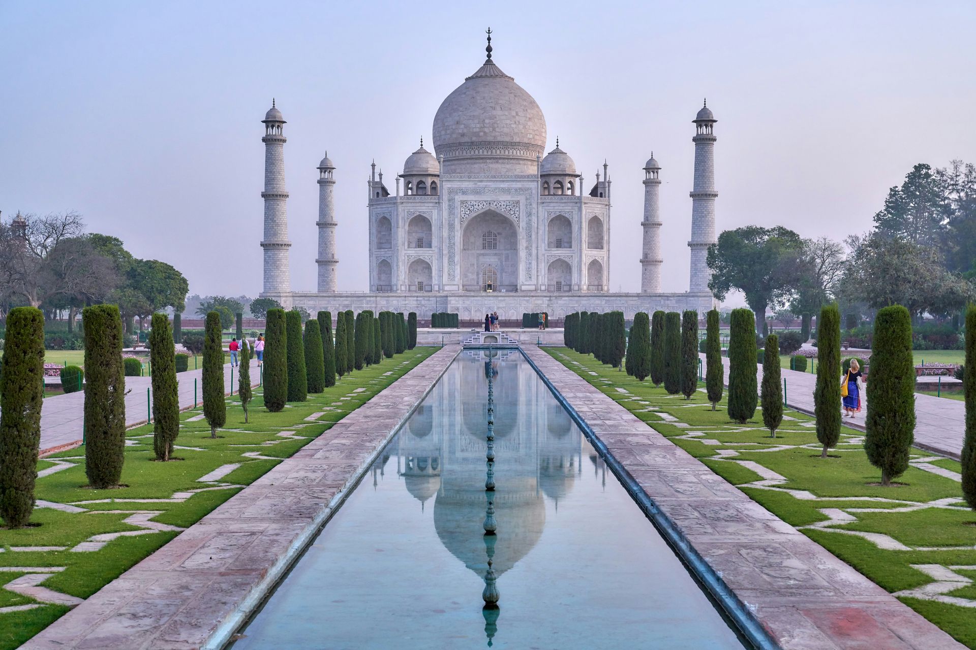
The Taj Mahal is a mausoleum built in the 1630s and 1640s by the Mughal Emperor Shah Jahan as a tribute to his wife, Mumtaz Mahal, who died while giving birth to their 14th child. UNESCO recognizes it as the greatest achievement of Indo-Islamic architecture, a designation that reflects the structure’s synthesis of Persian, Indian, and Islamic design traditions into a form no subsequent architect has equaled. The ivory-white marble mausoleum anchors a 42-acre complex that also includes a mosque, a guest house, and formal gardens arranged in precise geometric symmetry.
The Taj Mahal sits in Agra, accessible from New Delhi by train in up to three hours, making it a practical day trip from India’s capital for visitors whose itinerary centers on the north. The crowds at this site are substantial, and morning visits are recommended. The early hours avoid the densest visitor concentrations later in the day and allow travelers to experience the sunrise, which casts a changing spectrum of warm light across the marble surface, a phenomenon photographers have documented for over a century without exhausting the subject.
The structure’s scale, visible from the entry gate, creates a striking impression on approach. The central dome rises more than 200 feet, and the four minarets flanking the main structure lean slightly outward by design so that an earthquake would cause them to fall away from the main building, not onto it. The gardens, with their reflecting pools aligned along the central axis toward the mausoleum, create the effect that the building floats. Every element of the Taj Mahal was intentional in ways that a visit reveals progressively. The best moments come at dawn, when the marble shifts from gray to rose to white as the sun rises, a transformation that the symmetrical garden pools mirror from below. The Taj Mahal’s white marble also changes color in artificial light, appearing golden at night. This is a visual quality that evening visitors experience differently from those who come only at dawn.
Eddie Kiszka / Unsplash
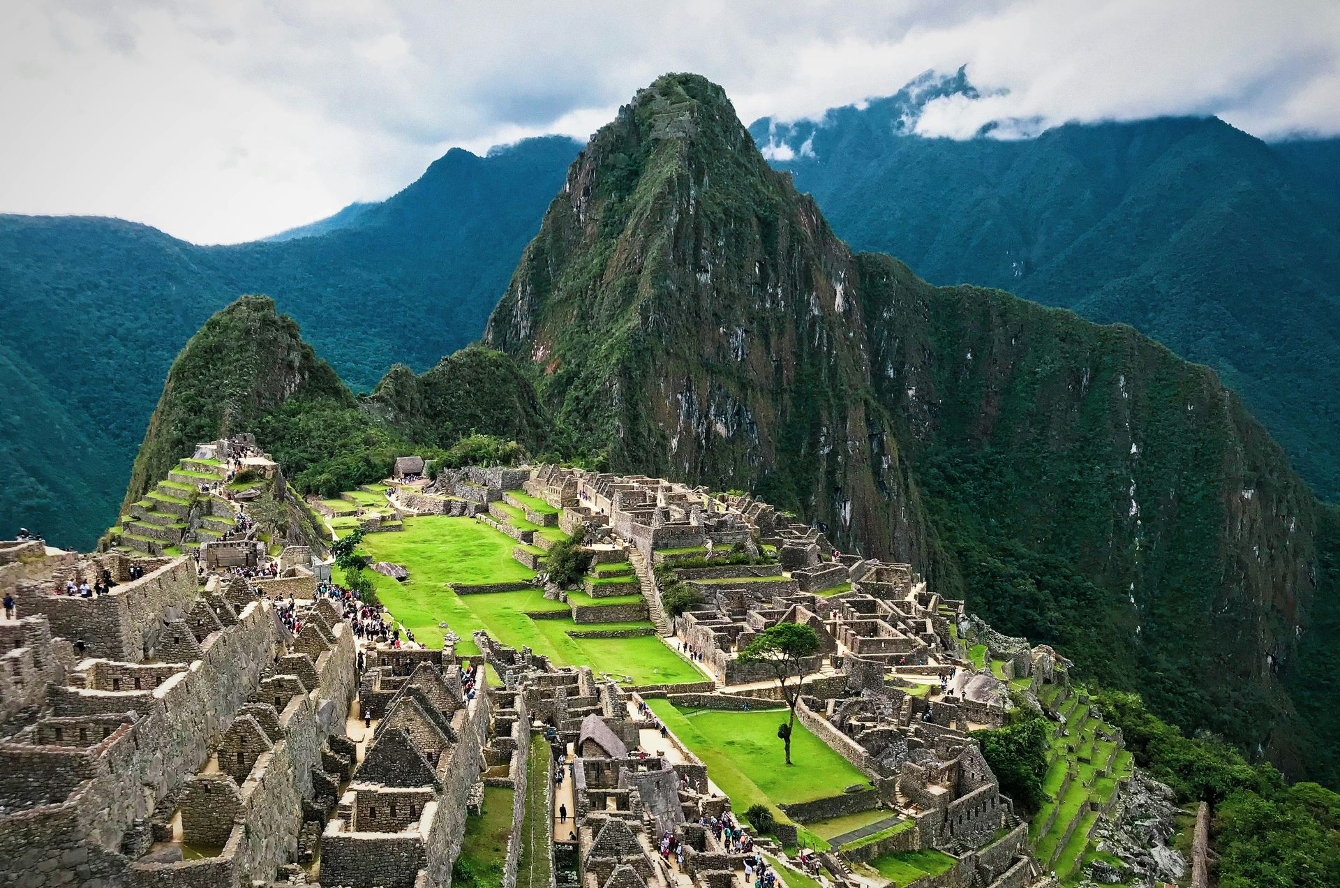
The ancient Incan citadel of Machu Picchu sits at an altitude of nearly 8,000 feet above sea level on a mountaintop in the Peruvian Andes, a position that provided the settlement with both natural defenses and a dramatic visual relationship with the surrounding peaks and valleys. The 200 structures that make up the citadel integrate with the landscape through agricultural terraces, irrigation canals, and stonework that follows the mountain’s natural contours, reflecting an Incan architectural approach that treated the built environment and the natural one as continuous.
The altitude requires acclimatization before visiting, and the recommended approach is to spend a night in the nearby town of Aguas Calientes before ascending. From Aguas Calientes, the citadel is reachable by early-morning bus or by a hike of up to 2 hours. Booking tickets in advance is essential. The site limits daily visitor numbers, and same-day tickets are not reliably available. Separate permits with limited availability exist for climbing the adjacent peaks of Huayna Picchu and Machu Picchu Mountain, both of which offer elevated views of the citadel and surrounding valley.
Machu Picchu also holds UNESCO World Heritage Site designation and earns recognition as one of the New Seven Wonders of the World. The biodiversity surrounding the citadel extends the experience beyond the architecture: the ecological zone supports a range of plant and animal species connected to the site through its water management systems. The citadel’s inaccessibility, which protected it from Spanish conquest and the subsequent destruction that overtook many Incan cities, is the reason it survives largely intact. The early morning ascent, when cloud and mist move through the ruins at altitude and the surrounding peaks begin to catch the first light, ranks among the definitive travel experiences in South America. Machu Picchu’s UNESCO World Heritage status and its New Seven Wonders designation reflect a global consensus that the site is irreplaceable, which has made visitor management and ticket limits an ongoing policy focus for Peru.
William Olivieri / Unsplash
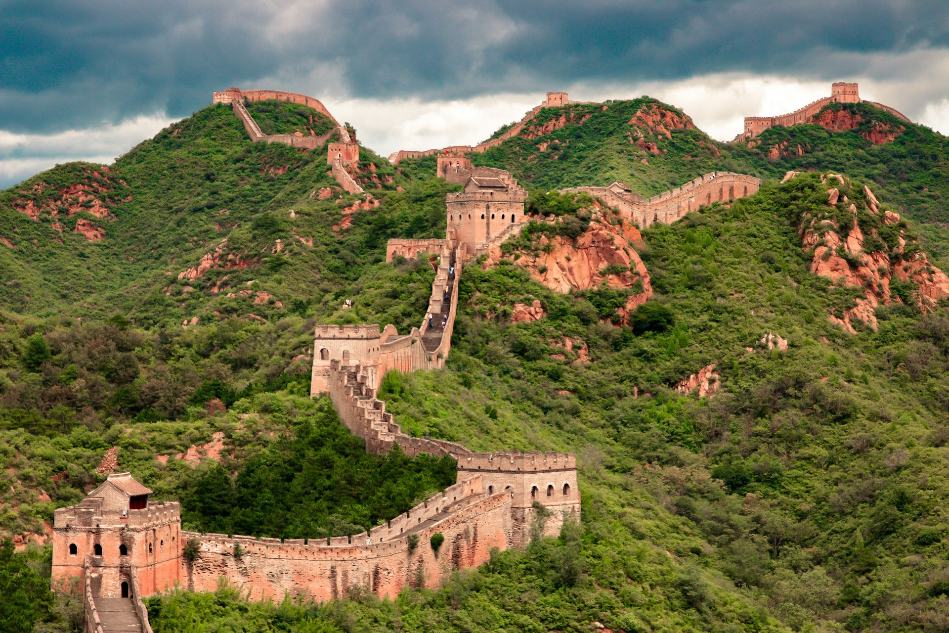
The Great Wall of China was built across a span of roughly 3,000 years, with the best-preserved sections dating from the Ming dynasty and stretching over approximately 5,500 miles. When you measure all sections ever constructed together, the total length reaches around 13,170 miles. The wall is the longest structure in the world and one of the most ambitious engineering projects in human history, built across mountains, deserts, and plains without mechanical assistance.
The Mutianyu section, located north of Beijing, is the most popular section for visitors: it is the longest restored section open to the public and in better condition than many other accessible parts. Tired visitors can take a cable car to the top of the wall rather than hiking the steep approach. The best times to visit Mutianyu are spring and fall, when temperatures are moderate, and foliage adds visual interest: cherry blossoms in spring and turning leaves in autumn give the wall’s gray stone a dramatically different appearance from its summer or winter state.
The wall’s scale is difficult to convey in photographs and only becomes comprehensible in person. Standing on the Mutianyu section and looking in either direction, the wall disappears into mountain ridges on both sides and reappears on distant peaks, demonstrating the ambition of a project that traced a political boundary across a physical landscape for thousands of miles. The original purpose, defense against nomadic invasions from the north, is less legible today than the sheer human determination that the structure embodies. The wall also served as a transportation corridor and communications network, with beacon towers allowing messages to travel hundreds of miles within hours, a logistical function as important as the defensive one. The Ming dynasty sections visible at Mutianyu also benefited from the era’s brick-and-mortar technology, which produced the durable crenelated walls that survive today with their watchtowers intact.
Fab Lentz / Unsplash
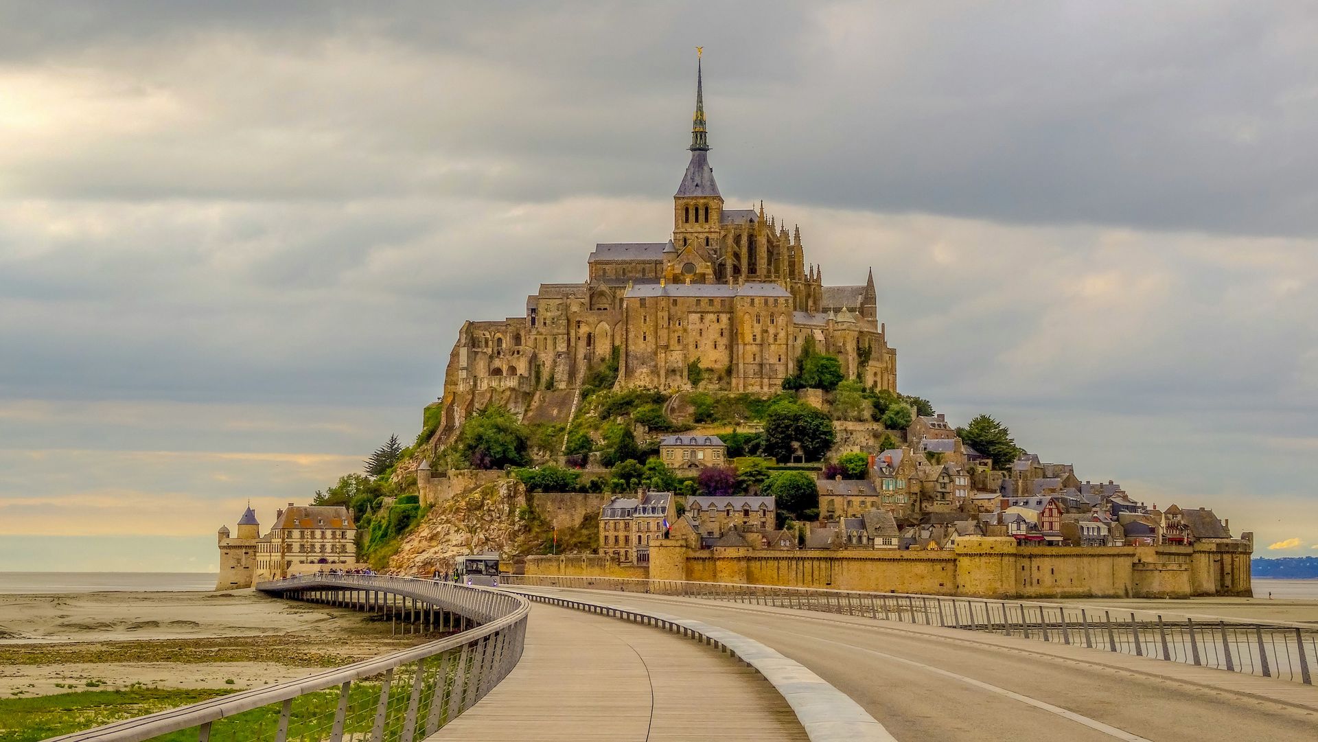
Mont-Saint-Michel is a medieval Benedictine monastery built atop a rocky island in the bay shared between the French regions of Brittany and Normandy, dating back to the 10th century. The island’s silhouette, an abbey rising from a conical rock above the water, is one of Europe’s most distinctive visual compositions, visible from a distance across the flat tidal plains that surround the bay. UNESCO recognizes the site as a World Heritage landmark.
The tides at Mont-Saint-Michel are among the fastest in Europe, and at high tide, water surrounds the island. A bridge connects the island to the mainland at all times, so visitors are never stranded, but timing a visit to witness the tidal transformation — when the water returns rapidly across the mudflats to encircle the rock — adds a natural drama that the architecture alone does not provide. Visitors can reach the abbey on foot or by shuttle bus from the mainland car parks.
The island also offers food specific to the Normandy region, and the source specifically highlights crepes, galettes, and Calvados — an apple brandy produced only in Normandy — as regional specialties worth seeking out during a visit. Staying overnight on the island is possible and gives visitors access to the quieter atmosphere after day visitors depart, when the narrow cobblestone streets that wind up through the village to the abbey feel closer to what the island’s medieval residents would have experienced. The architecture, setting, tide, and regional food culture together make Mont-Saint-Michel one of Europe’s most complete single-destination experiences. The bay surrounding the island also supports guided walks across the tidal flats with a licensed guide, an experience that puts visitors at water level with the island rising ahead of them, a perspective that no photograph from land replicates. Guided tidal flat crossings require advance booking with an authorized guide and depend on tidal conditions, which makes them an experience that rewards pre-planning.
Andrey Nuraliev / Unsplash
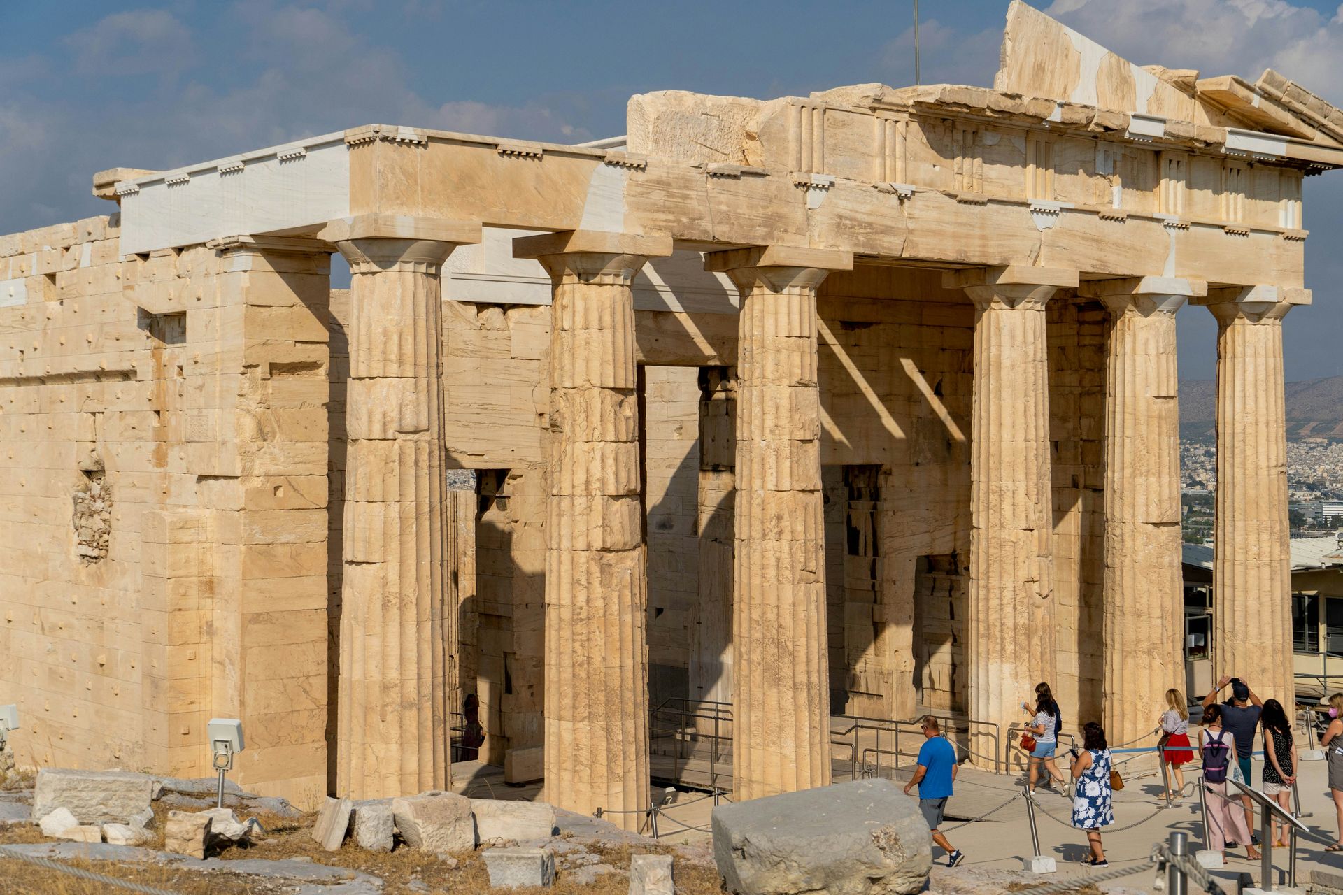
The Acropolis stands on a rocky hill above Athens, one of the most significant surviving monuments of ancient Greek civilization. The citadel’s most famous structure, the Parthenon temple, dominates the hilltop and offers views across the Greek capital that connect the ancient city to the modern one below. Construction of the Parthenon began in 447 B.C. and took roughly 15 years, producing a building so geometrically refined that its columns were made slightly curved to correct for the optical illusion of straightness that truly vertical columns create at that scale.
The Acropolis Museum, located at the base of the hill, complements the site by housing priceless antiquities and statues excavated from the area, with interpretive displays that explain ancient Greek society and the significance of what the hilltop once contained before centuries of war, occupation, and removal by foreign collectors. The museum is worth scheduling separately from the Acropolis itself, as the physical ruins above and the recovered objects below together give a fuller picture than either provides alone.
Spring and fall are the recommended visiting seasons, when temperatures are cooler, and visitor numbers are lower than the summer peak. The Acropolis in midsummer sun, at midday, in a crowd, is a genuinely uncomfortable experience, and the site’s exposed hilltop position offers no shade. Morning or late-afternoon visits during shoulder season put the light at angles that the marble responds to beautifully, and the Athens city view from the top changes character from dawn through dusk in ways that reward more than one visit. The Parthenon’s famously damaged state — the central roof is gone, the sculptures that once filled the pediments are split between the Acropolis Museum and the British Museum — gives the ruins a particular quality of speaking across distance to an original that visitors must reconstruct in imagination. The debate over the return of the Parthenon sculptures from the British Museum has made the Acropolis one of the most politically charged heritage sites in the world, as well as one of the most visited.
Florian Wehde / Unsplash
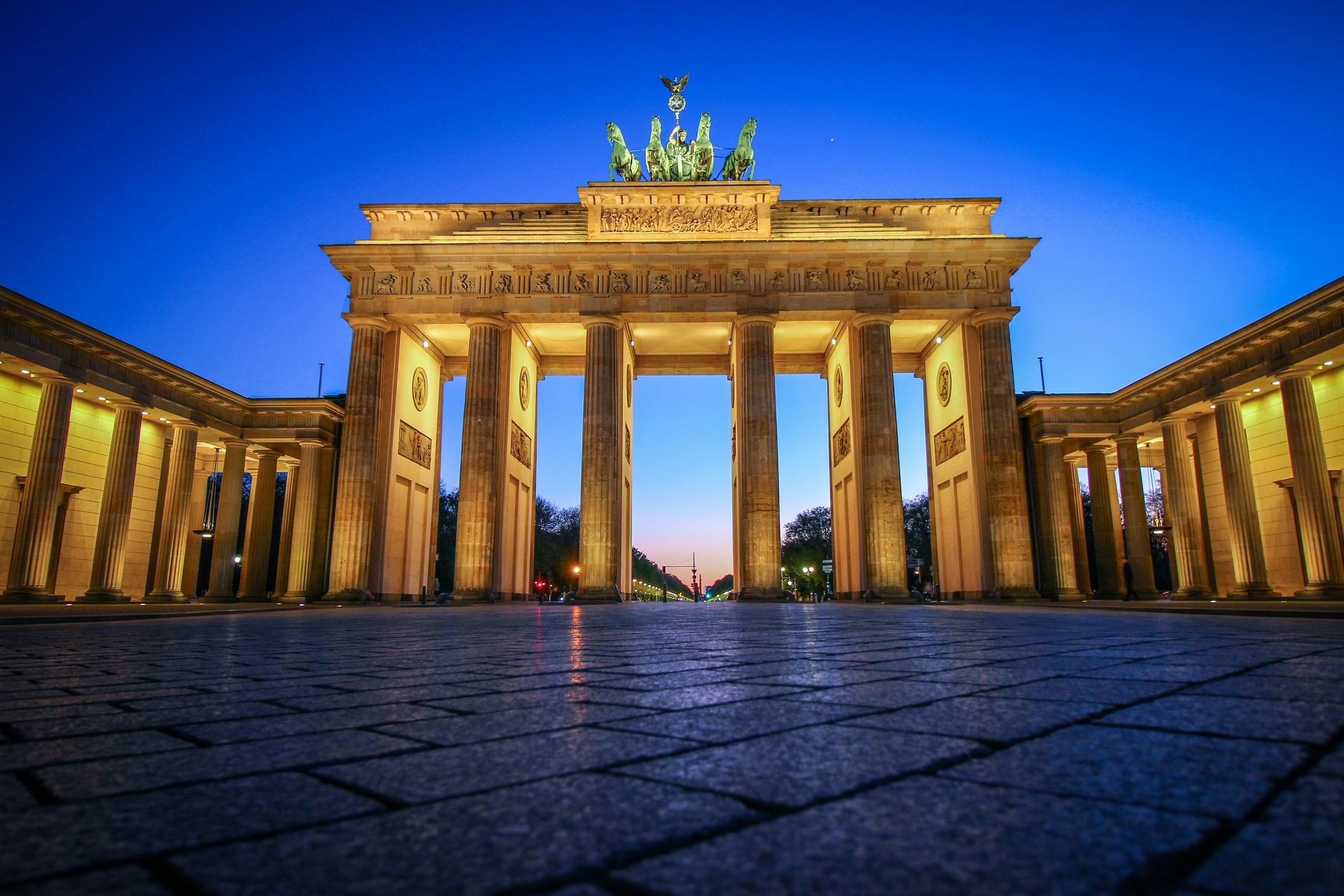
Builders completed the Brandenburg Gate in the late 1700s in the Greek Revival style, inspired by the entrance to the Acropolis in Athens. The approximately 85-foot-tall structure overlooks Pariser Platz, one of Berlin’s most architecturally refined squares, and is the only historical gate in Berlin that survived to the present. The gate sustained heavy damage during World War II Allied bombing campaigns, given its prominence as a symbol of the Third Reich, and restoration work completed in 1956 returned it to its current state.
The gate’s meaning changed fundamentally after Germany’s division and reunification. Standing at the border between East and West Berlin for 28 years during the Cold War, the Brandenburg Gate became the most visible symbol of a divided city and country. When the Berlin Wall fell in 1989, and Germany reunified the following year, the gate became the defining image of that event: the structure that had marked division now marking its end. That layering of meanings, from Prussian civic ambition to Nazi symbolism to Cold War division to reunification, gives the Brandenburg Gate a historical density that few landmarks anywhere carry in a single structure.
Entry is free, and the site is accessible at any time, making it one of the few major world landmarks with no cost barrier. Pariser Platz, which the gate frames at its eastern end, features embassies, hotels, and the rebuilt Adlon hotel — a Berlin institution — giving the immediate neighborhood a context that rewards exploration beyond a quick photograph. Protests sometimes gather around the gate, which should not deter a visit but will affect crowd levels on the day. The gate’s position as the starting point of Unter den Linden, Berlin’s historic boulevard, also gives it a natural connection to a long walk that passes through the center of the reunified city, lined with embassies, the Deutsche Oper, and Humboldt University, all the way to the Berliner Dom.
Thomas Griggs / Unsplash
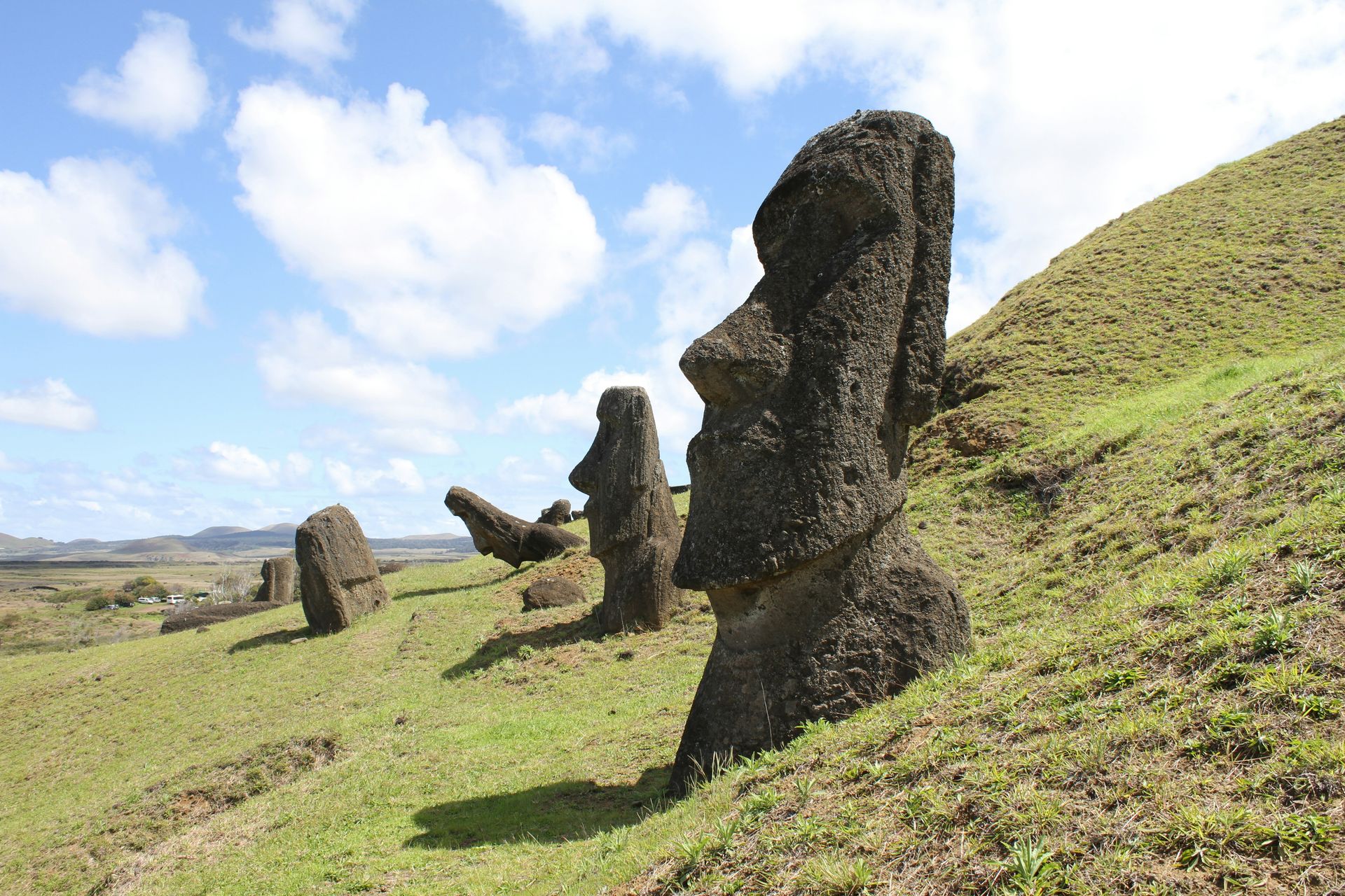
Easter Island sits approximately 2,200 miles west of Chile in the Pacific Ocean, making it one of the most remote permanently inhabited places on earth. The island is home to more than 1,000 moai, large humanlike stone monoliths carved by the island’s Polynesian settlers, the Rapanui, whose civilization and its decline remain subjects of ongoing research and debate. The largest moai, known as El Gigante, measures more than 70 feet tall and weighs at least 160 metric tons. The most photographed grouping is Ahu Tongariki on the southeast coast, where 15 moai stand side by side on the island's largest ceremonial platform, overlooking Hanga Nui Bay.
As of 2025, direct flights to Easter Island operate only from Santiago, Chile, meaning most international visitors need to connect through the Chilean capital. Higher prices are common during Chile’s summer season from December through March, and advance planning is important given limited flight capacity. Cruise ships also serve the island on select itineraries, providing an alternative access route for travelers whose schedules include a Pacific crossing.
The island’s isolation contributed to both the distinctive development of its culture and its vulnerability to the disruptions that followed European contact. Understanding the moai — why they were built, how the Rapanui moved them across the island without wheels, and why the civilization ultimately stopped building them — requires engagement with ongoing archaeological and anthropological conversations. A visit to the island puts the traveler directly into this debate. Easter Island is the kind of destination where the questions it raises are as compelling as the physical spectacle it offers. The sunrise over Ahu Tongariki, with the moai silhouetted against the Pacific horizon, is one of the most celebrated dawn views on earth. Many visitors time their stay to catch the first light of morning from the Ahu Tongariki platform.
