The yin and yang of satellite imagery shows the zen of storm formation
Weather satellites have been producing stunning images of the powerful bomb cyclone as it barrels across the northeast US.
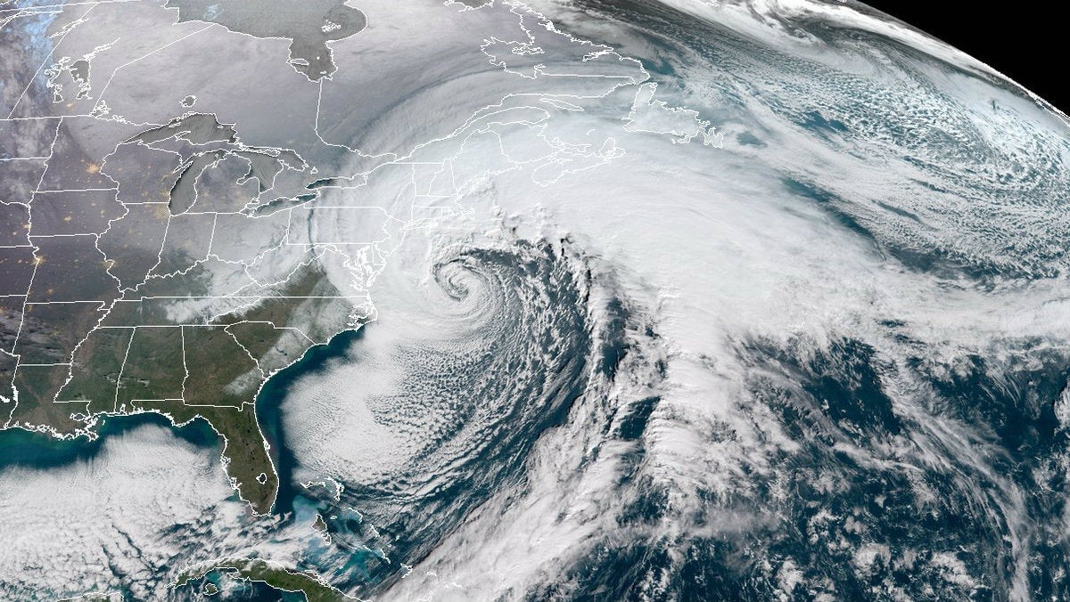

Weather satellites have been producing stunning images of the powerful bomb cyclone as it barrels across the northeast US.
The new GOES-16 satellite (Geostationary Operational Environmental Satellite), operated by the National Oceanic and Atmospheric Administration, has been capturing hypnotic, swirling shapes.
Stormy, yet zen-like
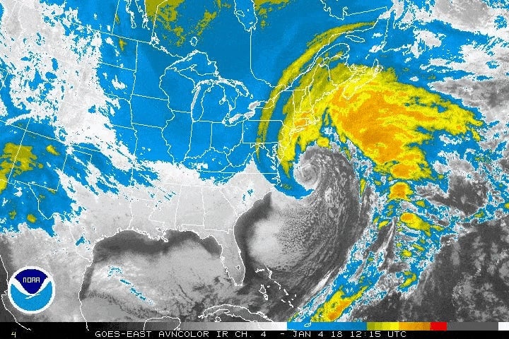
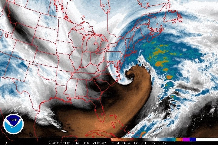
The swirling imagery is a result of the explosive cyclogenesis, also known as bombogenesis or a “bomb cyclone,” caused by a mass of cold air colliding with a warm one, resulting in a rapid drop in atmospheric pressure.
When the pressure plummets, air rushes to fill the spaces between the two masses, creating intense wind and strengthening the storm. As the air moves, the rotation of the earth creates a cyclonic effect that moves counterclockwise (clockwise in the Southern Hemisphere), causing winds to blow from the northeast—thus, a nor’easter:
The circulating winds cause the spiral shape to form as the masses of air circle around each other. GOES-16’s Advanced Baseline Imager (ABI) uses a camera sensitive to different wavelengths, resulting in images of storm formation that show the yin of the cold interacting with the yang of the warm:
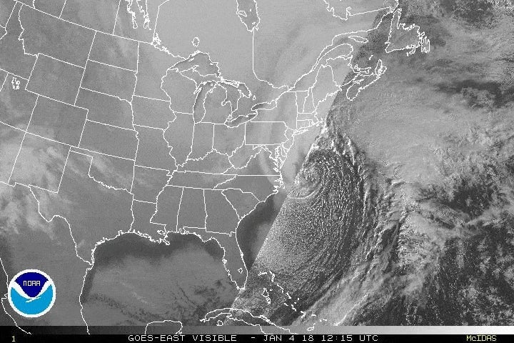
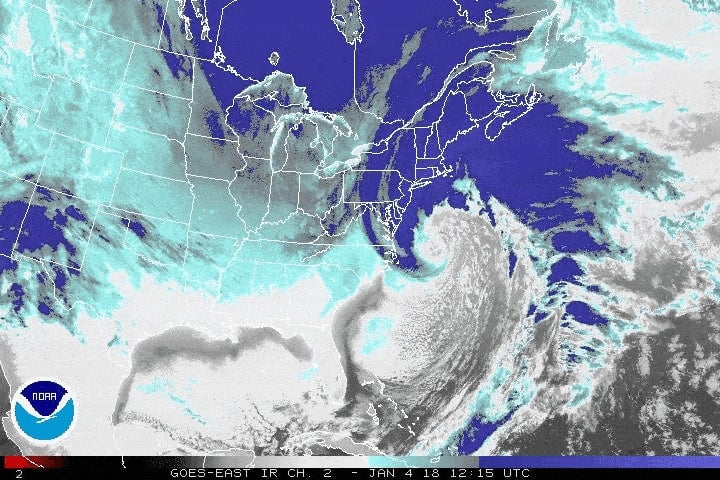
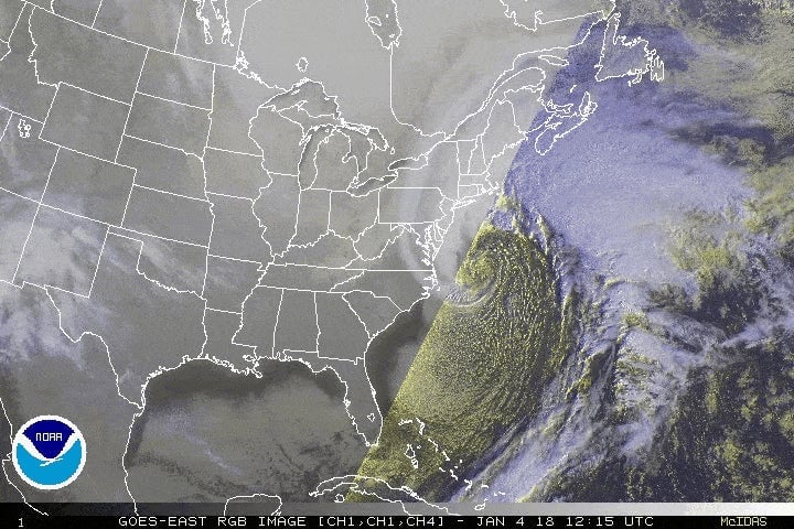
What makes GOES-16 imagery so powerful
Built by Lockheed Martin, the GOES-16, known as GOES-East, views the entire Western Hemisphere from 22,300 miles above. It is in a geosynchronous orbit as the Earth rotates, so it stays in the same place relative to the surface, capturing the same geographic region 24 hours a day.
The satellite is the first to offer ultra-high-definition imagery and gives forecasters their best-ever views of severe weather systems across North America.
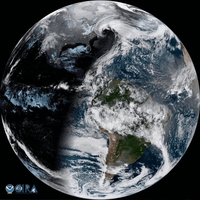
The satellite was launched in November 2016 and after a year of testing, officially joined NOAA’s operational network in December. GOES-East is the first in a series of satellites that will provide HD imagery.
“For weather forecasters, [GOES-East] will be similar to going from a black-and-white TV to super-high-definition TV,” Stephen Volz, assistant administrator for NOAA’s Satellite and Information Services Division, told Space.com before the launch.
GOES-East has better resolution and quicker updates than previous weather satellites. It uses the high-performance ABI camera, a sensor to monitor solar activity, and is NOAA’s first satellite to carry a lightning mapper. The ABI uses 16 filters to capture images in visible and infrared light, a major improvement over previous GOES satellites, which only used five imaging filters.
GOES-16’s primary scanning camera can also simultaneously capture images of active weather as often as every 30 seconds, the entire continental US every five minutes, and the Western Hemisphere every 30 minutes.
GOES-17 is set to launch in March, and two more Lockheed Martin-built GOES satellites are scheduled for launch in 2020 and 2024.