Just enough snow fell in the Sahara to be visible from space

This Landsat image shows snow rising with the local elevation near Aïn Séfra in the Sahara desert.
Image: NASA Earth Observatory/Joshua Stevens
By
We may earn a commission from links on this page.

Snow fell in the Sahara desert this week, temporarily transforming the red, arid hills and mountains outside of Aïn Séfra, Algeria, into a silky white landscape.

Snow is the region isn’t unheard of—there was a similar accumulation in late 2016. (Prior to that, the last significant recorded snowfall was 1979.) This week, when photographers captured the brief snowfall in person, some of the best images came from satellites.

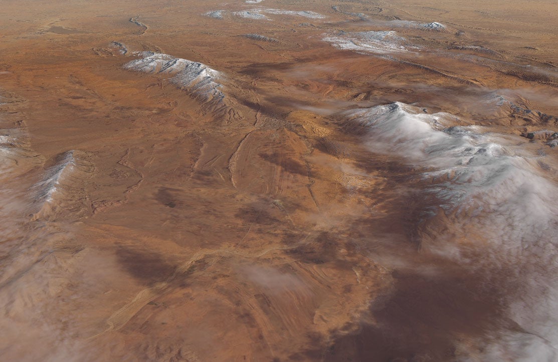
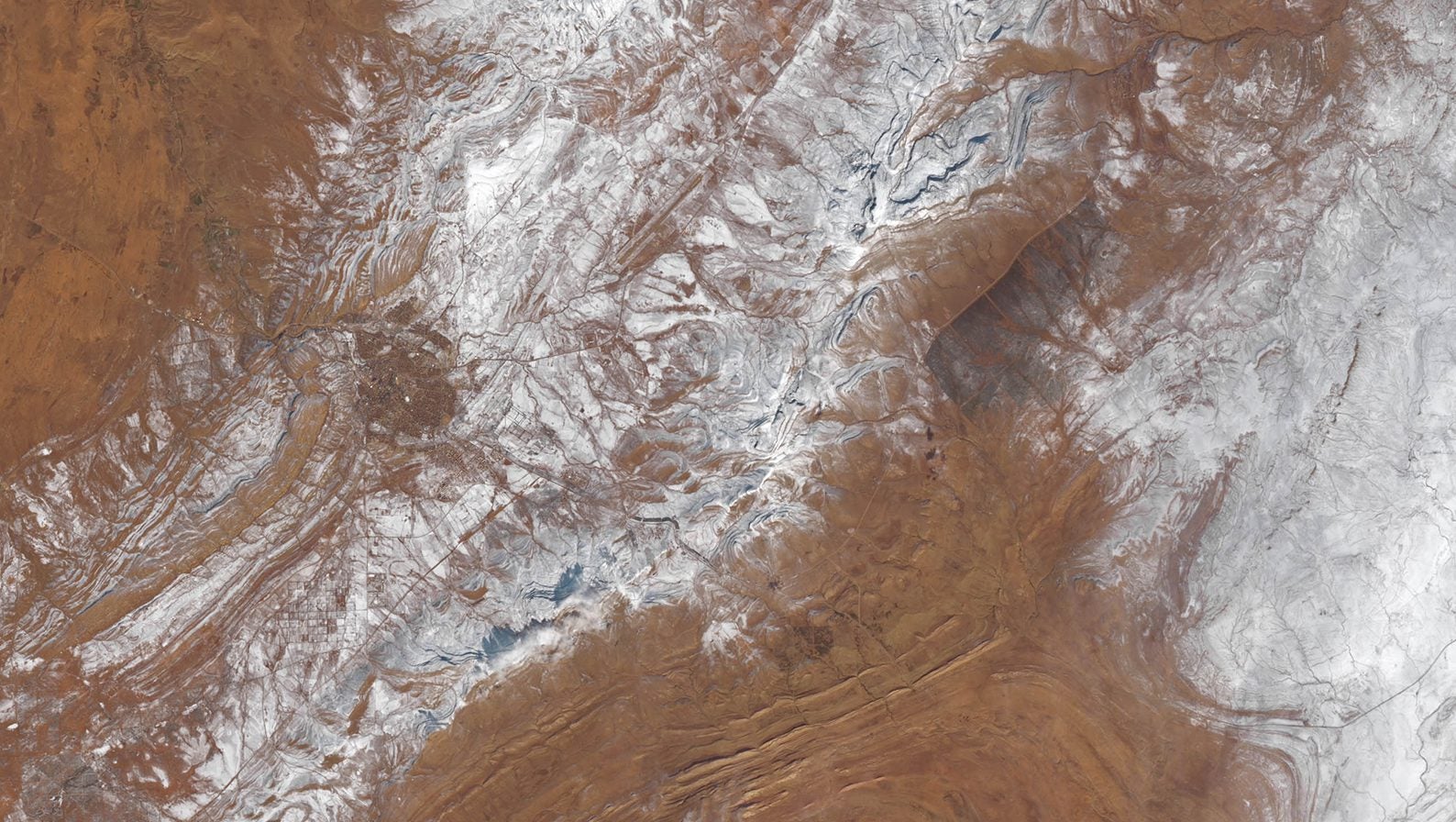
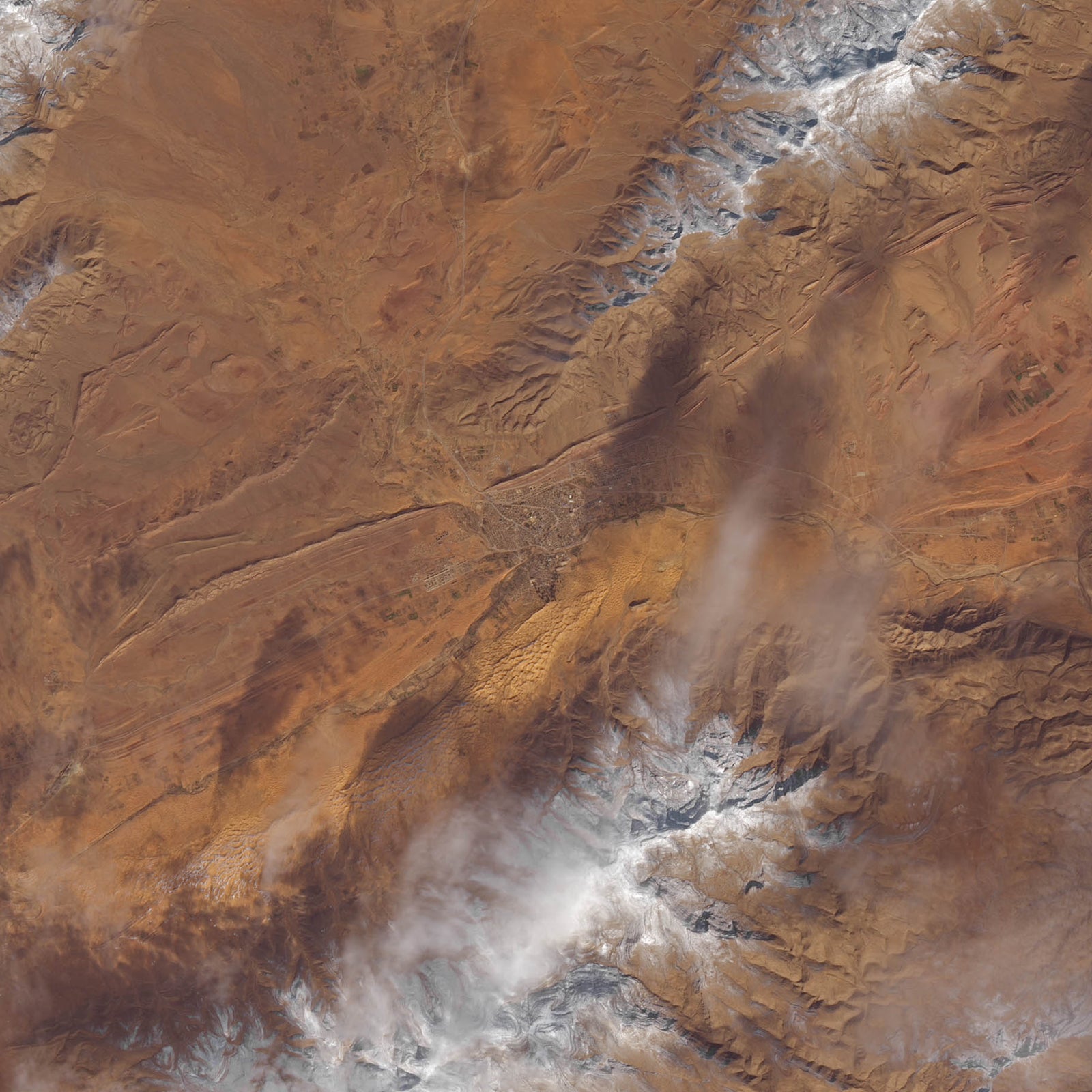
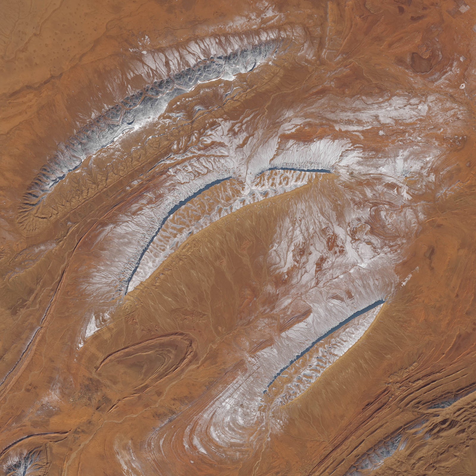
Imagery from NASA’s Landsat 8 shows the snowfall as of Jan. 8, in the context of a wider view of the area. These are cropped portions of much larger image available to view on NASA’s website.

The town of Aïn Séfra, wedged between two mountains in Algeria, as seen from space
Image: NASA Earth Observatory/Joshua Stevens
The snow near Aïn Séfra.
Image: NASA Earth Observatory/Joshua Stevens
Another view of the snow near Aïn Séfra..
Image: NASA Earth Observatory/Joshua Stevens

Additionally, NASA overlayed their color imagery over a topographical model, producing a virtual pilot’s eye view of the mountains from above.

A virtual flyover.
A virtual flyover.
Image: NASA Earth Observatory/Joshua Stevens