Donald Trump’s administration is struggling with Asian geography—not a good idea in an area of the world where sensitive territorial disputes abound. India regularly punishes people who show disputed territories as not belonging to its landmass. Vietnam refused to stamp Chinese passports that depicted a disputed area as belonging to its larger neighbor.
Donald Trump’s administration is struggling with Asian geography—not a good idea in an area of the world where sensitive territorial disputes abound. India regularly punishes people who show disputed territories as not belonging to its landmass. Vietnam refused to stamp Chinese passports that depicted a disputed area as belonging to its larger neighbor.
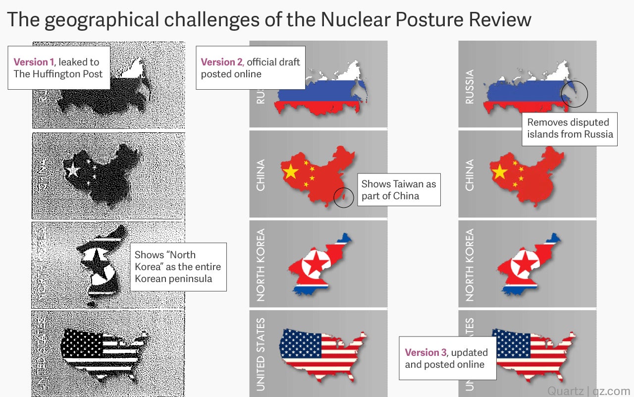
The administration’s Nuclear Posture Review, first leaked to The Huffington Post, had to go through multiple revisions before getting Asian geography right.
Join 500,000+ readers who start their day with Quartz.
By subscribing, you agree to our Terms of Service and Privacy Policy.
The initial leaked version made an egregious error: it labeled the entire Korean peninsula as “North Korea.” This is not just some obscure disputed territory; it threw all of South Korea in with the North, with the latter’s flag superimposed. It was if Kim Jong-un had finally made good on his family’s long-standing promise to unify the Koreas.
The official version released online fixed that problem, showing just the North. But it introduced another major mistake by including Taiwan in the map of China. “There was an error printed in the 2018 Nuclear Posture Review,” a Pentagon spokesperson told the Japan Times when they asked about the inclusion of Taiwan. It was as if China had finally invaded the self-governing island it has long considered a renegade province.
That second version was taken down for several hours. Then a third was released, which removed Taiwan from the China map. But that latest version also removed the entire Kuril island archipelago. These islands are under Russian jurisdiction, but the two furthest south are claimed by Japan. It was as if the Pentagon didn’t want to get involved in any more mapping disputes.