Here’s how fast a glacier can slip into the sea once it’s destabilized
There’s a foreboding climate-change lesson nestled in the Chugach Mountains of southeastern Alaska. Or rather, the lesson is in the 12-plus miles of bare sea and land where a glacier once stood.


There’s a foreboding climate-change lesson nestled in the Chugach Mountains of southeastern Alaska. Or rather, the lesson is in the 12-plus miles of bare sea and land where a glacier once stood.
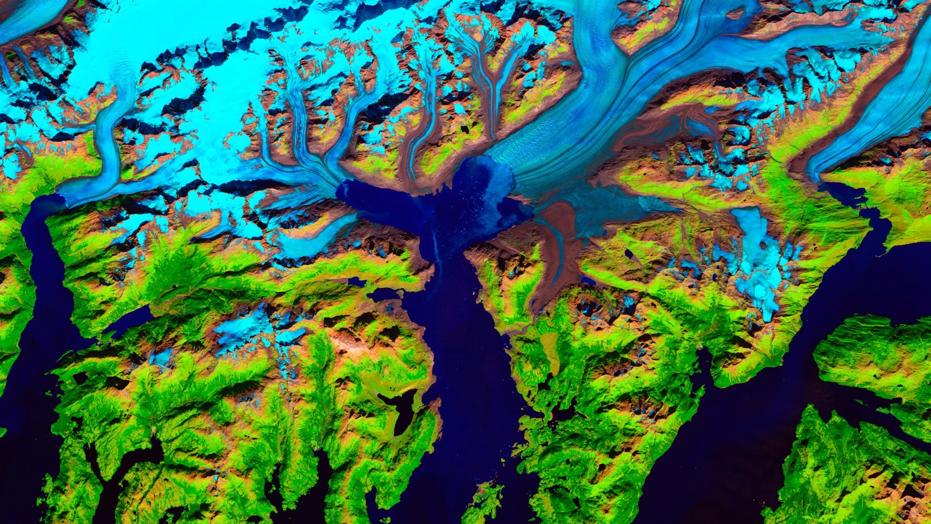
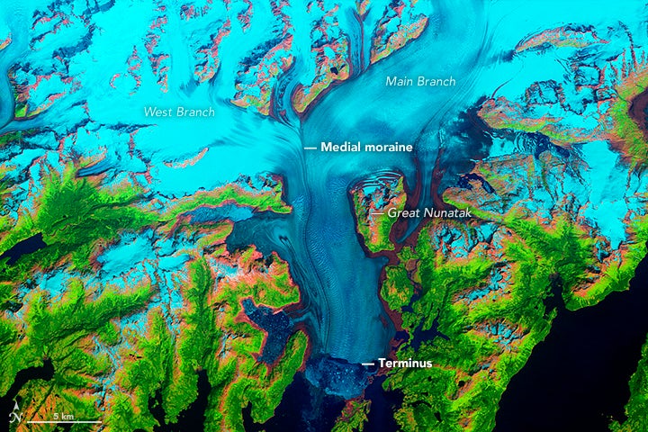
When a British expedition led by George Vancouver first surveyed it (pdf) in 1794, the Columbia Glacier was a site to behold: It snaked 43 miles (70 km) through the Chugach Mountains before meeting the sea, where it extended to nearly fill the Columbia Bay in the Prince William Sound. And that’s where it stayed, more or less, until the mid-1980s, when its “terminus” (the nose of the glacier) slipped off its “moraine” (an underwater ridge of ice and rock, built by the force of a glacier over time, that holds a glacier in place).
That initial slip completely changed the fate of the Columbia Glacier, and it was likely due to climate change. At that point, warming temperatures in the northern latitudes had begun to reshape the frozen north in myriad ways, heating permafrost and raising average winter temperatures above freezing, which reduced annual snowfall. Recent research (pdf) found that, by 1980, an increase in summer air temperature in the region by an average of 1°C (1.8°F) over pre-industrial levels had thinned the glacier just enough to slip its moraine, destabilizing it completely.
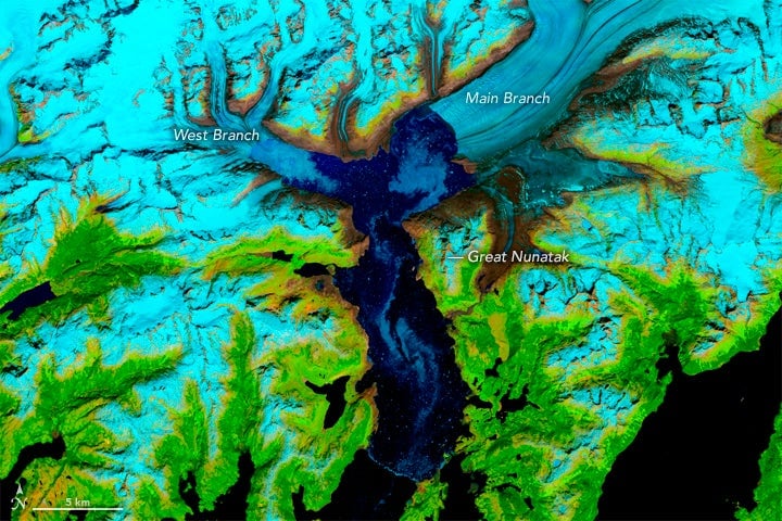
These images and the ones below are from EarthTime, a collaborative project between Carnegie Mellon University and the World Economic Forum.
Glacial dynamics physics took it from there. Once the Columbia lost its toehold on its moraine, it began hemorrhaging ice at an astonishing pace. It became locked in feedback loop: Each time ice broke off, the ice behind it would slide unimpeded forward and break off again, conveyer-belt style.
Icebergs began to fall off the glacier, first in smaller pieces, then in larger chunks after the nose of the glacier began to float around 2007. (Even “small” icebergs are dangerous; the Exxon Valdez oil spill was triggered by a tanker running aground trying to avoid a Columbia Glacier iceberg in 1989.)
The Columbia Glacier is losing an average of 4 billion metric tons of ice per year, making it a major contributor to the roughly 75 billion metric tons of ice that Alaskan glaciers have lost annually for the past two decades, and which are responsible for 0.2 millimeters of global sea level rise per year. That sounds like a negligible amount, but seas are rising globally an average of 3.2 mm per year. That means melting Alaskan glaciers are responsible for 6.25% of the total sea level rise per year, despite holding just 1% of the planet’s total glacial ice.
Plus, 75 billion metric tons is enough water to cover the state of Alaska in a foot-deep (30 cm) flood every seven years.


In the past three decades, the Columbia Glacier has retreated 12 miles, coiling back north towards the mountains where it began. NASA calls it “one of the most rapidly changing glaciers in the world.”
The hemorrhaging is expected to continue until about 2020, when models predict the glacier will have retreated enough to once again find stable footing and begin rebuilding its moraine. By then, it will be 15 miles farther inland than it was in the 1980s.
“It shows that a small temperature increase of less than 2°C is sufficient to destabilize a glacier,” Chris Rapley, a climate scientist at University College London who authored a paper on the glacier’s future restabilization, told the New Scientist. It also shows that we still have a lot to learn about ice dynamics; the ability of glaciers to start and stop retreats makes it exceptionally hard to accurately predict future sea-level rise from temperature rise alone. But by studying the Columbia Glacier, Rapley hopes to get a better idea of how tidal glaciers like it react to a changing climate given their physical conditions—which could help scientists make better predictions about global sea-level rise.