Descartes Labs unleashes machine learning on space data
Satellite imagery across the visual spectrum is cascading down from the heavens. The challenge is to figure out how to process it, learn from it—and monetize it.


Satellite imagery across the visual spectrum is cascading down from the heavens. The challenge is to figure out how to process it, learn from it—and monetize it.
Advances in distributed processing and machine learning have made it possible for researchers to manipulate and analyze data on, well, a planetary scale. Descartes Labs, a company spun out of the Los Alamos National Laboratory in New Mexico, is one of the leaders in the field. Now, its tool for leveraging Earth-observation data on a large scale is now available.
The lofty ambition is to model the world.
“After SimCity but before SimAnt, there’s this forgotten game called SimEarth,” Mark Johnson, Descartes’ CEO, recalled in a conversation with Quartz. “The idea was to try to take a planet from single-cell life to multi-cell life. When we were first starting the company, we thought, could we actually build a SimEarth? That’s a lofty goal but that’s the kind of thing, with computational power and new data coming online, that may be decades out rather than centuries out.”
Another analogue might be Mathematica, the computation program that became de rigueur for anyone doing advanced work in statistics, physics and other calculation-heavy fields. “Right now, data science requires a lot of skill, there’s no way to avoid math, stats, computer programming,” Johnson said. “But making the data easier to manipulate, that’s the job of a data refinery.”
Farm data to count on
Descartes is offering users, mostly scientists, the ability to run machine-learning algorithms on a massive set of satellite data, including exclusive access to imagery collected by the European aerospace giant Airbus, which snaps photos of the entire world once a quarter at a resolution of half a meter per pixel. The platform also integrates a database of weather information, which can help analysts looking for information about agriculture and shipping.
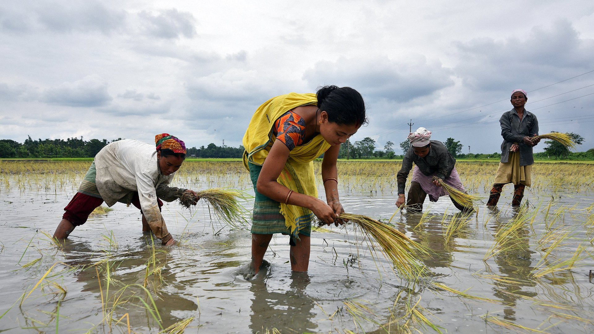
One researcher, Caitlin Kontgis, came to Descartes from her Ph.D. program in geography at the University of Wisconsin. She had focused her work on the Mekong Delta, the multi-country region that produces the majority of the rice in the world and can harvest three times a year, thanks to Southeast Asia’s climate, water and modern strains of rice.
Our information about global rice production is fairly limited, however. Descartes’ first major project was building a model of global corn production, which it could do thanks to the distinctive look of corn from orbit and the large-scale, industrial nature of its production. Rice paddies are often obscured by clouds and flooded with water, making them hard to distinguish from orbit, and typically tilled on a small scale by individual farmers.
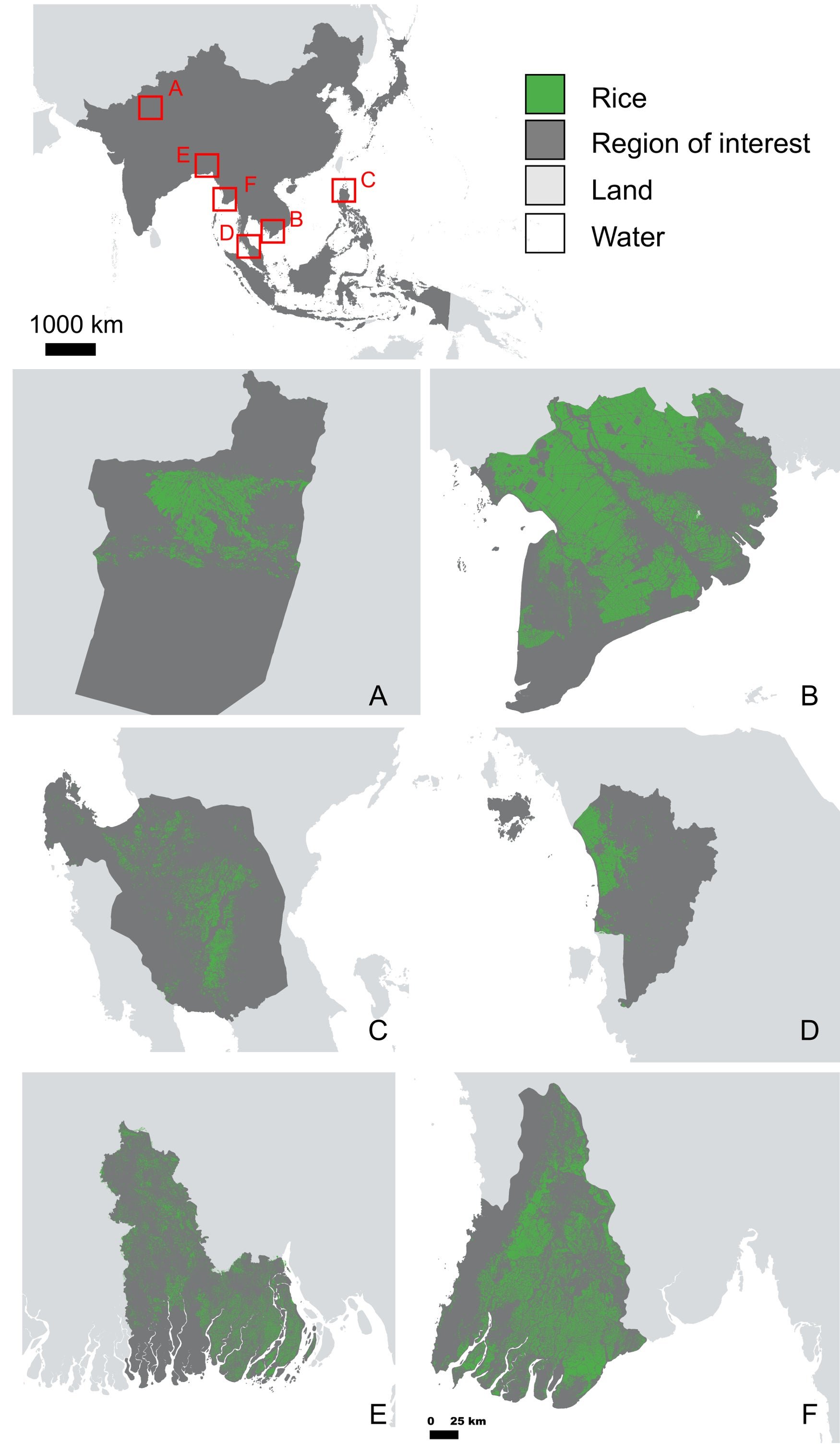
One of the data sets at Descartes, synthetic aperture radar from the European Space Agency’s Sentinel satellite, can see through clouds to the earth’s surface. Using that data and her experience doing on-the-ground fieldwork in Vietnam, Kontgis was able to “train” an algorithm to identify rice-growing acreage on the Mekong Delta from space.

What happened next, she says, demonstrates the robustness of Descartes’ tools. With the algorithm developed, Kontgis could use the company’s platform to deploy it across southeast Asia, automatically counting rice acreage throughout the region.
“The models I was running during my Ph.D. on the Mekong Delta on a university server would have to run overnight,” she says. “This is doing it for every Sentinel 1 pass over all of Asia, and it’s just taking a couple of hours.”
The data will interest everyone from local governments to food security NGOs to agribusiness. DARPA, the US military’s advanced research office, working with Descartes to track grain production in the Middle East as a leading indicator of potential conflicts, is interested in looking at rice harvests as well.
As the company grows its product offering, it hopes that “the information advantage from owning assets will erode.” That’s a pretty radical proposition—that anyone will be able to know as much about rice production—or copper shipping, or oil extraction—as the people who own rice paddies, copper mines and oil refineries.
Descartes, which raised $30 million last year in its second fundraising round, isn’t the only player in this field. Orbital Insight is another firm that promises to use data science to monetize information from space. Planet, a company that now operates the most commercial satellites in the world, is now focusing on developing its own platform to serve data from their spacecraft and others directly to customers.
Correction: An earlier version of this piece misreported Caitlin Kontgis’ alma mater.