What’s behind the record-setting snowstorms in the US west
It’s been an odd winter in the US. Except for a brief polar-vortex-induced cold snap that plunged swaths of the northeast and midwest into frigid temperatures, much of the country has experienced a relatively mild winter.


It’s been an odd winter in the US. Except for a brief polar-vortex-induced cold snap that plunged swaths of the northeast and midwest into frigid temperatures, much of the country has experienced a relatively mild winter.
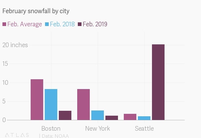
Yet in the past month, four snowstorms hit the Pacific northwest in nine days and Seattle ran up the highest February snowfall totals in decades. In the usually arid southwest, Flagstaff smashed its single-day snowfall record and Las Vegas recorded a measurable amount of snow for the first time in a decade. The snow anomalies reached all the way to Hawaii, where Maui saw snow at the lowest elevation ever recorded.

Many news accounts have suggested climate change might be at work, supercharging extreme winter weather. The full explanation, meteorologists warn, is a little messier.
“The simple way to put it, and it fits disgustingly well in this case, is shit happens,” said Washington state climatologist Nick Bond.
The main culprit is a high-pressure system—which pushes air away from its center and generally creates lower temperatures and clear, cloudless skies—that formed off the coast of Alaska at the beginning of February. The system created a bend in the jet stream, the band of air that usually spins an uninterrupted loop around the Arctic. As a result, cold air from the Arctic got sucked south along the West Coast, while warm air from the midlatitudes went north over Alaska.
There is some evidence that climate change could make the jet stream more likely to meander. Normally, the jet stream follows a straight path between cold air in the Arctic and warmer air in the mid-latitudes. But as the polar regions heat up, the temperature difference between the Arctic and mid-latitudes is getting smaller, and the jet stream may be getting wavier.
In any case, this winter, air swirled around the high-pressure system off the coast of Alaska, picking up moisture over the Pacific that fell as snow when it passed over the northwest. This weather pattern stuck around throughout February, growing strongest in the middle of the month when it whipped snowstorm after snowstorm into Washington.
“Sometimes these systems can set up and be there for five days, and other times they’re there for 30 days,” said Bond. “There is just a very important random quality to that.”
Why Maui got all that snow
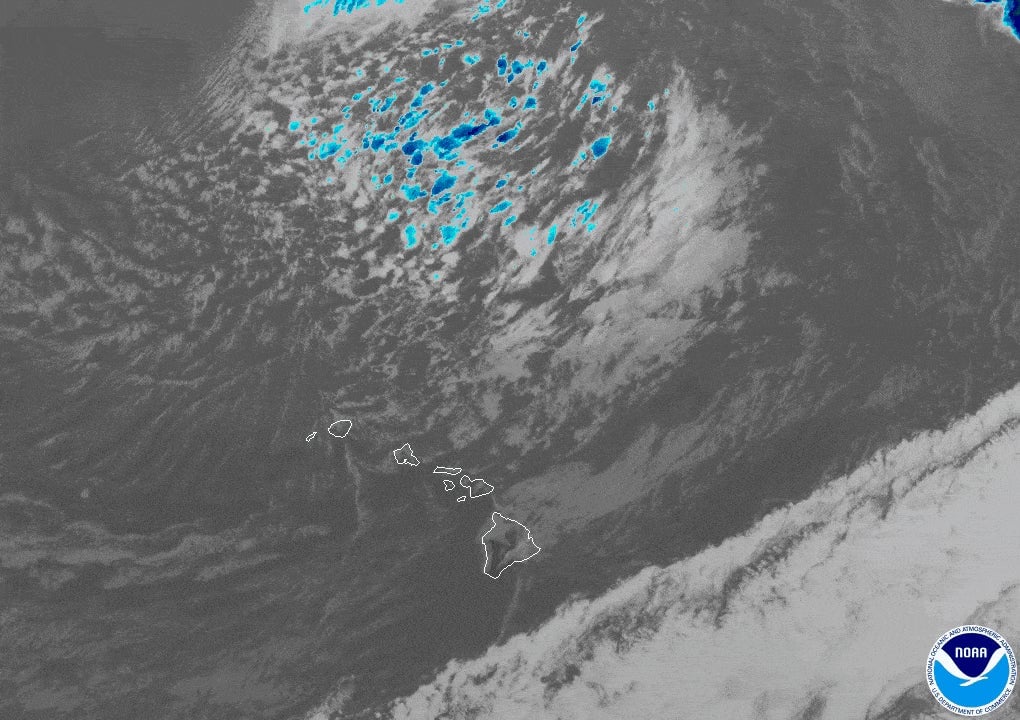
While the high-pressure system held near Alaska, low-pressure systems—which pull air in toward their center and often create clouds and precipitation—formed further south. On Feb. 11, as the meandering jet stream poured cold air toward Hawaii, a low-pressure system brought that record-breaking snow in Maui.

Alison Nugent, an atmospheric-sciences professor at the University of Hawaii at Mānoa, stressed that the weather pattern that caused the snow isn’t so unusual. “The winter is our wet season, so it’s not abnormal for low-pressure systems to bring precipitation and stormy weather,” she said.
In fact, most precipitation starts off as snow in the colder, higher altitudes of the atmosphere. As it falls, it might hit warmer air closer to the Earth’s surface and become rain. This time, there was enough cold air hanging low over Maui that the snow didn’t melt—it stuck to the slopes of Haleakalā, the island’s biggest volcano, and piled up.
“The islands are small and the Pacific is really large,” said Nugent. “You could have low-pressure systems breaking off and causing snow over the ocean all the time, but if you don’t have a little island there to catch it, you wouldn’t notice it.”
About those flakes in Flagstaff and Vegas
In the desert southwest, cold air from the arctic, a low-pressure system and “atmospheric rivers” of moisture from the tropics converged to blanket Flagstaff and dust Las Vegas with snow on Feb. 21-22.
“In February we’ve been stuck in this pattern that favors extreme precipitation,” said Thomas Galarneau, a professor of hydrology and atmospheric sciences at the University of Arizona.
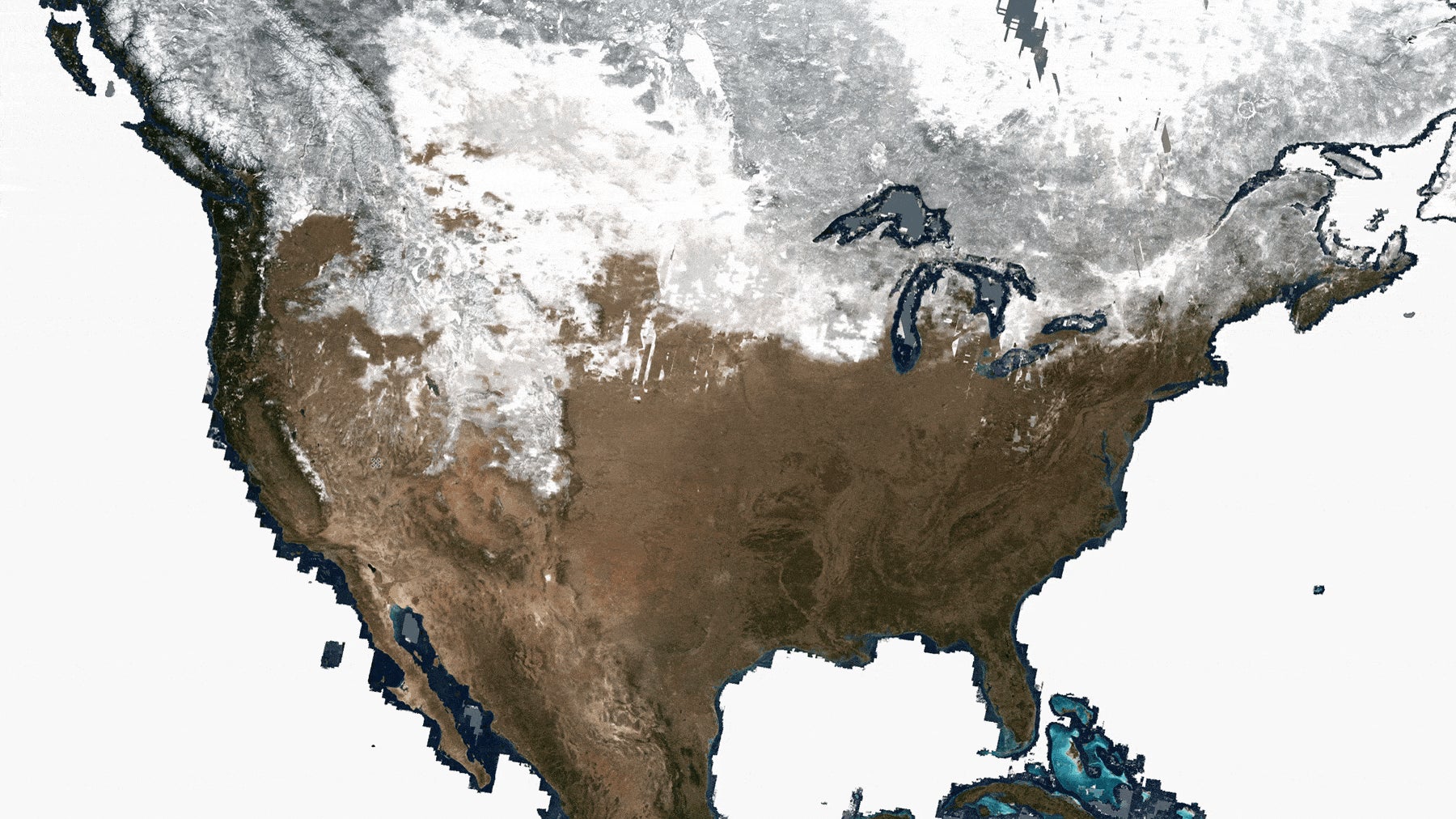
Aside from the extreme storms that have grabbed headlines this month, Washington State University climate scientist Deepti Singh points out that average temperatures across the US are warmer than normal. In fact, the season’s heavy snowfalls have only just begun to return mountain snowpack to normal levels. (You can compare last year to this year in the Sierra Nevada mountain range by using the slider on the image above.)
“We tend to compare what we experience today to what we’ve experienced in the past few years, and we tend to forget that having snowfall and cold conditions in winter is not abnormal,” Singh said. “It seems unusual because we’re getting used to warmer conditions.”