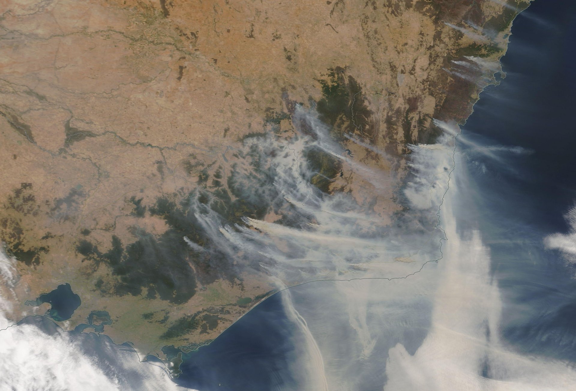
How Australia’s massive bushfires are generating thunderstorms
Big natural disasters can create their own weather systems. The Australian bushfires are now so intense that they’re starting to make thunderstorms.


Big natural disasters can create their own weather systems. The Australian bushfires are now so intense that they’re starting to make thunderstorms.
On Jan. 3, Australia’s meteorology bureau issued a severe thunderstorm warning for East Gippsland in Victoria. The thunderstorm condition is also happening in New South Wales, another state with intense fires and smoke.
The bureau explained the formation of fire-generated thunderstorms on social media:
Essentially, when hot air and smoke from bushfires rises and meets cool air from the atmosphere, it turns into pyrocumulus clouds, also known as “fire clouds.” These rare and dangerous clouds form fast and move quickly, creating gusty winds and thunderstorms.
The thunderstorms can lead to two atmospheric events that could quickly damage a large area: downbursts and lightning.
In the event of a downburst, the cooling wind can travel as fast as 170 miles per hour (270 km/h), knocking over fully grown trees. In the rare case when there might be water vapors in the air, it could cause a “rain bomb.” And if lightning occurs, the initial fire could spread quickly to other areas.
The pyrocumulus clouds in southeastern Australia are visible from the time-lapse video captured by satellites before the thunderstorms hit:
As global temperatures rise, pyrocumulus clouds may become more common. A similar fire-induced weather system took place during California’s wildfire season in 2018. The state’s hilly terrain created perfect conditions for not only thunderstorms, but fire tornadoes. An unprecedented number of wildfires in north Russia and the Arctic Circle in the summer of 2019, as captured by satellite images, contributed to an increase in lightning strikes in the North Pole.