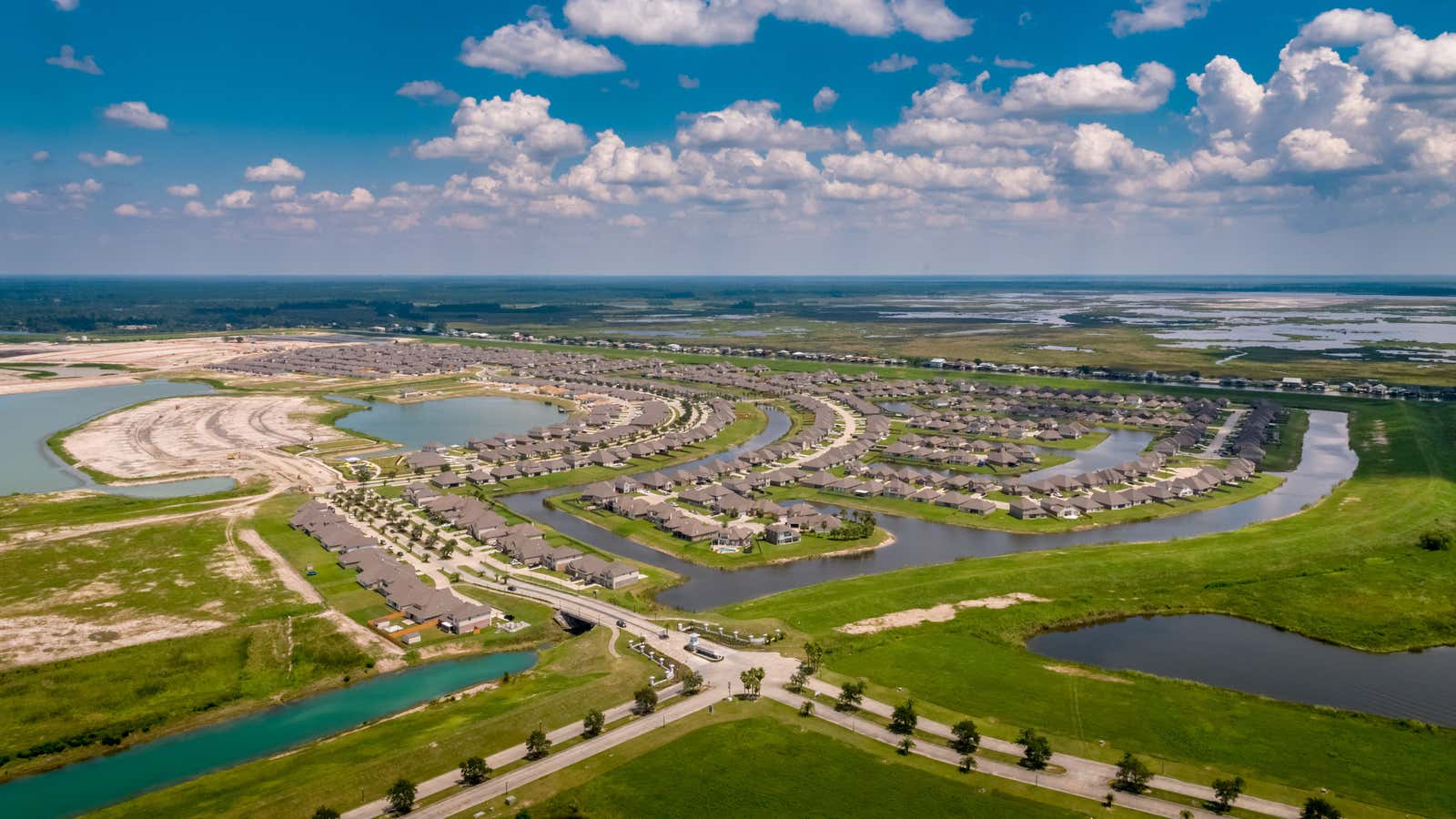
In the 19th and early 20th centuries, St. Tammany parish was a rural, sparsely populated corner of southeastern Louisiana best known for sawmills and a smattering of fancy resorts. It hugs the north shore of the vast estuary known as Lake Pontchartrain, whose opposite shore abuts New Orleans. In 1969, a 24-mile bridge was completed to connect the parish (Louisiana’s term for county) directly to the city, turning St. Tammany into a wealthy, predominantly white suburb.
Then, after Hurricane Katrina slammed into Louisiana in 2005, the parish began to adopt a new identity. St. Tammany became a place of refuge from the environmental hazards—storms, sea level rise, land loss—that plague New Orleans and other parishes on the outer fringes of the Louisiana coast.
At least 70% of the population of New Orleans fled the city immediately before and after Katrina, which became by far the most destructive natural disaster in US history—in part because the flooding caused by catastrophic levee failures was exacerbated by sea level rise. In the 15 years since, as the city has painstakingly rebuilt, many have returned home. But today, the city still has about 60,000 fewer residents than before the storm.
St. Tammany, though, was spared catastrophic levee failures. It remained relatively dry, and reopened quickly.
“You could get back into St. Tammany after just a few hours,” said Colette Pichon Battle, a native of the parish and executive director of the Gulf Coast Center for Law and Policy, a nonprofit law firm that focuses on environmental justice issues.
St. Tammany became a staging area for emergency relief efforts and a repository for debris from New Orleans. It also became a refuge for evacuees, hosting more than anywhere except Jefferson parish, which abuts the city to the west. As the immediate crisis passed, many decided to stay rather than take another chance on the Big Easy.
“Within a year or two you started to see that the housing that could come up most quickly was in St. Tammany,” said Battle, whose firm is based in Slidell, the parish’s largest city. “That was the place to go to rebuild.”
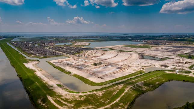
The post-Katrina population influx created some predictable problems: grinding traffic, overloaded classrooms, and a sudden boost in housing demand and costs. It also turned up the heat on simmering racial tensions. The incomers, including middle-class Black families from New Orleans and Hispanic families from across the American South who came for jobs rebuilding the gutted city, were significantly more diverse than existing residents—one of whom was David Duke, the infamous Ku Klux Klan leader.
“What you saw was a browning of this parish,” Battle said. “The growth and the demographic shifts were really freaking people out.”
That growth has not waned. St. Tammany is now one of the fastest-growing parishes in the state. Its population has quadrupled since 1970, to a quarter million, and is expected to double by 2030. According to a growing body of evidence compiled by researchers and state officials, an increasing share of that growth will be the result of regional inter-parish migration motivated by climate change and other environmental pressures. And the parish—like other potential climate havens across the state—isn’t ready.
“If you’re from St. Tammany, you’re experiencing a tidal wave of people,” Battle said. “It feels like a deluge.”
Reckoning with a changing landscape
Louisiana could be the first state in the US to witness large-scale climate change migration—not only a mass flight from specific catastrophes like Katrina or August’s Hurricane Laura, but a gradual accretion of decisions, made by one family at a time, to move to higher ground.
Some of these migrants will choose lower-risk places like St. Tammany as their destination, as a combination of sea level rise and land subsidence cause the Mississippi Delta region to lose about a football field’s worth of land every hour and a half. Already, the population is falling in high-risk parishes and growing in lower-risk ones, according to a major report the state produced last year: Strategic Adaptations for Future Environments, or LASAFE. Others will be relocated to destinations explicitly designed to accommodate climate migrants.
How will history remember the cities that adapt to climate migration? Visit the museum exhibition for Leeside, climate haven of the future.
Since Katrina, the state has undertaken what could be the world’s most ambitious coastal adaptation planning process. It includes a $50 billion, 50-year “master plan” to upgrade protective infrastructure and ecosystems, and LASAFE, which aggregated the results of a series of community-level planning workshops. It also includes the wholesale relocation of one community at exceptionally high risk: Isle de Jean Charles, whose residents are often referred to as America’s first climate refugees.
Mass population movement is a pervasive theme of these programs. But the task of mitigating further damage, especially to New Orleans itself, has been so all-consuming that communities on the receiving end of migration are only just beginning to grapple with the challenges and opportunities ahead.
“The state has inched towards dealing with this in the last decade,” said Christopher Dalbom, assistant director of the Institute on Water Resources Law and Policy at Tulane University. “I think we’re trying to make the vulnerable communities more livable. But how is Louisiana preparing receiver communities? I don’t think we are.”
LASAFE produced the first look at what that planning might entail. It began in 2017 as an effort to elicit input directly from residents of six coastal parishes, including St. Tammany, about their hopes and apprehensions about the future.
“The coastal master plan offers a very sophisticated picture of where the barriers are to protecting coastal wetland, and where we expect communities to disappear,” said Liz Williams Russell, coastal community resilience director at the Foundation for Louisiana, an advocacy group that worked with state officials on the process. “So how do we take that information about the physical ecosystem and plan around that?”
Over the course a year, Russell and her colleagues conducted 70 meetings with 3,000 residents across the six parishes, gathering data on population movement, flood risk, and other key facts. Then they solicited proposals for a slew of development projects ranging from parks to small business incubators.
The report concluded that “Louisiana is in the midst of an existential crisis.” It recommended that low-risk areas prepare for larger populations—including St. Tammany, which it identified as a key migrant destination.
By 2030, one projection in the report estimated, the parish’s current pace of development will consume half of its open land. To develop affordably and safely, the LASAFE report recommended that St. Tammany concentrate its future development in the lowest flood risk areas (defined as those outside the 100-year floodplain), which occupy a majority of the parish’s land but tend to be underdeveloped. It also included a pitch for a compact, mixed-use, flood-resistant pilot neighborhood designed by the Urban Land Institute, a Washington DC-based think tank, as well as a $11.5 million drainage system intersected by hiking trails.
The drainage system is currently being designed, but as for the report’s other recommendations, the parish appears to be moving in the opposite direction, Russell said. As local officials push to expand the parish’s tax base as much as possible, low-cost development outweighs considerations about flood risk in the permitting process, she said. Those looking for safety in St. Tammany could find themselves right back in the flood zone.
Meanwhile, the site for the ULI pilot neighborhood, near the small town of Hickory, is tied up in litigation over federal habitat protections for the endangered dusky gopher frog. And one rapidly-growing subdivision outside Slidell that Battle said is being marketed to incoming Black families is situated next to both a high-risk flood zone and a former Katrina debris dump.
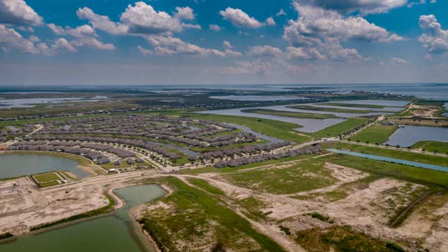
“In St. Tammany, there’s more and more attention on expanding development,” Russell said. “But in terms of creative management, I don’t see that yet.”
A new isle
In the case of Isle de Jean Charles, the state had an opportunity to build a climate haven from scratch for the island’s few dozen families. The destination: a former sugarcane farm just under one square mile in area, about 40 miles north of the original island, near the town of Schriever, Louisiana.
At first blush, relocating a single bayou community might seem a simpler task than re-inventing a parish to accommodate hundreds of thousands of new residents. But the process, which will have taken nearly two decades from first conception to final construction, has revealed a cultural and logistical minefield, opened rifts in the community it was meant to unite, and will ultimately leave out some members of the at-risk population.
The island itself is near the outermost edge of the Mississippi delta, where the land fragments and dissolves into the Gulf of Mexico. In the 1950s, it was about the size of Manhattan, inhabited, as it still is today, by a tight-knit community of descendants of the Biloxi-Chitimacha-Choctaw tribe. They first settled the area in the late 19th century after fleeing persecution on the mainland. Since then, the island, which is accessible only by a single sliver of road, has lost 98% of its land area.
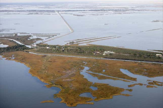
After more than a decade of petitioning the federal government for assistance, the island’s leaders, with the support of the state’s Office of Community Development (OCD), succeeded in 2017 in securing a $48 million grant from the Department of Housing and Urban Development to relocate inland. The years since have involved a tedious, sometimes contentious series of community meetings, votes, and planning sessions that have sometimes found state officials and local leaders at loggerheads.
The first problem was finding a place to go. Mat Sanders, OCD’s resilience program and policy administrator, said an initial survey of available properties that were nearby, big enough, and relatively insulated from flood risk yielded about 18 candidates. Some were disqualified when Sanders went to scope them out and found the ground wet—not a promising sign.
Finally, in March 2018, island residents voted to select a relatively high-elevation, inland parcel near the town of Schriever. It was dubbed the New Isle.
The New Isle wasn’t an entirely blank slate. Current residents had concerns about the development: They worried construction would worsen storm runoff, Sanders said, so the blueprint was designed to preserve existing wetlands. In response to input from the incoming tribal community, the design also allowed the neighborhood to be visually isolated from the surrounding area, to capture the sense of privacy islanders cherished.
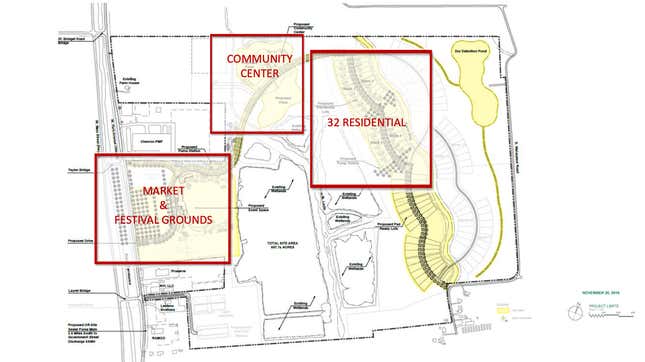
“We’ve taken great effort to instill as much self-determination within the community as humanly possible,” Sanders said. “We were trying to capture the feel and culture of the island and transfer it to the New Isle.”
But a number of sticking points emerged almost immediately, said Chantel Comardelle, the tribe’s executive secretary.
“One month after the award, when the state actually came down and saw that it was more complex than they originally thought, they started abandoning all the extra bells and whistles,” she said.
Comardelle said there was disagreement about who the new site would be for. The tribe’s original HUD proposal framed the relocation as an opportunity for a broader tribal reunification, in which any tribal member would be welcome even if their family had not lived on the island. It included space for many more homes, as well as a museum. But within months, the state’s plan was much smaller, stripped the tribal affiliation requirement, and narrowed eligibility, with a few exceptions, to the island’s current residents.
“We intended to regrow the community back to what it once was, but that component was never realized,” Comardelle said. “It’s just a relocation from here to there.”
Ultimately, about a dozen of the island’s roughly 100 eligible residents are choosing not to move to the new site when construction is complete next year, according to OCD. Comardelle’s family, including her 95-year-old grandmother, will be among them.
Those who stay behind
On a more fundamental level, Comardelle said, she is frustrated that the state seems to view relocation as a foregone conclusion. Houses in the New Isle are free, but predicated on a stipulation that a resident not occupy, rent, or modify their old house, and visit Isle de Jean Charles only for “ceremonial, cultural, historical and recreational purposes.” Some residents fear that the old town will either be bulldozed or just wash away.
Meanwhile, Comardelle said, the state is allowing the delta to transform from an inhabited area with a rich cultural history into an eco-tourism destination for those hoping to catch a last glimpse before it disappears forever. On the roads leading down to the island, she said, you can spot sparkling new fishing piers and parking areas, some built with money from the $21 billion BP Deepwater Horizon oil spill settlement. But no new levees have been built.
“When it’s recreation and fisheries and people having fun, they’re going to make an exception,” she said. “But they can’t protect the community.”
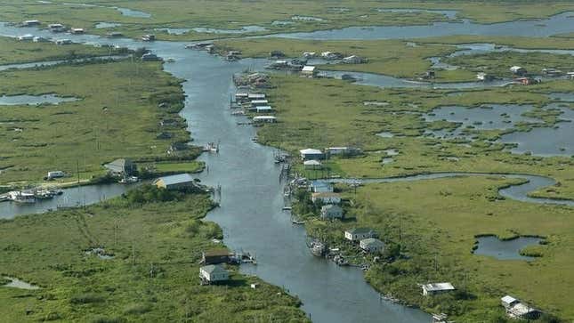
Richie Blink knows the feeling. He’s a councilman in Plaquemines parish, the state’s southernmost parish, whose population fell 14% between 2000 and 2010. If climate migrants are coming from anywhere, it’s here. But Blink said the market prices of oil and shrimp have a more immediate impact on migration decisions than the square footage of remaining wetland. And, he said, the notion of a mass exodus obscures the fact that, for the most part, the parish is still a vital economic engine for the state.
Although he agreed with the LASAFE report’s conclusion that high-risk flood zones have overall seen declines in household income and increases in poverty rates, Blink said the parish government’s most important tax base—business taxes on shrimp fleets, barges, oil refineries, and offshore drilling equipment—are still intact. Most people aren’t interested in relocation, he said; they want help to stay.
“We’re not here for the view. We’re here because there’s a need,” Blink said. “The jobs people do here can’t be done anywhere else. This isn’t a place you could just walk out of and not expect there to be widely felt economic consequences.”
The two development projects chosen in the parish to receive funding through LASAFE reflect that worldview: an expanded harbor for shrimp boats, and a mental health clinic geared toward helping people cope with the trauma of living in such a tumultuous place.
“It’s easy to say we should just be getting everyone out,” Tulane’s Dalbom said. “But the realities of that are so vast and complicated and difficult that it’s just unrealistic. The truth is there are and will be people living in these places for decades to come. We’re not turning off the light switch tomorrow.”
