A little shop in San Francisco is now offering what it says is the highest-resolution space radar imagery on the market.
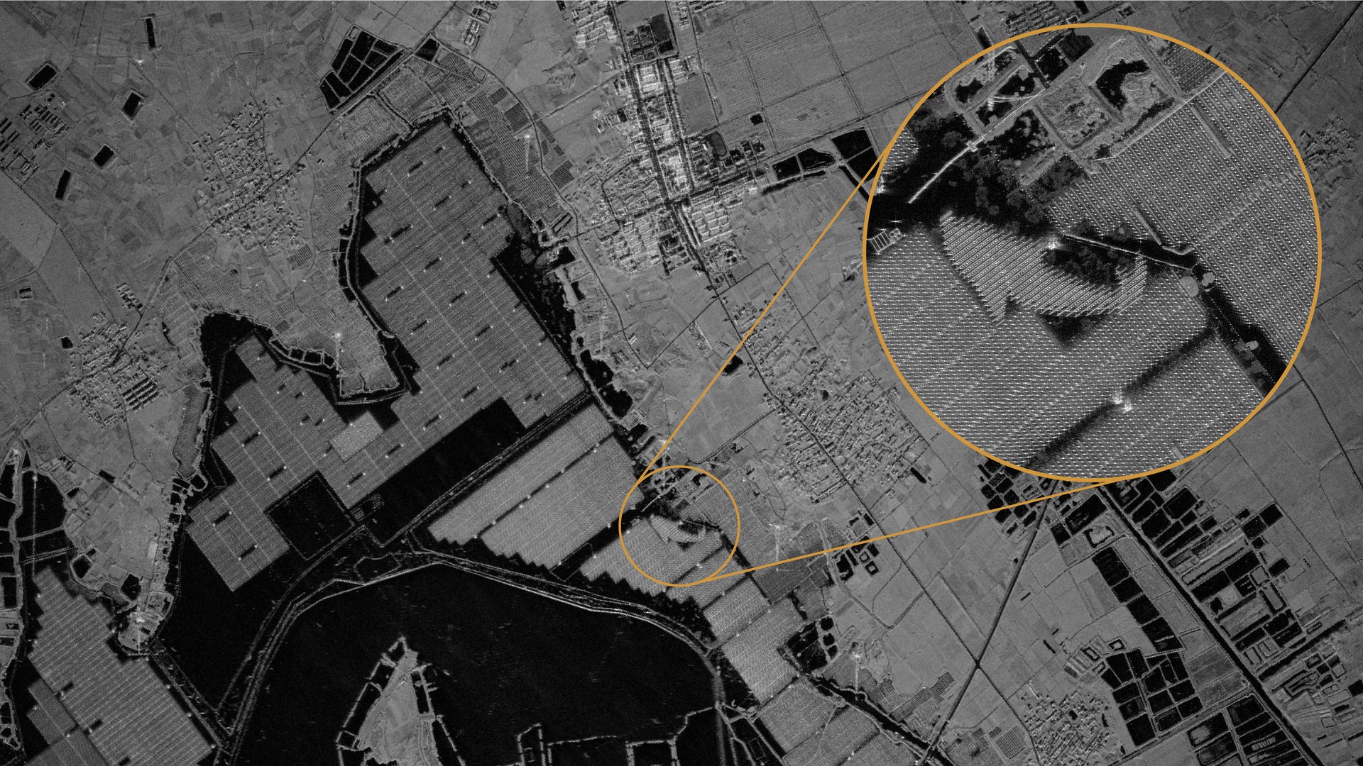
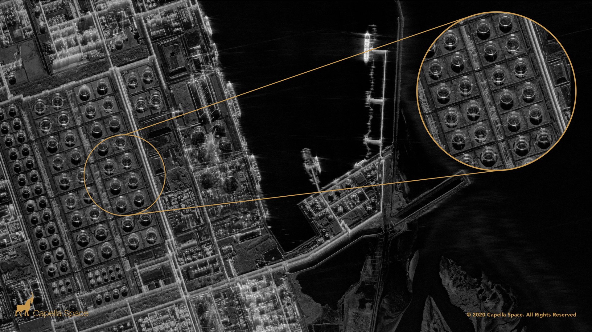
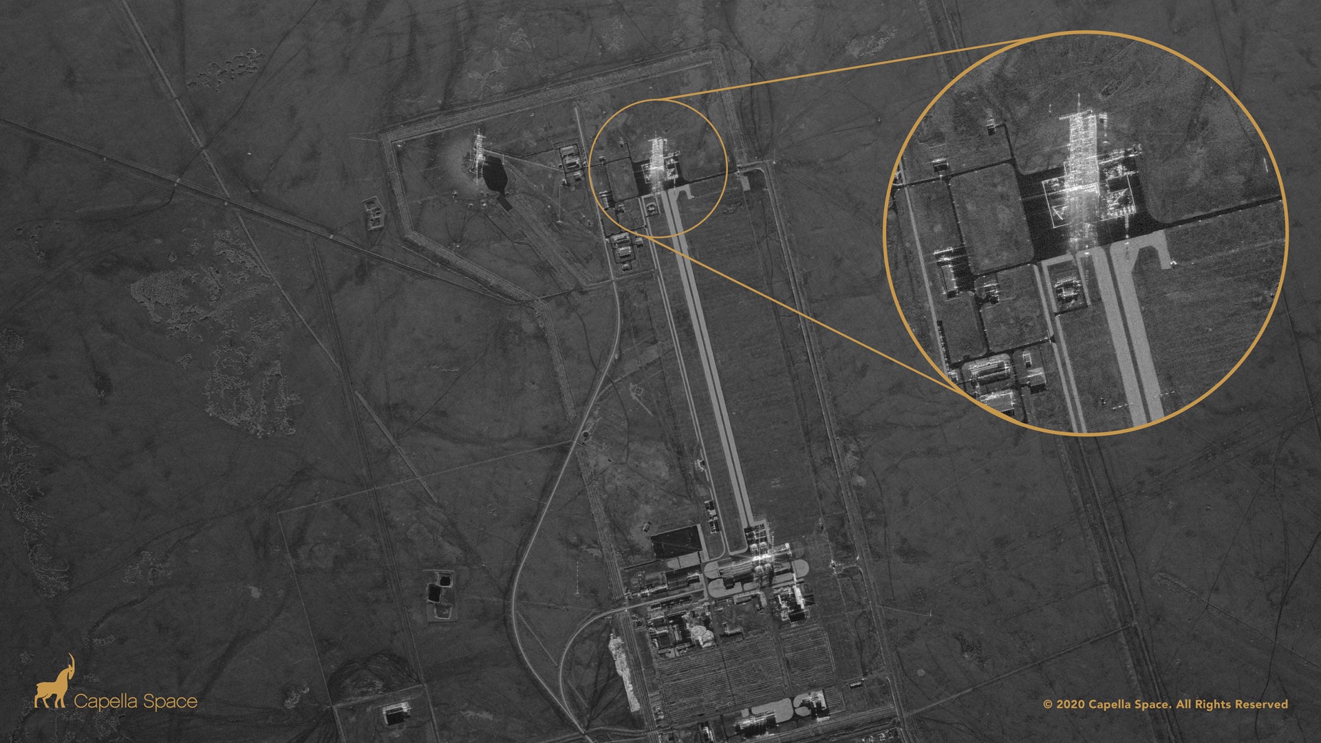
Capella Space released the first images taken by one of its orbiting spacecraft, demonstrating the ability to capture imagery at a resolution of 50 cm per pixel—the legal limit imposed by US regulators to prevent too-detailed reconnaissance imagery from falling into the wrong hands.
Founded in 2016, the company has launched two synthetic aperture radar (SAR) satellites that beam radio energy at the Earth from orbit, and decode its reflection back with a novel antenna design. After its first prototype was tested in orbit, Capella had to redesign the second satellite, launched earlier this year, to reach this level of detail. Over the next six months, the company plans to launch six more satellites and begin selling the data they collect worldwide.
“It’s business time,” CEO Payaam Banazadeh says. The company has 40 re-selling partners around the world ready to begin offering its imagery, along with largely undisclosed pilot customers working directly with Capella.
One of them is the US government, in the form of the Defense Innovation Unit (DIU), which collaborated with Capella after encountering Banazadeh and other founders at a Stanford University hackathon. In 2017, the company received a DIU contract to develop a prototype, inspired by growing concerns over North Korea’s nuclear missile program.
The best way to watch for the threat of pop-up missile launchers is with space radar, but in 2007 the government estimated the cost of such a system would fall somewhere between $27 billion and $94 billion. That was before the rise of small satellites and venture-backed space firms; in comparison, Capella has raised about $84 million.
“For government to get where we are today, they would have spent money to study the problem and at the end of that probably decide we shouldn’t move forward,” Banazadeh says. “With that study money, we’ve already built that capability.”
To be sure, Capella doesn’t yet have the full-on constant surveillance capability imagined by the government. But the first seven operational satellites will still be able to keep tabs on a wide swath of the planet, and the company imagines a constellation of 36 spacecraft could eventually provide broader coverage at costs an order of magnitude below a traditional system.
“DoD partners have been very impressed with the commercial availability of day, night, and all-weather imaging services,” Air Force general Steven “Bucky” Butow told Quartz. “Equally impressive is the low signal to noise ratio provided by such a compact and relatively inexpensive platform. Capella’s work over the past few years has shown the art of the possible with small satellite SAR—especially with novel antenna design—and drastically reducing the cost of building a satellite and launching it with this type of capability.”
A next step for Capella will be expanding its customer base to include users who don’t typically work with radar data, which is more complex to employ than visual-wavelength imagery produced by many remote-sensing companies, but arguably more robust. Because of the cost of the imagery, there has not been a large data set available for companies specializing in machine-learning analysis to develop SAR techniques. Capella plans to collaborate with these users to make the insights from their product more valuable in multiple sectors.
Competition among private space radar providers is heating up—notably, the Finnish company ICEYE already operates three high-resolution SAR satellites; the Japanese firm Synspective recently launched its first spacecraft, and another US firm, Predasar, plans to launch a 48-satellite network starting next year.
A version of this story originally appeared in Quartz’s Space Business newsletter.