The world needs to achieve net-zero emissions by 2050 in order to prevent catastrophic global warming. It’s a titanic task made even more difficult by the lack of up-to-date, reliable information about exactly where pollution comes from. Nearly all emissions information is based on years-old data self reported by emitters.
Solving this problem is the goal of Climate Trace, a coalition of 12 non-profits, academic institutions, and Al Gore. The group uses machine learning and satellite imagery to find the primary sources of the world’s greenhouse gas emissions.
“There is very little information about where emissions are coming from, only how many are in the sky,” Gavin McCormick told Quartz. McCormick is a co-founder of Watt Time, one of the organizations in the Climate Trace coalition.
In September they released their initial dataset, providing the first comprehensive, country-level accounting of global greenhouse gas emissions. It includes detailed data on sectors in the US and China, the world’s largest emitters, as well as smaller nations.
Tracking greenhouse gases isn’t a trivial task. And it’s expensive. “I know that for power plants it costs $30,000 to install a CO2 sensor in the stack, and most countries in the world have concluded it’s just not financially worth it,” explains McCormick.
For poor countries, it may be too expensive to do this on-the-ground monitoring; but for wealthy, large emitters, there is an incentive to hide this information. “We do think there are some countries that just have no interest in making this all open and transparent. It empowers activists, for example,” says McCormick. “It’s a mix of deliberately not being transparent and just the fact that it’s really expensive and difficult to do all this.”
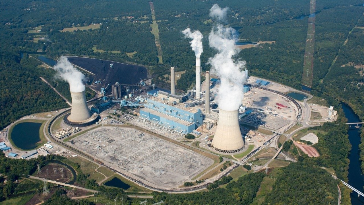
McCormick showed Quartz how Climate Trace is solving the problem. Each team in the coalition specializes in tracking emissions from a different sector of the economy; McCormick’s team monitors emissions from electricity generation.
“We train machine learning algorithms to match what we can see [from satellites] with what we know is true,” he says simply.
Here’s how it works:
First, they train the algorithm. Using datasets from countries such as the US and Taiwan, two of the best nations in the world for maintaining detailed data on power plants and emissions, they match satellite images to the known emissions data. This teaches the algorithm how to predict accurate emissions just from the images.
Then, they locate the world’s power plants. Using announcements from trade journals, buying datasets that list locations, and even sometimes consulting tagged images tourists have posted on social media, the team finds and names power plants.
They gather imagery. Once they know where the power plants are, they gather satellite images from various sources, like Planet Labs, the European Space Agency, and NASA, to feed into their algorithm. Here are the signals they’re using now:
Combine imagery: Climate Trace feeds these images into their artificial intelligence model, which spits out its emissions predictions for power plants around the globe.
One of the team’s current challenges is figuring out how to extrapolate when no satellite image is available. Most satellites are overhead at the same time of day, meaning they need to guess at electricity usage the rest of the time to estimate a plant’s emission. One way to do this is to combine their findings with energy-use data.
Despite these and other complications, McCormick says their data are accurate. “We don’t know that any individual source is perfect,” he explains. “We can use many independent signals, and if many independent signals all are accurate at predicting the same thing using completely different methods, and they all agree, that’s our definition of highly accurate.”
They validate their data both internally and externally. And, as they add more signals, like counting cars in a plants’ parking lot, or analyzing a buildings’ vibrations, their data will only get more accurate.
A recent win? “We improved our algorithms to get pretty good at removing clouds from the images, and that just made everything more accurate,” says McCormick.
Climate Trace is now planning to release every individual source of emissions worldwide.
“It is extremely ambitious. It’s possible we will fail,” laughs McCormick. “But we’ve been making enough progress that given time, I think we’re actually going to pull it off.”