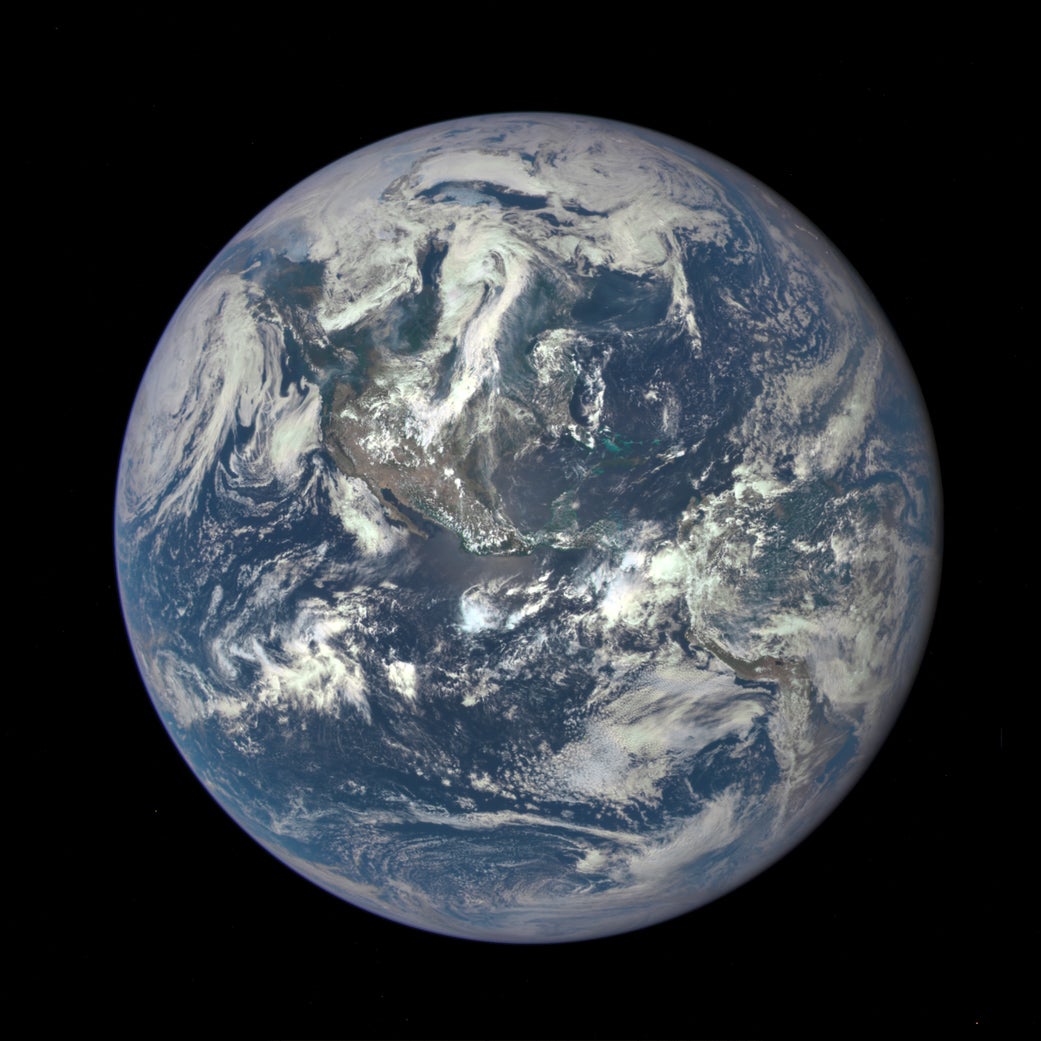
Behold: NASA’s first image of the whole Earth in decades
If you think you’ve seen a new photograph of the full Earth taken by NASA in the last few decades, you’ve been tricked. It hasn’t taken a full Earth snapshot in 43 years—until now. Today (July 20) NASA released an image from the Deep Space Climate Observatory (DSCOVR), marking the first full-disk Earth image released by the space agency since the Apollo era.


If you think you’ve seen a new photograph of the full Earth taken by NASA in the last few decades, you’ve been tricked. It hasn’t taken a full Earth snapshot in 43 years—until now. Today (July 20) NASA released an image from the Deep Space Climate Observatory (DSCOVR), marking the first full-disk Earth image released by the space agency since the Apollo era.

According to NASA’s website, the bluish tint is a result of sunlight scattered by air molecules.
Below is the famous image taken when the US last sent people to the moon, in 1972 on Apollo 17. (All three astronauts on the voyage claim to have taken it.)

The technology has changed quite a bit since 1972. Where those astronauts were using Hasselblad medium format and Nikon 35mm cameras loaded with specially made Kodak film, the DSCOVR satellite’s imaging instrument has a 4-megapixel CCD sensor that captures 10 bands of light, including invisible ultraviolet and near-infrared wavelengths.

While there are many satellites constantly capturing their views of the earth, most do so at low Earth orbit, a distance too close to see the whole earth at one time. Taking a photograph of the earth from low Earth orbit is like trying to take a selfie with your phone an inch in front of your nose.
Most images of Earth in recent years have been renderings made using the thousands of closeups taken by observation satellites in low Earth orbit. For instance, the image below, which was once the default background on new iPhones, is a rendering of multiple images stitched together (plus some photoshopped clouds) rather than a snapshot.

Of course NASA isn’t the only player in the space-imaging game. Other space agencies have taken full-disk images of the Earth since the Apollo missions. The Japanese Hayabusa spacecraft captured a full image of the earth in 2004 during its mission collecting samples from an asteroid. In January 2015, another Japanese craft, the Himawari-8 weather satellite, began recording full-disk images at 10 minute intervals. Even the US’s National Oceanic and Atmospheric Administration GOES satellites capture full-disk images of the earth, but these weather satellites are in geostationary orbits, meaning they capture the same view of the earth over and over.
DSCOVR can capture a full-disk image at any point in the Earth’s rotation.
The images captured during DSCOVR’s mission are an ancillary function for the satellite. Its primary function: to remain between the Earth and the sun to detect solar wind, for scientific and safety purposes. (The safety issue stems from concerns that a geomagnetic storm caused by solar wind could disrupt everything from power grids to the GPS system.) This vantage point gives it a view of an always-fully-lit Earth as the planet spins in front of it. The satellite, launched earlier this year, is expected to take a full earth image at least once a day and transmit it home.