This post was updated at 10:00 am ET on Sept. 19.
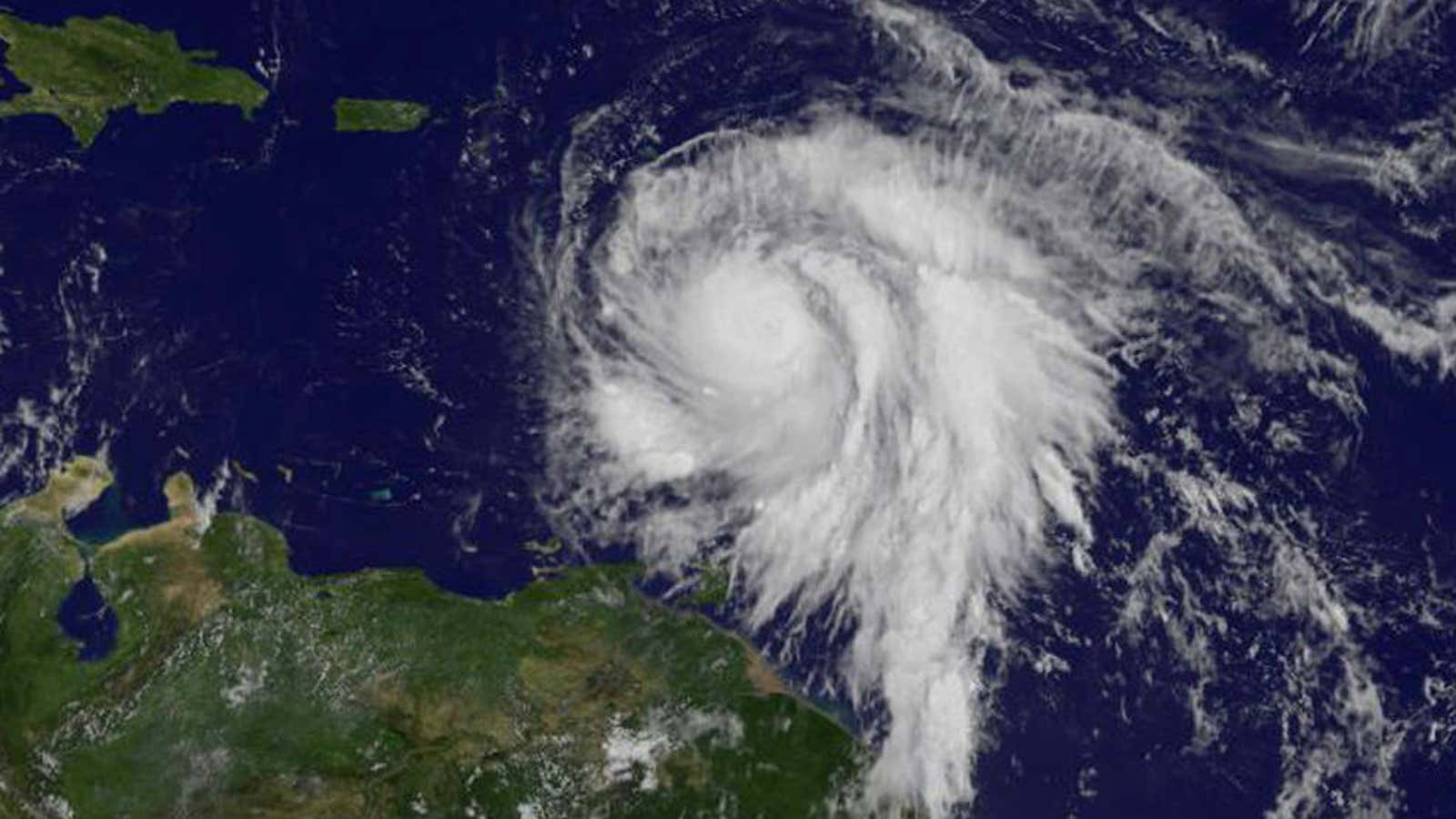
Another stormy week in the Atlantic: Hurricane Maria has strengthened as it takes aim at Puerto Rico, and Jose is steadily creeping up the east coast.
Hurricane Maria
Maria is now a category 5, with sustained maximum winds of 160 mph. The storm intensified rapidly into a “potentially catastrophic” hurricane as it moves toward Puerto Rico and the Leeward Islands, already devastated by Hurricane Irma.
Hurricane Maria tore through the island nation of Dominica last night (Sept. 18). It made landfall as a category 5, causing “widespread devastation,” according to Dominica’s prime minister, Roosevelt Skerrit, who spent the night posting frantic updates to his Facebook page as Maria ripped apart his home:
[protected-iframe id=”4e4ce7a1e06278c7fc86ee26afde5475-39587363-95155909″ info=”https://www.facebook.com/plugins/post.php?href=https%3A%2F%2Fwww.facebook.com%2FSupportRooseveltSkerrit%2Fposts%2F999445666863954&width=500″ width=”500″ height=”180″ frameborder=”0″ style=”border:none;overflow:hidden” scrolling=”no”]
“My roof is gone. I am at the complete mercy of the hurricane. House is flooding,” he wrote about an hour later. Skerrit survived the onslaught and was rescued shortly after posting the message.
Maria is forecasted to move over the northeastern Caribbean Sea today, and approach the Virgin Islands and Puerto Rico tonight and tomorrow. Many Virgin Islands residents evacuated to the US territory after Hurricane Irma. Now, those evacuees are in the path of Maria. In Puerto Rico, governor Ricardo Rosselló has declared a state of emergency and US president Donald Trump issued an emergency declaration to aid with relief funding.
“This is an event that will be damaging to the infrastructure, that will be catastrophic,” Rosselló said. “Our only focus right now should be to make sure we save lives.”
The NHC forecasts the storm will maintain it’s intensity as an “extremely dangerous” category 4 or 5 hurricane as it nears Puerto Rico, which could be the first time in 85 years a hurricane that strong makes landfall on the island.
A hurricane warning is in effect for Guadeloupe, Dominica, St. Kitts, Nevis, Montserrat, the British and US Virgin Islands, Puerto Rico, Culebra, and Vieques.
A tropical storm warning is in effect for Antigua, Barbuda, Saba, St. Eustatius, St. Martin, Anguilla, and Martinique.
A dangerous storm surge is expected to raise the water by as much as 7 to 11 feet above normal in the hurricane warning areas. The NHC forecasts around 10 inches of rain in most places, and up to 25 inches in isolated areas.
Almost all of the buildings on the 60-square-mile island of Barbuda—currently experiencing tropical-storm conditions from Maria—were destroyed when Irma ripped through Sept. 6. All 1,800 residents were evacuated to the sister island of Antigua, meaning Barbuda is now completely uninhabited.
“The damage is complete,” Ronald Sanders, Antigua and Barbuda’s ambassador to the US, told PRI’s the Takeaway. “For the first time in 300 years there’s not a single living person on the island of Barbuda—a civilization that has existed on that island for over 300 years has now been extinguished.”
Hurricane Jose
Jose is holding steady as it moves up the east coast. The category-1 storm, which isn’t expected to make landfall in the US, could still cause “dangerous surf and rip currents” along the east coast over the next two days.
While about 235 miles east-northeast of Cape Hatteras, North Carolina (350 miles south-southwest of Nantucket, Massachusetts), Jose had sustained maximum winds around 75 mph.
A tropical-storm warning is in effect for Watch Hill, Rhode Island north to Hull, Massachusetts, Block Island, Martha’s Vineyard, and Nantucket.
The NHC expects Jose to keep moving north at its current pace of 9 mph through today, followed by a turn northeast tonight. The center of the storm will pass well offshore of the Delmarva peninsula (which holds most of Delaware) later today, travel east of the New Jersey Coast on Wednesday, when the storm could start to weaken, and be offshore of southeastern Massachusetts by Thursday.
Tropical storm conditions are expected to begin in the warning areas early on Wednesday. The NHC has reduced its rain forecast slightly, and now predicts Jose will 1 -3 inches of rain over eastern Long Island, southern CT, southern Rhode Island, and southeast Massachusetts. Martha’s Vineyard and Nantucket could see as much as 5 inches, which could cause isolated flooding.
Track Hurricane Maria and Hurricane Jose
You can track the progress of the storms brewing around North America with this helpful tool from WNYC by selecting the storm name in the top left.
[protected-iframe id=”80293bf4947d3ad2e24c58bb3cd1946a-39587363-95155909″ info=”https://project.wnyc.org/hurricane-tracker/index.html?year=2017&storm=otis” width=”100%” height=”760″ frameborder=”0″ scrolling=”no”]
