Five years ago, the coasts of New York and New Jersey were devastated by a rare late-October superstorm.
Five years ago, the coasts of New York and New Jersey were devastated by a rare late-October superstorm.
On Oct. 29, 2012, a combination of record storm-wind area, a full-moon high tide, and poor infrastructure led to a devastating storm surge and flooding. Superstorm Sandy killed 72 people in the US and caused more than $70 billion in damage.
Join 500,000+ readers who start their day with Quartz.
By subscribing, you agree to our Terms of Service and Privacy Policy.
In the years since Sandy, even as communities have rebuilt and businesses reopened, much of the coastline remains vulnerable if another record flood were to hit again, which is more likely than not. City and state officials, anxious to keep memories of Sandy from fading, are working to drum up financial and public support for infrastructure projects that will fortify New York against future storms. Despite this year’s record hurricane season, which has caused hundreds of deaths and billions of dollars in damage in the US, Mexico, and the Caribbean, inspiring enthusiasm for increased storm preparedness is proving difficult.
One big idea to prevent massive destruction: A constellation of giant underwater gates that would rise in New York Harbor and beyond when disaster looms.
The National Institute for Coastal and Harbor Infrastructure (NICHI), a nonprofit group that advocates for coastal climate adaptation, is working to convince City Hall and the United States Army Corps of Engineers that a system of underwater gates, which can be raised and lowered to block surges, is the best way to protect the biggest city in the US from flooding. (The UK and Netherlands use similar systems: the Thames Barrier in London and Maeslantkering in Rotterdam.)
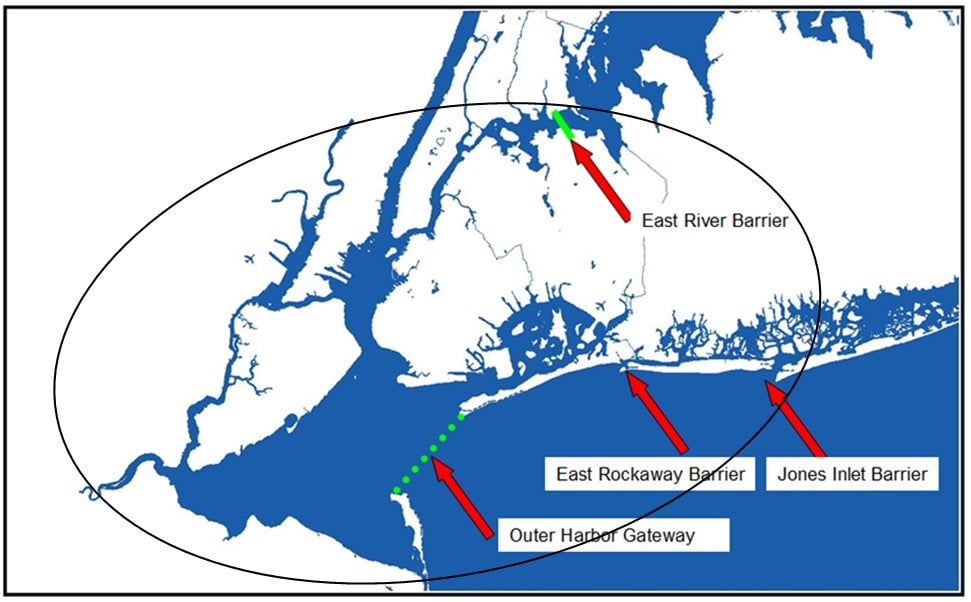
The NICHI makes the argument that though local protection projects are in development, there is no overall plan to connect them together on a regional scale. Outer harbor and coastal storm-surge barriers could protect all five boroughs of New York City, including its two major airports, as well as many parts of Long Island and northern New Jersey. If barriers like these were in place prior to Sandy, the group says, there would have been no flooding in most of the region.
The group is advocating for gates across the approaches to the harbor, which serves New York and New Jersey; one in the upper East River; two barriers in the East Rockaway and Jones Inlets; and two across Fire Island Inlet and Moriches Inlet. They argue that a regional flood-protection system, in conjunction with local projects, is the best “primary line of defense” against surges.
Installing gates to protect coastal areas, like the Sandy Hook community in New Jersey, which was virtually destroyed in 2012, could cost as much as $25 billion, and advocates of the plan say it’s worth the price because it could prevent hundreds of billions in potential damage.
The system would be costly and complicated, so the Army Corps is conducting a study of alternatives that might “better manage coastal flood risks in the region.”
There are other projects in the works (which the city tracks on this convenient map), though most of the major ones are yet to be completed.
Utilities in the city have been upgraded and crucial repairs have been made to the subways (though major work is still planned). The Army Corps helped the city complete construction on four new T-groins (structures that prevent sediment movement and erosion) in Sea Gate, a private beach community west of Coney Island in Brooklyn. The T-groins will protect the integrity of the private beach, which keeps the public beach anchored.
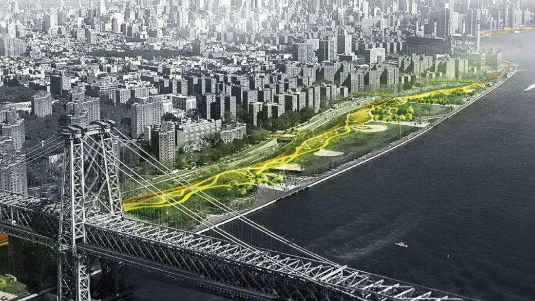
One of the biggest resiliency plans in development, known as “the Big U,” will be a system of berms (or levees) and walls around lower Manhattan up to midtown that will create a flood-protection zone and also provide increased access to the waterfront. The project is split into two parts: The East Side Coastal Resiliency Project (pictured at the top of this post) is in the final design phase, with construction slated for 2019, and concepts for the Lower Manhattan Coastal Resiliency Project are still being looked at, with construction estimated for 2020.
The US Department of Housing and Urban Development awarded the Bjarke Ingels Group, which came up with the idea, $335 million as a part of the Rebuild By Design competition.
Other initiatives, such as the Hunts Point Lifelines project in the Bronx, focus on the potential for staving off power loss in low-lying neighborhoods—Hunts Point processes about 60% of the city’s produce and half of its fish. The plan calls for a tri-generation energy plant that could serve as a micro-grid, providing up to 11.6 megawatts of power during emergencies. It’s still in the design and analysis phase, with construction estimated to begin in 2020.
Over the next 30 years, floods of 7.4 feet or more, which used to occur in the New York area once every 500 years and are now happening every 25, could strike as frequently as every five years, according to a new scientific study. The researchers say that sea-level rise caused by climate change is the biggest factor.
There is a consensus in the scientific community that global sea levels will rise over the next few hundred years. The only thing that is uncertain is exactly how much. The water level around New York City could rise up by 11 inches by 2030 and by more than 8 feet by 2100 if carbon emissions stay at current levels and the West Antarctic ice sheet melts. This means there will be a dramatic increase in the risk of storm surges from nor’easters and hurricanes.
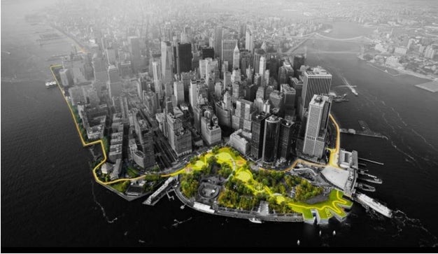
Officials say New York Harbor locations such as the Statue of Liberty, Ellis Island, and Brooklyn Bridge Park could be seriously damaged if a storm like Sandy were to hit again.
“All of these parks are in jeopardy,” Bill Golden, president of the NICHI told The New York Times. “Unless we have a storm-surge barrier, these parks are not going to be protected.”
The effects of climate change mean that tropical storms that form in the Atlantic will be more powerful, for longer periods of time. Getting hit by another Sandy isn’t a question of if—just when.