Thanks to the massive scale of 2017’s various disasters and crises, satellites and astronauts captured more than a few major news events while orbiting Earth this year.
Thanks to the massive scale of 2017’s various disasters and crises, satellites and astronauts captured more than a few major news events while orbiting Earth this year.
The resulting images offer a sharp “before and after” contrasts, crystallizing and simplifying complex events with arresting clarity and offering fresh perspectives on a long year. Here’s our selection:
Join 500,000+ readers who start their day with Quartz.
By subscribing, you agree to our Terms of Service and Privacy Policy.
China is currently the world’s largest producer of solar energy, though its choking air pollution stands in the way of even greater solar capacity. These images from NASA show a slice of the sheer scale of growth in China’s solar investments this year.
Hundreds of thousands of ethnic Rohingya, a Muslim minority in Myanmar, fled the country to escape ethnic cleansing at the hands of the military. Images from Planet Labs show the terrible growth of Rohingya refugee camps in Bangladesh.
As Quartz reported in November:
The left side of the photo is Bangladesh; the right side, Myanmar.
In the space of a few weeks between Sept. 21 and Nov. 10, you can see the “massive expansion of the camp over a short amount of time,” Micah Farfour, who analyzes imagery like this for Amnesty International, said in an email. “You can see there were once trees/vegetation where there are now structures (lighter colors).”
After years of drought, massive rainfall turned stretches of California into a quilt of wildflowers from March to April. The “super bloom” enticed photographers and nature lovers throughout the spring. Satellite images from Planet Labs show the stunning transformation of a once bone-dry desert.
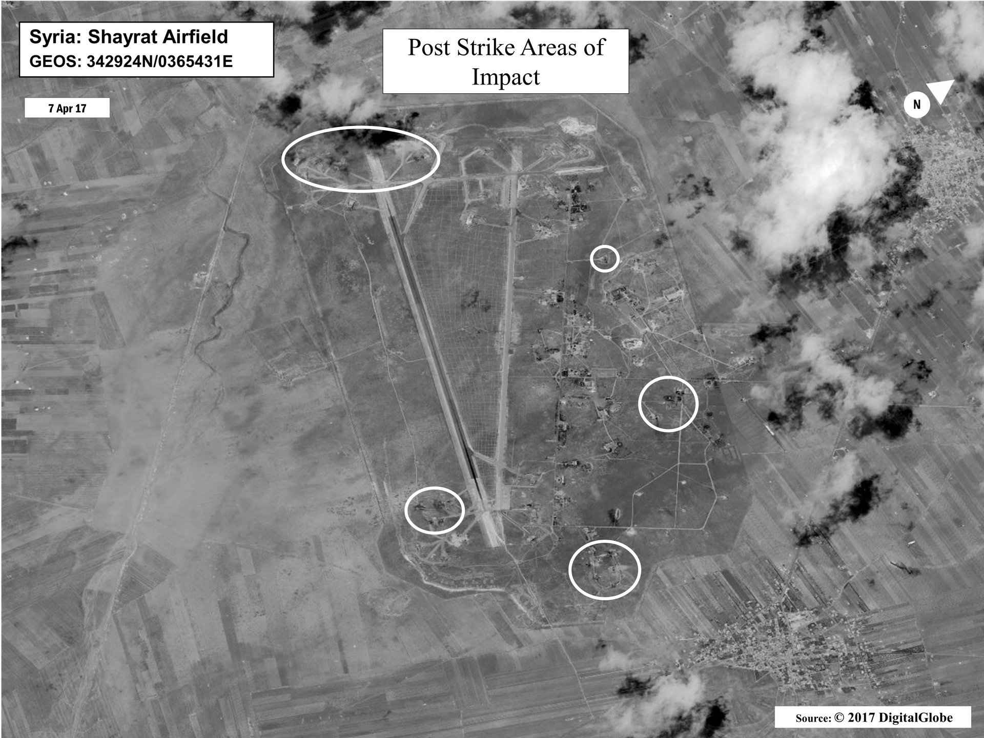
Followings reports of chemical weapons being used by Syrian president Bashar Al-Assad against his own people, US president Donald Trump ordered missile strikes on a Syrian airfield on April 6. The images, produced by a DigitalGlobe satellite and released by the Pentagon, show the damage done by 59 Tomahawk missiles.
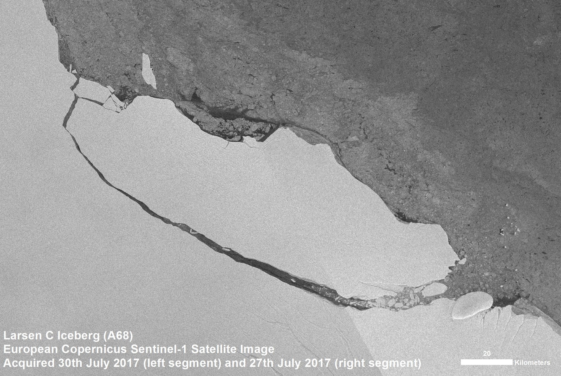
A Delaware-sized chunk of the Larson ice shelf broke off Antarctica in July of this year. As little daylight reaches the continent during long Antarctic winters, scientists used satellite imagery that could see in the dark, like this radar image from the European Space Agency’s Sentinel 1 satellite, to confirm the calving.
A July post on the ESA’s website notes the importance of radar imaging. “Radar images are indispensable because, apart from the region being remote, radar continues to deliver images regardless of the dark and bad weather,” the ESA explains.
The Atlantic hurricane season that stretches from June to November brought debilitating destruction to Texas and the Caribbean. One defining image of the season captures three massive storms in a single frame: Hurricanes Irma and Jose having already made landfall, while Katia moves west.
After Hurricane Harvey’s waters inundated the city of Houston, Quartz’s David Yanofsky compared Planet Lab’s before-and-after satellite images of the city, a case study of development without regard for disaster preparedness. The images show various subdivisions, highways, and even a prison taking on water.
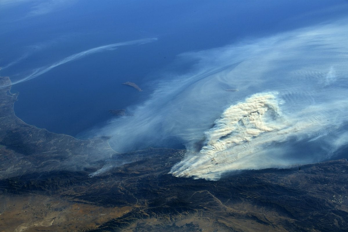
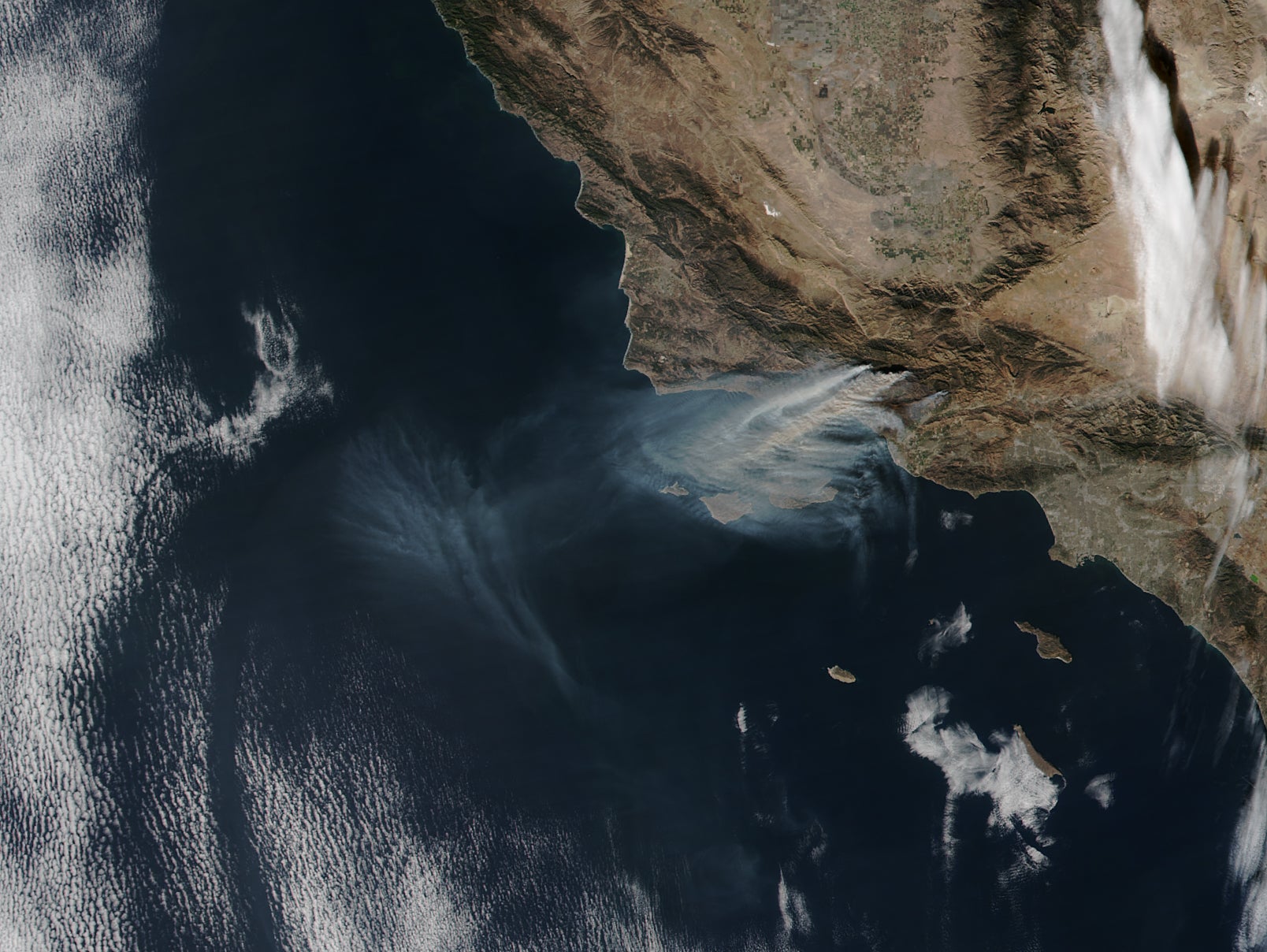
Devastating wildfires scorched California north to south throughout 2017. Some of the most recent fires, including the massive Thomas Fire which threatened Ventura, northwest of Los Angeles, were visible from the International Space Station.
An image from the NASA Suomi NPP satellite shows a wide view of the Thomas Fire’s smoke, billowing out to sea.
And NASA astronaut Randy Bresnik captured plumes of smoke during his multiple flyovers.