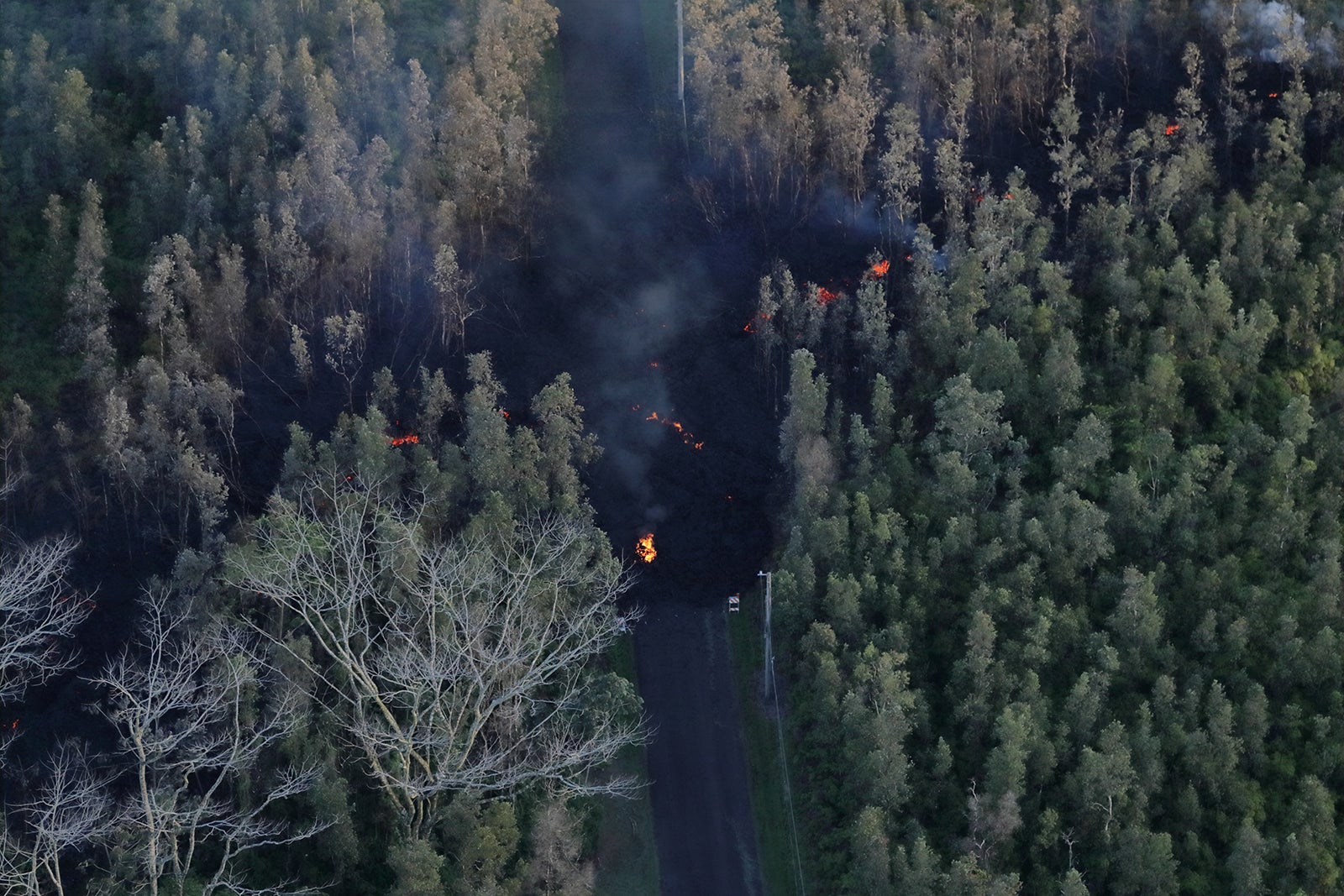
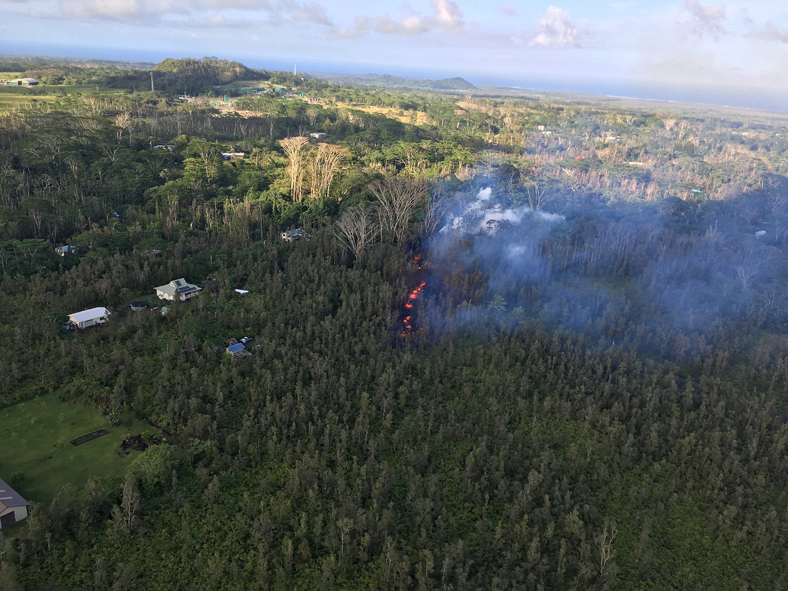
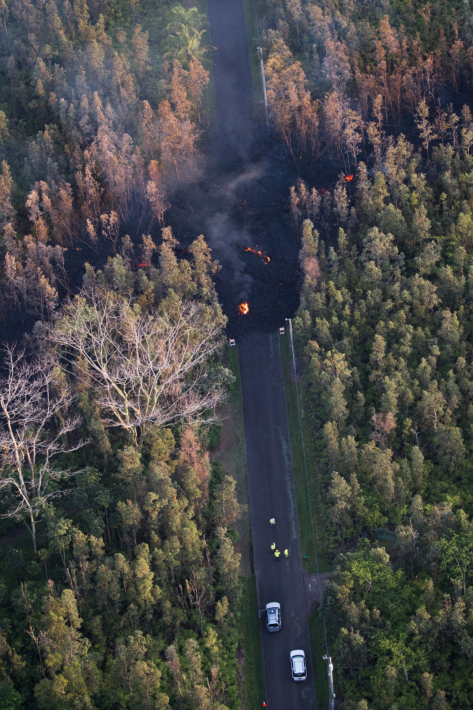
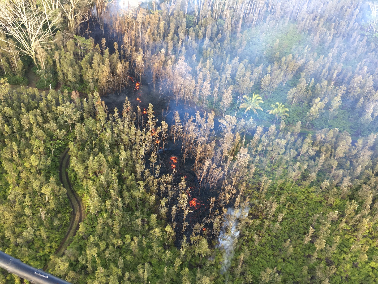
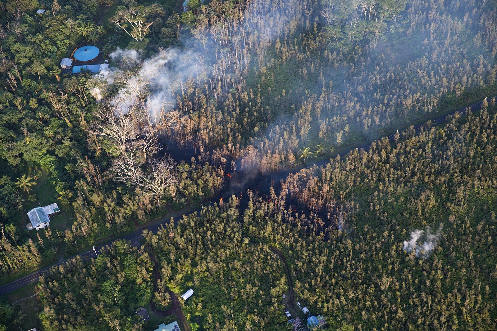
After keeping residents on watch for several days after a series of hundreds of earthquakes on Hawaii’s Big Island, Mount Kilauea, one of Hawaii’s most active volcanoes, erupted on May 4. Officials issued a mandatory evacuation for around 1,500 people on the east end of the island,the AP reports.
After keeping residents on watch for several days after a series of hundreds of earthquakes on Hawaii’s Big Island, Mount Kilauea, one of Hawaii’s most active volcanoes, erupted on May 4. Officials issued a mandatory evacuation for around 1,500 people on the east end of the island,the AP reports.
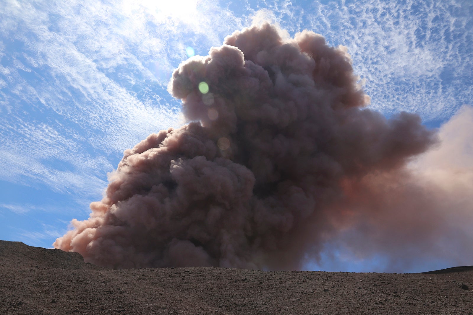
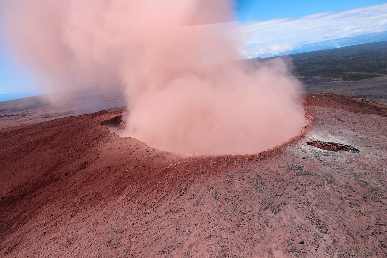
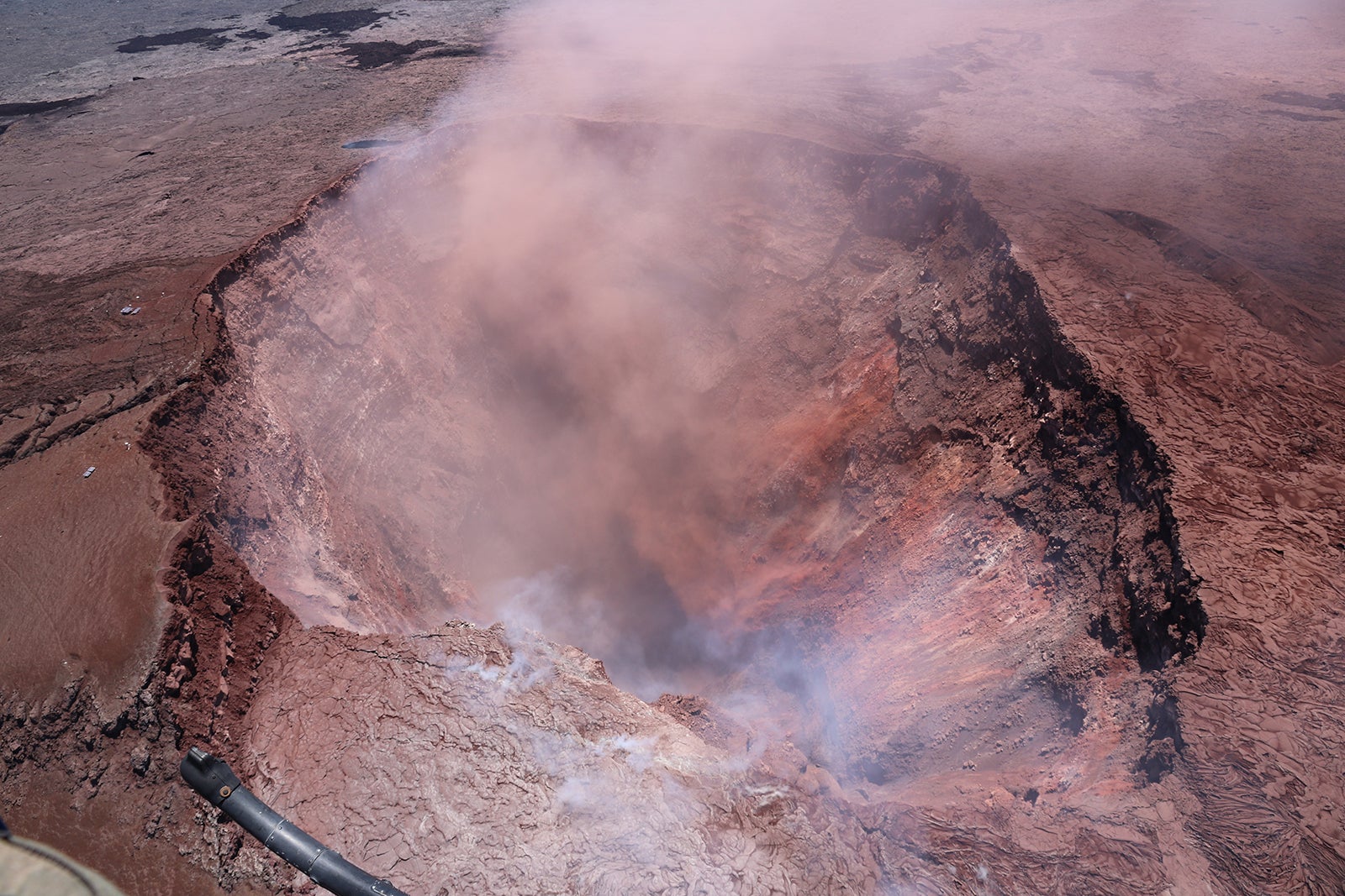
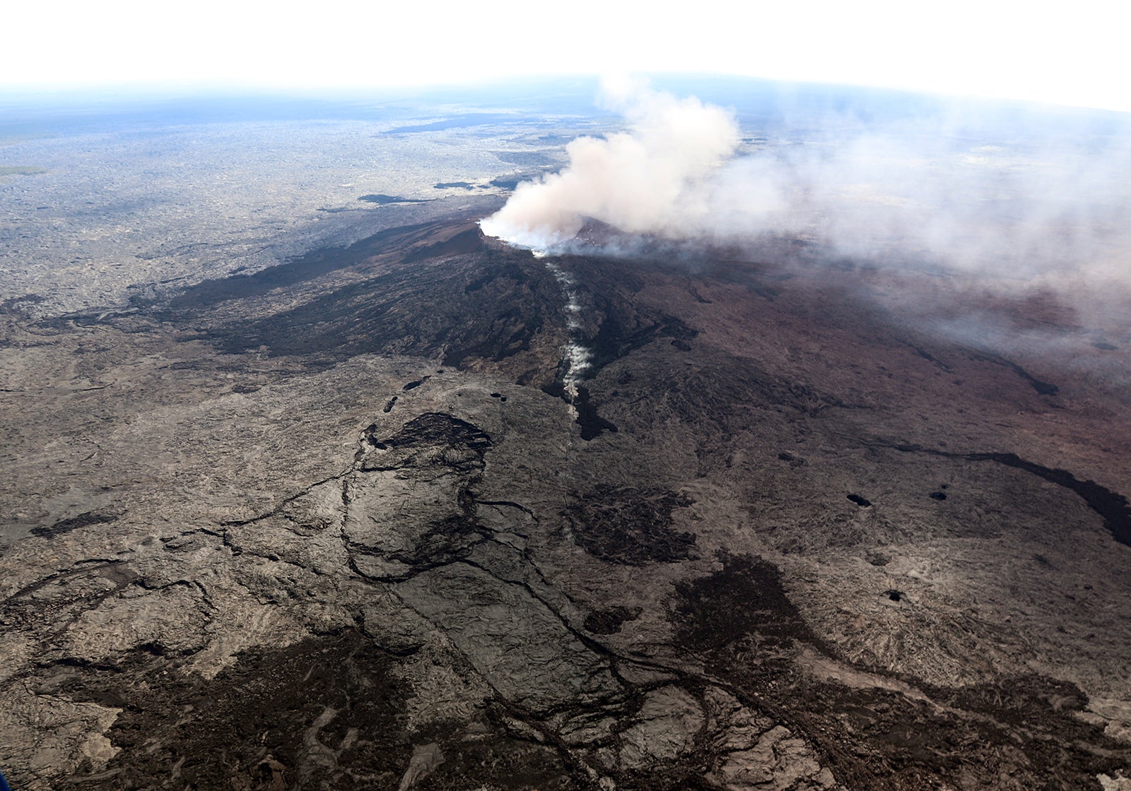
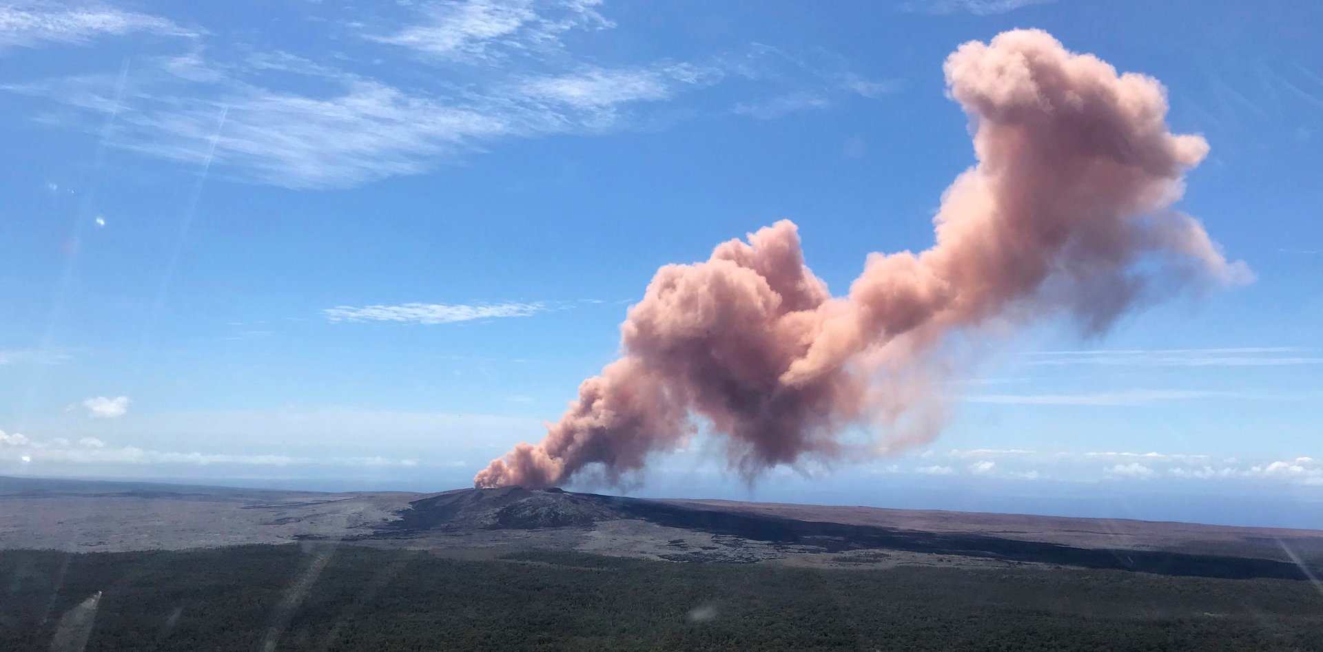
Aerial images from the unfolding scene show lava creeping and bubbling up through wooded areas and public roads, while reddish smoke and ash emanated from the Puʻu ʻŌʻō crater.
Join 500,000+ readers who start their day with Quartz.
By subscribing, you agree to our Terms of Service and Privacy Policy.