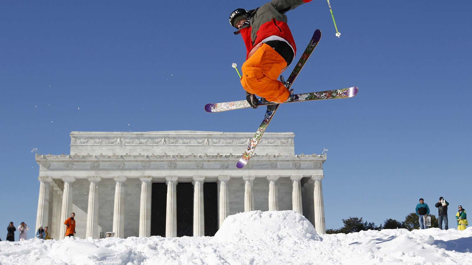
For the eastern US, this winter and spring have been like a brutal revival of the Ice Ages. One strong blast of polar weather after another sent temperatures plummeting deep into the country, and as the miserable weather on April 16 attests, this frigid free-for-all has life in it still.
As unusually cold as it’s been, super-bitter winters might be something our grandchildren will frequently complain about. That’s because the pattern in the jet stream that routed arctic air down to the East could become more common as the climate changes. Conversely, America’s West might expect more of the kind of hot weather that’s now causing droughts, high food prices, and a jacked-up risk of wildfires.
This unpleasant assessment comes from an international group of scientists who just released a study examining the past and the future of the jet stream. Working with lake-sediment cores and climate models, they discovered that the stream’s pattern shifted about 4,000 years ago into a “positive” or curvy phase—the same dynamic responsible for the ongoing hot/cold divide in America. And the fact that the planet’s poles are warming faster than the equator could “enhance the pattern so there will be more frequent or more severe winter weather extremes or both,” they predict.
Here are a few more specifics about what the future could bode, explained by University of Utah geochemist Gabe Bowen:
“In [the positive phase], the jet stream is very sinuous. As it comes in from Hawaii and the Pacific, it tends to rocket up past British Columbia to the Yukon and Alaska, and then it plunges down over the Canadian plains and into the eastern United States. The main effect in terms of weather is that we tend to have cold winter weather throughout most of the eastern US You have a freight car of arctic air that pushes down there.”
Bowen says that when the jet stream is curvy, “the West tends to have mild, relatively warm winters, and Pacific storms tend to occur farther north. So in Northern California, the Pacific Northwest and parts of western interior, it tends to be relatively dry, but tends to be quite wet and unusually warm in northwest Canada and Alaska.”
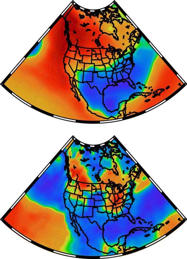
To help visualize these atmospheric fluctuations, the researchers generated this pair of maps showing a typical year under a curvy jet stream. The top map displays winter temperatures as regions of biting cold (blue) to comfortable warmth or unusual heat (orange and red). The bottom displays precipitation patterns as wetter (blue) and drier (orange) zones. This past winter hewed close to these models, although it was drier than average in California and abnormally frigid in the upper Midwest:

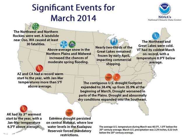
The scientists’ report is especially timely in that the nation just endured its coldest March since 2002. The average temperature across the contiguous states was 40.5 degrees, about 1 degree below the 20th-century norm. For a few more facts about the past month’s weather – for instance, it was the coldest March on record in Vermont—take a look at this graphic put out by the National Climatic Data Center:

This post originally appeared at The Atlantic Cities. More from our sister site:
When a cycling boom goes wrong
11 reasons the UN should make cities the focus of its development goals
