One moment, Achita Sankar Machhi was sitting in a plastic chair, fiddling with her television remote. The next she was on the floor, the chair atop her. She lived through a few surreal minutes as the earth trembled, making a monstrous thundering sound from its belly.
“It felt as if invisible hands were reaching out from deep within the earth and shaking me violently,” Machhi, a 28-year-old teacher and mother of two, recalled as if she was yet to wake up from the Feb. 13 nightmare.
Like her, most residents of her village, Dapchari, have an “earthquake” story to share. So do residents of 27 other villages in Palghar district, about 130 kilometres north of India’s financial capital, Mumbai.
They have all been rocked by over 1,000 tremors since November 2018, when it all began, according to the New Delhi-based National Centre for Seismology (NCS), an agency under India’s ministry of earth sciences that provides earthquake surveillance and hazard reports to the government. Their magnitude has ranged between 1.6 and 3.9 on the Richter scale—typically, one can feel it beyond 1 or 1.5, seismologists said.
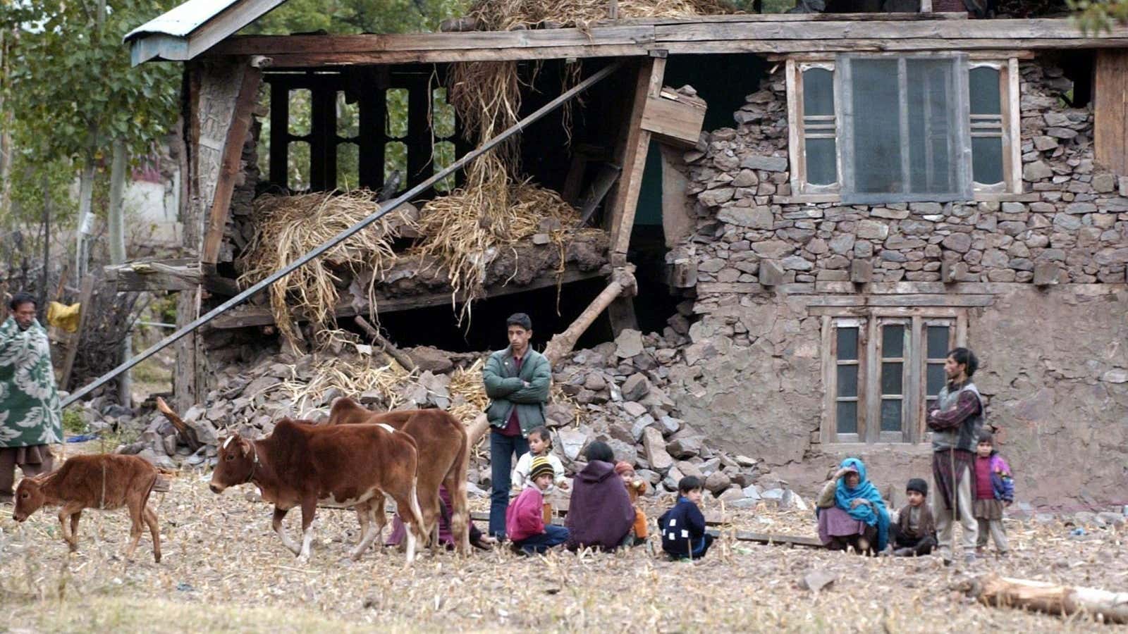
Dhundalwadi village, some 60 kilometres from Palghar city, has been identified as the epicentre. Around 250 houses out of the nearly 600 surveyed by village officials in the area were found to be damaged.
By January the phenomenon had almost become a way of life in the region. But on Feb. 01, things changed again.
Two-year-old Vaibhavi Ramesh Bhuyal was playing in a rice farm in Haladpada, about 2.5 kilometres from Dhundalwadi, when the earth shook. Scared, she ran towards her mother just a few metres away, tripped, and fell, hitting her head on a stone. Little Bhuyal died before her uncle could rush her to the nearest hospital eight kilometres away.
Since then, fear turned more palpable, more real.
Villagers now live in uncertainty, sleeping in tents or in the open, and always keeping the children in sight. In some schools, classes are no longer held inside rooms but in mandaps (makeshift tents typically set up for weddings and other ceremonies).
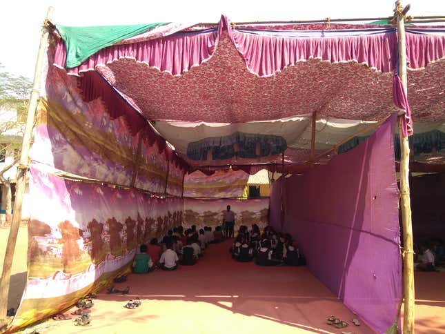
“Initially we refused to let the boarders stay in hostels and asked parents to drop them to school every day,” said Babasaheb Pawar, principal of the Somaiyya Trust Residential School, near Dhundalwadi. The institution caters to around 650 students, 350 of whom stay on campus. “But then attendance was severely affected, almost by 50%…We handed out letters requesting schools closer home to accommodate them for now.”
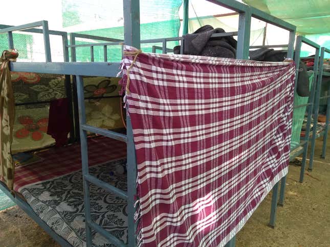
Four months on, tired of waiting for the tremors to stop, some schools have constructed makeshift tents for their boarders and moved their beds there.
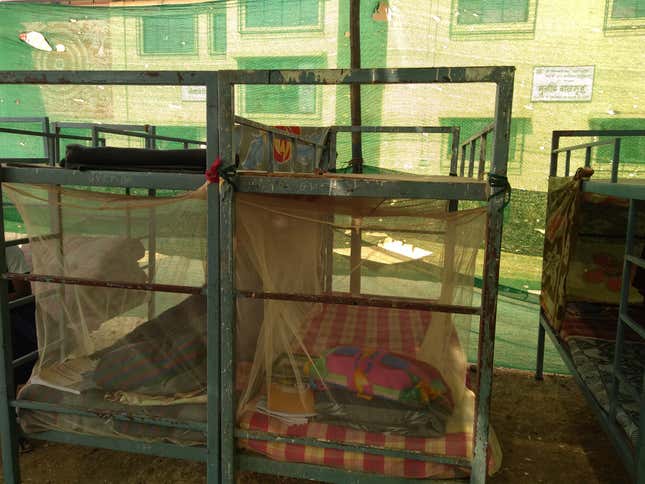
Now, the children brave both, the earthquakes and chilly nights as temperatures often dip below 10 degrees Celsius.
“Doesn’t matter how deeply I am sleeping, I wake up so many times at night whenever the earth shakes,” says Rita Chavan, a student of the Somaiyya Trust school.
Meanwhile, villagers have formed their own warning system: If only the ground shakes and the asbestos sheets of their homes make a rattling sound, there’s nothing much to worry. But if the vessels clank and the furniture shakes, rush to safety! There are other signs, too. For instance, if colonies of ants rush out of their nests in a hurry, a tremor is around the corner, say villagers.
Needless to say, none of these is foolproof.
Why is it happening?
The NCS has categorised these frequent tremors as a “swarm,” which is a series of low magnitude earthquakes that occur around a particular region over a period of time, lasting up to months in some cases. Similar activity has been recorded in the past from across peninsular India.
But seismologists are divided about why they occur.
A section points to the annual monsoon. “It is likely that a change in the water table caused by monsoons is causing these jolts,” believes Santosh Kumar, a scientist at the Institute of Seismological Research (ISR), Gandhinagar, Gujarat. Rainwater seeping into the rocks raises the pressure inside them, which is then released in the form of quakes or swarms. This happens particularly in areas with a tectonic movement of earth’s seven different plates: African, Antarctic, Eurasian, Indo-Australian, North American, Pacific, and South American.
“Typically, if it is a swarm, then it is unlikely that any big earthquake may follow,” said Vineet Kumar Gahalaut, director of NCS. But he adds a caveat: “These natural processes are dynamic and non-linear in nature and what has happened in the past may not hold true for future events.” Kumar of ISR, too, admits that the reason for swarms remains a mystery.
Usually, the hydro-seismicity swarms die down in three-to-four months after rains. In Palghar, though, indications are they may continue till the end of March, according to Kumar. Besides, swarms can be deadly too, as witnessed in Indonesia last August.
But what if there’s more to them than just rainwater, like the other section of earthquake researchers believes?
The seismo-tectonic atlas of India, which locates the many areas prone to quakes, shows over 66 active faults, including a few in and around Palghar. “We suspect the tremors are a result of that,” according to Ravi Sinha, professor in the department of civil engineering at the Indian Institute of Technology, Bombay.
Typically, damaging earthquakes occur around such fault lines, barring a few caused by volcanoes. “Since these are believed to be seismic in nature, they need to be taken more seriously because, in one in 10 cases, these tremors can end up becoming deadly,” says Sinha.
A team of the Hyderabad-based National Geophysical Research Institute (NGRI) has been studying tremors in and around Palghar since the 1980s. The Dhamni dam on Surya river flowing nearby had also been observed three decades ago to find the cause, said Srinagesh D, who heads the seismological observatory at NGRI and is leading the team studying the recent tremors.
The NGRI team, which on Jan. 28 placed accelerometers in and around Dhundalwadi, a device used to measure tremors, has noticed that the quakes are typically originating from a depth of 12-13 kms beneath the earth’s surface.
“The Indian plate is moving in the north-east direction and is colliding with the other plates, leading to the jolts. Therefore, these are tectonic in nature,” added Srinagesh. “The stress gets accumulated in the fault lines and leads to earthquakes.”
Both Sinha and Srinagesh are fairly certain that the percolated monsoon water alone cannot trigger these collisions in the bed of the earth. “I am not saying that the monsoon water has no role to play, but they can just be triggers and not the actual reason,” believes Srinagesh.
The NGRI team will be submitting its report to the government by the end of this month that will, apart from mentioning their number and magnitude, state that they are a result of the fault line.
Mumbai, nuclear plants, and fear
The Indian subcontinent is no stranger to major earthquakes. The disasters in Nepal (2015), Gujarat (2001), Latur (1993), Uttarakashi (1991), and Pakistan (2015) are still fresh in memory.
So there’s much to worry about the Palghar phenomenon—apart from the plight of the locals spending sleepless nights, of course.
For starters, it is just a two-hour train journey from Mumbai, the world’s second-most populous city and also one of its most densely populated areas (26,357 people per square kilometre). The bustling metropolis’s infrastructure is so appalling it doesn’t need earthquakes for buildings to fall, just the annual rains will do. Floods, stampedes, and fires—Mumbai experiences it all at frequent intervals.
What’s also worrying is the presence of two nuclear power plants—Tarapur, located less than 50 kms from Dhundalwadi, and Trombay, on Mumbai’s eastern coast. Although experts Quartz spoke to don’t see any stress signs as of now, an earthquake has never been correctly predicted.
Is the government ready for the worst?
“We have distributed over 1,000 tarpaulin sheets and have given out 10,000 booklets to increase awareness about what causes quakes and how to deal with it. We are also conducting daily training programmes,” said Vivekanand Kadam of the district disaster management cell (DDMC). “We have also given around 1,200 tents and have asked medical officers and ambulances to be on stand by.”
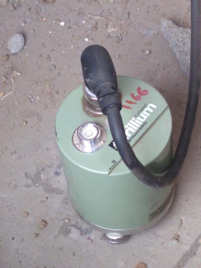
The India meteorological department has set up three seismographs in the region while NGRI has five. The government has instructed schools to go through the earthquake manual twice a day.
“But when kids are scared you can’t expect them to remember the manual,” said Jibhaw Devman Paghare, the principal of the Dhundalwadi Asharmshala school.
India is divided into four sesimic zones from 2 to 5. While the areas in zone-2 are least susceptible to earthquakes, zone-5 faces the highest risk. Interestingly, there is no zone-1, which has been knocked out of the country’s seismic zone map by the Bureau of Indian Standards (BIS), the national standards body of India.
“Before the Bhuj earthquake in 2001 and a few others before that, there was an understanding that certain areas such as the Deccan plateau will not face such collisions. But these incidents were an eye-opener and everyone realised that no part of India is completely safe and, therefore, zone-1 was completely knocked out,” explained Deepankar Choudhury, a civil engineering professor at IIT-Bombay.
Palghar falls in zone-3. This means buildings here should be able to withstand earthquakes of intensity 5.5-6.5 on the Medvedev-Sponheuer-Karnik (MSK) scale. While magnitude, measured on the Richter scale is a quantitative measure of the energy released, intensity, measured on the MSK scale is a qualitative measure of how people experience the quake. Therefore, it is likely that a moderate magnitude earthquake can be high-intensity depending on what people experienced or the damages caused, explained Choudhury.
“It is usually said that it isn’t the earthquake, but the buildings that kill people. Therefore, if during construction, proper standards laid down by the BIS have been followed, the (building) may withstand an earthquake of even up to 6-6.5 magnitude,” says Srinagesh.
Choudhury insists that, like in Japan, soil testing before beginning construction should be made mandatory for buildings. “It may increase the cost by 1%-5% depending on the area, but it will be worth it.”
Meanwhile, the state government is also looking to raze some houses identified as risky.
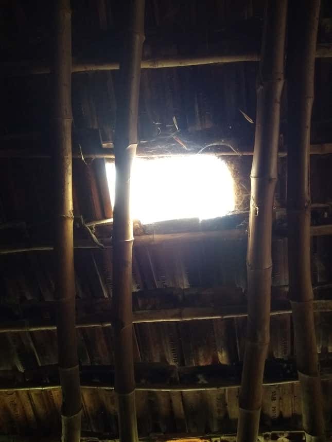
Some, like Sunita (who uses only her first name), are hanging somewhere in between. The thatched roof of her hut in Dhundalwadi today has a gaping hole caused by numerous jolts. “The ground was moving and I suddenly woke up,” she recalls the first tremor months ago.
Nobody knows if her family will be helped in rebuilding the hut. Worse, nobody knows if her hut will withstand another jolt.
