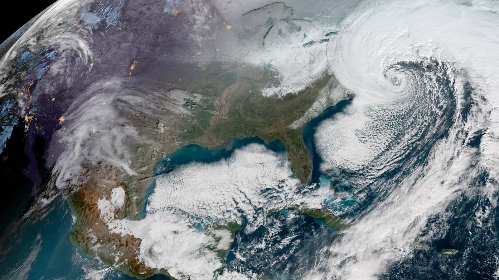
The east coast of the US is going to be hit with a one-two punch.
The powerful winter storm currently walloping the northeast, is bringing heavy snow, high winds, and blizzard conditions. Forecasters referred to it as a “bomb cyclone” because of its rapid drop in atmospheric pressure, which causes the system to intensify quickly.
And it’s not over when the storm passes: It’s pulling in a brutal blast of air via the polar vortex that will plunge already-icy temperatures in the eastern US to record lows tomorrow (Jan. 6) and throughout the weekend.
The National Oceanic and Atmospheric Administration (NOAA) expects the storm’s pressure to keep dropping, possibly to as low as 950 millibars, making it one of the strongest winter storms in recent memory.
Polar-vortex cold looms
As the storm system moves north, a front of bitterly cold air from the Arctic will move in to take its place, plunging temperatures to 40 degrees below normal across the mid-Atlantic states and the northeast.
The cold air is a product of the polar vortex, the weather phenomena that results from the large pocket of cold air circulating around the North Pole interacting with the polar jet stream, causing it to break its shape and split. When this happens, the jet stream pushes swaths of arctic air south, resulting in colder-than-normal winter temperatures.
The vortex is represented in the gif below by the swirling purple mass, which shows forecasted temperatures as low as -21°F.
The rapid change in pressure from a bomb cyclone draws cold air in quickly, creating icy temperatures in its wake.
Wind-chill warnings, watches, and advisories are in effect through most of the midwest, south, and northeast. The cold front is expected to break records throughout the east. The state of New Hampshire could be colder than Mars, with a forecasted low of -35° F on Mount Washington (vs. a high of -2°F on that other planet).
Tracking the east coast storm
The National Weather Service (NWS) expects the current storm to “continue to rapidly intensify” as it moves up the east coast. Strong, damaging winds could down trees and power lines, which may lead to widespread power outages just as the polar vortex moves in.
Snow has fallen at a rate of about an inch per hour—parts of Virginia received 8.5 inches overnight, Atlantic City, NJ could see as much as 18, and New England is forecast to get up to 12. Winds as high as 77 mph (the strength of a category-1 hurricane) were reported in eastern North Carolina. Thousands of customers have already lost power in Virginia.
Blizzard warnings are in effect from Virginia to Maine, and winter weather advisories for most of the eastern coast. (You can find the forecast and specific warnings for a particular area here.) Forecasters expects the storm to track north-northeast and then remain over Canada into tomorrow.
Despite the cold, some in southern states that rarely see snow have found ways to take advantage of the rare event:
