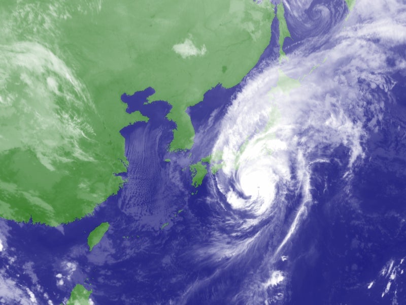
Typhoon Wipha—one of three intense tropical cyclones to affect Asia over the past few days—will make landfall in Japan early in the morning of October 16, local time. The storm’s clouds already cover nearly the whole of Japan, as this satellite image from the Japan Meteorological Agency (JMA) shows:
The good news: The storm is weakening as it moves northward and is now much less formidable than its peak category 4 status just two days ago. The bad news: Heavy rains, strong wind, and potentially dangerous storm surge are still predicted for the entire Tokyo area, as well as the site of the troubled Fukushima nuclear reactors.
A JMA spokesman called the approaching typhoon a “once in a decade event.” The last strong storm to strike eastern Japan was Typhoon Ma, in October 2004, which caused $600 million in losses. The JMA categorizes Wipha as “large” in size and “strong” in intensity, with damaging winds extending for hundreds of kilometers from the center.
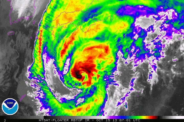
Here’s how Wipha appeared from satellite late Tuesday, Japan time:
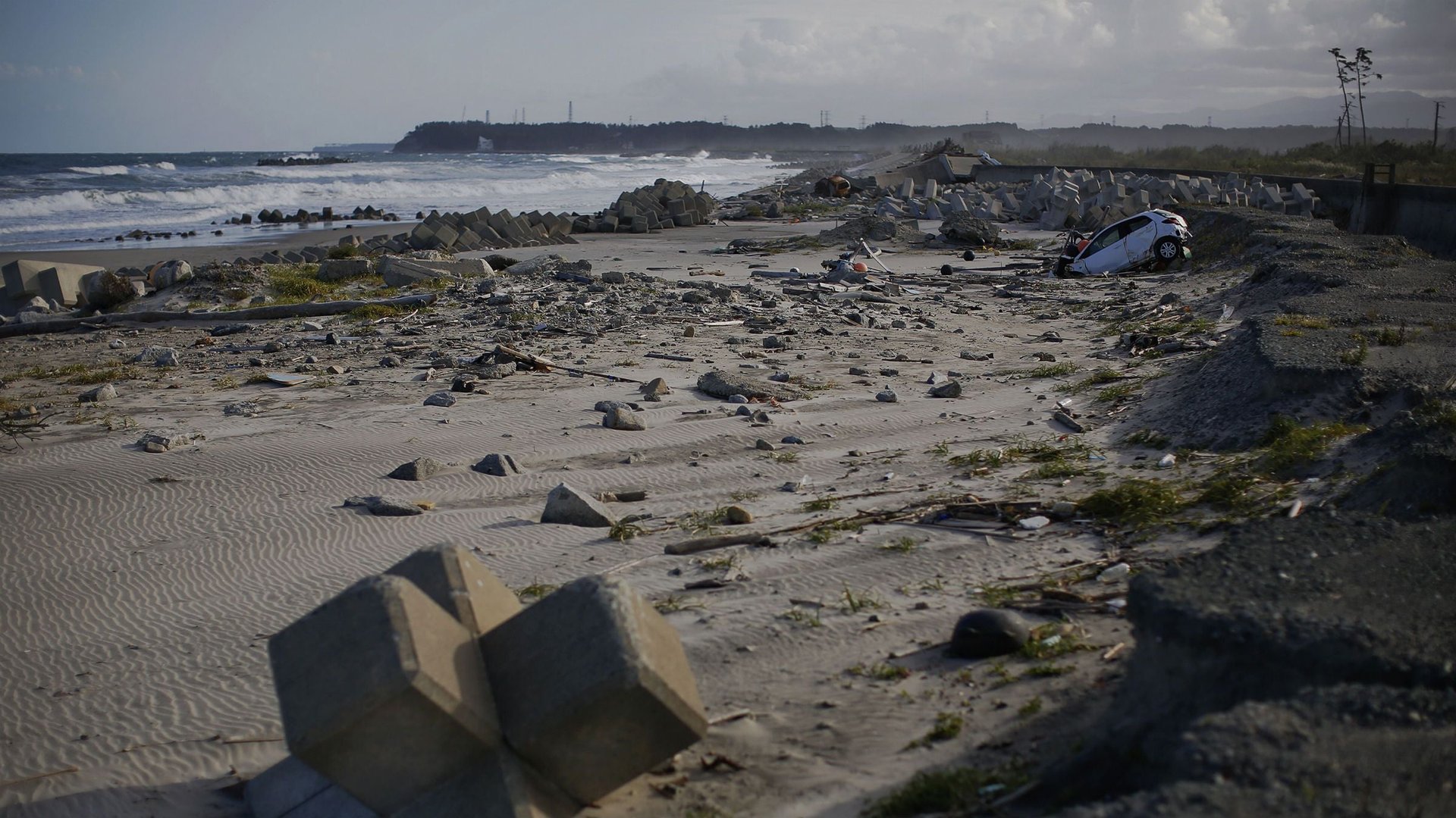
Wipha has forced the caretakers of the Fukushima reactors, Tokyo Electric Power Corp (Tepco), to take extraordinary preparation measures for the second time in as many months, in an effort to avoid radioactive rainwater runoff to seep into the Pacific Ocean. In September, a weaker typhoon named Man-yi forced the construction of dozens of contaminated rainwater holding tanks, which subsequently sprung leaks. According to the Wall Street Journal, Japan’s nuclear oversight panel has again allowed Tepco to allow “lightly contaminated” water to drain to the sea, just because there’s nowhere else to put it.
Excessive rainwater will again be the biggest risk to safety at Fukushima. Some weather models predict heavy rains in excess of five inches (125 mm) to fall over the next 12 hours—a true deluge. However, unlike during Man-yi in September, the closer approach of the more intense Wipha could lead to strong winds, as well. The JMA gave a greater than 90% chance of winds in excess of 55 mph (90 kph) in Tokyo and along the coast of Fukushima for the next 12 hours.
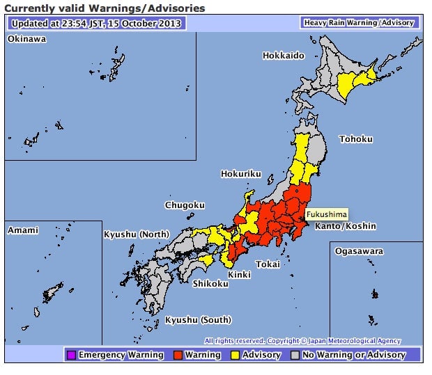
The JMA currently has a heavy rain warning in effect for Fukushima prefecture:
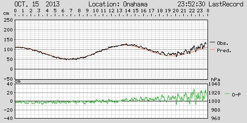
A real-time tide gauge from JMA shows storm surge has already begun to rise in Fukushima. Luckily, damage from storm surge is expected to be minimal as Wipha should make its closest approach around low tide:
The key will be to watch the storm’s track. Currently, Wipha’s center is expected to track near or directly over Tokyo. That’s actually better news than if the storm makes a last minute jog to the left (west), which would bring the most intense part of the typhoon—the eastern half—over land. The more the typhoon tracks west, the heavier the rain and more intense winds would be directed onshore toward Tokyo and Fukushima.
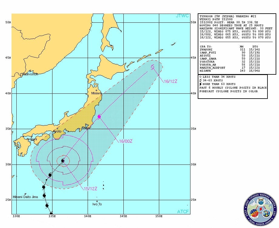
The current forecast from the US Navy’s Joint Typhoon Warning Center, in Pearl Harbor, Hawaii, shows Wipha’s center coming within 17 miles of Tokyo’s Narita airport, and passing just offshore of Fukushima: