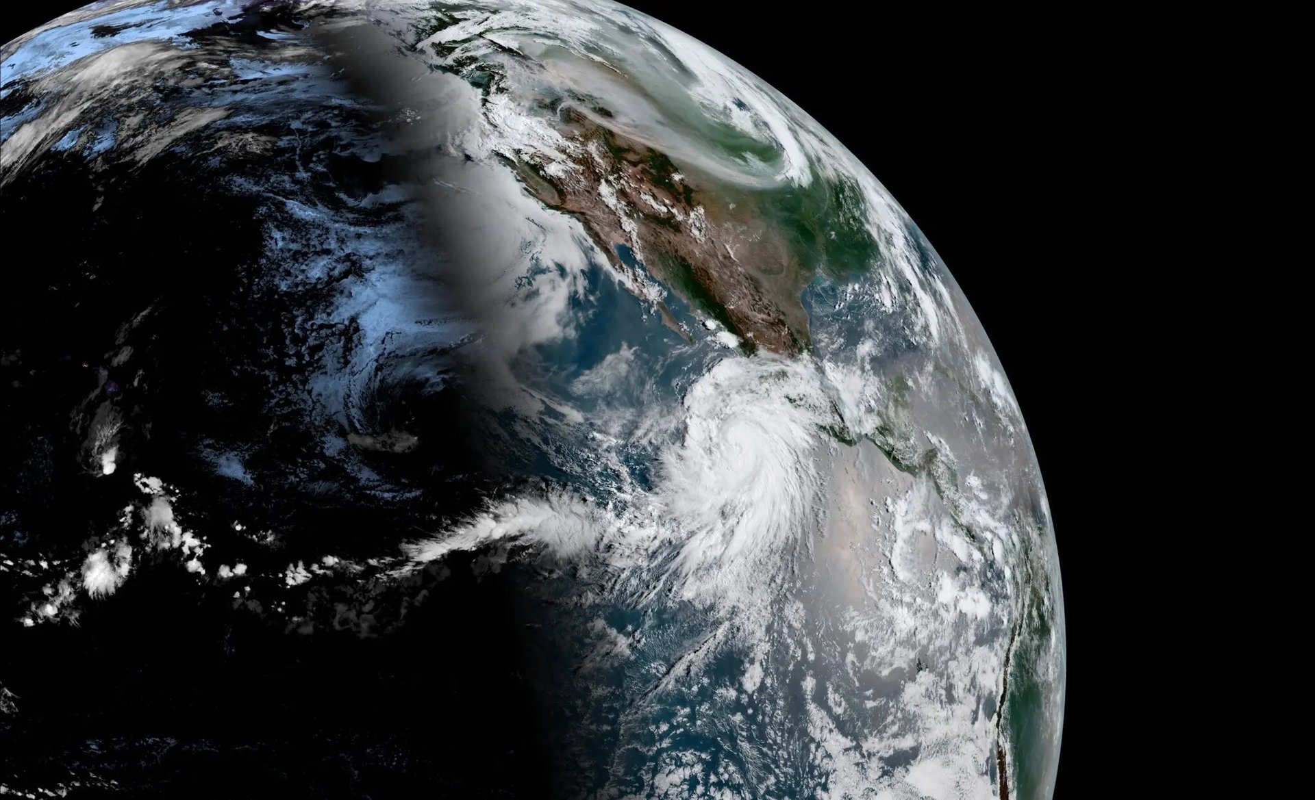
Hurricane Hilary is expected to bring record rainfall to California
It is the first major storm to hit the West Coast during the Pacific hurricane season

Hurricane Hilary—recently upgraded to a severe Category 4 storm—is expected to bring record rainfall to California next week after hitting Mexico’s west coast and Baja region. According to the latest update from the National Hurricane Center (NHC), the storm was 357 miles (575 km) southwest of Cabo San Lucas, Mexico, and had recorded sustained winds of 145 mph (230 km/h), with even higher gusts.
Suggested Reading
While the hurricane is forecasted to weaken to a tropical storm by the time it hits California, that would still be a record-breaking weather event. The last time California saw a tropical storm make landfall was in 1939. In fact, Hilary marks the first time a tropical storm watch has been issued for the region in modern National Weather Service (NWS) history.
Related Content
The NHC also confirmed that the southwestern US could see flash floods from extreme rainfall this weekend, while oceans caused by Hilary will spread from southwestern Mexico all the way to the Baja California peninsula.
Years’ worth of rain in a single storm
The powerful storm could bring years’ worth of precipitation to extremely dry parts of California, including Death Valley, the driest place in North America.
The average rainfall for the area—which is conserved as a national park—is less than two inches. According to the NHC, Hilary could dump four to six inches in Death Valley within a span of just two to three days.
The same goes for Palm Springs—the popular desert resort town—which receives an average annual rainfall of five inches, or roughly the expected forecast this weekend.
El Niño is back in officially back. How does it affect hurricanes?
El Niño—the global climate phenomenon that occurs in the Pacific Ocean every two to seven years—has officially arrived this summer, according to a June report by the NWS.
This weather pattern, part of a cycle of sea currents meeting in the eastern Pacific Ocean, is marked by warmer-than-average temperatures on the ocean surface in countries bordering the equator. This can cause a range of environmental and economic issues, including excessive rainfall and high temperatures stunting agricultural yields.
It can also increase the frequency of hurricanes in the region. During El Niño, the position of the Pacific jet stream—the narrow current of air that encircles the globe—is disrupted by warm air rising, pushing it towards the east Pacific.
This, in turn, weakens upper-level winds and reduces vertical wind sheer (an angled air current that can prevent hurricanes from forming) which, mixed with a high moisture level caused by the warmer sea temperature, creates conditions favorable to hurricanes in the Pacific.
However, the same El Niño wind patterns can reduce the frequency of hurricanes in the Atlantic. The same forces work in the inverse, strengthening vertical wind shear on the other side of the US, while the comparatively low sea temperatures cause a change in pressure known as a sinking motion, generally increasing atmospheric stability.