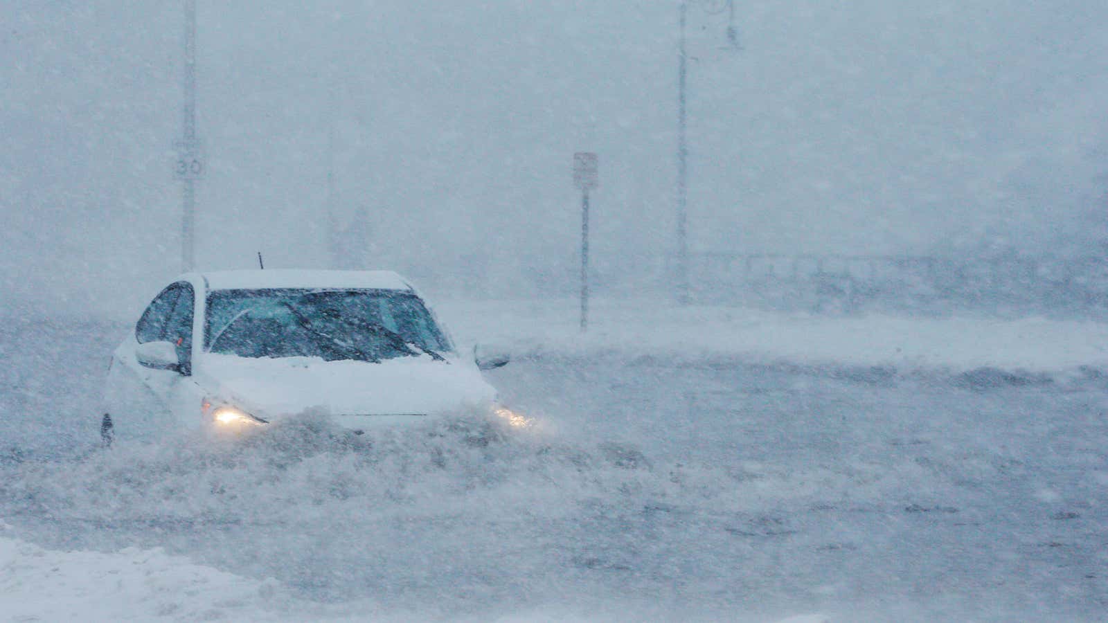
The powerful nor’easter walloping the East Coast with strong wind, heavy rain, and snow has the potential to become one of the most destructive storms in recent memory.
The US has been hit by severe weather across the country this week—30,000 people are under evacuation order ahead of a winter storm that could dump 6 feet of snow on Northern California and a major storm brought record rainfall and flooding from Texas to Tennessee on Feb. 28.
Now, the Northeast is feeling the effects of the massive storm moving up the coast today (March 2) and tomorrow with driving rain, heavy snow, and hurricane-strength wind gusts as high as 75 miles per hour. Boston will likely its second record-setting flood in just two months.
Meteorologists warn that a combination of weather conditions means the Boston area is going to see the worst damage. A flood warning is in effect and the National Weather Service (NWS) is urging people take the storm very seriously, warning that “This is a LIFE & DEATH situation for those living along the coast.”
Satellite imagery from the National Oceanic and Atmospheric Administration shows the sheer size of the storm system developing along the coast:
The ingredients for a perfectly awful storm
For New England, this storm has the potential to be more severe than the “bomb cyclone” that pounded the East Coast in January, causing record flooding and forcing thousands to evacuate.
This new storm system will undergo similar bombogenesis—the quick drop in pressure that results in powerful, circulating winds that blow from the northeast (thus, a nor’easter), and causes storms to strengthen. However, the incredibly strong wind, high storm surge, astronomical high tides, and a mass of low pressure in the Arctic means the effects of this storm are going to be even worse than the January bomb.
“It’s like throwing a dart at a target and hitting a bullseye,” Benjamin Sipprell, a meteorologist at the National Weather Service Boston office, told Quartz
The “Greenland Block” traps the storm
The storm is going linger because of a winter weather phenomenon known as the “Greenland Block,” a large area of high pressure in the Arctic that keeps the system from moving north, causing it to dump heavy rain and wet snow over Boston through Saturday night.
To make matters worse, the storm is occurring during the three highest astronomical tides of the month—when a high tide occurs during a full moon, ocean water doesn’t fully recede during the low-tide cycle. So if a storm hits, coastal areas remain flooded and water can’t move back out to the ocean.
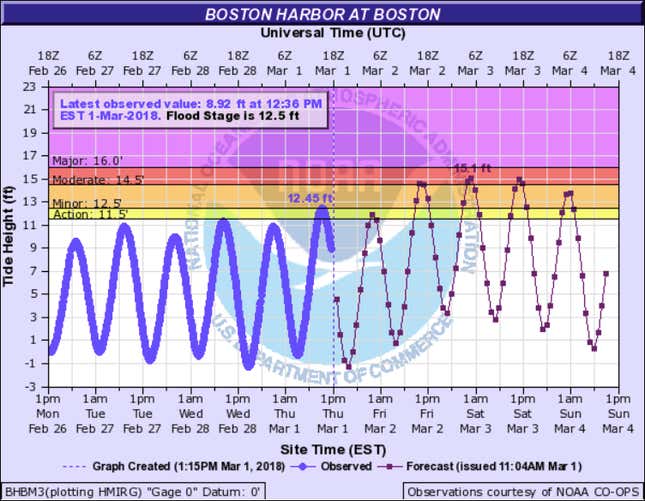
Massachusetts emergency officials warn of a “potentially life threatening situation” and the NWS water-level forecast shows a record 15.4 ft of water could flood Boston Harbor.

Only twice has the Boston seen tide levels above 15 feet—in 1978 and again during the January bomb cyclone. According to the NWS forecast, the current storm could bring tide levels that high three times over the next 36 hours.
Boston-area beach communities like Cape Anne and Plum Island are in danger of being completely flooded and cut off.
Massachusetts governor Charlie Baker has activated 200 members of the Massachusetts National Guard to assist with water-rescue operations and is urging residents in areas that flooded in January to evacuate.
While two record storms in two months isn’t necessarily a direct result of climate change, meteorologists say it would be concerning if weather events like this continue to happen with increasing strength or frequency.
