The North Atlantic ocean is the warmest it's ever been
El Niño has developed in the Pacific Ocean, but it's not the only contributing factor

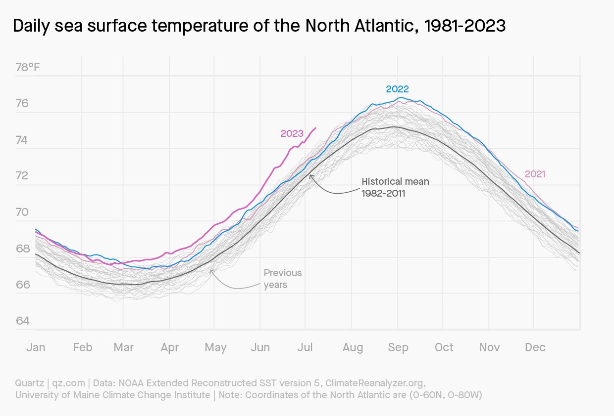
The North Atlantic ocean is getting less frigid, with 2023 shaping up to be the warmest year on record. Sea surface temperatures for June 2023 across the North Atlantic were 0.91°C above average, according to the European Centre for Medium-Range Weather Forecasts. This is around 0.5°C more than the previous warmest June, recorded in 2010.
Suggested Reading
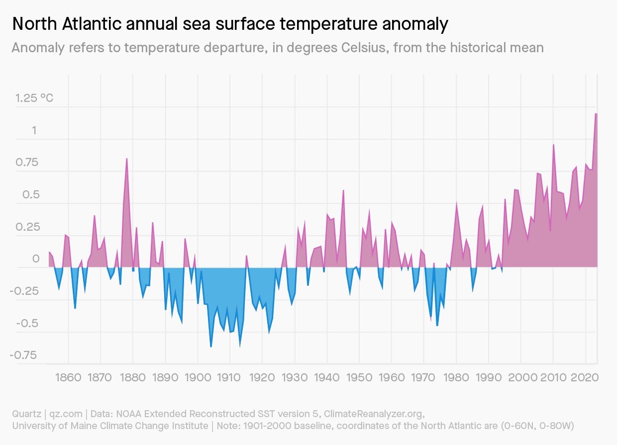
Since May, daily sea surface temperatures have reached higher than the two degree range above the historical mean, indicating extreme warming conditions. Above average warming has been accelerating since the 1980s with recent years setting record high temperatures.
Related Content
Scientists are still examining why this year in particular is so off the charts. “There are multiple contributing factors,” said Sean Birkel, a climatologist at the University of Maine. Birkel and other scientists observe three things happening: there’s an El Niño in the Pacific, a large scale pattern in the jet stream that has developed over North America, and record warm temperatures across the North Atlantic that’s associated with weak atmospheric circulation.“These are likely all connected, but to what extent and the details, we don’t know yet.”

The El Niño effect
Oceans around the world are experiencing warming temperatures due in part to El Niño, which creates a band of warm water in the Pacific Ocean. The World Meteorological Organization (WMO) stated El Niño this year would set the stage for a surge in global temperatures and disruptive weather and climate patterns, possibly into 2024.
Warm conditions in the Pacific influence weather patterns in North America, creating atmospheric pressure, rain, and storms that pass over the Pacific Northwest and Canada, eventually down through the northeast US, and end up in the North Atlantic. A band of warmer air creates conditions for higher temperatures and cloud cover that could develop into heat domes, heat waves, and lightening storms. Symptoms of these conditions this year so far are the wildfires in Canada, record-breaking continual summer rain in parts of the northeast US, and a warmer Atlantic Ocean.

This year scientists are seeing unusual atmospheric conditions in the North Atlantic, with weaker westerly and easterly winds. Weaker wind movement means air and water circulation is reduced, allowing the sea surface to just heat up. Higher sea surface temperatures exacerbate marine waters that are already experiencing heatwaves below the surface. Ocean heat content has been on the rise since the 1960s, absorbing more than 90% of the Earth’s excess heat, according to the National Oceanic and Atmospheric Administration (NOAA).
The excess heat is attributed to decades of rising greenhouse gas emissions, accelerated by burning fossil fuels. Greenhouse gases prevent heat radiated from the Earth’s surface from escaping into space, resulting in the heat getting absorbed by the ocean.
While year-to-year conditions may vary, overall the Earth is warmer than it was decades ago, which could mark a new era for future observations. “As the climate warms, we should expect to see more years in which record values are measured,” said Birkel.
